Search results
Appearance
There is a page named "File:Saxony location map.svg" on Wikipedia
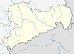
- DescriptionSaxony location map.svg Deutsch: Positionskarte Sachsen, Deutschland. Geographische Begrenzung der Karte: English: Location map Saxony, Germany...(2,068 × 1,508 (214 KB)) - 22:35, 31 July 2021
- This image is a derivative work of the following images: File:Saxony_location_map.svg licensed with Cc-by-sa-3.0,2.5,2.0,1.0, GFDL 2009-01-30T18:17:17Z...(2,068 × 1,508 (834 KB)) - 06:24, 19 May 2023
- This image is a derivative work of the following images: File:Saxony_location_map_G.svg licensed with Cc-by-sa-3.0,2.5,2.0,1.0, GFDL 2009-05-30T23:26:10Z...(800 × 583 (165 KB)) - 13:12, 18 August 2024
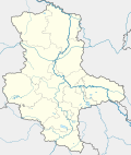
- Alike 3.0 truetrue You may select the license of your choice. English map of Saxony-Anhalt, Germany German Karte von Sachsen-Anhalt author name string:...(1,957 × 2,306 (1.27 MB)) - 07:51, 25 October 2022
- der Karte:}} {{en|Location map [[w:en:Hesse|Hesse]], Germany. Geographic limits of the map:}} * N: 51 Lower Saxony location map.svg licensed with Cc-by-sa-3...(928 × 1,116 (1.22 MB)) - 09:08, 23 March 2022
- File:Karte VTO 2012 under CC-by-sa.png (category Maps of Saxony-Anhalt)This image is a derivative work of the following images: File:Saxony-Anhalt_location_map.svg licensed with Cc-by-sa-3.0,2.5,2.0,1.0, GFDL 2009-09-22T17:14:07Z...(2,000 × 2,357 (632 KB)) - 02:34, 30 September 2020
- This image is a derivative work of the following images: File:Lower_Saxony_CE.svg licensed with Attribution, Cc-by-3.0,2.5,2.0,1.0, Cc-by-sa-3.0,2.5,2...(430 × 366 (232 KB)) - 15:32, 20 October 2020
- DescriptionLower Saxony location map.svg Deutsch: Positionskarte von Niedersachsen, Deutschland Quadratische Plattkarte, N-S-Streckung 160 %. Geographische...(1,422 × 1,202 (250 KB)) - 08:54, 23 March 2022
- DescriptionSaxony location map G.svg Deutsch: Positionskarte Sachsen einschl. der Lage innerhalb Deutschlands. Geographische Begrenzung der Karte: English:...(2,068 × 1,508 (905 KB)) - 19:21, 23 October 2020
- DescriptionLower Saxony location map coast.svg English: Cropped Version of File:Lower Saxony location map.svg, showing only the coast Deutsch: Küstenlinie...(896 × 435 (272 KB)) - 23:21, 5 September 2020
- https://creativecommons.org/licenses/by-sa/4.0CC BY-SA 4.0 Creative Commons Attribution-Share Alike 4.0 truetrue English A map of the Duchy of Saxony (1000 CE)....(4,431 × 3,875 (4.7 MB)) - 18:06, 19 August 2024
- DescriptionLower Saxony location map G.svg Deutsch: Positionskarte von Niedersachsen einschl. der Lage innerhalb Deutschlands Quadratische Plattkarte...(1,424 × 1,203 (481 KB)) - 01:10, 9 September 2020
- |Description={{en|Blank map of Europe showing national borders as they stood from 1956-1990.}} |Source=*[[:File:Blank_map_of_Europe.svg|]] |Date=2011-10-30...(450 × 456 (475 KB)) - 19:03, 24 April 2024
- may select the license of your choice. English Locator map of Landkreis Mittelsachsen in Saxony, Germany. German Lage von Landkreis Mittelsachsen in Sachsen...(1,075 × 1,273 (575 KB)) - 23:32, 30 October 2020
- DescriptionFlag map of Saxony.svg Flag map of Saxony Date 7 December 2011, 02:25 (UTC) Source Saxony_location_map.svg Flag of Saxony (state).svg Author Saxony_location_map...(1,983 × 1,400 (58 KB)) - 22:42, 29 May 2024
- DescriptionSaxony relief location map.jpg Deutsch: Physische Positionskarte Sachsen, Deutschland. Geographische Begrenzung der Karte: English: Physical Location...(1,838 × 1,340 (901 KB)) - 19:21, 23 October 2020
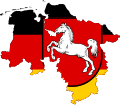
- DescriptionFlag map of Lower Saxony.svg Flag map of Lower Saxony Date 6 December 2011, 22:47 (UTC) Source Lower_Saxony_location_map.svg Flag of Lower Saxony.svg Author...(1,320 × 1,147 (266 KB)) - 22:37, 29 May 2024
- DescriptionMunicipalities in Saxony.svg Deutsch: Lage der Gemeinden in Sachsen, Deutschland. Stand 2008 nach der Kreisreform in Sachsen. English: Locator map of municipalities...(5,070 × 3,809 (1.65 MB)) - 04:19, 23 January 2023
- DescriptionSaxony-Anhalt relief location map.jpg Deutsch: Physische Positionskarte Sachsen-Anhalt, Deutschland. Geographische Begrenzung der Karte: English:...(1,273 × 1,500 (691 KB)) - 19:19, 23 October 2020


