
File:Se-map.gif
No higher resolution available.
Se-map.gif (328 × 353 pixels, file size: 5 KB, MIME type: image/gif)
| This is a file from the Wikimedia Commons. Information from its description page there is shown below. Commons is a freely licensed media file repository. You can help. |
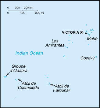
| Description | Map of Seychelles | |||
| Source | Website CIA | |||
| Author | CIA | |||
| Permission (Reusing this file) |
|

File history
Click on a date/time to view the file as it appeared at that time.
| Date/Time | Thumbnail | Dimensions | User | Comment | |
|---|---|---|---|---|---|
| current | 07:03, 14 November 2010 | | 328 × 353 (5 KB) | Hoshie | Reverted to version as of 19:06, 13 June 2005: the newer version is at File:Seychelles-CIA WFB Map.png |
| 22:08, 19 November 2006 |  | 328 × 352 (10 KB) | Siebrand | Updated version | |
| 19:06, 13 June 2005 |  | 328 × 353 (5 KB) | Dubaduba~commonswiki | Category:Seychelles {{PD-USGov-CIA-WF}} |
File usage
The following pages on the English Wikipedia use this file (pages on other projects are not listed):
Global file usage
The following other wikis use this file:
- Usage on az.wikipedia.org
- Usage on be-tarask.wikipedia.org
- Usage on bg.wikipedia.org
- Usage on br.wikipedia.org
- Usage on bs.wikipedia.org
- Usage on ca.wikipedia.org
- Usage on ceb.wikipedia.org
- Usage on cs.wikipedia.org
- Usage on da.wikipedia.org
- Usage on de.wikipedia.org
- Usage on eo.wikipedia.org
- Usage on eu.wikipedia.org
- Usage on fr.wikipedia.org
- Usage on fy.wikipedia.org
- Usage on gl.wikipedia.org
- Usage on he.wikipedia.org
- Usage on hif.wikipedia.org
- Usage on hr.wikipedia.org
- Usage on hu.wikipedia.org
- Usage on hu.wiktionary.org
- Usage on hy.wikipedia.org
- Usage on id.wikipedia.org
- Usage on io.wikipedia.org
- Usage on it.wikipedia.org
View more global usage of this file.