
File:Shovel Down Stone Row - geograph.org.uk - 1513000.jpg
No higher resolution available.
Shovel_Down_Stone_Row_-_geograph.org.uk_-_1513000.jpg (640 × 427 pixels, file size: 76 KB, MIME type: image/jpeg)
| This is a file from the Wikimedia Commons. Information from its description page there is shown below. Commons is a freely licensed media file repository. You can help. |
Summary
| Description |
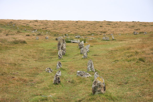
English: Shovel Down Stone Row Looking up to the Fourfold Circle cairn at the head of the double row. Another double row can be seen running at an angle across the hillside. |
| Date | |
| Source | From geograph.org.uk |
| Author | Guy Wareham |
| Attribution (required by the license) | Guy Wareham / Shovel Down Stone Row / |
| Camera location | | View this and other nearby images on: OpenStreetMap |
|---|
_heading:180.00&language=en)
| Object location | | View this and other nearby images on: OpenStreetMap |
|---|
_heading:180.00&language=en)
Licensing

|
This image was taken from the
Creative Commons Attribution-ShareAlike 2.0 license. |
This file is licensed under the Creative Commons Attribution-Share Alike 2.0 Generic license.
Attribution: Guy Wareham
- You are free:
- to share – to copy, distribute and transmit the work
- to remix – to adapt the work
- Under the following conditions:
- attribution – You must give appropriate credit, provide a link to the license, and indicate if changes were made. You may do so in any reasonable manner, but not in any way that suggests the licensor endorses you or your use.
- share alike – If you remix, transform, or build upon the material, you must distribute your contributions under the same or compatible license as the original.
File history
Click on a date/time to view the file as it appeared at that time.
| Date/Time | Thumbnail | Dimensions | User | Comment | |
|---|---|---|---|---|---|
| current | 00:59, 3 March 2011 | | 640 × 427 (76 KB) | GeographBot | == {{int:filedesc}} == {{Information |description={{en|1=Shovel Down Stone Row Looking up to the Fourfold Circle cairn at the head of the double row. Another double row can be seen running at an angle across the hillside.}} |date=2009-09-28 |source=From [ |
File usage
The following pages on the English Wikipedia use this file (pages on other projects are not listed):
Global file usage
The following other wikis use this file:
- Usage on de.wikipedia.org
- Usage on fr.wikipedia.org
- Usage on www.wikidata.org