
File:Site of former Kirkby Bentinck station, 2000 (geograph 3725232).jpg

Size of this preview: 800 × 490 pixels. Other resolutions: 320 × 196 pixels | 640 × 392 pixels | 1,024 × 627 pixels | 1,280 × 784 pixels | 2,396 × 1,468 pixels.
Original file (2,396 × 1,468 pixels, file size: 2.76 MB, MIME type: image/jpeg)
| This is a file from the Wikimedia Commons. Information from its description page there is shown below. Commons is a freely licensed media file repository. You can help. |
.jpg)
Summary
| Description |
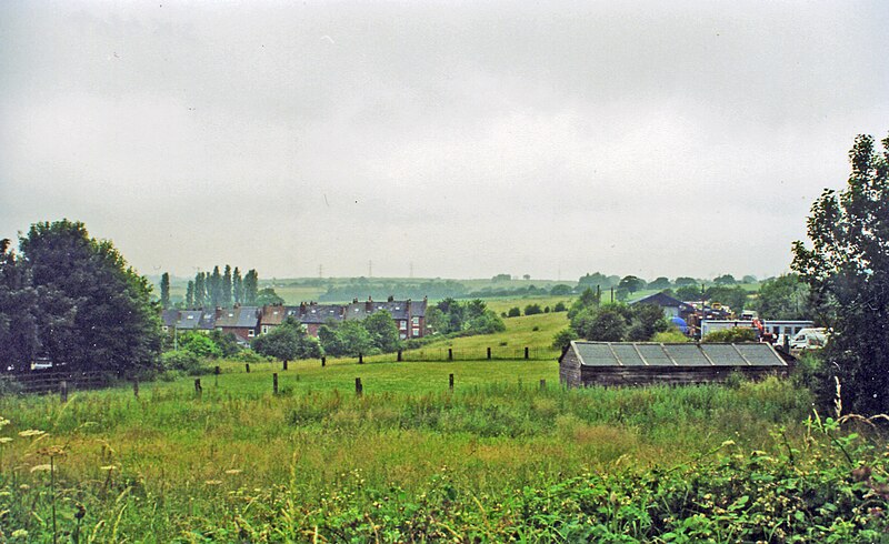
English: Site of former Kirkby Bentinck station, 2000. View westward from the B6018 road at Castle Hill near Kirkby-in-Ashfield, towards Chesterfield and Sheffield along the course of the ex-GCR Sheffield - Nottingham - London etc. main line! The station and this section of the line had been closed from 4/3/63 and the area has been totalling transformed since the 1980s' closure of the numerous collieries and associated railways: in the past there had been five railway stations in this immediate area. (This station had been 'Kirkby & Pinxton' until 1/3/25). |
| Date | |
| Source | From geograph.org.uk |
| Author | Ben Brooksbank |
| Permission (Reusing this file) |
Creative Commons Attribution Share-alike license 2.0 |
| Camera location | | View this and other nearby images on: OpenStreetMap |
|---|
.jpg¶ms=053.094033_N_-001.272575_E_globe:Earth_type:camera_heading:292.00&language=en)
Licensing

|
This image was taken from the
Creative Commons Attribution-ShareAlike 2.0 license. |
This file is licensed under the Creative Commons Attribution-Share Alike 2.0 Generic license.
Attribution: Ben Brooksbank
- You are free:
- to share – to copy, distribute and transmit the work
- to remix – to adapt the work
- Under the following conditions:
- attribution – You must give appropriate credit, provide a link to the license, and indicate if changes were made. You may do so in any reasonable manner, but not in any way that suggests the licensor endorses you or your use.
- share alike – If you remix, transform, or build upon the material, you must distribute your contributions under the same or compatible license as the original.
File history
Click on a date/time to view the file as it appeared at that time.
| Date/Time | Thumbnail | Dimensions | User | Comment | |
|---|---|---|---|---|---|
| current | 14:20, 30 November 2013 | | 2,396 × 1,468 (2.76 MB) | Chevin | == {{int:filedesc}} == {{Information |Description={{en|1='''Site of former Kirkby Bentinck station, 2000.'''<br/> View westward from the B6018 road at Castle Hill near Kirkby-in-Ashfield, towards Chesterfield and Sheffield along the course of the ex-GC... |
File usage
The following pages on the English Wikipedia use this file (pages on other projects are not listed):
.jpg)