
File:Sossusvlei Tsauchab with water.jpg

Size of this preview: 800 × 600 pixels. Other resolutions: 320 × 240 pixels | 640 × 480 pixels | 1,024 × 768 pixels | 1,280 × 960 pixels | 2,000 × 1,500 pixels.
Original file (2,000 × 1,500 pixels, file size: 721 KB, MIME type: image/jpeg)
| This is a file from the Wikimedia Commons. Information from its description page there is shown below. Commons is a freely licensed media file repository. You can help. |
Summary
| Camera location | | View this and other nearby images on: OpenStreetMap |
|---|
| Description |
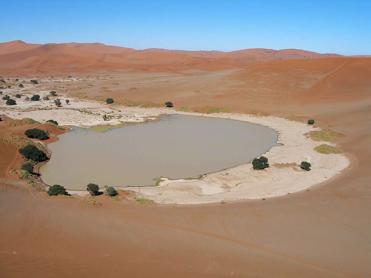
Afrikaans: Die kleipan by Sossusvlei met water gevul, soos dit eens in 'n dekade gesien kan word. Dit word gevoed deur die Tsauchab-rivier via die Sesriem-canyon, en is geleë in die sentrale Namib-Naukluft, westelike Hardap-streek, Namibië
English: The clay pan at Sossusvlei filled with water, as it can be seen once in a decade. It is fed by the Tsauchab river via the Sesriem canyon, and is situated in the central Namib Naukluft, western Hardap Region, Namibia
|
| Date | |
| Source | Own work |
| Author | Falense |
| Permission (Reusing this file) |
GFDL |
| Other versions |
Winter 2006; Spring 2009   |
Licensing

|
Permission is granted to copy, distribute and/or modify this document under the terms of the GNU Free Documentation License, Version 1.2 or any later version published by the Free Software Foundation; with no Invariant Sections, no Front-Cover Texts, and no Back-Cover Texts. A copy of the license is included in the section entitled GNU Free Documentation License. |
| This file is licensed under the Creative Commons Attribution-Share Alike 3.0 Unported license. | ||
| ||
| This licensing tag was added to this file as part of the GFDL licensing update. |
File history
Click on a date/time to view the file as it appeared at that time.
| Date/Time | Thumbnail | Dimensions | User | Comment | |
|---|---|---|---|---|---|
| current | 12:06, 12 December 2009 | | 2,000 × 1,500 (721 KB) | Ikiwaner | ca corrected, shadows/highlights adjustment |
| 21:37, 18 July 2006 |  | 2,000 × 1,500 (438 KB) | Falense | {{Information |Description=Tsauchab filled with water in Sossusvlei, Namibia |Source=own Photo |Date=2006/03/30 |Author= Falense |Permission=GFDL }} |
File usage
The following pages on the English Wikipedia use this file (pages on other projects are not listed):
Global file usage
The following other wikis use this file:
- Usage on af.wikipedia.org
- Usage on de.wikipedia.org
- Usage on es.wikipedia.org
- Usage on fi.wikipedia.org
- Usage on fr.wikipedia.org
- Usage on it.wikipedia.org
- Usage on ka.wikipedia.org
- Usage on nl.wikipedia.org