
File:St. Augustine Major Roadways.jpg
No higher resolution available.
St._Augustine_Major_Roadways.jpg (315 × 207 pixels, file size: 15 KB, MIME type: image/jpeg)
| This is a file from the Wikimedia Commons. Information from its description page there is shown below. Commons is a freely licensed media file repository. You can help. |
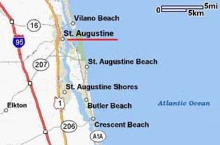
Summary
| Description |
English: Map of major roadways in vicinity of St. Augustine, Florida |
| Source | http://www.nps.gov/foma/directions.htm |
| Author | United States National Park Service |
Licensing
| This image or media file contains material based on a work of a National Park Service employee, created as part of that person's official duties. As a work of the U.S. federal government, such work is in the public domain in the United States. See the NPS website and NPS copyright policy for more information. |
File history
Click on a date/time to view the file as it appeared at that time.
| Date/Time | Thumbnail | Dimensions | User | Comment | |
|---|---|---|---|---|---|
| current | 20:57, 1 August 2010 | | 315 × 207 (15 KB) | 7mike5000 | {{Information |Description={{en|1=Map of major roadways in vicinity of St. Augustine, Florida}} |Source=http://www.nps.gov/foma/directions.htm |Author=United States National Park Service |Date= |Permission= |other_versions= }} [[Category:St. Augustine, F |
File usage
The following pages on the English Wikipedia use this file (pages on other projects are not listed):