
Search results
The page "File:Tamil Nadu District Map.png" does not exist. You can ask for it to be uploaded, but consider checking the search results below to see whether the topic is already covered.
 Inkscape on TN Districts Numbered.png, for use in 1996 tamil nadu lok sabha election page. The map is a wikipedia tamil nadu district map. Used the information...(573 × 724 (201 KB)) - 15:33, 15 February 2023
 Inkscape on TN Districts Numbered.png, for use in 1989 tamil nadu lok sabha election page. The map is a wikipedia tamil nadu district map. Used the information...(573 × 724 (193 KB)) - 15:32, 15 February 2023
 Inkscape on TN Districts Numbered.png, for use in 1996 tamil nadu lok sabha election page. The map is a wikipedia tamil nadu district map. Used the information...(573 × 724 (199 KB)) - 15:33, 15 February 2023
 This image is a derivative work of the following images: File:Map of Tamil Nadu districts.svg licensed with Cc-by-sa-4.0 2016-03-08T06:23:04Z Nirinsanity...(1,668 × 2,032 (332 KB)) - 02:50, 23 February 2023
 Distinguished 38 districts of Tamil Nadu state in Indian Map, that also shows the Union Territory regions (Puduchery and Karaikal). Tamil இந்தியாவின், தமிழ்நாடு...(3,333 × 4,138 (2.55 MB)) - 05:37, 5 December 2023
 Map showing the different districts of Tamil Nadu, India English...(557 × 739 (93 KB)) - 07:27, 11 October 2020
 DescriptionTamil Nadu District Map (Tamil).png தமிழ்: தமிழகத்தில் உள்ள 38 மாவட்டங்களின் வரைப்படம். English: .The Updated District Map of Tamil Nadu with 38...(3,333 × 4,138 (2.59 MB)) - 05:37, 5 December 2023
 Creative Commons Attribution-Share Alike 4.0 truetrue English Districts of Tamil Nadu Wikimedia username: Jaishink URL: https://commons.wikimedia...(800 × 992 (197 KB)) - 05:37, 5 December 2023
 Creative Commons Attribution-Share Alike 4.0 truetrue English districts in Tamil Nadu URL: https://commons.wikimedia.org/wiki/user:Heinz_OSM author name...(1,231 × 896 (149 KB)) - 05:37, 5 December 2023
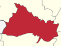 Other information English: Cropped from Dharmapuri district Tamil Nadu.png This file is licensed under the Creative Commons Attribution-Share Alike 3...(245 × 185 (10 KB)) - 12:34, 7 December 2022
 File:Vellar Basin Overlay.xcf (category Maps of Tamil Nadu)Alike 4.0 truetrue English Overlayed image of Vellar River basin onto map of Tamil Nadu. URL: https://commons.wikimedia.org/wiki/user:Starkenborgher author...(1,773 × 2,201 (2.11 MB)) - 07:26, 31 July 2022
 Attribution-Share Alike 4.0 truetrue English Image of Tondai Nadu region including Chitoor and Nellore districts of Andhra Pradesh URL: https://commons.wikimedia...(850 × 1,041 (277 KB)) - 01:57, 22 December 2022
 Disclaimer: With this statement DEMIS BV grants you permission to freely copy the PNG images returned by our server and use them for your own purposes, including...(720 × 441 (166 KB)) - 13:04, 20 February 2024
 DescriptionTamil Nadu Literacy Map 2011.png English: A Choropleth map of Tamilnadu state, India, showing the district wise literacy rate in 2011. Date...(1,122 × 1,240 (235 KB)) - 19:44, 23 October 2021
 Districts: I, the copyright holder of this work, hereby publish it under the following license: This file is licensed under the Creative Commons Attribution-Share...(1,987 × 2,463 (649 KB)) - 11:15, 16 April 2023
 Districts: I, the copyright holder of this work, hereby publish it under the following license: This file is licensed under the Creative Commons Attribution-Share...(637 × 799 (289 KB)) - 11:15, 16 April 2023
 DescriptionDharmapuri district Tamil Nadu.png English: Map of Dharmapuri district, Tamil Nadu, India Date 14 August 2013, 23:35:44 Source Own work Author...(1,000 × 1,241 (223 KB)) - 23:23, 6 October 2020
 DescriptionVellore district Tamil Nadu.png English: Map of Vellore district, Tamil Nadu, India Date 14 August 2013, 23:43:58 Source Own work Author Coppercholride...(1,000 × 1,241 (254 KB)) - 22:01, 29 October 2020
 DescriptionThanjavur district Tamil Nadu.png English: Map of Thanjavur district, Tamil Nadu, India Date 14 August 2013, 23:43:13 Source Own work Author...(1,000 × 1,241 (254 KB)) - 13:42, 29 October 2020
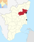 DescriptionViluppuram district Tamil Nadu.png English: Map of Viluppuram district, Tamil Nadu, India Date 14 August 2013, 23:43:57 Source Own work Author...(1,000 × 1,241 (254 KB)) - 20:17, 29 October 2020


.png)

.png)


.png)


