
File:Tellico Dam Map.png
Size of this preview: 776 × 600 pixels. Other resolutions: 311 × 240 pixels | 621 × 480 pixels | 994 × 768 pixels | 1,280 × 989 pixels | 2,560 × 1,978 pixels | 3,300 × 2,550 pixels.
Original file (3,300 × 2,550 pixels, file size: 5.3 MB, MIME type: image/png)
| This is a file from the Wikimedia Commons. Information from its description page there is shown below. Commons is a freely licensed media file repository. You can help. |
| Description |
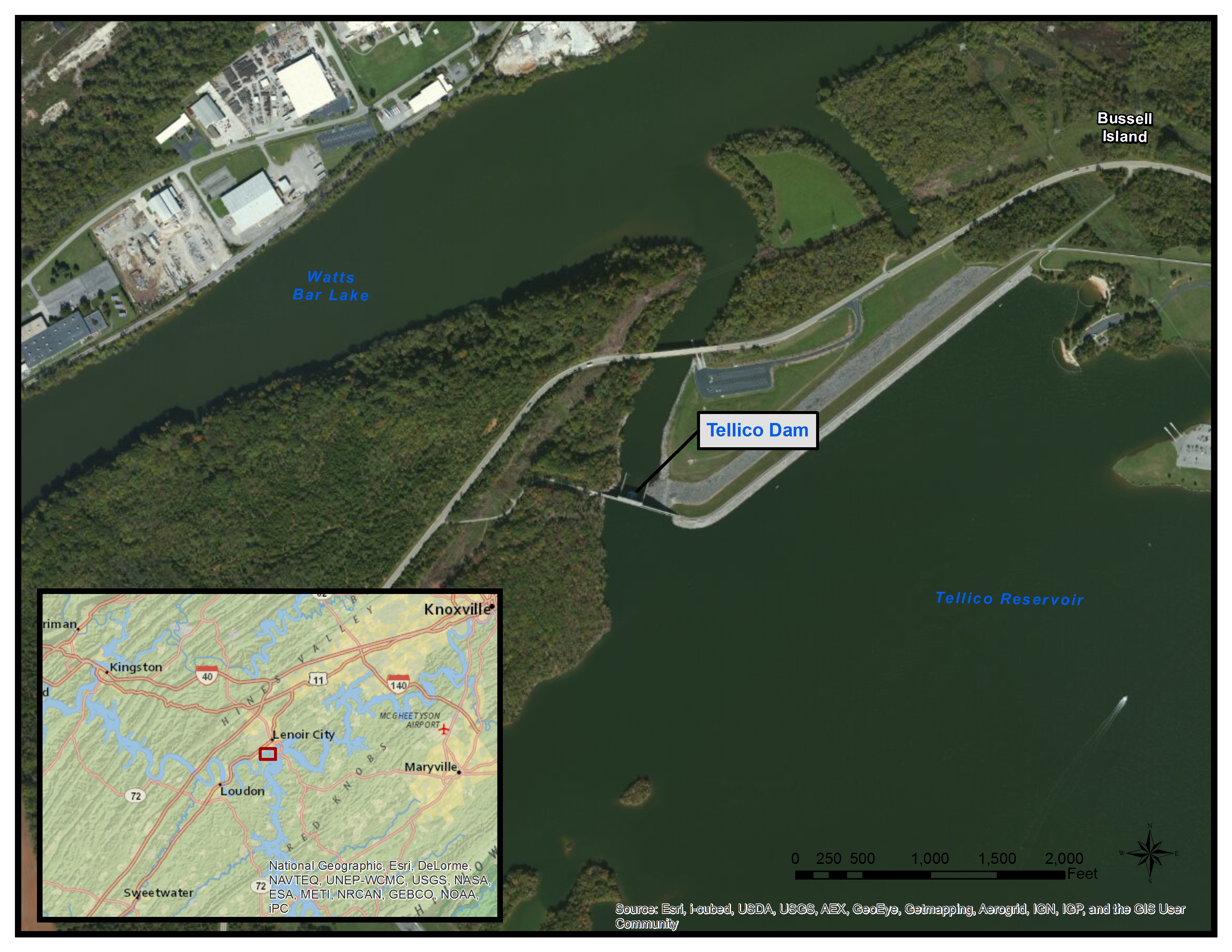
English: Map showing the location of Tellico Dam in Tennessee. |
| Source | http://www.esri.com/software/arcgis/arcgisonline/services/map-services |
| Author | ESRI |
| Permission (Reusing this file) |
http://www.esri.com/legal/copyright-trademarks |
| This work has been released into the public domain by its author, ESRI. This applies worldwide. In some countries this may not be legally possible; if so: ESRI grants anyone the right to use this work for any purpose, without any conditions, unless such conditions are required by law.
|
File history
Click on a date/time to view the file as it appeared at that time.
| Date/Time | Thumbnail | Dimensions | User | Comment | |
|---|---|---|---|---|---|
| current | 21:08, 22 April 2013 | | 3,300 × 2,550 (5.3 MB) | Totranm | Lowered resolution so thumbnail could be made |
| 21:00, 22 April 2013 |  | 11,000 × 8,500 (32.34 MB) | Totranm | {{subst:Upload marker added by en.wp UW}} {{Information |Description = {{en|Map showing the location of Tellico Dam in Tennessee. }} |Source = http://www.esri.com/software/arcgis/arcgisonline/services/map-services |Author = ESRI |Permission = http://ww... |
File usage
The following pages on the English Wikipedia use this file (pages on other projects are not listed):