
File:The M22 at Ballygrooby - geograph.org.uk - 220940.jpg
No higher resolution available.
The_M22_at_Ballygrooby_-_geograph.org.uk_-_220940.jpg (640 × 426 pixels, file size: 135 KB, MIME type: image/jpeg)
| This is a file from the Wikimedia Commons. Information from its description page there is shown below. Commons is a freely licensed media file repository. You can help. |
Summary
| Description |
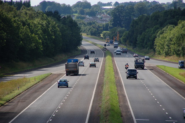
English: The M22 at Ballygrooby.
The M22 was intended as a westward extension of the M2 from Antrim to Castledawson carrying traffic for the north west of NI. It opened in two sections in 1971 and 1973 to just beyond Randalstown. The remainder was never built although the statutory procedures are now underway to build a dual carriageway instead. This is the view west towards Castledawson at Ballygrooby near Randalstown. |
| Date | |
| Source | From geograph.org.uk |
| Author | Albert Bridge |
| Permission (Reusing this file) |
Creative Commons Attribution Share-alike license 2.0 |
| Camera location | | View this and other nearby images on: OpenStreetMap |
|---|
Licensing

|
This image was taken from the
Creative Commons Attribution-ShareAlike 2.0 license. |
This file is licensed under the Creative Commons Attribution-Share Alike 2.0 Generic license.
Attribution: Albert Bridge
- You are free:
- to share – to copy, distribute and transmit the work
- to remix – to adapt the work
- Under the following conditions:
- attribution – You must give appropriate credit, provide a link to the license, and indicate if changes were made. You may do so in any reasonable manner, but not in any way that suggests the licensor endorses you or your use.
- share alike – If you remix, transform, or build upon the material, you must distribute your contributions under the same or compatible license as the original.
File history
Click on a date/time to view the file as it appeared at that time.
| Date/Time | Thumbnail | Dimensions | User | Comment | |
|---|---|---|---|---|---|
| current | 19:33, 10 October 2006 | | 640 × 426 (135 KB) | Regan123~commonswiki | {{geograph|J0989|Aubrey Dale}} The M22 at Ballygrooby The M22 was intended as a westward extension of the M2 from Antrim to Castledawson carrying traffic for the north west of NI. It opened in two sections in 1971 and 1973 to just beyond Randalstown. The |
File usage
The following pages on the English Wikipedia use this file (pages on other projects are not listed):
Global file usage
The following other wikis use this file:
- Usage on de.wikipedia.org
- Usage on nl.wikipedia.org
- Usage on pl.wikipedia.org
- Usage on www.wikidata.org