
File:Tuareg map he.svg

Size of this PNG preview of this SVG file: 608 × 600 pixels. Other resolutions: 243 × 240 pixels | 487 × 480 pixels | 778 × 768 pixels | 1,038 × 1,024 pixels | 2,076 × 2,048 pixels | 672 × 663 pixels.
Original file (SVG file, nominally 672 × 663 pixels, file size: 40 KB)
| This is a file from the Wikimedia Commons. Information from its description page there is shown below. Commons is a freely licensed media file repository. You can help. |
| Description |
|
||
| Date | (UTC) | ||
| Source |
|
||
| Author | Mark Dingemanse, Cumulus (talk) | ||
| Permission (Reusing this file) |
This file is licensed under the Creative Commons Attribution 2.5 Generic license.
|
||
| Other versions |
[]
|


This W3C-unspecified vector image was created with Inkscape .
Original upload log
This image is a derivative work of the following images:
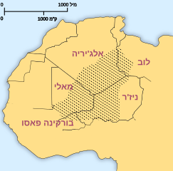
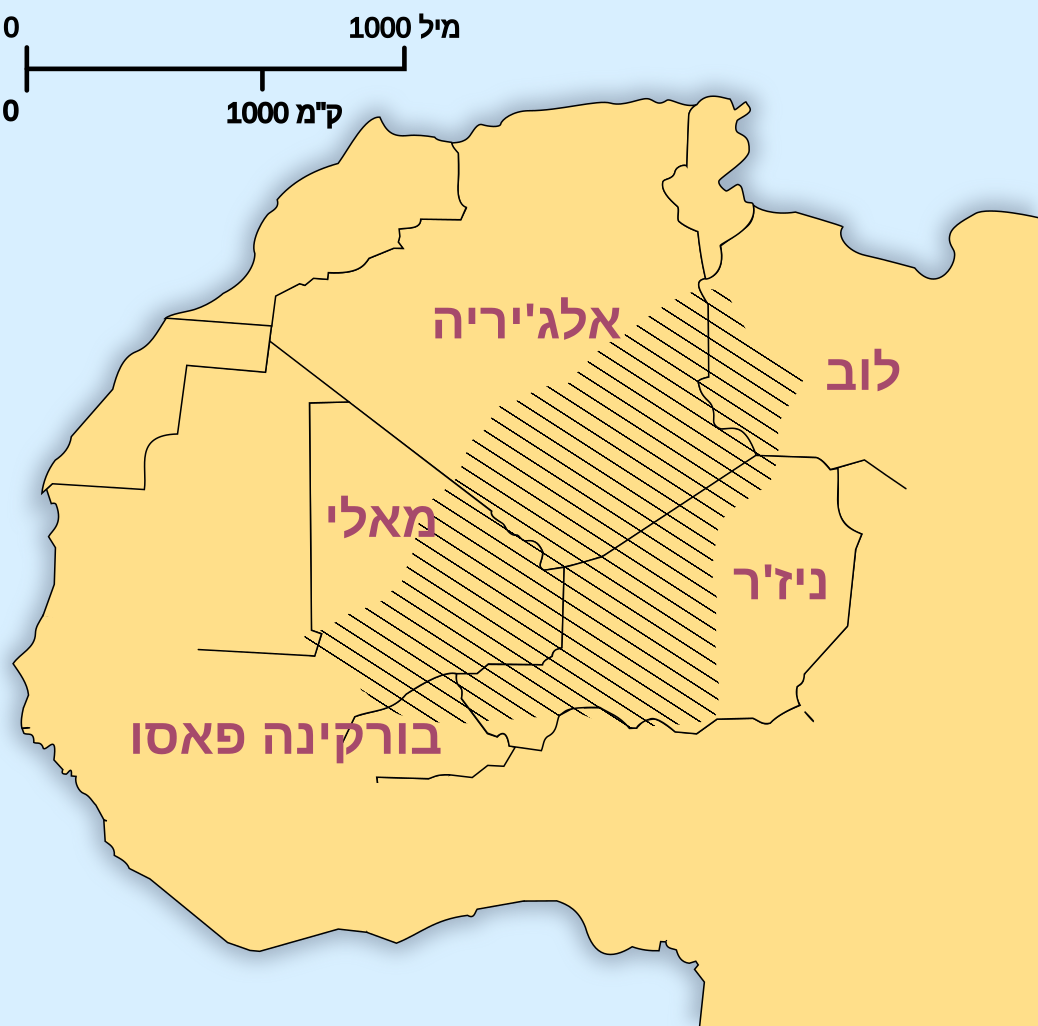
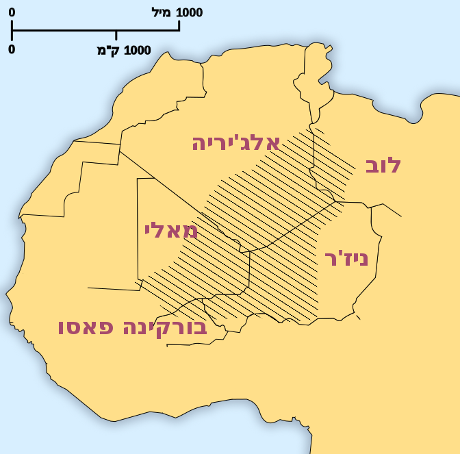
- File:Tuareg_area.png licensed with Cc-by-2.5
- 2004-12-26T22:36:42Z Mark Dingemanse 400x395 (11325 Bytes) Areas where significant numbers of Tuaregs live - created by Mark Dingemanse - {{cc-by-2.0}}
Uploaded with derivativeFX
File history
Click on a date/time to view the file as it appeared at that time.
| Date/Time | Thumbnail | Dimensions | User | Comment | |
|---|---|---|---|---|---|
| current | 16:08, 28 July 2024 | | 672 × 663 (40 KB) | Ата | File uploaded using svgtranslate tool (https://svgtranslate.toolforge.org/). Added translation for uk. |
| 13:30, 13 January 2010 |  | 672 × 663 (35 KB) | Ori~ | ed | |
| 12:56, 13 January 2010 |  | 672 × 663 (35 KB) | Cumulus | Bold text, hebrew in the distance scale. {{inkscape}} | |
| 12:44, 13 January 2010 |  | 672 × 663 (35 KB) | Cumulus | {{Information |Description=Areas where significant numbers of Tuaregs live. *Basset (1952) *Bernus (1996) ''Touaregs: un peuple du désert''. *Lhote (1984) *Sudlow (2001) *Bougchiche, Lamara. (1997) ''Langues et litteratures berberes des origines a nos |
File usage
No pages on the English Wikipedia use this file (pages on other projects are not listed).
Global file usage
The following other wikis use this file:
- Usage on ar.wikipedia.org
- Usage on he.wikipedia.org
- Usage on uk.wikipedia.org