
Fort Ricasoli
| Fort Ricasoli | |
|---|---|
Forti Rikażli | |
fort | |
| Area | 83,800 m2 (902,000 sq ft)[1] |
| Height | up to 20 m (66 ft) |
| Site information | |
| Owner | Government of Malta |
| Controlled by | Malta Film Commission Waste Oils Co. Ltd. |
| Open to the public | No |
| Condition | Mostly intact but dilapidated |
| Site history | |
| Built | 1670–1698 |
| Built by | Order of Saint John |
| In use | 1674–1964 |
| Materials | Limestone |
| Battles/wars | French invasion of Malta (1798) Siege of Malta (1798–1800) World War II |
| Events | Froberg mutiny |
Fort Ricasoli (
Fort Ricasoli saw use during the French invasion of Malta in 1798 and the subsequent Maltese insurrection, after which it ended up in British hands. Ricasoli was the site of the Froberg mutiny in 1807, and it was also used as a military hospital during the 19th century. It saw use once again in World War II, when parts of it were destroyed by aerial bombardment. After it was decommissioned in the 1960s, the fort was used for industrial purposes. Today, the fort remains mostly intact but in a dilapidated state, and it is used as a filming location and a tank cleaning facility. Plans to restore the fort were approved in June 2019.
Hospitaller rule
Background
Fort Ricasoli stands on the easternmost peninsula on the east side of the

A small semi-circular battery which was known as San Petronio Battery, and later as Orsi battery, was built at Gallows' Point in 1602.[7] On 18 January 1629, the Italian knight Alessandro Orsi financed the construction of a tower near the battery. It was officially called Torre San Petronio, but it was commonly known as Orsi Tower[7][8] or Torri Teftef by the locals.[9] The name San Petronio was chosen during the rule of Grandmaster de Paola, and the name dell’Orso became much popular after the renovation of the battery itself apart from the building of the tower.[10][3] It was also known as Torre De Falcha (Tower of the Gallows) in historic documents. Its exterior was plastered and painted with yellow ochre.[11] The tower was designed by Bartolomeo Ganga.[12] At this point the peninsula became known as Punta dell'Orso.[13]
The tower was built to prevent the escape of slaves from the island.[14] The tower and battery were protected by a sea-filled ditch and a drawbridge.[7][15] The tower and battery are visible in the distance in a 1664 drawing of the Grand Harbour by Willem Schellinks.[7] They remained standing until they were destroyed by waves in a storm on 8 February 1821,[5] and today only the rock-hewn ditch of the battery remains.[7][16]
In 1644, Giovanni de’ Medici proposed that Fort St. Angelo in Birgu be abandoned and a new fort be constructed on Orsi Point. The new fort would have been also called Fort St. Angelo, and would be manned with the garrison of the old fort. He drew up plans for the proposed fort, but they were never implemented.[5]
Construction and modifications

In 1669, fears of an Ottoman attack rose after the
In 1714, the French engineers Jacop de Puigirand de Tigné, Charles François de Mondion and Philippe de Vendôme criticized the small size of the fort's bastions, which they deemed ineffective. De Tigné proposed a number of alterations, including repairing the existing parapets and embrasures, as well as constructing a retrenchment within the fort. Vendôme proposed the construction of a canal separating the fort from the mainland. In 1722, the repairs proposed by de Tigné were implemented, although the retrenchment and canal were never built due to a lack of funds. The fort was in a bad state by the mid-18th century, and some maintenance work was done in 1761.[15]
In 1785, Ricasoli was armed with eighty cannons, including forty-one 24-pounders, making it the most heavily armed fort in Malta.[20] Parts of the fort's enceinte were rebuilt under the direction of Antoine Étienne de Tousard in the 1790s.[21]
The fort was also used as a prison prior to the construction of the
French occupation
Fort Ricasoli saw use during the French invasion of Malta in June 1798, during the French Revolutionary Wars. At the time, it was commanded by the Bali de Tillet, and was garrisoned by the Cacciatori, who were a volunteer chasseur light infantry regiment.[23] The fort repelled three French attacks, before surrendering after Grand Master Hompesch officially capitulated to Napoleon.[15]
In the subsequent Maltese uprising and blockade, the fort remained in French hands. It continually fired at the insurgents' San Rocco Battery, which was located about 700 m (2,300 ft) away.[24]
British rule
.jpg)
The fort continued to be an active military installation throughout the
The fort was also used as a temporary naval hospital in the late 1820s and early 1830s, before

In 1844, the fort was manned by 500 men. In 1848, Sir John Fox Burgoyne inspected Malta's fortifications, and considered Ricasoli as "impregnable". In the 1850s, artillery of a higher calibre was introduced to the fort, and the guns were replaced a number of times over the following decades. The seaward enceinte had been completely overhauled by 1878, and by the 1900s, new gun emplacements, searchlights and a torpedo station had been installed. In the 1930s, concrete fire control towers were built on No. 2, No. 3 and No. 4 bastions, and further searchlights were installed.[15]
Fort Ricasoli was active in the defence of Malta during
Recent history
Industrial use

After the fort was handed over to the Maltese government, it was initially abandoned but it later became a container depot for raw material arriving in Malta. In 1976, part of the ditch near the Left Ravelin was filled in, and St. Dominic Demi-Bastion was breached to make way for a new road.[5]
In 1964, the fort's ditch became a tank cleaning farm for the Malta Drydocks. The depot, which is known as Ricasoli Tank Cleaning Facilities, treats liquid waste from ships arriving in the Grand Harbour and removes oil and other chemicals prior to releasing the waste into the sea.[33] The facility was privatized in 2012,[34] and it is currently under the management of Waste Oils Co. Ltd.[35]
The area around the fort eventually became an industrial park, which was known as Ricasoli Industrial Estate after the fort. The industrial estate was demolished in 2007 to make way for SmartCity Malta.[36]
Filming location
Most of the fort is leased to the Malta Film Commission, and it has been used extensively as a location for various films and serials. In recent years, huge sets were built within its walls for the films Cutthroat Island (1995), Gladiator (2000), Troy (2004), Agora (2009), and Napoleon (2023). In these films, the fort stood in as Port Royal, Rome, Troy, Alexandria, and Toulon respectively.[37] The fort was also used in the filming of Assassin's Creed (2016)[38] and Entebbe (2018).
The TV miniseries
The first season of HBO's adaptation of George R. R. Martin's Game of Thrones used various parts of the fort to represent the Red Keep.[39]
Present condition
_02_ies.jpg)

Today, Fort Ricasoli remains largely intact, although it is in a dilapidated state.[40] The headland that it is built upon is prone to coastal erosion, and some of the walls between No. 3 and No. 4 bastions have already collapsed into the sea.[41] In 2004, the Restoration Unit of the Ministry of Resources and Infrastructure removed, restored and re-attached part of the fort's walls,[42] but nothing has been done to restore the entire fort.[43]
In May 2015, the Democratic Alternative[44] and some NGOs suggested that the campus of the proposed American University of Malta should be split up between Fort Ricasoli and the nearby Fort Saint Rocco and Fort San Salvatore.[45] This proposal was not implemented, as the campus is to be split up between Dock No. 1 in Cospicua and Żonqor Point in Marsaskala.[46]
By 2018, heritage NGOs had made repeated calls for the fort to be restored.[47][48] Some works meant to attract more film productions began in early 2019,[49] and plans for extensive restoration works (originally submitted to the Planning Authority in 2013) were approved in June 2019.[50] This move was welcomed by NGOs.[51]
Layout
Fort Ricasoli has an irregular plan following the coastline of the peninsula it is built upon. The fort consists of a bastioned land front and its outworks, an enceinte facing the sea, and a tenaille trace facing Rinella Bay of the Grand Harbour.
Land front

The land front consists of the following bastions and demi-bastions, which are linked together by curtain walls:[52]
- St. Dominic's Demi-Bastion, also known as Left Demi-Bastion or No. 5 Bastion – the demi-bastion at the northern end of the land front. It was damaged during the Froberg mutiny of 1807, when its magazine was blown up.[53]
- St. Francis Bastion, also known as Central Bastion or No. 6 Bastion – a pentagonal bastion at the centre of the land front. It contains a traverse and a covered abris.[54]
- St. John's Demi-Bastion, also known as Right Demi-Bastion or No. 7 Bastion – the demi-bastion at the southern end of the land front.[55]
The land front contains casemates, which were used as barracks.[30]

The land front is further protected by the following outworks:
- a faussebraye in the form of a crownwork encircling the entire land front.[56]
- St. Dominic Counterguard – a casemated counterguard near the left extremity of the land front. It was heavily damaged by the action of seawater, with half of the structure having collapsed.[57]
- two triangular ravelins between the St. Francis Bastion and either of the demi-bastions.[58] The Left Ravelin contains a 6-inch (152mm) breech-loading (BL) gun emplacement.[59]
- two caponiers leading from the land front to each of the ravelins. Extensive modifications were made to their structures by the British.[60][61]
The outworks are surrounded by a ditch,[62] a covertway[63] and a glacis.[64]
Sea front enceinte

The enceinte facing the open sea is made up of the following bastions and curtain walls:
- No. 1 Bastion – a demi-bastion linked to a tenaille, forming Point Battery. It originally contained an échaugette, a protruding tower, but this was dismantled to make way for a directing station for the Brennan Torpedo System. A gun emplacement for an RML 12.5-inch 38 ton gun is located on the bastion's face.[65]
- No. 1 Curtain – curtain wall between No. 1 and No. 2 bastions, containing a casemated battery and a searchlight emplacement.[66]
- No. 2 Bastion – an asymmetrical bastion containing embrasures, and various British gun emplacements, magazines and a fire control tower.[67]
- No. 2 Curtain – curtain wall between No. 2 and No. 3 bastions, containing embrasures, an expense magazine (where ammunition intended for immediate use was stored) and a searchlight emplacement.[68]
- No. 3 Bastion – a flat-faced bastion, containing embrasures and various British gun emplacements, magazines and a fire control tower.[69]
- a curtain wall near No. 4 Bastion, containing embrasures, magazines and a sally port. Part of the curtain wall has collapsed into the sea.[70]
- No. 4 Bastion – a small bastion, containing a gun emplacement, magazine, gun crew shelters and a fire control tower.[71]
- No. 5 Curtain – curtain wall between No. 4 Bastion and St. Dominic Demi-Bastion of the land front, containing gun emplacements, magazines and gun crew shelters.[72]
A shallow rock-hewn ditch extends from No. 1 to No. 3 bastions.[73]
Harbour tenaille trace


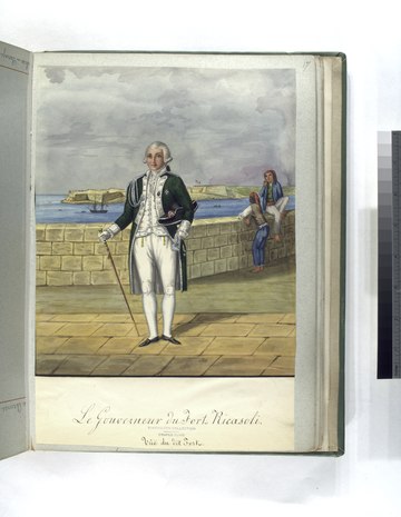
The enceinte along Rinella Bay is made up of a tenaille trace with high walls.[74] The fort's main gate is located within the enceinte.[75] The Governor's House (now demolished) and a Chapel of St Nicholas are located within the fort, close to the main gate.[76] An inscription on the gate commemorates the inauguration of the fort in 1698 and gives praise to Grand Master Perellos.[3]
The rock-hewn ditch of Orsi Battery can still be seen at the northern end of the tenaille, at the tip of the peninsula.[16]
The British built a
Further reading
- Quintano, Anton (1977). Henry Frendo (ed.). "Fort Ricasoli: A Historical Survey, 1670–1798" (PDF). Storja. 78 (13). University of Malta: 164–165.
References
- ^ "The American University of Malta – Preliminary Alternative Sites Evaluation Report" (PDF). Office of the Prime Minister. August 2015. p. 8. Archived from the original (PDF) on 16 November 2015.
- ^ "Knights' Fortifications around the Harbours of Malta". UNESCO Tentative List. Retrieved 15 July 2015.
- ^ a b c Abela, Giovanni Francesco (3 April 1772). "Malta illustrata... accresciuta dal Cte G.A. Ciantar". Mallia. p. 93. Retrieved 3 April 2019 – via Google Books.
- ^ "Malta bil chzejer tehne u li ghadda min ghaliha: L'euel parti". 3 April 1865. Retrieved 3 April 2019 – via Google Books.
- ^ a b c d e Quintano, Anton. "Fortifications: Fort Ricasoli". Heritage: An Encyclopedia of Maltese Culture and Civilization. 4. Midsea Books Ltd: 1101–1107.
- ISBN 9781447841791.
- ^ ISBN 978-99957-67-38-9.
- ^ Abela, Giovanni Francesco (1647). Della Descrizione di Malta Isola nel Mare Siciliano con le sue Antichità, ed Altre Notizie (in Italian). Paolo Bonacota. p. 20.
- ^ Castagna, P. P. (1865). Malta bil chzejer tehne u li ghadda min ghaliha (in Maltese). Vol. 1. p. 160.
- ^ Zammit, Vincent (2005). "Lost ancient landmarks: Orsi tower". Heritage: An Encyclopedia of Maltese Culture and Civilization. 4 (64). Midsea Books Ltd: 1255–1257.
- ^ Duggan, Terrance M. P. (20 July 2013). "Erasing Malta's Heritage of Surfacing and Paintwork on Facades and Fortifications and, A Request to the Reader". Malta Today. Retrieved 3 April 2019.
- ^ Serracino, Joseph (6 January 2018). "Dawra kulturali mal-Port il-Kbir (4)" (PDF). Orizzont. p. 20.
- ^ Bonniċi, A. (1975, September 20). Il-Forti Ricasoli u l-Palazz Bichi. Leħen is-Sewwa, pp. 3.
- OCLC 317186765.
- ^ a b c d e f g h Bonnici, Hermann (2004–2007). "Fort Ricasoli" (PDF). Arx – Online Journal of Military Architecture and Fortification (1–4): 33–38. Archived from the original (PDF) on 15 November 2015. Retrieved 10 October 2015.
- ^ a b "Orsi Battery remains – Fort Ricasoli" (PDF). National Inventory of the Cultural Property of the Maltese Islands. 28 June 2013. Archived from the original (PDF) on July 14, 2015. Retrieved 13 July 2015.
- OCLC 958683792.
- ^ "Vella, J. (2007). Antonio Maurizio Valperga. Programm tal-festa Marija Immakulata fil-belt ta' Bormla Festa 2007, 49, 51, 53, 55" (PDF).
{{cite journal}}: Cite journal requires|journal=(help) - ^ https://www.um.edu.mt/library/oar/bitstream/123456789/41375/1/L-arkitettura_xhieda_ta_l-identita_nazzjonali_1989.pdf [bare URL PDF]
- ^ Spiteri, Stephen C. (2014). "Fort Manoel". ARX Occasional Papers (4): 176. Retrieved 30 January 2016.
- ^ Spiteri, Stephen C. (2011). "Fort Tigné 1792". ARX Occasional Papers (1): 6. Retrieved 30 January 2016.
- ^ "Corradino Correctional Facility". Ministry for Home Affairs and National Security. Archived from the original on 29 June 2015.
- ^ "Caccatori Maltesi". Historical Re-Enactment Group of Malta. 24 June 2009. Retrieved 28 August 2015.
- ^ Spiteri, Stephen C. (May 2008). "Maltese 'siege' batteries of the blockade 1798–1800" (PDF). Arx – Online Journal of Military Architecture and Fortification (6): 35. Retrieved 24 March 2015.
- ^ Dandria, David (1 February 2015). "The 1807 Froberg regiment mutiny at Fort Ricasoli". Times of Malta. Archived from the original on 14 March 2015.
- ^ "Regimental Hospitals and Military Hospitals of the Malta Garrison". Maltarmc.com. British Army Medical Services And the Malta Garrison 1799 – 1979. Archived from the original on 17 November 2015. Retrieved 30 November 2014.
- ^ Bonniċi, A. (1975, NOvember 15). L-Ospizju tal-Furjana. Leħen is-Sewwa, pp. 3.
- ^ Bonniċi, A. (1975, November 1). L-erwieħ ta' Wied Għammieq. Leħen is-Sewwa, pp. 4, 11.
- ^ "Wied Ghammieq Cemetery Sadly neglected". The Malta Independent. 11 May 2006. Retrieved 15 November 2015.
- ^ Her Majesty's Stationery Office. 1866. p. 327.
- ^ Debono, Charles (20 November 2011). "The Battle of Valletta 70 years ago". Times of Malta. Archived from the original on 7 January 2016.
- ^ Leone-Ganado, P. (2019, March 20). Octogenarian recalls 1949 storm that almost killed her father, Times of Malta, pp. 3.
- ^ "Decision on Ricasoli port facilities for waste oils postponed". Times of Malta. 5 March 2015. Retrieved 15 November 2015.
- ^ "Parliament was 'bypassed' over Ricasoli tank farm". Times of Malta. 28 May 2012. Archived from the original on 17 November 2015.
- ^ "Waste Oils given 30-year contract to manage Ricasoli Tank Cleaning Facilities". Times of Malta. 4 January 2013. Archived from the original on 17 November 2015.
- ^ Zammit, Rosanne (3 August 2007). "Mepa approves demolition of Ricasoli factories". Times of Malta. Archived from the original on 17 November 2015.
- ^ a b "Fort Ricasoli". Malta Film Commission. Retrieved 30 November 2014.
- ^ Siegel, Lucas (4 November 2014). "New Assassin's Creed Set Pictures, Shooting Information from Malta". Comicbook.com. Archived from the original on 27 November 2015.
- ^ "Locations of Thrones: Malta (Part 1)". Cultureaddicthistorynerd.com. 9 August 2011. Retrieved 30 November 2014.
- ^ Carabott, Sarah (29 August 2016). "Forts under attack from neglect and vandalism". Times of Malta. Archived from the original on 30 August 2016.
- ^ Said, Edward (17 October 2006). "In need of repair". Times of Malta. Retrieved 30 November 2014.
- ^ Cini, George (20 January 2004). "Lm110,000 restoration job on Fort Ricasoli rampart". Times of Malta. Retrieved 15 November 2015.
- ^ Said, Edward (3 September 2010). "Fort Ricasoli is under serious threat". Times of Malta. Retrieved 9 March 2014.
- ^ "AD suggests Ricasoli as new university site". Times of Malta. 4 May 2015. Retrieved 5 May 2015.
- ^ Alternative Sites proposal for a new University Campus. National Independent Forum for Sustainability. 25 May 2015. pp. 10–11. Retrieved 6 June 2015.
- ^ "'American' University to occupy Dock 1 buildings and reduced Zonqor site". Times of Malta. 20 August 2015. Retrieved 20 August 2015.
- ^ Camilleri, Neil (16 July 2018). "Ricasoli: The fort that is not so slowly being eaten up by the sea". The Malta Independent. Archived from the original on 21 October 2018.
- ^ "Association calls for emergency works, long-term restoration plan for Fort Ricasoli". The Malta Independent. 27 August 2018. Archived from the original on 28 August 2018.
- ^ Demicoli, Keith (16 April 2019). "Fort Ricasoli undergoing restoration works to attract more film productions". TVM. Archived from the original on 18 April 2019.
- ^ Leone Ganado, Philip (18 June 2019). "Not a moment too soon... Fort Ricasoli will finally be restored". Times of Malta. Archived from the original on 18 June 2019.
- ^ Fsadni, Stephanie (24 June 2019). "Fort Ricasoli restoration – 'all layers of history must be preserved'". Times of Malta. Archived from the original on 24 June 2019.
- ISBN 9789990996531.
- ^ "St Dominic Demi-Bastion – Fort Ricasoli" (PDF). National Inventory of the Cultural Property of the Maltese Islands. 28 June 2013. Archived from the original (PDF) on April 2, 2015. Retrieved 13 July 2015.
- ^ "Central Bastion – Fort Ricasoli" (PDF). National Inventory of the Cultural Property of the Maltese Islands. 28 June 2013. Archived from the original (PDF) on July 14, 2015. Retrieved 13 July 2015.
- ^ "Right Demi-Bastion & adjoining curtain – Fort Ricasoli" (PDF). National Inventory of the Cultural Property of the Maltese Islands. 28 June 2013. Archived from the original (PDF) on July 14, 2015. Retrieved 13 July 2015.
- ^ "Faussebraye – Fort Ricasoli" (PDF). National Inventory of the Cultural Property of the Maltese Islands. 28 June 2013. Archived from the original (PDF) on July 14, 2015. Retrieved 13 July 2015.
- ^ "Counterguard – Fort Ricasoli" (PDF). National Inventory of the Cultural Property of the Maltese Islands. 28 June 2013. Archived from the original (PDF) on July 14, 2015. Retrieved 13 July 2015.
- ^ "Right Ravelin – Fort Ricasoli" (PDF). National Inventory of the Cultural Property of the Maltese Islands. 28 June 2013. Archived from the original (PDF) on July 14, 2015. Retrieved 13 July 2015.
- ^ "Left Ravelin – Fort Ricasoli" (PDF). National Inventory of the Cultural Property of the Maltese Islands. 28 June 2013. Archived from the original (PDF) on July 14, 2015. Retrieved 13 July 2015.
- ^ "Right Caponier – Fort Ricasoli" (PDF). National Inventory of the Cultural Property of the Maltese Islands. 28 June 2013. Archived from the original (PDF) on July 14, 2015. Retrieved 13 July 2015.
- ^ "Left Caponier – Fort Ricasoli" (PDF). National Inventory of the Cultural Property of the Maltese Islands. 28 June 2013. Archived from the original (PDF) on July 14, 2015. Retrieved 13 July 2015.
- ^ "Land front ditch – Fort Ricasoli" (PDF). National Inventory of the Cultural Property of the Maltese Islands. 28 June 2013. Archived from the original (PDF) on July 14, 2015. Retrieved 13 July 2015.
- ^ "Covertway – Fort Ricasoli" (PDF). National Inventory of the Cultural Property of the Maltese Islands. 28 June 2013. Archived from the original (PDF) on July 14, 2015. Retrieved 13 July 2015.
- ^ "Glacis – Fort Ricasoli" (PDF). National Inventory of the Cultural Property of the Maltese Islands. 28 June 2013. Archived from the original (PDF) on July 14, 2015. Retrieved 13 July 2015.
- ^ "No 1 Bastion and Tenaille – Fort Ricasoli" (PDF). National Inventory of the Cultural Property of the Maltese Islands. 28 June 2013. Archived from the original (PDF) on July 14, 2015. Retrieved 13 July 2015.
- ^ "No 1 Curtain – Fort Ricasoli" (PDF). National Inventory of the Cultural Property of the Maltese Islands. 28 June 2013. Archived from the original (PDF) on July 14, 2015. Retrieved 13 July 2015.
- ^ "No. 2 Bastion – Fort Ricasoli" (PDF). National Inventory of the Cultural Property of the Maltese Islands. 28 June 2013. Archived from the original (PDF) on July 14, 2015. Retrieved 13 July 2015.
- ^ "No.2 Curtain – Fort Ricasoli" (PDF). National Inventory of the Cultural Property of the Maltese Islands. 28 June 2013. Archived from the original (PDF) on July 14, 2015. Retrieved 13 July 2015.
- ^ "No. 3 Bastion – Fort Ricasoli" (PDF). National Inventory of the Cultural Property of the Maltese Islands. 28 June 2013. Archived from the original (PDF) on July 14, 2015. Retrieved 13 July 2015.
- ^ "Curtain near No.4 Bastion – Fort Ricasoli" (PDF). National Inventory of the Cultural Property of the Maltese Islands. 28 June 2013. Archived from the original (PDF) on July 14, 2015. Retrieved 13 July 2015.
- ^ "No 4 Bastion – Fort Ricasoli" (PDF). National Inventory of the Cultural Property of the Maltese Islands. 28 June 2013. Archived from the original (PDF) on July 14, 2015. Retrieved 13 July 2015.
- ^ "No 5 Curtain – Fort Ricasoli" (PDF). National Inventory of the Cultural Property of the Maltese Islands. 28 June 2013. Archived from the original (PDF) on July 14, 2015. Retrieved 13 July 2015.
- ^ "Sea front ditch – Fort Ricasoli" (PDF). National Inventory of the Cultural Property of the Maltese Islands. 28 June 2013. Archived from the original (PDF) on July 14, 2015. Retrieved 13 July 2015.
- ^ a b "Harbour tenaille trace – Fort Ricasoli" (PDF). National Inventory of the Cultural Property of the Maltese Islands. 28 June 2013. Archived from the original (PDF) on July 14, 2015. Retrieved 13 July 2015.
- ^ "Main Gate and remains of Governor's House – Fort Ricasoli" (PDF). National Inventory of the Cultural Property of the Maltese Islands. 28 June 2013. Archived from the original (PDF) on July 14, 2015. Retrieved 13 July 2015.
- ^ "Chapel of St Nicholas – Fort Ricasoli" (PDF). National Inventory of the Cultural Property of the Maltese Islands. 28 June 2013. Archived from the original (PDF) on July 14, 2015. Retrieved 13 July 2015.
Further reading
- Quintano, Anton (1999). Ricasoli, Malta: History of a Fort. Publishers Enterprises Group (PEG), Limited. ISBN 9789990902433.
External links
| |
| Authority control databases: Geographic |
|---|