
Freeport, Bahamas
This article needs additional citations for verification. (July 2009) |
Freeport | |
|---|---|
City | |
| City of Freeport | |
UTC-5 (Eastern Time Zone) | |
| Area code | 242 |
| IATA airport code | FPO |
| ICAO airport code | MYGF |
| Website | http://gbpa.com/home/ |
Freeport is a
The main airport serving the city is the Grand Bahama International Airport, which receives domestic flights from various islands of the Bahamas as well as several international flights from the United States, Italy, and Canada. Freeport is also served by domestic Bahamian ferry services to other islands, and an international ferry connection to Miami.
The Grand Bahama Port Authority (GBPA) operates the free trade zone, under the Hawksbill Creek Agreement signed in August 1955 whereby the Bahamian government agreed that businesses in the Freeport area would pay no taxes before 1980, later extended to 2054.[1] The area of the land grants within which the Hawksbill Creek Agreement applies has been increased to 56,000 hectares (138,000 acres).[2]
History
Freeport is a 600 km2 (230 sq mi) free trade zone on Grand Bahama Island, established in 1955 by the government of The Bahamas. The city of Freeport emerged from a land grant comprising 20,000 hectares (50,000 acres) of swamp and scrub to become a cosmopolitan centre. The Grand Bahama Port Authority (GBPA) operates the free-trade zone, under special powers conferred by the government under the Hawksbill Creek Agreement,[3] which was recently[when?] extended until August 3, 2054. The agreement also increased the land grants to 56,000 hectares (138,000 acres).
The city was severely impacted by Hurricane Dorian with damage still being assessed as of 12 September 2019.[4][needs update]
Geography
Freeport is located just 108 kilometres (67 mi) off the coast of
National parks
Parks include the Rand Nature Centre, named after its founder James Rand; Petersons Cay, a small isle about 300 yards off the shore of Grand Bahama; and the Lucayan National Park founded by Peter Barratt, a former architect and town planner of Freeport. The Lucayan National Park is 16 hectares (40 acres) in extent and includes five ecological zones stretching from the south shore to the pineyard.[5] There is an extensive underwater cave system beneath the park. One cave entrance is accessible by stairs at the national park, while other caves are accessible for certified scubas.
Climate
Freeport features a
| Climate data for Freeport (1971-2000) | |||||||||||||
|---|---|---|---|---|---|---|---|---|---|---|---|---|---|
| Month | Jan | Feb | Mar | Apr | May | Jun | Jul | Aug | Sep | Oct | Nov | Dec | Year |
| Mean daily maximum °C (°F) | 24.3 (75.8) |
24.4 (75.9) |
25.8 (78.4) |
27.4 (81.3) |
29.7 (85.4) |
31.2 (88.2) |
32.2 (90.0) |
32.3 (90.2) |
31.7 (89.0) |
29.7 (85.4) |
27.3 (81.2) |
25.1 (77.2) |
28.4 (83.2) |
| Mean daily minimum °C (°F) | 15.9 (60.7) |
15.6 (60.0) |
17.5 (63.5) |
19.2 (66.6) |
21.1 (69.9) |
23.2 (73.8) |
23.9 (75.1) |
23.9 (75.1) |
23.3 (74.0) |
21.4 (70.5) |
19.4 (66.9) |
17.0 (62.6) |
20.1 (68.2) |
| Average precipitation mm (inches) | 83.1 (3.27) |
72.6 (2.86) |
93.5 (3.68) |
66.8 (2.63) |
104.7 (4.12) |
176.0 (6.93) |
165.4 (6.51) |
207.8 (8.18) |
217.4 (8.56) |
142.8 (5.62) |
93.0 (3.66) |
73.7 (2.90) |
1,496.8 (58.92) |
| Average rainy days | 10 | 9 | 9 | 7 | 12 | 17 | 18 | 19 | 19 | 16 | 11 | 10 | 157 |
| Mean monthly sunshine hours | 217 | 226 | 279 | 270 | 279 | 270 | 279 | 279 | 240 | 248 | 210 | 217 | 3,014 |
| Mean daily sunshine hours | 7 | 8 | 9 | 9 | 9 | 9 | 9 | 9 | 8 | 8 | 7 | 7 | 8 |
| Percent possible sunshine | 65 | 71 | 75 | 70 | 67 | 65 | 66 | 69 | 65 | 70 | 65 | 67 | 68 |
| Average ultraviolet index | 5 | 7 | 9 | 10 | 11 | 11 | 11 | 11 | 10 | 8 | 6 | 5 | 9 |
| Source 1: WMO [8] | |||||||||||||
| Source 2: Weather Atlas (rain days, sun, and uv)[9] | |||||||||||||
Economy
Tourism draws more than 1 million visitors per year, but has diminished since 2004, when major hurricanes Hurricane Frances and Hurricane Jeanne made landfall; in 2016, Hurricane Matthew hit the island. In early September 2019, Hurricane Dorian moved over the area and stalled for over a day, causing extensive devastation. Several cruise ships stop weekly at the island. Much of the tourist industry is centered on the seaside suburb of Lucaya, owing its name to the pre-Columbian Lucayan inhabitants of the island evidence of whom has been found on the island. Freeport features at least two Junkanoo festivals near New Year's.
The city is often promoted as Freeport/Lucaya. Most hotels on the island are located in Lucaya along the southern shore facing the Northwest Providence Channel. The primary shopping venue for tourists is the Port Lucaya Marketplace in Lucaya. Recovery from the 2004 Hurricanes Jeanne and Frances took nearly a decade and led to closure of the older shopping venue International Bazaar and neighboring Bahamas Princess Resort and Casino.
Notable natives and residents
- Janine Antoni - conceptual artist
- Robert Antoni - novelist, professor
- Sebastian Bach - Canadian singer, frontman of the band Skid Row
- JoBeth Coleby-Davis - Bahamian Progressive Liberal Party politician, attorney
- Andre Deveaux- NHL player
- Joanna Evans Olympian Swimmer
- Tynia Gaither - sprint Olympian
- Jeffery Gibson - 400mH world champ medalist & Olympian
- Shavez Hart - sprint Olympian
- Jack Hayward - British businessman
- Raymond Higgs - Olympian Jumper
- Buddy Hield - NBA player
- Jonquel Jones - WNBA player
- Johnny Kemp- Singer/Songwriter
- Justin Hill - British writer
- Michael Mathieu - sprint Olympic medalist
- Demetrius Pinder - sprint Olympic medalist
- Mate Pavic- Croatian professional tennis player
- Vasek Pospisil - Canadian professional tennis player
- Magnum Rolle - NBA Player
- Alonzo Russell - sprint Olympian medalist
- Nivea Smith - Sprint athlete
- Teray Smith - Sprint Olympian
- Michael Strachan- NFL player
- Donald Thomas- high jump world champion and Olympian
- Andrae Williams - sprint Olympic medalist
- LaToy Williams - sprint athlete
- Chavez Young - baseball player
Twin towns – sister cities
Freeport is twin towns and
- Concord, North Carolina, United States, since 2019 [10]
- Newark, New Jersey, United States, since 1990[11]
Gallery
-
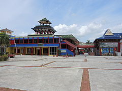 The International Bazaar
 -
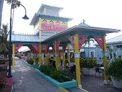 Port Lucaya Marketplace
 -
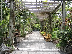 The Garden of the Groves
 -
 Bridge in the Garden of the Groves
 -
 Seagulls at Taino Beach
 -
 Taino Beach
 -
 Boardwalk at Lucayan National Park
 -
 Lucayan National Park
 -
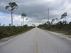 Grand Bahama Highway
 -
 Kitesurf at Banana Bay
 -
 Freeport Harbor
 -
 Freeport Cruise Ship Terminal
 -
 Freeport Cruise Terminal Shops


See also
References
- ^ Blount, Steve. "Freeport, Bahamas". USA Today. Retrieved 8 January 2014.
- ^ "Freeport Grand Bahama". Government of the Bahamas. 25 October 2023.
- ^ "The History of Freeport, Grand Bahama Island". Retrieved 8 January 2014.
- ^ Lyons (Now), Kate; Rourke, Alison; Singh, Maanvi; Weaver (Earlier), Matthew (3 September 2019). "Storm pummels Grand Bahama for 24 hours – as it happened". The Guardian.
- ^ "The National Parks of The Bahamas". Bnt.bs. Retrieved 8 January 2014.
- ^ ^ Walker, N. D., Roberts, H. H., Rouse, L. J. and Huh, O. K. (1981, November 5). Thermal History of Reef-Associated Environments During A Record Cold-Air Outbreak Event. Coral Reefs (1982) 1:83–87
- ^ "78062: Freeport, Grand Bahama (Bahamas, The)". ogimet.com. OGIMET. 30 January 2022. Retrieved 31 January 2022.
- ^ "Climatological Information". WMO. 2016. Retrieved November 24, 2011.
- ^ "Monthly weather forecast and climate - Freeport, The Bahamas". Weather Atlas. Retrieved March 29, 2020.
- ^ Thompson, Adam (9 August 2019). "Concord's new sister city – Freeport, Bahamas". Independent Tribune. Retrieved 4 January 2021.
- ^ Sister Cities https://sistercities.org/sites/default/files/Newark,%20NJ-Freeport,%20Bahamas.pdf. Retrieved 4 January 2021.
{{cite web}}: Missing or empty|title=(help)
Further reading
- Barratt, Peter. Grand Bahama. IM Publishing, Freeport, 2002 (3rd edition) ISBN 0-9717351-0-7
External links
 Media from Commons
 Travel information from Wikivoyage
- "Freeport ( 2009-11-01)," Microsoft Encarta Online Encyclopedia 2008.
- "Fast Facts," Grand Bahama Port Authority, http://www.gbpa.com/index.php/freeport, c.2008.
| Geographic | |
|---|---|
| Other | |