
Fulton Street station (New York City Subway)
Fulton Street | |||||||||||
|---|---|---|---|---|---|---|---|---|---|---|---|
| Structure | Underground | ||||||||||
| Levels | 3 (Eighth Avenue Line platforms intersect the other 3 lines; Nassau Street platforms are on 2 levels) | ||||||||||
| Other information | |||||||||||
| Opened | Transfer between IND Eighth Avenue Line, BMT Nassau Street, and IRT Broadway–Seventh Avenue Line: July 1, 1948[2] Transfer to IRT Lexington Avenue Line: August 25, 1950[3] | ||||||||||
| Accessible | |||||||||||
| Traffic | |||||||||||
| 2022 | 14,963,870[4] | ||||||||||
| Rank | 5 out of 423[4] | ||||||||||
| |||||||||||
| |||||||||||
| |||||||||||


The Fulton Street station is a major
The Lexington Avenue Line station was built for the
The Lexington Avenue, Nassau Street, and Broadway–Seventh Avenue Line stations run north–south under
History
First subway
Construction and opening
Planning for a subway line in New York City dates to 1864.[5]: 21 However, development of what would become the city's first subway line did not start until 1894, when the New York State Legislature passed the Rapid Transit Act.[5]: 139–161 The subway plans were drawn up by a team of engineers led by William Barclay Parsons, the Rapid Transit Commission's chief engineer.[6]: 3 The Rapid Transit Construction Company, organized by John B. McDonald and funded by August Belmont Jr., signed the initial Contract 1 with the Rapid Transit Commission in February 1900,[7] in which it would construct the subway and maintain a 50-year operating lease from the opening of the line.[5]: 165 In 1901, the firm of Heins & LaFarge was hired to design the underground stations.[6]: 4 Belmont incorporated the Interborough Rapid Transit Company (IRT) in April 1902 to operate the subway.[5]: 162–191
Several days after Contract 1 was signed, the Board of Rapid Transit Railroad Commissioners instructed Parsons to evaluate the feasibility of extending the subway south to
The IRT Lexington Avenue Line station opened on January 16, 1905, as part of a one-stop southward extension from
Early modifications

To address overcrowding, in 1909, the New York Public Service Commission proposed lengthening the platforms at stations along the original IRT subway.[21]: 168 As part of a modification to the IRT's construction contracts made on January 18, 1910, the company was to lengthen station platforms to accommodate ten-car express and six-car local trains. In addition to $1.5 million (equivalent to $49.1 million in 2023) spent on platform lengthening, $500,000 (equivalent to $16.4 million in 2023) was spent on building additional entrances and exits. It was anticipated that these improvements would increase capacity by 25 percent.[22]: 15 The northbound platform at the Fulton Street station was extended 150 feet (46 m) to the south, while the southbound platform was extended 135 feet (41 m) to the south. The northbound platform extension required underpinning adjacent buildings, while the southbound platform extension was largely in the basements of adjacent properties and involved extensive reconstruction of these buildings.[22]: 117 On January 23, 1911, ten-car express trains began running on the East Side Line, and the next day, ten-car express trains began running on the West Side Line.[21]: 168 [23] Staircases from the southbound platform to 195 Broadway, at the northwest corner of Broadway and Dey Street, opened in 1916.[24]
Dual Contracts expansion
After the original IRT opened, the city began planning new lines. In April 1912, the
Broadway–Seventh Avenue Line
_26_-_IRT_7th_Avenue.jpg)
As part of the Dual Contracts, the New York City Public Service Commission planned to split the original IRT system into three segments: two north-south lines, carrying through trains over the
The Public Service Commission began soliciting bids for the William Street portion of the line in September 1914.[40][41] Smith, Hauser, & McIsaac submitted a low bid of $2.254 million (equivalent to $69 million in 2023).[41] The awarding of the contract was delayed by a dispute over whether gas mains should be carried on temporary overpasses above the tunnel's excavation site.[42][43] Another dispute arose over the locations of subway entrances. The Fulton Street station was supposed to have entrances along the sidewalk on William Street,[44] but local business and civic groups argued that the subway entrances, despite being only 6.5 feet (2.0 m) wide, would occupy much of the 9-foot-wide (2.7 m) sidewalk.[45][46] By March 1916, two business owners on the street had agreed to add subway entrances in their buildings to the Fulton Street station.[47][48] Prior to the start of construction, the city government agreed to pay for any damage caused by the project.[49] The contractors underpinned every building along the tunnel because most of the buildings had shallow foundations that extended only to a shallow layer of quicksand, rather than to the bedrock below.[35][36] Discussions of the station's exits continued through early 1918.[50]
The line was nearly completed by late 1917, but the signals and station finishes were incomplete due to
Nassau Street Line

Also as part of the Dual Contracts, the BRT (after 1923, the
The city government agreed to build the Nassau Street Line in May 1927,
When the construction contracts were awarded, work had been projected to be completed in 39 months.[57] The line was constructed 20 feet (6.1 m) below the active IRT Lexington Avenue Line, next to buildings along the narrow Nassau Street, and the project encountered difficulties such as quicksand.[57][70] Nassau Street is only 34 feet (10 m) wide, and the subway floor was only 20 feet (6.1 m) below building foundations. As a result, 89 buildings had to be underpinned to ensure that they would stay on their foundations.[57] Construction was done at night so as to not disturb workers in the Financial District.[57][71] By early 1929, sixty percent of the work had been finished.[57][72] The project was 80 percent complete by April 1930,[73][71] and Charles Meads & Co. was awarded a $252,000 contract to install the Fulton Street station's finishes the next month.[74][75] The plans had been changed so that the southbound platform was above the northbound platform.[71][74][75] Later that year, a federal judge ruled that the city government did not have to pay the BMT $30 million in damages for failing to construct the Nassau Street Line.[76] The total construction cost was $10.072 million (equivalent to $225 million in 2023)[70][77] for 0.9 miles (1.4 km) of new tunnels, or $2,068 per foot ($6,780/m), which was three times the normal cost of construction at the time.[57]
The
IND expansion

Mayor Hylan's original plans for the
The Broadway/Nassau Street station was part of a three-stop extension of the IND Eighth Avenue Line from Chambers Street in Lower Manhattan to
The
20th-century improvements
1940s to 1960s

The city government took over the BMT's operations on June 1, 1940,
The New York City Transit Authority (NYCTA), the BOT's successor, announced plans in 1956 to add fluorescent lights to the Fulton Street station.[109] The NYCTA also asked the city government in 1958 to provide $66,700 for a moving walkway connecting the IND and IRT platforms at Fulton Street.[110][111] The moving walkway, measuring 105 feet (32 m) long, would have been the first in the New York City Subway system.[111][112] The NYCTA publicly announced plans for the moving walkway in August 1960; the agency's chairman Charles L. Patterson claimed that the moving walkway would ease congestion in the passageways between each platforms.[112]
In late 1959, contracts were awarded to extend the platforms at Fulton Street on the Lexington Avenue Line, as well as nine others on the same line,[a] to 525 feet (160 m) to accommodate ten-car trains.[113] Work on the platform extension at Fulton Street began in April 1960 and was still underway two years later.[114] The platform-lengthening project was substantially completed by November 1965.[115] During the 1964–1965 fiscal year, the platforms at Fulton Street on the Broadway–Seventh Avenue Line, along with those at four other stations on the line, were lengthened to 525 feet (160 m) to accommodate a ten-car train of 51-foot IRT cars.[116]
1970s to 1990s
A passageway from the Lexington Avenue Line station to the
During the early 1990s, the MTA removed some advertisements from the Lexington Avenue Line platforms to reduce what an MTA spokesman described as "the perception of chaos".[125] The MTA also removed three of the station's high entry-exit turnstiles to increase passenger flow.[126] The New York State Legislature agreed to give the MTA $9.6 billion for capital improvements in April 1993. Some of the funds would be used to renovate nearly one hundred New York City Subway stations,[127][128] including the BMT platforms at Fulton Street and the IND platform at Broadway–Nassau Street.[129] In 1994, amid a funding shortfall, the administration of mayor Rudy Giuliani proposed delaying the IND station's renovation.[130][131] That October, the MTA announced it had indefinitely postponed plans for renovating the IND's Broadway–Nassau Street station.[132][133] Ultimately, the BMT and IND platforms were both renovated during the 1990s.[134]: 10 Additionally, in January 1994, Automated Fare Collection turnstiles went into service at the Broadway–Nassau/Fulton Street station, making it one of the first stations in the system to receive these turnstiles.[135]
In late 1996, as part of a pilot program to reduce overcrowding, the MTA placed orange decals on the Lexington Avenue Line platforms with the words "Step Aside" and employed platform attendants during rush hours.[136] Additionally, to reduce dwell times, the MTA started enforcing a policy that required conductors to close their doors after 45 seconds.[137] This trial was shortly expanded to other stations.[138] These policies reduced dwell times by about six seconds per train, allowing the MTA to operate an extra train during rush hours.[139]
21st-century renovation
Fulton Center plans and IRT renovation
After several pieces of transit infrastructure in Lower Manhattan were destroyed or severely damaged during the September 11, 2001, attacks, officials proposed a $7 billion redesign of transit in the neighborhood.[123]: S.5 [140] Plans for a massive transit hub in Lower Manhattan, which was to incorporate the Fulton Street station, were first announced in January 2002.[141][142] At the time, a Straphangers Campaign survey had ranked the station as one of the worst in the system;[143] the complex was extremely hard to navigate because its four stations were built by different companies at different times.[144][145] By April 2003, the MTA had released preliminary plans for a $750 million transit hub at Fulton Street, connecting six subway stations and constructing a new head house and the Dey Street Passageway.[144] That December, the Federal Transit Administration allocated $750 million to the Fulton Street Transit Center (later the Fulton Center).[146] The project was to include a domed station building at Fulton Street and Broadway.[147][148] The transit center was to be financed using money from the September 11 recovery fund.[149]
By May 2006, the budget for Fulton Center had grown, and the project had been delayed.[150] Further delays and costs were incurred in February 2007.[151] The MTA downsized the original plans for the transit center due to cost overruns,[152][153] and the agency partially funded the project using 2009 federal stimulus money.[154][155][156] Despite delays with the Fulton Center project, the MTA began renovating the IRT platforms.[157] The rehabilitation of the Seventh Avenue Line platform started in 2005[158] and was completed by November 2006.[159] The Lexington Avenue Line station at the western end of the complex began refurbishment in 2008. Historical features, such as the tiling, were preserved.[160]
Fulton Center approval


In January 2009, the MTA received $497 million in additional stimulus money, bringing the total cost of the Fulton Street Transit Center to $1.4 billion.[154][160][161] By then, a reporter for The New York Times wrote that the station's ramps, passageways, and stairs were so confusing that "The Fulton Street subway station might be a good spot for M. C. Escher to set up an easel, if the surrealist artist were still alive and sketching."[162] This intricate system of ramps was replaced by two new mezzanines.[134]: 11 Work on the IND mezzanine commenced in January 2010; the reconstruction of the transfer mezzanine over the Fulton Street IND platform resulted in traffic flow changes.[163] The Eighth Avenue Line station adopted the "Fulton Street" name in December 2010 to become unified with the other platforms in the station complex.[164] The eastern mezzanine and parts of the western mezzanine had opened by 2011,[165]: 44 and the western mezzanine was completed by 2012.[166]: 2
New entrances were also opened as part of the project.
Station layout
| Ground | Street level | Exits/entrances Elevators located:
|
| Basement 1 | Mezzanine | Fare control, station agents, connections and retail at Fulton Center |
| Northbound Seventh | ← ← | |
| Island platform | ||
| Southbound Seventh | | |
| Side platform | ||
| Southbound Nassau | | |
| Side platform | ||
| Northbound Lexington | ← ← | |
| Southbound Lexington | | |
| Side platform | ||
| Basement 2 | Eastern mezzanine | Connections between services |
| Northbound Nassau | ← ← | |
| Side platform | ||
| Western mezzanine | Connections and Fulton Center retail | |
| Basement 3 | Northbound Eighth | ← ← |
| Island platform | ||
| Southbound Eighth | or Rockaway Park–Beach 116th Street (High Street) → | |
The station consists of three levels; all of the platforms, except for the IND Eighth Avenue Line platform, are oriented roughly on a north–south axis. Most transfers are made through the IND platform, which runs east–west three stories below ground level, beneath the other three stations. The stacked-staggered configuration of the BMT Nassau Street Line platforms splits the IND mezzanine levels into halves. The eastern half stretches from Nassau Street to William Street, from the southbound Nassau Street Line platform to the Broadway–Seventh Avenue Line platform. Similarly, the western half of the mezzanine stretches from Nassau Street to Broadway, from the northbound Nassau Street Line to the Lexington Avenue Line platforms. Transferring passengers have to use the third-basement-level IND platform to navigate between both halves of the mezzanine, since the Nassau Street Line's platforms bisect the mezzanine on both the first and second basement levels.[134]: 11
Originally, a network of passageways and ramps loosely connected the various lines with each other, causing congestion during peak hours.[134]: 11 [162] The transfer mezzanine, also known as the IND mezzanine, was built as part of the Fulton Center project in the 2010s. This mezzanine replaced these ramps and made several adjacent entrances redundant.[163]
| Greenwich St | Church St
|
Broadway | Fulton Center / Westfield Shops |
Nassau St | William St | ||||
1
|
R / W
|
4 / 5
|
J / Z south
|
mezzanine
| |||||
underpass
|
underpass
|
Dey Street Passageway | underpass
|
mezzanine
|
J / Z north
|
mezzanine
|
2 / 3
| ||
| mezzanine | ← A / C →
|
||||||||
| PATH | |||||||||
Lower Manhattan transit | ||||||||||||||||||||||||||||||||||||||||||||||||||||||||||||||||||||||||||||||||||||||||||||||||||
|---|---|---|---|---|---|---|---|---|---|---|---|---|---|---|---|---|---|---|---|---|---|---|---|---|---|---|---|---|---|---|---|---|---|---|---|---|---|---|---|---|---|---|---|---|---|---|---|---|---|---|---|---|---|---|---|---|---|---|---|---|---|---|---|---|---|---|---|---|---|---|---|---|---|---|---|---|---|---|---|---|---|---|---|---|---|---|---|---|---|---|---|---|---|---|---|---|---|---|
| ||||||||||||||||||||||||||||||||||||||||||||||||||||||||||||||||||||||||||||||||||||||||||||||||||
Artwork
.jpg)
There are various artworks at the Fulton Street station. The Sky Reflector-Net, atop the Fulton Center building at the southeast corner of Fulton Street and Broadway, was installed in 2014 and commissioned as part of the MTA Arts & Design program.[172] The Sky Reflector-Net uses hundreds of aluminum mirrors to provide natural sunlight from a 53 ft (16 m) skylight to an underground area as much as four stories deep.[173][174] The complex also features digital signage with art, which is displayed as part of the MTA's Digital Art program.[175][176]
The connection from the Broadway–Seventh Avenue Line platform to the Eighth Avenue Line platform contains the artwork Marine Grill Murals, salvaged from the Marine Grill restaurant in the Hotel McAlpin at Herald Square.[177] The six murals in the station are part of a set of glazed terracotta mosaics created by Fred Dana Marsh in 1912 for the Marine Grill and were discarded in 1990 when the Marine Grill was demolished.[177][178] The murals were subsequently salvaged from a dumpster.[178] Each mural measures 8 feet 2 inches (2.49 m) tall by 11 feet 7 inches (3.53 m) wide and is shaped like a lunette. Of the 16 original murals, 12 depicted two sets of six related scenes, while the other four depicted separate motifs.[179] The New York Landmarks Conservancy preserved six of the murals, which were reinstalled at the Fulton Street station in 2001 for $200,000.[178]
Prior to the Fulton Center project, the mezzanine above the IND platform showcased an artwork by Nancy Holt, Astral Grating, which was installed in 1987 in conjunction with Lee Harris Pomeroy Architects.[180] The artwork consisted of light fixtures on the ceiling, made of welded steel.[180][181] The light fixtures signified five constellations, namely Aries, Auriga, Canis Major, Cygnus, and Piscis Austrinus. The work was uninstalled and placed in storage when Fulton Center was built.[181] Astral Grating was the first artwork created by a female artist to be installed in the subway system through the MTA Arts & Design program.[182]
Exits
Due to the highly fragmented nature of the Fulton Street station, most of its entrances are only signed as serving certain routes, even though all exits technically provide access to all routes.
On Broadway, five entrances are signed as serving the Eighth Avenue Line and southbound Lexington Avenue Line platforms (the A, C, 4, and 5 trains). At Broadway and Fulton Street, two stairs go up to the northwestern corner and one goes to 195 Broadway near the southwestern corner. One stair each goes up to the northwestern corner of Broadway's intersections with Dey and Cortlandt Streets. Additionally, one entrance, a stair at the northeast corner of Maiden Lane and Broadway at the southern end of the Lexington Avenue Line station, is signed as serving the Eighth Avenue Line and northbound Lexington Avenue Line platforms.[185] The entrances on Broadway originally had cast-iron hoods with leaf patterns;[186] similar hoods still exist at the Wall Street/Broadway and Borough Hall stations.[187]: 10 The original entrances at the northwest and northeast corners of Fulton Street and Broadway were replaced in 1933 when the IND station opened.[188] Prior to the completion of Fulton Center, there was no access from ground level to the southern ends of the Lexington Avenue Line platforms.[134]: 10
Four Broadway entrances are signed as providing access to several routes in the complex. There is a stair and elevator at the southwest corner of Dey Street and Broadway; they are signed as providing access to all services except the northbound Lexington Avenue Line platform, and are also signed as an entrance as the separate
Seven entrances are signed as serving the Eighth Avenue Line and Broadway–Seventh Avenue Line platforms (the A, C, 2, and 3 trains). At Fulton and William Streets are five entrances: two stairs to the northeastern corner, one to the southeastern corner, and one stair and one elevator to the southwestern corner. There are also two part-time entrances inside the office building at 110 William Street; one is on William Street and the other is on John Street.[193] When the Broadway–Seventh Avenue Line station was built in 1918, it had been designed to allow a subway entrance to be built inside any building on William Street between Ann Street to the north and John Street to the south.[50] As such, there was formerly an entrance in a building on the east side of William Street south of Ann Street.[194] Another exit, at the northeast corner of William and Fulton Streets, was removed before 1930.[195]
Six entrances are signed as serving the Eighth Avenue Line platform and either of the Nassau Street Line platforms (the A, C,

.JPG)


IRT Broadway–Seventh Avenue Line platform
Fulton Street | ||||||||||||||||||||||||||||||||||||||||||||||||||||||||||||||||||||||||||||||||||
|---|---|---|---|---|---|---|---|---|---|---|---|---|---|---|---|---|---|---|---|---|---|---|---|---|---|---|---|---|---|---|---|---|---|---|---|---|---|---|---|---|---|---|---|---|---|---|---|---|---|---|---|---|---|---|---|---|---|---|---|---|---|---|---|---|---|---|---|---|---|---|---|---|---|---|---|---|---|---|---|---|---|---|
 Platform view, facing north | ||||||||||||||||||||||||||||||||||||||||||||||||||||||||||||||||||||||||||||||||||
| Station statistics | ||||||||||||||||||||||||||||||||||||||||||||||||||||||||||||||||||||||||||||||||||
| Division | A (IRT)[1] | |||||||||||||||||||||||||||||||||||||||||||||||||||||||||||||||||||||||||||||||||
| Line | IRT Broadway–Seventh Avenue Line | |||||||||||||||||||||||||||||||||||||||||||||||||||||||||||||||||||||||||||||||||
| Services | 2 3 | |||||||||||||||||||||||||||||||||||||||||||||||||||||||||||||||||||||||||||||||||
| Platforms | 1 island platform | |||||||||||||||||||||||||||||||||||||||||||||||||||||||||||||||||||||||||||||||||
| Tracks | 2 | |||||||||||||||||||||||||||||||||||||||||||||||||||||||||||||||||||||||||||||||||
| Other information | ||||||||||||||||||||||||||||||||||||||||||||||||||||||||||||||||||||||||||||||||||
| Opened | July 1, 1918[53] | |||||||||||||||||||||||||||||||||||||||||||||||||||||||||||||||||||||||||||||||||
| Accessible | ||||||||||||||||||||||||||||||||||||||||||||||||||||||||||||||||||||||||||||||||||
| Opposite- direction transfer | Yes | |||||||||||||||||||||||||||||||||||||||||||||||||||||||||||||||||||||||||||||||||
| ||||||||||||||||||||||||||||||||||||||||||||||||||||||||||||||||||||||||||||||||||
| ||||||||||||||||||||||||||||||||||||||||||||||||||||||||||||||||||||||||||||||||||
| ||||||||||||||||||||||||||||||||||||||||||||||||||||||||||||||||||||||||||||||||||
The Fulton Street station on the IRT Broadway–Seventh Avenue Line has two tracks and one island platform.[200] It is situated underneath William Street between John Street to the south and Ann Street to the north.[183] The 2 train stops here at all times,[201] while the 3 train stops here at all times except late nights.[202] The station is between Park Place to the north and Wall Street to the south.[203]
The platform is 525 feet (160 m) long.
BMT Nassau Street Line platforms
Fulton Street Z | |||||||||||||||||||||||||||||||||||||||||||||||||||||||||||||||||||||||||||||||||||||||||
|---|---|---|---|---|---|---|---|---|---|---|---|---|---|---|---|---|---|---|---|---|---|---|---|---|---|---|---|---|---|---|---|---|---|---|---|---|---|---|---|---|---|---|---|---|---|---|---|---|---|---|---|---|---|---|---|---|---|---|---|---|---|---|---|---|---|---|---|---|---|---|---|---|---|---|---|---|---|---|---|---|---|---|---|---|---|---|---|---|---|
| Levels | 2 | ||||||||||||||||||||||||||||||||||||||||||||||||||||||||||||||||||||||||||||||||||||||||
| Platforms | 2 side platforms (1 on each level) | ||||||||||||||||||||||||||||||||||||||||||||||||||||||||||||||||||||||||||||||||||||||||
| Tracks | 2 (1 on each level) | ||||||||||||||||||||||||||||||||||||||||||||||||||||||||||||||||||||||||||||||||||||||||
| Other information | |||||||||||||||||||||||||||||||||||||||||||||||||||||||||||||||||||||||||||||||||||||||||
| Opened | May 29, 1931[79] | ||||||||||||||||||||||||||||||||||||||||||||||||||||||||||||||||||||||||||||||||||||||||
| Accessible | |||||||||||||||||||||||||||||||||||||||||||||||||||||||||||||||||||||||||||||||||||||||||
| Opposite- direction transfer | Yes | ||||||||||||||||||||||||||||||||||||||||||||||||||||||||||||||||||||||||||||||||||||||||
| |||||||||||||||||||||||||||||||||||||||||||||||||||||||||||||||||||||||||||||||||||||||||
| |||||||||||||||||||||||||||||||||||||||||||||||||||||||||||||||||||||||||||||||||||||||||
| |||||||||||||||||||||||||||||||||||||||||||||||||||||||||||||||||||||||||||||||||||||||||
The Fulton Street station on the BMT Nassau Street Line has two tracks and two
The platforms measure 535 feet (163 m) long.[71] The northbound platform is about 14.5 feet (4.4 m) wide, while the southbound platform ranges from 14 to 17.7 feet (4.3 to 5.4 m) wide.[197]: 2757 The station is constructed on two levels because of the extreme narrowness of Nassau Street, which forced contractors to avoid buildings' foundations while they constructed the station,[60][71] as well as a curve at Fulton Street.[70][75] Nassau Street is only 40 feet (12 m) wide at this point, and the western and eastern walls on both levels abut the foundations of adjacent buildings.[71] Since the platforms on both levels are to the left of the tracks, the most direct entrances are on the left side of each platform. Northbound trains are more directly accessed via entrances on the west side of Nassau Street, and southbound trains are more directly accessed via entrances on the east side of Nassau Street.[74][75] The IND platform passes underneath both levels of this station; the two platforms are connected to each other and to the other stations in the complex via the IND platform.[74][75]
The walls of the Nassau Street Line station were originally decorated with orange tile bands, similar to those used at IND stations.
IRT Lexington Avenue Line platforms
Fulton Street | ||||||||||||||||||||||||||||||||||||||||||||||||||||||||||||||||||||
|---|---|---|---|---|---|---|---|---|---|---|---|---|---|---|---|---|---|---|---|---|---|---|---|---|---|---|---|---|---|---|---|---|---|---|---|---|---|---|---|---|---|---|---|---|---|---|---|---|---|---|---|---|---|---|---|---|---|---|---|---|---|---|---|---|---|---|---|---|
.jpg) Southbound R142 4 train at the station | ||||||||||||||||||||||||||||||||||||||||||||||||||||||||||||||||||||
| Station statistics | ||||||||||||||||||||||||||||||||||||||||||||||||||||||||||||||||||||
| Division | A (IRT)[1] | |||||||||||||||||||||||||||||||||||||||||||||||||||||||||||||||||||
| Line | IRT Lexington Avenue Line | |||||||||||||||||||||||||||||||||||||||||||||||||||||||||||||||||||
| Services | 4 5 | |||||||||||||||||||||||||||||||||||||||||||||||||||||||||||||||||||
| Platforms | 2 side platforms | |||||||||||||||||||||||||||||||||||||||||||||||||||||||||||||||||||
| Tracks | 2 | |||||||||||||||||||||||||||||||||||||||||||||||||||||||||||||||||||
| Other information | ||||||||||||||||||||||||||||||||||||||||||||||||||||||||||||||||||||
| Opened | January 16, 1905[12] | |||||||||||||||||||||||||||||||||||||||||||||||||||||||||||||||||||
| Accessible | ||||||||||||||||||||||||||||||||||||||||||||||||||||||||||||||||||||
| Opposite- direction transfer | Yes | |||||||||||||||||||||||||||||||||||||||||||||||||||||||||||||||||||
| ||||||||||||||||||||||||||||||||||||||||||||||||||||||||||||||||||||
| ||||||||||||||||||||||||||||||||||||||||||||||||||||||||||||||||||||
| ||||||||||||||||||||||||||||||||||||||||||||||||||||||||||||||||||||
New York City Landmark | ||||||||||||||||||||||||||||||||||||||||||||||||||||||||||||||||||||
| Designated | October 23, 1979[6] | |||||||||||||||||||||||||||||||||||||||||||||||||||||||||||||||||||
| Reference no. | 1096 | |||||||||||||||||||||||||||||||||||||||||||||||||||||||||||||||||||
The Fulton Street station on the IRT Lexington Avenue Line has two tracks and two side platforms.[200] It is situated underneath Broadway between Cortlandt Street to the south and Fulton Street to the north.[183] The 4 train stops here at all times,[208] while the 5 train stops here at all times except late nights.[209] The station is between Brooklyn Bridge–City Hall to the north and Wall Street to the south.[203] The platforms were originally 350 feet (110 m) long, like at other Contract 2 stations,[6]: 4 but were lengthened during the 1959 expansion of the station.[113]
As with other stations built as part of the original IRT, the station was constructed using a
There are
IND Eighth Avenue Line platform
Fulton Street | ||||||||||||||||||||||||||||||||||||||||||||||||||||||||||||||||||||||||||||||||||
|---|---|---|---|---|---|---|---|---|---|---|---|---|---|---|---|---|---|---|---|---|---|---|---|---|---|---|---|---|---|---|---|---|---|---|---|---|---|---|---|---|---|---|---|---|---|---|---|---|---|---|---|---|---|---|---|---|---|---|---|---|---|---|---|---|---|---|---|---|---|---|---|---|---|---|---|---|---|---|---|---|---|---|
 The IND Eighth Avenue Line platform | ||||||||||||||||||||||||||||||||||||||||||||||||||||||||||||||||||||||||||||||||||
| Station statistics | ||||||||||||||||||||||||||||||||||||||||||||||||||||||||||||||||||||||||||||||||||
| Division | B (IND)[1] | |||||||||||||||||||||||||||||||||||||||||||||||||||||||||||||||||||||||||||||||||
| Line | IND Eighth Avenue Line | |||||||||||||||||||||||||||||||||||||||||||||||||||||||||||||||||||||||||||||||||
| Services | A C | |||||||||||||||||||||||||||||||||||||||||||||||||||||||||||||||||||||||||||||||||
| Platforms | 1 island platform | |||||||||||||||||||||||||||||||||||||||||||||||||||||||||||||||||||||||||||||||||
| Tracks | 2 | |||||||||||||||||||||||||||||||||||||||||||||||||||||||||||||||||||||||||||||||||
| Other information | ||||||||||||||||||||||||||||||||||||||||||||||||||||||||||||||||||||||||||||||||||
| Opened | February 1, 1933[92] | |||||||||||||||||||||||||||||||||||||||||||||||||||||||||||||||||||||||||||||||||
| Accessible | ||||||||||||||||||||||||||||||||||||||||||||||||||||||||||||||||||||||||||||||||||
| Opposite- direction transfer | Yes | |||||||||||||||||||||||||||||||||||||||||||||||||||||||||||||||||||||||||||||||||
| Former/other names | Broadway–Nassau Street | |||||||||||||||||||||||||||||||||||||||||||||||||||||||||||||||||||||||||||||||||
| ||||||||||||||||||||||||||||||||||||||||||||||||||||||||||||||||||||||||||||||||||
| ||||||||||||||||||||||||||||||||||||||||||||||||||||||||||||||||||||||||||||||||||
| ||||||||||||||||||||||||||||||||||||||||||||||||||||||||||||||||||||||||||||||||||
| ||||||||||||||||||||||||||||||||||||||||||||||||||||||||||||||||||||||||||||||||||
The Fulton Street station (formerly the Broadway–Nassau Street station) on the IND Eighth Avenue Line has two tracks and one island platform.[200] It is situated underneath Fulton Street between Broadway to the west and William Street to the east.[183] The A train stops here at all times,[214] while the C train stops here at all times except late nights.[215] The station is between Chambers Street to the north and High Street to the south.[203]
The platform is about 22 feet (6.7 m) wide throughout the length of the station.
The mezzanine is split in half by the BMT Nassau Street line directly above. Therefore, the IND platform is also used by passengers transferring between from IRT Lexington and northbound BMT Nassau trains to IRT Seventh Avenue and southbound BMT Nassau trains.[134]: 11
Gallery
-
 Northbound R211A A train arriving
 -
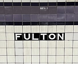 Tile caption below trim line
 -
 One of three elevators from the IND platform


Ridership
The Fulton Street station has historically ranked among the New York City Subway's ten busiest stations.[219] The Fulton Street station recorded 19.502 million entries in 1963, which had declined to 15.805 million in 1973.[220]
During the 2000s, an estimated 225,000 people either entered, exited, or transferred at the station on an average day.[134]: 6 By 2011, the Fulton Street station was the 11th-busiest in the system;[219] at the time, an average of 63,203 riders entered the station every weekday.[221] In 2019, the station had 27,715,365 boardings, making it the fifth most-used station in the 423-station system. This amounted to an average of 94,607 passengers per weekday.[4] Due to the COVID-19 pandemic in New York City, ridership dropped drastically in 2020, with only 8,855,302 passengers entering the station that year. However, it was still the system's fifth most-used station.[222][223]
Notes
References
- ^ a b c d e "Glossary". Second Avenue Subway Supplemental Draft Environmental Impact Statement (SDEIS) (PDF). Vol. 1. Metropolitan Transportation Authority. March 4, 2003. pp. 1–2. Archived from the original (PDF) on February 26, 2021. Retrieved January 1, 2021.
- ^ from the original on June 25, 2020. Retrieved April 21, 2020.
- ^ from the original on May 2, 2022. Retrieved December 30, 2020.
- ^ a b c "Annual Subway Ridership (2017–2022)". Metropolitan Transportation Authority. 2022. Retrieved November 8, 2023.
- ^ a b c d e Walker, James Blaine (1918). Fifty Years of Rapid Transit — 1864 to 1917. New York, N.Y.: Law Printing. Retrieved November 6, 2016.
- ^ a b c d e f g h i "Interborough Rapid Transit System, Underground Interior" (PDF). New York City Landmarks Preservation Commission. October 23, 1979. Archived (PDF) from the original on September 21, 2020. Retrieved November 19, 2019.
- ^ Report of the Board of Rapid Transit Railroad Commissioners for the City of New York For The Year Ending December 31, 1904 Accompanied By Reports of the Chief Engineer and of the Auditor. Board of Rapid Transit Railroad Commissioners. 1905. pp. 229–236.
- ^ Report of the Board of Rapid Transit Railroad Commissioners For And In The City of New York Up to December 31, 1901. Board of Rapid Transit Railroad Commissioners. 1902. Archived from the original on May 2, 2022. Retrieved December 30, 2020.
- ^ a b Scott, Charles (1978). "Design and Construction of the IRT: Civil Engineering" (PDF). Historic American Engineering Record. pp. 208–282 (PDF pp. 209–283). Archived (PDF) from the original on January 17, 2021. Retrieved December 20, 2020.
 This article incorporates text from this source, which is in the public domain.
{{cite web}}: CS1 maint: postscript (link) - ^ "A New Method of Tunneling Under Broadway, New York". Engineering Record. Vol. 48, no. 17. October 24, 1903. pp. 492–494. Archived from the original on May 2, 2022. Retrieved December 30, 2020.
- ^ from the original on June 4, 2023. Retrieved June 4, 2023.
- ^ (PDF) from the original on July 7, 2021. Retrieved May 6, 2023.
- ProQuest 571612079.
- from the original on May 10, 2022. Retrieved May 6, 2023.
- ProQuest 571615106.
- from the original on August 13, 2023. Retrieved May 6, 2023.
- (PDF) from the original on December 17, 2021. Retrieved September 18, 2016.
- (PDF) from the original on July 7, 2021. Retrieved September 18, 2016.
- from the original on March 7, 2018. Retrieved May 6, 2023.
- from the original on May 7, 2023. Retrieved May 6, 2023.
- ^ a b Hood, Clifton (1978). "The Impact of the IRT in New York City" (PDF). Historic American Engineering Record. pp. 146–207 (PDF pp. 147–208). Archived (PDF) from the original on January 17, 2021. Retrieved December 20, 2020. This article incorporates text from this source, which is in the public domain.
{{cite web}}: CS1 maint: postscript (link) - ^ a b Report of the Public Service Commission for the First District of the State of New York For The Year Ending December 31, 1910. Public Service Commission. 1911. Archived from the original on January 20, 2021. Retrieved January 8, 2021.
- from the original on April 5, 2018. Retrieved April 5, 2018.
- ^ New York (State). Legislature. Senate (1917). Documents of the Senate of the State of New York. pp. 317, 320. Archived from the original on January 23, 2021. Retrieved January 6, 2021.
- from the original on August 13, 2023. Retrieved May 5, 2023.
- ProQuest 574907612.
- from the original on August 13, 2023. Retrieved May 6, 2023.
- ProQuest 97294038.
- from the original on May 7, 2023. Retrieved May 6, 2023.
- ^ (PDF) from the original on July 7, 2021. Retrieved November 10, 2017.
- (PDF) from the original on July 7, 2021. Retrieved November 6, 2016.
- ^ "Annual report. 1916-1917". HathiTrust. Interborough Rapid Transit Company. December 12, 2013. p. 22. Archived from the original on March 18, 2020. Retrieved September 5, 2016.
- (PDF) from the original on December 12, 2019. Retrieved August 26, 2016.
- from the original on August 13, 2023. Retrieved May 6, 2023.
- ^ a b Engineering News-record. McGraw-Hill Publishing Company. 1916. Archived from the original on August 13, 2023. Retrieved May 6, 2023.
- ^ from the original on August 13, 2023. Retrieved May 6, 2023.
- from the original on May 7, 2023. Retrieved May 6, 2023.
- ProQuest 575057514.
- from the original on August 13, 2023. Retrieved May 6, 2023.
- ProQuest 575294036.
- ^ from the original on August 13, 2023. Retrieved May 6, 2023.
- from the original on August 13, 2023. Retrieved May 6, 2023.
- ProQuest 575330801.
- ProQuest 575380384.
- from the original on September 29, 2020. Retrieved May 6, 2023.
- ProQuest 575436068.
- ProQuest 97988649.
- ProQuest 575543133.
- from the original on August 13, 2023. Retrieved May 6, 2023.
- ^ from the original on September 21, 2020. Retrieved May 7, 2023.
- from the original on October 22, 2022. Retrieved May 6, 2023.
- ProQuest 575790318.
- ^ (PDF) from the original on May 30, 2020. Retrieved November 6, 2016.
- (PDF) from the original on February 21, 2021. Retrieved November 6, 2016.
- ProQuest 575946310.
- ^ State of New York Transit Commission Third Annual Report for the Calendar Year 1923. New York State Transit Commission. 1924. p. 501. Archived from the original on May 30, 2023. Retrieved May 30, 2023.
- ^ a b c d e f g h i j Linder, Bernard (February 2016). "Contract 4 Subway Controversy". The Bulletin. Vol. 59, no. 2. Electric Railroaders' Association. Archived from the original on August 16, 2016. Retrieved July 28, 2016.
- from the original on August 13, 2023. Retrieved May 7, 2023.
- from the original on August 13, 2023. Retrieved May 7, 2023.
- ^ from the original on August 13, 2023. Retrieved May 7, 2023.
- from the original on August 13, 2023. Retrieved May 7, 2023.
- from the original on May 7, 2023. Retrieved May 7, 2023.
- ^ from the original on May 7, 2023. Retrieved May 7, 2023.
- ^ a b c Moscow, Warren (August 21, 1927). "Nassau Street Subway Again Proves Nuisance As Board Rejects Bids". The Brooklyn Citizen. pp. 1, 4. Archived from the original on May 7, 2023. Retrieved May 7, 2023.
- ^ from the original on August 13, 2023. Retrieved May 7, 2023.
- from the original on May 7, 2023. Retrieved May 7, 2023.
- from the original on May 7, 2023. Retrieved May 7, 2023.
- ^ "Board Awards Nassau Street Tube Contracts". The Standard Union. November 23, 1927. p. 3. Archived from the original on May 7, 2023. Retrieved May 7, 2023.
- from the original on May 7, 2023. Retrieved May 7, 2023.
- ^ from the original on July 26, 2018. Retrieved July 28, 2016.
- ^ a b c d e f g h i "Bids Asked for B.-M.T. Subway in Manhattan". The Brooklyn Citizen. April 20, 1930. p. 3. Archived from the original on May 10, 2023. Retrieved May 10, 2023 – via Newspapers.com.
- from the original on May 7, 2023. Retrieved May 7, 2023.
- from the original on May 7, 2023. Retrieved May 7, 2023.
- ^ from the original on August 13, 2023. Retrieved May 7, 2023.
- ^ ProQuest 1113639010.
- from the original on May 14, 2023. Retrieved May 14, 2023.
- ProQuest 1114186438.
- ^ Cunningham, Joseph; DeHart, Leonard O. (January 1, 1993). A History of the New York City Subway System. J. Schmidt, R. Giglio, and K. Lang. Archived from the original on May 2, 2022. Retrieved December 30, 2020.
- ^ from the original on December 17, 2021. Retrieved July 28, 2016.
- ProQuest 1114103146.
- ISBN 9780814719541. Archivedfrom the original on May 22, 2020. Retrieved December 30, 2020.
- ProQuest 1114181918.
- from the original on June 14, 2018. Retrieved July 28, 2016.
- ProQuest 1114100391.
- from the original on June 28, 2019. Retrieved August 1, 2019.
- ^ from the original on June 14, 2018. Retrieved June 29, 2018.
- ISBN 978-0-82325-369-2.
- ProQuest 1113431477.
- from the original on June 14, 2018. Retrieved June 29, 2018.
- from the original on September 12, 2012. Retrieved June 29, 2018.
- ProQuest 1114839882.
- ^ from the original on June 26, 2018. Retrieved June 29, 2018.
- ^ a b Whitman, Hamilton (March 16, 1930). "The Sandhogs: Men of Courage, Energy and Skill". The Brooklyn Daily Eagle. p. 89. Archived from the original on June 17, 2023. Retrieved June 17, 2023.
- ^ ProQuest 1113601174.
- ProQuest 1131194666.
- from the original on May 7, 2023. Retrieved May 7, 2023.
- from the original on February 12, 2023. Retrieved May 7, 2023.
- from the original on May 7, 2023. Retrieved May 7, 2023.
- ^ from the original on May 7, 2023. Retrieved May 7, 2023.
- ^ "New Boro Tube Traffic is Light". The Brooklyn Daily Eagle. February 1, 1933. pp. 1, 3. Archived from the original on May 7, 2023. Retrieved May 7, 2023.
- ^ from the original on December 16, 2022. Retrieved December 16, 2022.
- ProQuest 1222085885.
- ^ ProQuest 1114618529.
- from the original on July 19, 2021. Retrieved May 14, 2022.
- ProQuest 1243059209.
- from the original on January 7, 2022. Retrieved May 14, 2022.
- ProQuest 1248134780.
- ProQuest 1327387636.
- from the original on May 11, 2023. Retrieved May 8, 2023.
- from the original on May 8, 2023. Retrieved May 8, 2023.
- ^ ProQuest 1327015355.
- ^ from the original on May 8, 2023. Retrieved May 8, 2023.
- ^ a b c Annual Report For The Year Ending June 30, 1959 (PDF). New York City Transit Authority. 1959. p. 9. Archived (PDF) from the original on May 11, 2021. Retrieved December 28, 2020.
- from the original on January 8, 2021. Retrieved May 8, 2023.
- ^ New York City Transit Authority (1968). Minutes and Proceedings. p. 152. Archived from the original on May 2, 2022. Retrieved January 26, 2021.
- ^ a b Annual Report 1964–1965. New York City Transit Authority. 1965.
- from the original on May 8, 2023. Retrieved May 8, 2023.
- from the original on May 25, 2023. Retrieved May 25, 2023.
- from the original on March 9, 2018. Retrieved December 26, 2020.
- from the original on March 31, 2019. Retrieved May 8, 2023.
- from the original on July 7, 2022. Retrieved July 7, 2022.
- from the original on March 27, 2020. Retrieved May 6, 2023.
- ^ a b Port Authority of New York and New Jersey (2007). Permanent WTC PATH Terminal: Environmental Impact Statement. United States Department of Transportation; Federal Transit Administration. Archived from the original on October 7, 2021. Retrieved December 30, 2020.
- ProQuest 285347546.
- from the original on May 15, 2022. Retrieved May 9, 2023.
- ProQuest 1237383241.
- ^ Benenson, Joel (April 1, 1993). "Albany deal to save the $1.25 fare". New York Daily News. p. 1059. Archived from the original on April 28, 2023. Retrieved April 28, 2023.
- from the original on April 28, 2023. Retrieved April 28, 2023.
- ^ "Stop the Fussing". Newsday. May 28, 1993. p. 56. Archived from the original on May 3, 2023. Retrieved April 28, 2023.
- ^ Rein, Lisa (May 24, 1994). "Citing cuts, TA derails Main St. rehab". New York Daily News. p. 683. Archived from the original on July 11, 2022. Retrieved July 11, 2022.
- ProQuest 278734171.
- from the original on July 5, 2022. Retrieved July 4, 2022.
- ^ Kalikow, Peter (October 27, 1994). "The Coliseum Could Lay a Golden Egg". Newsday. pp. 44, 48. Archived from the original on August 13, 2023. Retrieved May 31, 2023.
- ^ a b c d e f g h i j "Chapter 1: Purpose and Need". Fulton Street Transit Center, Final Environmental Impact Statement and Section 4(f) Evaluation (PDF). Metropolitan Transportation Authority. Archived (PDF) from the original on September 9, 2015. Retrieved January 3, 2015.
- from the original on December 21, 2022. Retrieved May 9, 2023.
- from the original on November 24, 2022. Retrieved November 24, 2022.
- from the original on November 24, 2022. Retrieved November 24, 2022.
- from the original on November 24, 2022. Retrieved November 24, 2022.
- from the original on January 26, 2021. Retrieved May 31, 2023.
- from the original on February 4, 2018. Retrieved February 3, 2018.
- from the original on February 26, 2018. Retrieved February 24, 2018.
- ProQuest 305672193.
- ProQuest 305728875.
- ^ from the original on February 26, 2018. Retrieved February 24, 2018.
- ProQuest 219204996.
- from the original on February 26, 2018. Retrieved February 24, 2018.
- ^ Chung, Jen (May 26, 2004). "Fulton Street Transit Center Design Unveiled". Gothamist. Retrieved August 14, 2023.
- ISSN 0362-4331. Retrieved August 14, 2023.
- from the original on February 26, 2018. Retrieved February 24, 2018.
- from the original on December 31, 2017. Retrieved February 25, 2018.
- from the original on February 26, 2018. Retrieved February 25, 2018.
- from the original on February 26, 2018. Retrieved February 26, 2018.
- ^ Shapiro, Julie (March 13, 2008). "Some sort of building will rise at Fulton, M.T.A. says". DOWNTOWN EXPRESS | The Newspaper of Lower Manhattan. Archived from the original on January 8, 2017. Retrieved February 26, 2018.
- ^ from the original on February 26, 2018. Retrieved February 26, 2018.
- ^ "Fulton Center". MTA. Archived from the original on February 19, 2014. Retrieved February 23, 2014.
- ^ "Fulton Street Transit Center | No. 7 Subway Extension". Therealdeal.com. March 25, 2014. Archived from the original on April 29, 2014. Retrieved May 1, 2014.
- ^ from the original on October 28, 2021. Retrieved December 30, 2020.
- from the original on February 26, 2018. Retrieved February 25, 2018.
- ^ "Construction Update | Construction Schedule". Archived from the original on April 8, 2014.
- ^ a b "Project Updates: Fulton Center". Lower Manhattan Development Corp. May 2009. Archived from the original on August 16, 2006.
- ^ "Back on Track: Fulton Transit Center" (PDF). MTA. June 9, 2009. Archived from the original (PDF) on April 8, 2014.
- ^ from the original on May 8, 2023. Retrieved May 8, 2023.
- ^ a b "Fulton Street Transit Center Construction Update and Service Changes January 9–11 and January 16–17" (Press release). New York Metropolitan Transportation Authority. January 7, 2010. Archived from the original on January 25, 2010. Retrieved February 7, 2010.
- ^ "Fulton Street Transit Center: Construction Update and Subway Service Changes". mta.info. Metropolitan Transportation Authority. December 2010. Archived from the original on December 17, 2010. Retrieved December 28, 2020.
- ^ "Fulton Street Transit Center – Community Board 1 Quarterly Construction Update" (PDF). Metropolitan Transportation Authority. February 13, 2012. Archived (PDF) from the original on February 23, 2018. Retrieved February 21, 2018.
- ^ "Fulton Street Transit Center – Community Board 1 Quarterly Construction Update" (PDF). Metropolitan Transportation Authority. October 2012. Archived (PDF) from the original on February 28, 2018. Retrieved October 2, 2016.
- ^ "New Dey Street Entrance Opened". mta.info. Metropolitan Transportation Authority. Archived from the original on April 28, 2019. Retrieved July 4, 2016.
- ^ Donohue, Pete (October 27, 2014). "Fulton Center subway hub to open in November". NY Daily News. Archived from the original on November 22, 2020. Retrieved October 28, 2014.
- ^ Plagianos, Irene (October 27, 2014). "Fulton Transit Hub Will Finally Open on Nov. 10, MTA Says". DNAinfo New York. Archived from the original on October 30, 2014. Retrieved October 28, 2014.
- ^ "Fulton Center reopens after 13 years". New York Daily News. November 10, 2014. Archived from the original on May 8, 2023. Retrieved May 8, 2023.
- ^ "NYC subway gun scanner pilot program unveiled by Mayor Eric Adams and NYPD Commissioner Edward Caban". ABC7 New York. March 28, 2024. Retrieved March 29, 2024.
- from the original on May 8, 2023. Retrieved May 8, 2023.
- ^ Solomon, Benjamin; Li, Shirley (June 25, 2014). "NY's Subway Will Soon See Daylight for the First Time Ever". Wired. Archived from the original on February 17, 2015. Retrieved February 16, 2015.
- ^ Cassidy, Robert (May 19, 2016). "NYC subway station lights the way for 300,000 riders a day". Building Design + Construction. Archived from the original on May 8, 2023. Retrieved May 8, 2023.
- ^ "Digital Art". Metropolitan Transportation Authority. Archived from the original on May 8, 2023. Retrieved May 8, 2023.
- ^ Beete, Paulette (July 30, 2015). "Spotlight on MTA Arts and Design". National Endowment for the Arts. Archived from the original on May 8, 2023. Retrieved May 8, 2023.
- ^ ISBN 978-1-58093-403-9. Archivedfrom the original on April 30, 2022. Retrieved April 30, 2022.
- ^ from the original on April 30, 2022. Retrieved April 30, 2022.
- from the original on April 30, 2022. Retrieved April 30, 2022.
- ^ a b "Astral Grating: Lee Harris Pomeroy Architects, Nancy Holt and MTA Arts & Design". CultureNOW. November 24, 2022. Archived from the original on November 24, 2022. Retrieved November 24, 2022.
- ^ a b "Astral Grating". MTA. Archived from the original on November 24, 2022. Retrieved November 24, 2022.
- ^ Yakas, Ben (March 30, 2023). "Bringing the cosmos underground: celebrating public art created by women for the NYC subway". Gothamist. Archived from the original on May 4, 2023. Retrieved May 8, 2023.
- ^ a b c d e f g "MTA Neighborhood Maps: Lower Manhattan". Metropolitan Transportation Authority. 2015. Archived from the original on August 29, 2021. Retrieved August 16, 2016.
- ^ "MTA Accessible Stations". MTA. May 20, 2022. Archived from the original on December 10, 2021. Retrieved July 5, 2022.
- ^ a b c "MTA Neighborhood Maps: Fulton St (4)(5)". Metropolitan Transportation Authority. 2018. Archived from the original on November 8, 2020. Retrieved December 19, 2020.
- ProQuest 572082004.
- ^ "New York MPS Wall Street Subway Station (IRT)". Records of the National Park Service, 1785 - 2006, Series: National Register of Historic Places and National Historic Landmarks Program Records, 2013 - 2017, Box: National Register of Historic Places and National Historic Landmarks Program Records: New York, ID: 75313935. National Archives.
- ^ Proceedings of the Board of Transportation of the City of New York. New York City Board of Transportation. 1932. pp. 128–129. Archived from the original on August 13, 2023. Retrieved May 28, 2023.
{{cite book}}: CS1 maint: date and year (link) - ^ "Dey St. Concourse Structural Box-New York, N.Y." Engineering News Record. December 16, 2009. Archived from the original on May 8, 2023. Retrieved May 8, 2023.
- ^ Plagianos, Irene (May 25, 2016). "Passage Linking Fulton Center to WTC Transit Hub Opening Thursday". DNAinfo New York. Archived from the original on May 13, 2023. Retrieved May 8, 2023.
- ^ Warerkar, Tanay (May 26, 2016). "Passageway Connecting WTC Hub and Fulton Center Finally Opens". Curbed NY. Archived from the original on May 8, 2023. Retrieved May 8, 2023.
- ^ Dunlap, David W. (June 2, 2013). "Spared Demolition, an 1889 Building Gets a Second Life". City Room. Archived from the original on January 26, 2021. Retrieved August 5, 2020.
- ^ "MTA Neighborhood Maps: Fulton St (2)(3)". Metropolitan Transportation Authority. 2018. Archived from the original on August 29, 2021. Retrieved December 19, 2020.
- ^ Minutes of the Board of Estimate and Apportionment of The City of New York From September 1, 1918, To October 31, 1918. Vol. IV. New York City Board of Estimate. 1918. pp. 3524, 3543–3547. Archived from the original on August 13, 2023. Retrieved August 2, 2022.
- ^ Proceedings of the Transit Commission, State of New York. New York State Transit Commission. 1930. p. 310.
- ^ "MTA Neighborhood Maps: Fulton St (J)(Z)". Metropolitan Transportation Authority. 2018. Archived from the original on August 29, 2021. Retrieved December 19, 2020.
- ^ a b c d e f Stv Inc. (February 2020). "New York City Transit System-wide Platform Screen Door Feasibility Study Summary of Conclusions". Metropolitan Transportation Authority. Retrieved January 28, 2022.
- ^ New York City Transit Authority Committee Agenda March 1988. New York City Transit Authority. March 18, 1988. pp. H-51-59.
- ^ Transit Authority Committee Agenda November 1991. New York City Transit Authority. November 15, 1991. p. E.3.
- ^ OCLC 1056711733.
- ^ "2 Subway Timetable, Effective June 26, 2022". Metropolitan Transportation Authority. Retrieved August 26, 2023.
- ^ "3 Subway Timetable, Effective June 26, 2022". Metropolitan Transportation Authority. Retrieved August 26, 2023.
- ^ a b c d "Subway Map" (PDF). Metropolitan Transportation Authority. September 2021. Retrieved September 17, 2021.
- ^ "J/Z Subway Timetable, Effective July 2, 2023". Metropolitan Transportation Authority. Retrieved August 26, 2023.
- ^ a b c Carlson, Jen (February 18, 2016). "Map: These Color Tiles In The Subway System Used To Mean Something". Gothamist. Archived from the original on May 10, 2023. Retrieved May 10, 2023.
- ^ a b Gleason, Will (February 18, 2016). "The hidden meaning behind the New York subway's colored tiles". Time Out New York. Archived from the original on May 10, 2023. Retrieved May 10, 2023.
- ^ Whitehorne, Wayne (October 31, 1997). Showing Image 1389. nycsubway.org (image). Retrieved May 10, 2023.
- ^ "4 Subway Timetable, Effective December 4, 2022". Metropolitan Transportation Authority. Retrieved August 26, 2023.
- ^ "5 Subway Timetable, Effective June 26, 2022". Metropolitan Transportation Authority. Retrieved August 26, 2023.
- ^ a b c Framberger, David J. (1978). "Architectural Designs for New York's First Subway" (PDF). Historic American Engineering Record. pp. 1–46 (PDF pp. 367–412). Archived (PDF) from the original on January 17, 2021. Retrieved December 20, 2020. This article incorporates text from this source, which is in the public domain.
{{cite web}}: CS1 maint: postscript (link) - from the original on May 8, 2023. Retrieved May 8, 2023.
- ^ Molinelli, Don (September 12, 1961). "Mosaics in Subways Are Deep Stuff". Daily News. p. 26. Archived from the original on May 8, 2023. Retrieved May 8, 2023.
- ^ "American Telephone and Telegraph Building" (PDF). New York City Landmarks Preservation Commission. July 25, 2006. p. 14. Archived (PDF) from the original on December 27, 2016. Retrieved December 30, 2020.
- ^ "A Subway Timetable, Effective June 26, 2022". Metropolitan Transportation Authority. Retrieved August 26, 2023.
- ^ "C Subway Timetable, Effective June 26, 2022". Metropolitan Transportation Authority. Retrieved August 26, 2023.
- ^ Rosenfeld, Robbie (December 10, 2010). Showing Image 116078. nycsubway.org (image). Retrieved May 10, 2023.
- ^ David M. (February 19, 2009). Showing Image 98431. nycsubway.org (image). Retrieved May 10, 2023.
- from the original on July 1, 2022. Retrieved July 1, 2022.
- ^ a b Grynbaum, Michael M. (June 7, 2011). "Main St. Stop in Flushing Joins List of Subway's Busiest". City Room. Archived from the original on May 3, 2023. Retrieved May 2, 2023.
- from the original on May 9, 2023. Retrieved May 8, 2023.
- from the original on May 8, 2023. Retrieved May 8, 2023.
- ^ "Subway and bus ridership for 2020". MTA. August 31, 2020. Archived from the original on October 31, 2021. Retrieved July 8, 2022.
- ^ Gannon, Devin (May 18, 2020). "In 2020, NYC subway saw a billion fewer total trips than year prior". 6sqft. Archived from the original on June 30, 2022. Retrieved July 8, 2022.
Further reading
- Stookey, Lee (1994). Subway ceramics : a history and iconography of mosaic and bas relief signs and plaques in the New York City subway system. Brattleboro, Vt: L. Stookey. OCLC 31901471.
External links
- nycsubway.org – IRT East Side Line: Fulton Street
- nycsubway.org – IRT West Side Line: Fulton Street
- nycsubway.org – BMT Nassau St./Jamaica Line: Fulton Street
- nycsubway.org – IND 8th Avenue: Broadway/Nassau Street
- nycsubway.org — Marine Grill Murals, 1913 Artwork by Fred Dana Marsh (2000)
- nycsubway.org — Astral Grating Artwork by Nancy Holt (1987)
- MTA's Arts For Transit — Fulton Street/William Street
| Broadway– Seventh Ave. Line |
| ||||
|---|---|---|---|---|---|
| Lexington Ave. Line |
| ||||
| Eighth Ave. Line |
| ||||
| Nassau St. Line | |||||
| |||||