
Gaua
Santa Maria | |
|---|---|
 Map of Gaua | |
 | |
| Geography | |
| Location | Pacific Ocean |
| Coordinates | 14°15′54″S 167°31′12″E / 14.26500°S 167.52000°E |
| Archipelago | Vanuatu, Banks Islands |
| Area | 330 km2 (130 sq mi) |
| Highest elevation | 767 m (2516 ft) |
| Highest point | Mount Gharat |
| Administration | |
Vanuatu | |
| Province | Torba Province |
| Largest settlement | Jolap |
| Demographics | |
| Population | 2,491 (2009) |
| Pop. density | 7.5/km2 (19.4/sq mi) |
Gaua [gawa] (formerly known as Santa Maria Island) is the largest and second most populous of the Banks Islands in Torba Province in northern Vanuatu. It covers 342 km2.
Geography

Gaua is subject to frequent earthquakes and cyclones. The climate is humid tropical; the average annual rainfall exceeds 3500 mm. It has rugged terrain, reaching up to Mount Gharat (797 m), the peak of the active stratovolcano which lies at the center of the island. Its most recent eruption was in 2013. The volcano has a 6 × 9 km caldera, within which lies a crater lake, known as Lake Letas, which is the largest lake in Vanuatu. To the east of the lake is Siri Waterfall (120 m drop).
Natural history
The upper slopes of the island have been recognised as an
Population and languages
In 2009, the island had a population of 2,491, and an annual growth rate of 2.0 percent.[2] The inhabitants are scattered among various coastal villages on the western, southern and northeastern sides of the island. The eastern side has a few hamlets with an immigrant community, the members of which have come from the two smaller islands Merig and Merelava, that lie southeast of Gaua. The largest village on Gaua is Jolap [ʧʊlap], on the west coast.[3]
In addition to
Economy
The livelihood of the people of Gaua is based on the agricultural economy that is traditional throughout of Melanesia: a combination of fishing and horticulture. Their principal exports are copra and cacao.
The island is served by Gaua Airport, which is located in the northeast corner of the island.
Names
The modern name Gaua is pronounced [gawa] in Bislama, the lingua franca of Vanuatu, and in French or English.
In the local Banks languages, the island was traditionally known not by one name, but two. One name reconstructs in Proto-Torres–Banks as a form *ɣaua [ɣaˈua], the other one as *laᵑgona. These respectively referred to the northeast half of the island, and its southwestern half (where one finds Lakona Bay, and also where the Lakon language is spoken).
Thus the
Some modern languages have generalized one of these two etyma to refer to the whole island. Thus it is called Gog (< *ɣaua).
History
Gaua was first sighted by Europeans during the Spanish expedition of
Gallery
-

-

-
 Baravit Beach (east coast)
 -
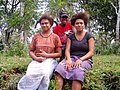 Local people
 -
 Gaua as seen from space


References
- ^ "Gaua". BirdLife Data Zone. BirdLife International. 2021. Retrieved 10 February 2021.
- ^
"2009 National Census of Population and Housing: Summary Release" (PDF). Vanuatu National Statistics Office. 2009. Retrieved November 21, 2010.
{{cite journal}}: Cite journal requires|journal=(help) - ^ Satellite photo of Jolap village.
- ^ See entries Agō and Alkon in the Online Mwotlap dictionary.
- ^ Kelly, Celsus, O.F.M. La Austrialia del Espíritu Santo. The Journal of Fray Martín de Munilla O.F.M. and other documents relating to the Voyage of Pedro Fernández de Quirós to the South Sea (1605-1606) and the Franciscan Missionary Plan (1617-1627) Cambridge, 1966, p.39, 62.
External links
- "Gaua". Global Volcanism Program. Smithsonian Institution.
- Our Forest our Future; Managing Biodiversity in the South Pacific, Gaua Island, Vanuatu, Rudolf Hahn, CTA FAO 2013, youtube video
- Volcano World: Gaua
- Detailed list and map of the Banks and Torres languages, including those of Gaua
| Provinces of Vanuatu |  | |
|---|---|---|
| Islands and islets | ||
| Authority control databases: Geographic |
|---|