
Gotthard Pass
| Gotthard Pass | |
|---|---|
| Range | Lepontine Alps |
| Coordinates | 46°33′22.5″N 8°34′04″E / 46.556250°N 8.56778°E |
| Topo map | Swiss Federal Office of Topography swisstopo |
 Location in Switzerland )(see detailed map | |
The Gotthard Pass or St. Gotthard Pass (
Since the Middle Ages, transit across the Gotthard played an important role in Swiss history, the region north of the Gotthard becoming the nucleus of the
Geography
The Gotthard Pass lies on the main watershed of the Gotthard massif, a massif lying at the heart of the
The nearest towns are

Just southeast of the culminating point of the Gotthard Pass, at an elevation of about 2,090 metres above sea level, are several lakes. The largest is named Lago della Piazza and has a surface of 3.94
A few kilometres away and slightly above the Gotthard Pass are found two large dams and artificial lakes: Lago di Lucendro at the foot of Pizzo Lucendro and Lago della Sella at the foot of Pizzo Centrale. They are respectively part of the Reuss and Ticino basin, although both are located within the canton of Ticino.
History

Though the pass was locally known in antiquity, it was not generally used until the early 13th century because travel involved fording the turbulent Reuss, swollen with snowmelt during the early summer, in the narrow steep-sided Schöllenen Gorge, below Andermatt.
The first wooden bridge across Schöllenen Gorge was built around 1220, and in the following years the pass rapidly gained in importance.
The bridge permitted traffic to follow the Reuss to its headwaters and over the saddle at the top—a continental divide between the Rhine, which flows into the North Sea, and the river Ticino towards Milan, which after leaving Switzerland flows into the Po and ultimately into the Adriatic Sea.
The Gotthard Pass was formerly known as Monte Tremolo (its southern slope is still known as Val Tremola).[citation needed]
A chapel dedicated to Saint
The opening of the Schöllenen Gorge for traffic was an important factor in the original
The Swiss also had an interest in extending their influence south of the Alps to secure the trade route across the pass to

The "
A new road, including a tunnel with a length of c. 60 m, was built in 1707/8. The tunnel, known as Urnerloch, was the first road tunnel to be built in the Alps. It was constructed by Pietro Morettini (1660–1737).
The path across Schöllenen Gorge, and thus across the pass, still carried only foot traffic and pack animals until 1775,[citation needed] when the first carriage made the journey on an improved road.[citation needed]
The Battle of Gotthard Pass took place on 24 September 1799.
The new Gotthard road was built in 1830,[citation needed] wide enough to allow (single-lane) motorized traffic. It is said[by whom?] that the first car traversed the pass in 1895. The first reported[where?] surmounting of the pass in 1901 still took more than a day.
With the Gotthard Road Tunnel (opened in 1980) the pass itself was again reduced to limited importance for traffic.
-
 The modern concrete span of the third Devil's Bridge (Teufelsbrücke, built 1958) showing an older bridge (built 1830) below
 -
 Gotthard Post near the summit
 -
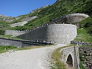
 Old road: summit of the Gotthard
 -
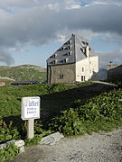 Gotthard Hospice
 -
-
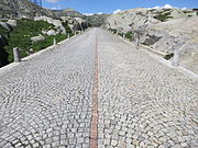
 Tremola valley


Roads, railways, and tunnels

In addition to the National Road 2, crossing the pass and connecting
The last tunnel, the 57 kilometres (35 mi) Gotthard Base Tunnel (a double-tube railway tunnel), opened in 2016. At around 500 metres above sea level, it provides for the first time a flat route through the massif and the Alps from the northern plains at Erstfeld to the southern plains at Bodio. It is the longest and deepest railway tunnel in the world. This tunnel, combined with two shorter tunnels planned near Zürich and Lugano as part of the NRLA project, reduced the 3 hour 40 min rail journey from Zürich to Milan by one hour, while increasing the size and number of trains that can operate along the route because the line is nearly level, compared with the spirals of the older tunnel.
| Route | Type | Major tunnel | Since | Maximum height | Remarks |
|---|---|---|---|---|---|
| Pass | Bridle path | - | 13th century | 2,106 m | |
| Pass (Tremola) | Paved road | - | 1830 | 2,106 m | |
Gotthard Railway (summit line)
|
Railway | Gotthard Tunnel | 1882 | 1,151 m | Second highest conventional railway in Switzerland, car shuttle train services from 1924 until 1980, world's longest tunnel until 1906[7] |
| Pass (National Road 2) | Highway | - | 1977 | 2,106 m | Closed to motorized traffic in winter from 1980 onwards |
| A2 | Motorway | Gotthard Road Tunnel | 1980 | 1,175 m | Second highest motorway in Switzerland,[8] lowest direct north-south road through the Alps, world's longest road tunnel until 2000[9] |
Gotthard Railway (base line)
|
High-speed railway | Gotthard Base Tunnel | 2016 | 549 m | First flat route through the Alps, world's longest and deepest railway tunnel |
Illustrations
A number of international artists have been inspired by the dramatic scenery of the Gotthard Pass, the Schöllenen Gorge and the Teufelsbrücke.
-
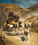 The Gotthard Post (oil on canvas by Rudolf Koller, 1874)
 -
 Winterreise 1790 über den Gotthard (colored engraving by Wilhelm Rothe according drawing by Johann Gottfried Jentzsch, 1790)
 -
 Construction of the Devil's Bridge (oil on canvas by Carl Blechen, c. 1833)
 -
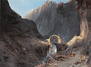
 The Teufelsbrücke, St. Gotthard (oil on canvas by J. M. W. Turner c. 1803/04)
 -
 Field Marshal Alexander Suvorov Crossing St. Gotthard Pass in 1799 (by Alexander von Kotzebue)
.jpg)

.jpg)


In popular culture
See also
- List of highest paved roads in Europe
- List of mountain passes
- List of the highest Swiss passes
- Tremola San Gottardo
Bibliography
- Clausewitz, Carl von (2020). Napoleon Absent, Coalition Ascendant: The 1799 Campaign in Italy and Switzerland, Volume 1. Trans and ed. Nicholas Murray and Christopher Pringle. Lawrence, Kansas: University Press of Kansas. ISBN 978-0-7006-3025-7.
- Clausewitz, Carl von (2021). The Coalition Crumbles, Napoleon Returns: The 1799 Campaign in Italy and Switzerland, Volume 2. Trans and ed. Nicholas Murray and Christopher Pringle. Lawrence, Kansas: University Press of Kansas. ISBN 978-0-7006-3034-9.
- ISBN 978-88-8191-281-0.
References
- ISBN 9783035609226.
For thousands of years the Gotthard Pass has been an important threshold between north and south Europe and for many centuries has played a significant role in the economy and culture of central Switzerland. Since the early thirteenth century, the pass has been a vital trade route connecting different cultures and language regions.
- ^ "Gotthard Pass Route: Airolo–San Gottardo–Andermatt". postauto.ch. PostBus Switzerland. Retrieved 23 February 2022.
The Gotthard, also known as the "King of Mountain Passes", is reached via the extraordinary mountain road with views of the old Tremola route.
- ISBN 9783839433652.
...zwischen 1218 und 1231 ansetzen könne, und just in jenen Interdezennien sei ja die Schöllenen bezwungen worden, die Teufelsbrücke gebaut und der König der Pässe, das royale Zentralalpenmassiv, dem Transitverkehr erschlossen worden...
[...could start between 1218 and 1231, and it was precisely in those interdecades that the Schöllenen was conquered, the Teufelsbrücke was built and the king of passes, the royal massif in the central Alps, was opened up to transit traffic...] - ^ Bruno Meier, Von Morgarten bis Marignano (2015), p. 23.
- ^ Lauf-Belart, Gotthardpass (1924), 165f.
- ^ Hans-Peter Bärtschi: Gotthardbahn in German, French and Italian in the online Historical Dictionary of Switzerland, 2004-07-29.
- ^ Until the opening of the Simplon Tunnel
- ^ After the San Bernardino Tunnel
- ^ Until the opening of the Lærdal Tunnel
- ^ Rebecca Silverman (September 7, 2013). "Wolfsmund GN 1". Anime News Network. Retrieved June 7, 2015.
External links
- Cycling Elevation profiles for both sides on the old road
- Free Pictures St. Gotthard Pass
- The Gotthard, Switzerland
- Sankt Gotthard Pass Archived 2015-04-02 at the Wayback Machine (in English)
- Coolidge, William Augustus Brevoort (1911). . Encyclopædia Britannica. Vol. 24 (11th ed.). pp. 6–7.
| International | |
|---|---|
| National | |
| Other | |