
Grand Avenue–Newtown station
Grand Avenue–Newtown Q53 SBS, Q60 | ||||||||||||||||||||||||||||||||||||||||||||||||||||||||||||||||||||
|---|---|---|---|---|---|---|---|---|---|---|---|---|---|---|---|---|---|---|---|---|---|---|---|---|---|---|---|---|---|---|---|---|---|---|---|---|---|---|---|---|---|---|---|---|---|---|---|---|---|---|---|---|---|---|---|---|---|---|---|---|---|---|---|---|---|---|---|---|
| Structure | Underground | |||||||||||||||||||||||||||||||||||||||||||||||||||||||||||||||||||
| Platforms | 2 side platforms | |||||||||||||||||||||||||||||||||||||||||||||||||||||||||||||||||||
| Tracks | 4 | |||||||||||||||||||||||||||||||||||||||||||||||||||||||||||||||||||
| Other information | ||||||||||||||||||||||||||||||||||||||||||||||||||||||||||||||||||||
| Opened | December 31, 1936 | |||||||||||||||||||||||||||||||||||||||||||||||||||||||||||||||||||
| Opposite- direction transfer | Yes | |||||||||||||||||||||||||||||||||||||||||||||||||||||||||||||||||||
| Traffic | ||||||||||||||||||||||||||||||||||||||||||||||||||||||||||||||||||||
| 2023 | 3,893,242[3] | |||||||||||||||||||||||||||||||||||||||||||||||||||||||||||||||||||
| Rank | 71 out of 423[3] | |||||||||||||||||||||||||||||||||||||||||||||||||||||||||||||||||||
| ||||||||||||||||||||||||||||||||||||||||||||||||||||||||||||||||||||
| ||||||||||||||||||||||||||||||||||||||||||||||||||||||||||||||||||||
| ||||||||||||||||||||||||||||||||||||||||||||||||||||||||||||||||||||
| ||||||||||||||||||||||||||||||||||||||||||||||||||||||||||||||||||||
| ||||||||||||||||||||||||||||||||||||||||||||||||||||||||||||||||||||


The Grand Avenue–Newtown station is a local
The station opened on December 31, 1936 as part of the Independent Subway System's Queens Boulevard Line. The opening of the station brought significant growth to Elmhurst.
History
The
The first section of the line opened on August 19, 1933 from the connection to the Eighth Avenue Line at

In August 1936, tracks were installed all the way to 178th Street, and the stations to Union Turnpike were completed.
In Elmhurst, almost all of the century-old buildings in the heart of the village were destroyed for the construction of the subway. Land was taken on the west side of the Broadway to avoid the demolition of St. James Episcopal Church and the Reformed Church of Newtown.[20]: 145 [21]: 23 An easement was granted so the line could pass under the old St. James Church building at the southwest corner of Broadway and 51st Avenue.[22][23] Many nineteenth century residences and the Wandowenock Fire Company buildings had to be torn down. To allow the subway line to curve into Queens Boulevard from Broadway, the northeast corner of the two streets was removed, in addition to some stores. New buildings were built behind a new curb line once the subway was completed, bringing a new face to Elmhurst. The introduction of the subway stimulated local growth in Elmhurst. Commercial buildings and apartment houses replaced existing structures.[20]: 145 [21]: 23 The Metropolitan Transportation Authority announced in April 2024 that it would make esthetic improvements to the station during mid-2024 as part of its Re-New-Vation program.[24]
Station layout
| Ground | Street level | Exit/entrance |
| Mezzanine | Fare control, station agent, MetroCard machines | |
| Platform level | Side platform | |
| Southbound local | ← ← ← ← | |
| Southbound express | ← | |
| Northbound express | | |
| Northbound local | | |
| Side platform | ||


There are four tracks and two
In between the local tracks and the express tracks, there are trackway walls.
Both platforms have a medium
Concrete-clad columns, painted blue, run along both platforms at regular intervals with alternating ones having the standard black name plates in white lettering.[39][32] These piers are located every 15 feet (4.6 m) and support girders above the platforms. The roof girders are also connected to columns in the walls adjoining each platform.[40]: 3
The tunnel is covered by a U-shaped trough that contains utility pipes and wires. The outer walls of this trough are composed of columns, spaced approximately every 5 feet (1.5 m) with concrete infill between them. There is a 1-inch (25 mm) gap between the tunnel wall and the platform wall, which is made of 4-inch (100 mm)-thick brick covered over by a tiled finish. The columns between the tracks are also spaced every 5 feet (1.5 m), with no infill.[40]: 3
Exits
Each side has two sets of street stairs. There is a full-time entrance at Justice Avenue and Broadway on the west end, with staircases to either side of Broadway. There are also exits to either southern corner of Queens Boulevard at 54th Avenue (the southeast-corner staircase being outside the First Presbyterian Church of Newtown complex), and another staircase to the northern side of Queens Boulevard at 54th Avenue.[41]
References
- ^ "Borough of Queens, New York City". Government of New York City. Archived from the original on May 20, 2022. Retrieved June 21, 2020.
- ^ "Glossary". Second Avenue Subway Supplemental Draft Environmental Impact Statement (SDEIS) (PDF). Vol. 1. Metropolitan Transportation Authority. March 4, 2003. pp. 1–2. Archived from the original (PDF) on February 26, 2021. Retrieved January 1, 2021.
- ^ a b c "Annual Subway Ridership (2018–2023)". Metropolitan Transportation Authority. 2023. Retrieved April 20, 2024.
- ^ See:
- Duffus, R.L. (September 22, 1929). "Our Great Subway Network Spreads Wider; New Plans of Board of Transportation Involve the Building of More Than One Hundred Miles of Additional Rapid Transit Routes for New York". The New York Times. ISSN 0362-4331. Retrieved August 19, 2015.
- Board of Transportation of the City of New York Engineering Department, Proposed Additional Rapid Transit Lines And Proposed Vehicular Tunnel, dated August 23, 1929
- Duffus, R.L. (September 22, 1929). "Our Great Subway Network Spreads Wider; New Plans of Board of Transportation Involve the Building of More Than One Hundred Miles of Additional Rapid Transit Routes for New York". The New York Times.
- ^ "Queens Lauded as Best Boro By Chamber Chief". The Brooklyn Daily Eagle. September 23, 1929. p. 40. Retrieved October 4, 2015.
- ISSN 0362-4331. Retrieved March 27, 2020.
- ISSN 0362-4331. Retrieved August 4, 2016.
- ISBN 978-0-7385-9785-0.
- ISSN 0362-4331. Retrieved December 11, 2016.
- The New York Sun. December 13, 1933. p. 47. Retrieved July 30, 2016.
- ^ "Trains Testing Jamaica Link Of City Subway". The Brooklyn Daily Eagle. April 10, 1937. p. 3. Retrieved April 24, 2018.
- ISSN 0362-4331. Retrieved April 26, 2016.
- ^ a b Neufeld, Ernest (August 23, 1936). "Men Toil Under Earth to Build Subway" (PDF). Long Island Daily Press. p. 2 (Section 2). Retrieved August 12, 2016.
- ^ See:
- "500 More Quit Subway Work On Boulevard: General Strike Order Issued Today; 72 Walk Out in Jamaica" (PDF). Long Island Daily Press. April 2, 1935. p. 2. Retrieved July 30, 2016.
- "Aldermen Probe Strike on Subway" (PDF). Long Island Daily Press. April 3, 1935. p. 4. Retrieved July 30, 2016.
- ISBN 978-3-642-30484-2.
- ISSN 0362-4331. Retrieved April 26, 2016.
- ProQuest 1222323973.
- ^ "Trains Testing Jamaica Link Of City Subway". The Brooklyn Daily Eagle. April 10, 1937. p. 3. Retrieved April 24, 2018.
- ^ "Jamaica Will Greet Subway" (PDF). The New York Sun. April 23, 1937. p. 8. Retrieved April 24, 2018.
- ^ a b Seyfried, Vincent F. (1995). Elmhurst : from town seat to mega-suburb. Vincent F. Seyfried.
- ^ ISBN 978-0-486-26358-8.
- ^ "Old St. James Episcopal Church" (PDF). New York City Landmarks Preservation Commission. September 19, 2017. p. 10. Retrieved June 21, 2020.
- ^ "St. James Church" (PDF). National Register of Historic Places, National Park Service. November 12, 1999. p. 15. Retrieved June 21, 2020.[permanent dead link]
- ^ Pozarycki, Robert (April 23, 2024). "These 13 NYC subway stations will receive 'Re-NEW-vation' upgrades and cleaning this spring and summer". amNewYork. Retrieved April 24, 2024.
- OCLC 49777633 – via Google Books.
- ^ "Late Night Subway Service" (PDF). Metropolitan Transportation Authority. March 23, 2023. Retrieved June 2, 2023.
- ^ "E Subway Timetable, Effective December 4, 2022". Metropolitan Transportation Authority. Retrieved August 26, 2023.
- ^ "F Subway Timetable, Effective August 28, 2023". Metropolitan Transportation Authority. Retrieved August 26, 2023.
- ^ "M Subway Timetable, Effective August 28, 2023". Metropolitan Transportation Authority. Retrieved August 26, 2023.
- ^ "R Subway Timetable, Effective August 28, 2023". Metropolitan Transportation Authority. Retrieved August 26, 2023.
- ^ "Subway Map" (PDF). Metropolitan Transportation Authority. September 2021. Retrieved September 17, 2021.
- ^ a b c E., Bill (July 31, 2007). "Trackway Walls at Grand Avenue". www.nycsubway.org. Retrieved December 13, 2016.
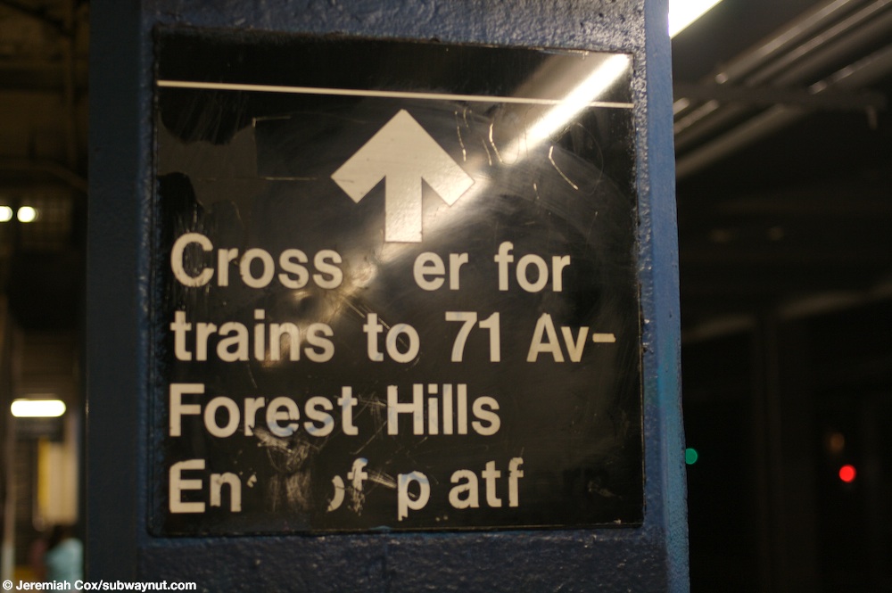
- ^ Cox, Jeremiah (June 5, 2008). "A sign indicating that the crossover to the other platform is at the easternmost end of the platform". subwaynut.com. Archived from the original on December 20, 2016. Retrieved December 13, 2016.
- ^ Cox, Jeremiah (June 5, 2008). "Two High Entrance Turnstiles, and Two High Exit Only turnstiles on the very narrow portion of the mezzanine that serves as an overpass between the two platforms". subwaynut.com. Retrieved December 13, 2016.
- ^ Cox, Jeremiah (June 5, 2008). "Another name tablet at Grand Ave-Newtown this one has a direction pointer for 54th Avenue underneath it". subwaynut.com. Retrieved December 13, 2016.
- from the original on July 1, 2022. Retrieved July 1, 2022.
- ^ Carlson, Jen (February 18, 2016). "Map: These Color Tiles In The Subway System Used To Mean Something". Gothamist. Retrieved May 10, 2023.
- ^ Gleason, Will (February 18, 2016). "The hidden meaning behind the New York subway's colored tiles". Time Out New York. Retrieved May 10, 2023.
- ^ a b Cox, Jeremiah (June 5, 2008). "Looking down the Manhattan-bound platform at Grand Avenue-Newtown all the station columns look like boring columns of concrete with no forms in them or indentations giving them character". subwaynut.com. Retrieved December 13, 2016.
- ^ a b "New York MPS Elmhurst Avenue Subway Station (IND)". Records of the National Park Service, 1785 - 2006, Series: National Register of Historic Places and National Historic Landmarks Program Records, 2013 - 2017, Box: National Register of Historic Places and National Historic Landmarks Program Records: New York, ID: 05000672. National Archives.
- ^ "MTA Neighborhood Maps: Grand Av Newtown (M)(R)" (PDF). mta.info. Metropolitan Transportation Authority. 2018. Retrieved September 13, 2018.
- ^ Cox, Jeremiah (June 5, 2008). "hen the station opened their must have been a different staircase. There are two now fenced off staircases leading up from the Manhattan-bound platform up to the mezzanine when it is entirely outside of fare control. There is no place to put Queens-bound platform staircases because the mezzanine is only two thirds the width of the tracks and platforms here". subwaynut.com. Retrieved December 13, 2016.
- ^ Cox, Jeremiah (June 5, 2008). "Looking up a closed staircase from the Manhattan-bound platform that leads directly up to the mezzanine to a portion of it that is now outside of fare control". subwaynut.com. Retrieved December 13, 2016.
- ^ Cox, Jeremiah (June 5, 2008). "The mezzanine gets narrow, and the two separate sections of the mezzanine for trains in each direction ends making the entire 2/3 full width mezzanine outside of fare control". subwaynut.com. Retrieved December 13, 2016.
- ^ Cox, Jeremiah (June 5, 2008). "Looking down the mezzanine outside of fare control with the ugly black chain link fences visible on both sides segregating the area from within fare control". subwaynut.com. Retrieved December 13, 2016.
- ^ "R Train". January 13, 2015. Archived from the original on January 13, 2015. Retrieved July 12, 2016.
{{cite web}}: CS1 maint: bot: original URL status unknown (link)
External links
- nycsubway.org – IND Queens Boulevard Line: Grand Avenue/Newtown
- The Subway Nut — Grand Avenue–Newtown
- Grand Avenue — Broadway entrance from Google Maps Street View
- 54th Avenue entrance from Google Maps Street View
- Platforms from Google Maps Street View
- Mezzanine from Google Maps Street View