
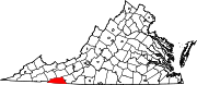
Grayson County, Virginia
Grayson County | |
|---|---|
 Present-day Grayson County Courthouse | |
|
UTC−4 (EDT) | |
| Congressional district | 9th |
| Website | www |
Grayson County is a
History
Grayson County was founded in 1793 from part of Wythe County. It was named for William Grayson,[3] delegate to the Continental Congress from 1784 to 1787 and one of the first two U.S. Senators from Virginia. The first courthouse was built in Greensville, later called Oldtown, constructed in 1794 and rebuilt beginning in 1832. In 1842, the Virginia General Assembly authorized the division of Grayson County, the northeastern portion becoming Carroll County.
During the
The county seat since shortly before the American Civil War has been
Geography
According to the U.S. Census Bureau, the county has a total area of 446 square miles (1,160 km2), of which 442 square miles (1,140 km2) is land and 3.8 square miles (9.8 km2) (0.8%) is water.[7] The southernmost point in Virginia lies in Grayson County. Additionally, it is the only county in Virginia containing an Oceanic climate.[8]
Adjacent counties
|
|
National protected areas
- Blue Ridge Parkway (part)
- Jefferson National Forest(part)
- Mount Rogers National Recreation Area (part)
Major highways
Demographics
| Census | Pop. | Note | %± |
|---|---|---|---|
| 1800 | 3,912 | — | |
| 1810 | 4,941 | 26.3% | |
| 1820 | 5,598 | 13.3% | |
| 1830 | 7,675 | 37.1% | |
| 1840 | 9,087 | 18.4% | |
| 1850 | 6,677 | −26.5% | |
| 1860 | 8,252 | 23.6% | |
| 1870 | 9,587 | 16.2% | |
| 1880 | 13,068 | 36.3% | |
| 1890 | 14,394 | 10.1% | |
| 1900 | 16,853 | 17.1% | |
| 1910 | 19,856 | 17.8% | |
| 1920 | 19,816 | −0.2% | |
| 1930 | 20,017 | 1.0% | |
| 1940 | 21,916 | 9.5% | |
| 1950 | 21,379 | −2.5% | |
| 1960 | 17,930 | −16.1% | |
| 1970 | 15,439 | −13.9% | |
| 1980 | 16,579 | 7.4% | |
| 1990 | 16,278 | −1.8% | |
| 2000 | 17,917 | 10.1% | |
| 2010 | 15,533 | −13.3% | |
| 2020 | 15,333 | −1.3% | |
| U.S. Decennial Census[9] 1790-1960[10] 1900-1990[11] 1990-2000[12] 2010[13] 2020[14] | |||
2020 census
| Race / Ethnicity (NH = Non-Hispanic) | Pop 2010[13] | Pop 2020[14] | % 2010 | % 2020 |
|---|---|---|---|---|
White alone (NH)
|
14,627 | 13,396 | 94.17% | 87.37% |
Black or African American alone (NH)
|
317 | 887 | 2.04% | 5.78% |
Alaska Native alone (NH)
|
30 | 26 | 0.19% | 0.17% |
| Asian alone (NH) | 15 | 24 | 0.10% | 0.16% |
| Pacific Islander alone (NH) | 0 | 2 | 0.00% | 0.01% |
| Some Other Race alone (NH) | 7 | 30 | 0.05% | 0.20% |
| Mixed Race or Multi-Racial (NH) | 121 | 372 | 0.78% | 2.43% |
| Hispanic or Latino (any race) | 416 | 596 | 2.68% | 3.89% |
| Total | 15,533 | 15,333 | 100.00% | 100.00% |
2000 Census
As of the
There were 7,259 households, out of which 26.40% had children under the living with them, 57.60% were married couples living together, 8.50% had a female householder with no husband present, and 29.90% were non-families. 26.80% of all households were made up of individuals, and 12.90% had someone living alone who was 65 years of age or older. The average household size was 2.31 and the average family size was 2.77.
In the county, the population was spread out, with 19.50% under the age of 18, 7.60% from 18 to 24, 29.80% from 25 to 44, 26.20% from 45 to 64, and 16.90% who were 65 years of age or older. The median age was 40 years. For every 100 females there were 107.70 males. For every 100 females aged 18 and over, there were 109.70 males.

The median income for a household in the county was $28,676, and the median income for a family was $35,076. Males had a median income of $24,126 versus $17,856 for females. The
Economy
Grayson is economically isolated, without an Interstate Highway and surrounded by mountains. It struggled to attract and retain business; a situation made much worse beginning in 2009 with the recession. 20,000 acres are being exploited for growing industrial Christmas trees; migrant laborer workers are transported to complete the risky jobs replacing local for hire signs/opportunities. Losses of jobs in the furniture and textile sectors resulted in an unemployment rate of 14.6%. As part of the reformation of county government beginning in 2009, the new but idle River North Correctional Center was activated by the state brought in several hundred jobs. County government efforts were successful in retaining Core Fitness' Nautilus facility as the largest employer in the county and integrating local businesses as part of their supply chain. Independence Lumber suffered significant losses in a fire in November 2012 which forced it to relocate operations to North Carolina. Efforts by the county led to the company rebuilding and reopening its facility in 2014 with 125 jobs. By 2014 a focus on job creation brought additional business operations and 300 more jobs to the county and resulted in an unemployment rate of only 6.9%.[16] By April 2019, the unemployment rate had plummeted to just 2.6%.[17]
Government
In 2009, the county, in dire financial condition from mismanagement and the failing economy, hired Jonathan Sweet as County Administrator. The county debt was $18.3 million and operational expenses were being paid by added borrowing. By 2015 the county had reversed its fiscal direction, revitalized the business climate, and begun to regain the confidence of its citizens. The county fund balance was 35% of its operating expenses and government operations were financially stable with reduced debt.[16]
Board of Supervisors
- At-Large District: John Fant (I)
- Elk Creek District: Tracy "Zeke" Anderson (R)
- Oldtown District: Kenneth Ray Belton (R)
- Providence District: Mike Hash (R)
- Wilson District: Brant Ivey (R)
Constitutional officers
| Office | Person | Political party |
|---|---|---|
| Clerk of the Circuit Court ‡ | Susan M. Herrington | (R) |
| Commissioner of the Revenue | Larry D. Bolt | (R) |
| Commonwealth's Attorney ‡ | Brandon R. Boyles | (R) |
| Sheriff ‡ | Richard A. Vaughan | (I) |
| Treasurer | R. Pete Hall, Jr. | (R) |
- ‡Positions shared with Galax City.
Legislative representation
Grayson is represented by Republican
| Year | Republican | Democratic | Third party | |||
|---|---|---|---|---|---|---|
| No. | % | No. | % | No. | % | |
| 2020 | 6,529 | 80.30% | 1,535 | 18.88% | 67 | 0.82% |
| 2016 | 5,592 | 76.76% | 1,407 | 19.31% | 286 | 3.93% |
| 2012 | 4,801 | 67.42% | 2,068 | 29.04% | 252 | 3.54% |
| 2008 | 4,540 | 62.88% | 2,480 | 34.35% | 200 | 2.77% |
| 2004 | 4,655 | 65.22% | 2,430 | 34.05% | 52 | 0.73% |
| 2000 | 4,236 | 61.82% | 2,467 | 36.00% | 149 | 2.17% |
| 1996 | 3,004 | 46.92% | 2,661 | 41.56% | 738 | 11.53% |
| 1992 | 3,378 | 48.68% | 2,615 | 37.69% | 946 | 13.63% |
| 1988 | 3,968 | 61.51% | 2,441 | 37.84% | 42 | 0.65% |
| 1984 | 4,508 | 65.43% | 2,319 | 33.66% | 63 | 0.91% |
| 1980 | 3,494 | 53.37% | 2,875 | 43.91% | 178 | 2.72% |
| 1976 | 3,021 | 48.33% | 3,146 | 50.33% | 84 | 1.34% |
| 1972 | 3,565 | 67.48% | 1,603 | 30.34% | 115 | 2.18% |
| 1968 | 3,563 | 54.09% | 1,926 | 29.24% | 1,098 | 16.67% |
| 1964 | 3,105 | 48.88% | 3,238 | 50.98% | 9 | 0.14% |
| 1960 | 3,893 | 58.65% | 2,738 | 41.25% | 7 | 0.11% |
| 1956 | 4,039 | 62.18% | 2,426 | 37.35% | 31 | 0.48% |
| 1952 | 4,449 | 61.78% | 2,734 | 37.97% | 18 | 0.25% |
| 1948 | 3,669 | 55.86% | 2,741 | 41.73% | 158 | 2.41% |
| 1944 | 3,298 | 55.77% | 2,607 | 44.08% | 9 | 0.15% |
| 1940 | 2,806 | 50.78% | 2,703 | 48.91% | 17 | 0.31% |
| 1936 | 3,343 | 52.63% | 3,005 | 47.31% | 4 | 0.06% |
| 1932 | 1,624 | 41.03% | 2,306 | 58.26% | 28 | 0.71% |
| 1928 | 2,728 | 61.43% | 1,713 | 38.57% | 0 | 0.00% |
| 1924 | 1,442 | 46.88% | 1,611 | 52.37% | 23 | 0.75% |
| 1920 | 2,153 | 54.73% | 1,781 | 45.27% | 0 | 0.00% |
| 1916 | 1,244 | 56.16% | 967 | 43.66% | 4 | 0.18% |
| 1912 | 832 | 42.32% | 842 | 42.83% | 292 | 14.85% |
Education
Public high school
Private high school
- Mouth of Wilson
Culture
Located in the Appalachian region of the United States, Grayson County has long been famous for its traditional, or "old-time" music and musicians. Although the entire Appalachian region is known for its music, the region around Mount Airy, North Carolina and Galax, Virginia is one of the areas where this music has remained strongest, even among young people. The Old Fiddler's Convention, one of the most prominent traditional music contests in the United States, has been held annually in Galax since 1935.[19] Grayson County is also the home of other fiddlers' conventions and old time and bluegrass festivals such as the Grayson County Fiddlers Convention, Fries Fiddlers Convention, and the Wayne C. Henderson Guitar Festival. The Whitetop Mountain Band, The New Ballards Branch Bogtrotters, The Wolfe Brothers String Band, and the Konnarock Critters are among many of the best known old time bands of the area.
Communities
Towns
Census-designated places
- Baywood
- Hilltown (partly in Carroll County)
- Stevens Creek
Other unincorporated communities
Notable people
- John Calhoun Dickenson (1815-1890), planter and politician
- Henry Whitter (1892–1941), early country musician
- Wade Ward (1892–1971), old-time country music banjo player and fiddler
- Estil C. Ball (1913–1978), singer-songwriter, fingerstyle guitarist, and country, gospel and folk musician
- Wayne Henderson, guitar maker and fingerstyle guitar player
- Kenneth Y. Tomlinson, former editor of Reader's Digest
See also
- National Register of Historic Places in Grayson County, Virginia
- North Carolina–Tennessee–Virginia Corners
- Grayson Highlands State Park
References
- ^ "Grayson County, Virginia". United States Census Bureau. Retrieved January 30, 2022.
- ^ "Find a County". National Association of Counties. Archived from the original on May 31, 2011. Retrieved June 7, 2011.
- ^ Gannett, Henry (1905). The Origin of Certain Place Names in the United States. Govt. Print. Off. pp. 142.
- ^ The wartime correspondence of Earl Carson Andis is published in Fields and Hughes, Grayson County: A History in Words and Pictures (Grayson County Historical Society, 1976) pp. 99-133
- ^ For some explanation of what had been a decade-long controversy over the county seat relocation, see the NRIS for the old courthouse, section 8 p. 6 available at http://www.dhr.virginia.gov/registers/Counties/Grayson/038-0004_Old_Grayson_County_Courthouse_1997_Final_Nomination.pdf
- ^ Fields and Hughes, p. 10
- ^ "US Gazetteer files: 2010, 2000, and 1990". United States Census Bureau. February 12, 2011. Retrieved April 23, 2011.
- ^ "Climate Virginia: Temperature, climate graph, Climate table for Virginia". en.climate-data.org.
- US Census Bureau. Retrieved January 24, 2022.
- ^ "Historical Census Browser". University of Virginia Library. Retrieved January 2, 2014.
- ^ "Population of Counties by Decennial Census: 1900 to 1990". United States Census Bureau. Retrieved January 2, 2014.
- ^ "Census 2000 PHC-T-4. Ranking Tables for Counties: 1990 and 2000" (PDF). United States Census Bureau. Archived (PDF) from the original on October 9, 2022. Retrieved January 2, 2014.
- ^ a b "P2 Hispanic or Latino, and Not Hispanic or Latino by Race – 2010: DEC Redistricting Data (PL 94-171) - Grayson County, Virginia". United States Census Bureau.
- ^ a b "P2 Hispanic or Latino, and Not Hispanic or Latino by Race – 2020: DEC Redistricting Data (PL 94-171) - Grayson County, Virginia". United States Census Bureau.
- ^ "U.S. Census website". United States Census Bureau. Retrieved May 14, 2011.
- ^ a b Prall, Derek (July 2015). "Home is where the heart is". American City & County. 130 (7): 16–23.
- ^ Local Area Unemployment Statistics Map, Bureau of Labor Statistics
- ^ Leip, David. "Dave Leip's Atlas of U.S. Presidential Elections". uselectionatlas.org. Retrieved December 9, 2020.
- ^ "Old Fiddler's Convention". www.oldfiddlersconvention.com.
External links
Places adjacent to Grayson County, Virginia | ||||||||||||||||
|---|---|---|---|---|---|---|---|---|---|---|---|---|---|---|---|---|
| ||||||||||||||||
 | ||||
| CDPs | ||||
| Other communities | ||||
| Footnotes | ‡This populated place also has portions in an adjacent county or counties | |||
| ||||
36°39′N 81°14′W / 36.65°N 81.23°W
| International | |
|---|---|
| National | |
| Geographic | |
| Other | |