
Greeley County, Kansas
Greeley County | |
|---|---|
UTC−6 (MDT) | |
| Congressional district | 1st |
| Website | greeleycounty.org |
Greeley County is a
History
Early history
For many
19th century
In 1802, Spain returned most of the land to France, but Spain kept title to about 7,500 square miles. In 1803, most of the land in modern day Kansas was acquired by the United States from France as part of the 828,000 square mile Louisiana Purchase for 2.83 cents per acre.
In 1854, the Kansas Territory was organized, and Kansas became the 34th U.S. state in 1861. In 1873, Greeley County was established.
Geography
According to the
Adjacent counties
- Wallace County (north)
- Wichita County (east/Central Time border)
- Hamilton County (south)
- Prowers County, Colorado (southwest)
- Kiowa County, Colorado (west)
- Cheyenne County, Colorado (northwest)
Demographics

| Census | Pop. | Note | %± |
|---|---|---|---|
| 1890 | 1,264 | — | |
| 1900 | 493 | −61.0% | |
| 1910 | 1,335 | 170.8% | |
| 1920 | 1,028 | −23.0% | |
| 1930 | 1,712 | 66.5% | |
| 1940 | 1,638 | −4.3% | |
| 1950 | 2,010 | 22.7% | |
| 1960 | 2,087 | 3.8% | |
| 1970 | 1,819 | −12.8% | |
| 1980 | 1,845 | 1.4% | |
| 1990 | 1,774 | −3.8% | |
| 2000 | 1,534 | −13.5% | |
| 2010 | 1,247 | −18.7% | |
| 2020 | 1,284 | 3.0% | |
| 2023 (est.) | 1,181 | [8] | −8.0% |
| U.S. Decennial Census[9] 1790-1960[10] 1900-1990[11] 1990-2000[12] 2010-2020[1] | |||
As of the
of any race were 11.54% of the population.There were 602 households, out of which 34.20% had children under the age of 18 living with them, 61.10% were married couples living together, 4.50% had a female householder with no husband present, and 31.20% were non-families. 28.60% of all households were made up of individuals, and 12.80% had someone living alone who was 65 years of age or older. The average household size was 2.50 and the average family size was 3.10.
In the county, the population was spread out, with 28.20% under the age of 18, 6.80% from 18 to 24, 27.30% from 25 to 44, 19.90% from 45 to 64, and 17.70% who were 65 years of age or older. The median age was 39 years. For every 100 females there were 98.40 males. For every 100 females age 18 and over, there were 92.80 males.
The
Government
County
As of January 1, 2009, Greeley County and the City of Tribune have operated as a
Presidential elections
This county is often carried by Republican candidates, as are most rural western Kansas counties. The last time a Democratic candidate won the county was in 1976, and a Democratic candidate has only won the county three times in its history: 1932 (Franklin D. Roosevelt), 1964 (Lyndon B. Johnson), and most recently in 1976 by Jimmy Carter.
| Year | Republican | Democratic | Third party | |||
|---|---|---|---|---|---|---|
| No. | % | No. | % | No. | % | |
| 2020 | 549 | 85.65% | 78 | 12.17% | 14 | 2.18% |
| 2016 | 534 | 82.15% | 83 | 12.77% | 33 | 5.08% |
| 2012 | 543 | 81.04% | 113 | 16.87% | 14 | 2.09% |
| 2008 | 591 | 79.33% | 151 | 20.27% | 3 | 0.40% |
| 2004 | 584 | 79.46% | 138 | 18.78% | 13 | 1.77% |
| 2000 | 628 | 78.21% | 143 | 17.81% | 32 | 3.99% |
| 1996 | 567 | 71.95% | 161 | 20.43% | 60 | 7.61% |
| 1992 | 504 | 57.73% | 191 | 21.88% | 178 | 20.39% |
| 1988 | 506 | 59.32% | 317 | 37.16% | 30 | 3.52% |
| 1984 | 699 | 73.27% | 227 | 23.79% | 28 | 2.94% |
| 1980 | 600 | 63.36% | 235 | 24.82% | 112 | 11.83% |
| 1976 | 389 | 43.42% | 479 | 53.46% | 28 | 3.13% |
| 1972 | 639 | 68.49% | 212 | 22.72% | 82 | 8.79% |
| 1968 | 465 | 59.85% | 227 | 29.21% | 85 | 10.94% |
| 1964 | 388 | 44.80% | 469 | 54.16% | 9 | 1.04% |
| 1960 | 645 | 70.57% | 262 | 28.67% | 7 | 0.77% |
| 1956 | 599 | 77.09% | 174 | 22.39% | 4 | 0.51% |
| 1952 | 725 | 79.06% | 181 | 19.74% | 11 | 1.20% |
| 1948 | 391 | 53.34% | 326 | 44.47% | 16 | 2.18% |
| 1944 | 378 | 63.00% | 215 | 35.83% | 7 | 1.17% |
| 1940 | 497 | 64.55% | 268 | 34.81% | 5 | 0.65% |
| 1936 | 396 | 50.45% | 388 | 49.43% | 1 | 0.13% |
| 1932 | 359 | 42.64% | 440 | 52.26% | 43 | 5.11% |
| 1928 | 439 | 78.25% | 121 | 21.57% | 1 | 0.18% |
| 1924 | 357 | 64.21% | 75 | 13.49% | 124 | 22.30% |
| 1920 | 273 | 69.47% | 93 | 23.66% | 27 | 6.87% |
| 1916 | 210 | 43.57% | 168 | 34.85% | 104 | 21.58% |
| 1912 | 95 | 35.58% | 33 | 12.36% | 139 | 52.06% |
| 1908 | 206 | 64.58% | 89 | 27.90% | 24 | 7.52% |
| 1904 | 149 | 85.63% | 14 | 8.05% | 11 | 6.32% |
| 1900 | 118 | 75.64% | 36 | 23.08% | 2 | 1.28% |
| 1896 | 121 | 60.80% | 76 | 38.19% | 2 | 1.01% |
| 1892 | 241 | 67.89% | 0 | 0.00% | 114 | 32.11% |
| 1888 | 422 | 59.02% | 180 | 25.17% | 113 | 15.80% |
Laws
The
Education
Unified school districts
Communities

List of townships / incorporated cities / unincorporated communities / extinct former communities within Greeley County.[18]
Cities
Ghost Towns
- Astor
- Colokan
- Hector
- Walkinghood
- Whitelaw
Townships
Greeley County was previously divided into three townships. However, in 1992, Colony Township and Harrison Township were merged into Tribune Township, leaving only one township for the county. This was not reported to the U.S. census until 2006, thus the 2000 census did not reflect the merger, but the 2010 census did.[19]
None of the cities within the county are considered governmentally independent, and all figures for the townships include those of the cities. In the following table, the population center is the largest city (or cities) included in that township's population total, if it is of a significant size.
| Township | FIPS |
Population center |
Population | Population density /km2 (/sq mi) |
Land area km2 (sq mi) |
Water area km2 (sq mi) |
Water % | Geographic coordinates |
|---|---|---|---|---|---|---|---|---|
| Colony | 14975 | 172 | 0 (0) | 919 (355) | 0 (0) | 0% | 38°28′10″N 101°55′42″W / 38.46944°N 101.92833°W | |
| Harrison | 30325 | 107 | 0 (1) | 511 (197) | 0 (0) | 0% | 38°21′25″N 101°41′14″W / 38.35694°N 101.68722°W | |
| Tribune | 71475 | Tribune | 1,255 | 2 (6) | 586 (226) | 0 (0) | 0% | 38°31′51″N 101°44′36″W / 38.53083°N 101.74333°W |
| Sources: "Census 2000 U.S. Gazetteer Files". U.S. Census Bureau, Geography Division. Archived from the original on August 2, 2002. | ||||||||
See also
- Horace Greeley Museum, home in Tribune of the Greeley County Historical Society
- Community information for Kansas
- Kansas locations by per capita income
- List of counties in Kansas
- List of townships in Kansas
- List of cities in Kansas
- List of unincorporated communities in Kansas
- List of ghost towns in Kansas
References
- ^ a b c "QuickFacts; Greeley County, Kansas; Population, Census, 2020 & 2010". United States Census Bureau. Archived from the original on August 16, 2021. Retrieved August 16, 2021.
- ^ "Annual Estimates of the Resident Population for Counties: April 1, 2020 to July 1, 2021". Retrieved October 3, 2022.
- ^ "Find a County". National Association of Counties. Archived from the original on May 31, 2011. Retrieved June 7, 2011.
- ^ http://www.ipsr.ku.edu/ksdata/ksah/population/popden2.pdf [bare URL PDF]
- ^ Gannett, Henry (1905). The Origin of Certain Place Names in the United States. Govt. Print. Off. p. 143.
- ISBN 9780598638700. Retrieved February 13, 2009.
- ^ "US Gazetteer files: 2010, 2000, and 1990". United States Census Bureau. February 12, 2011. Retrieved April 23, 2011.
- ^ "Annual Estimates of the Resident Population for Counties: April 1, 2020 to July 1, 2023". United States Census Bureau. Retrieved April 3, 2024.
- ^ "U.S. Decennial Census". United States Census Bureau. Retrieved July 24, 2014.
- ^ "Historical Census Browser". University of Virginia Library. Retrieved July 24, 2014.
- ^ "Population of Counties by Decennial Census: 1900 to 1990". United States Census Bureau. Retrieved July 24, 2014.
- ^ "Census 2000 PHC-T-4. Ranking Tables for Counties: 1990 and 2000" (PDF). United States Census Bureau. Archived (PDF) from the original on March 27, 2010. Retrieved July 24, 2014.
- ^ "Unified Greeley County, Kansas - Innovative Government - Greeley County, Kansas". greeleycounty.org. February 2012. Retrieved March 3, 2019.
- ^ Greeley County residents pass unification Archived 2009-03-21 at the Wayback Machine, Garden City Telegram, November 7, 2007. Accessed November 8, 2007.
- ^ TRIBUNE | City and county to unify, The Kansas City Star, November 7, 2007. Accessed November 8, 2007.
- ^ "Dave Leip's Atlas of U.S. Presidential Elections". uselectionatlas.org. Retrieved March 3, 2019.
- ^ "Map of Wet and Dry Counties". Alcoholic Beverage Control, Kansas Department of Revenue. November 2010. Archived from the original on September 30, 2011. Retrieved August 1, 2011.
- ^ a b "General Highway Map of Greeley County, Kansas" (PDF). Kansas Department of Transportation (KDOT). December 2010. Archived (PDF) from the original on October 2, 2023.
- ^ Kansas: 2010, Population and Housing unit Counts, pdf p. 21 (2012)
- Notes
Further reading
External links
- County
- Maps
- Greeley County maps: Current, Historic, KDOT
- Kansas highway maps: Current, Historic, KDOT
- Kansas railroad maps: Current, 1996, 1915, KDOT and Kansas Historical Society
Places adjacent to Greeley County, Kansas | |
|---|---|
Municipalities and communities of Greeley County, Kansas, United States | ||
|---|---|---|
| Cities | 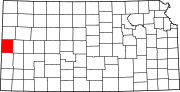 | |
| Ghost towns | ||
| Townships | ||
| ||
| International | |
|---|---|
| National | |