
Greene County, Tennessee
Greene County | |
|---|---|
 Greene County Courthouse in Greeneville | |
|
UTC−4 (EDT) | |
| Congressional district | 1st |
| Website | greenecountytngov |
Greene County is a
History
This section needs additional citations for verification. (February 2020) |
Greene County developed from the "Nolichucky settlement," established by pioneer Jacob Brown on land leased in the early 1770s from the
After the United States became independent, Greene County was formed in 1783 from the original Washington County, North Carolina, part of the former Washington District. The county is named for Major General Nathanael Greene[4] (1742-1786), a major general in the Continental Army from Rhode Island. John Crockett, father of Davy Crockett, and his wife settled in the county near Limestone. Davy Crockett was born there in 1786. At the time, the area was part of the extra-legal state Franklin.
Greene County is the home of
As with yeomen farmers in much of East Tennessee, those in Greene County were generally Unionist and opposed to secession on the eve of the Civil War. In Tennessee's Ordinance of Secession referendum on June 8, 1861, Greene Countians voted against secession by a vote of 2,691 to 744.[5] Following the vote (the call for secession was passed statewide), the second session of the East Tennessee Convention convened in Greeneville. It called for a separate, Union-aligned state to be formed in East Tennessee.
A railroad bridge near Mosheim was among those destroyed by the East Tennessee bridge-burning conspiracy in November 1861. Several of the conspirators who had taken part in the burning of this bridge were later captured and executed by Confederate supporters, including Jacob Hensie, Henry Fry, Jacob and Henry Harmon, and noted local potter Alex Haun.[6]
Geography
According to the
Greene County is drained by the Nolichucky River, which traverses the southern half of the county. This river is impounded by Nolichucky Dam south of Greeneville, creating Davy Crockett Lake.
Major highways
Adjacent counties

- Hawkins County (north)
- Washington County (east)
- Unicoi County (southeast)
- Madison County, North Carolina (south)
- Cocke County (southwest)
- Hamblen County (west)
National protected areas
- Andrew Johnson National Cemetery
- Andrew Johnson National Historic Site
- Appalachian Trail (part)
- Cherokee National Forest (part)
State protected areas
- Bible Covered Bridge State Historic Site
- Joachim Bible Refuge
- David Crockett Birthplace State Park (part)
- Lick Creek Bottoms Wildlife Management Area
- Nolichucky Wildlife Management Area
- Rocky Fork State Park(part)
Other historic sites
Government
Elected Officials
County Mayor
Kevin Morrison was elected County Mayor in August 2018 and began as mayor on September 1, 2018.
County Commission
Members of the county commission are elected by geographic district. They are as follows:
- District 1: Baileyton, Ottway, West Pines
- Charles Tim White
- Dale Tucker
- Kathy Crawford
- District 2: Chuckey, Chuckey Doak
- Brad Peters
- Kaleb Powell
- Joshua Arrowood
- District 3: Doak, Tusculum View
- Robin Quillen
- Jason Cobble
- Clifford "Doc" Bryant
- District 4: Camp Creek, Courthouse
- George Clemmer
- Bill Dabbs
- Lyle Parton
- District 5: Debusk, Nolachuckey, Middle School, South Greene
- Lloyd "Hoot" Bowers
- Pamela Carpenter
- Gary Shelton
- District 6: McDonald, Mosheim
- Jeffrey Bible
- Josh Kesterson
- John Waddle
- District 7: Glenwood, Greeneville High School
- Teddy Lawing
- Paul Burkey
- VACANT
Presidential elections
Like all of East Tennessee, Greene County is a Republican stronghold. The last Democratic presidential candidate to carry this county was Franklin D. Roosevelt in 1936.
| Year | Republican | Democratic | Third party | |||
|---|---|---|---|---|---|---|
| No. | % | No. | % | No. | % | |
| 2020 | 22,259 | 79.25% | 5,199 | 18.51% | 629 | 2.24% |
| 2016 | 18,562 | 78.71% | 4,216 | 17.88% | 805 | 3.41% |
| 2012 | 17,245 | 72.19% | 6,225 | 26.06% | 417 | 1.75% |
| 2008 | 17,151 | 69.52% | 7,110 | 28.82% | 409 | 1.66% |
| 2004 | 16,382 | 67.71% | 7,635 | 31.56% | 177 | 0.73% |
| 2000 | 12,540 | 60.24% | 7,909 | 37.99% | 367 | 1.76% |
| 1996 | 9,779 | 53.10% | 6,885 | 37.39% | 1,752 | 9.51% |
| 1992 | 9,912 | 47.48% | 7,857 | 37.64% | 3,106 | 14.88% |
| 1988 | 11,947 | 69.73% | 5,077 | 29.63% | 108 | 0.63% |
| 1984 | 13,215 | 73.15% | 4,763 | 26.37% | 87 | 0.48% |
| 1980 | 10,704 | 63.13% | 5,822 | 34.34% | 430 | 2.54% |
| 1976 | 8,664 | 54.56% | 7,070 | 44.52% | 146 | 0.92% |
| 1972 | 9,772 | 76.89% | 2,764 | 21.75% | 173 | 1.36% |
| 1968 | 7,957 | 58.26% | 2,947 | 21.58% | 2,753 | 20.16% |
| 1964 | 6,913 | 53.89% | 5,916 | 46.11% | 0 | 0.00% |
| 1960 | 8,835 | 66.55% | 4,406 | 33.19% | 35 | 0.26% |
| 1956 | 7,396 | 64.87% | 3,949 | 34.63% | 57 | 0.50% |
| 1952 | 6,864 | 64.98% | 3,656 | 34.61% | 43 | 0.41% |
| 1948 | 4,375 | 55.56% | 3,282 | 41.68% | 218 | 2.77% |
| 1944 | 4,922 | 64.21% | 2,726 | 35.56% | 17 | 0.22% |
| 1940 | 4,587 | 50.21% | 4,406 | 48.23% | 142 | 1.55% |
| 1936 | 4,313 | 47.62% | 4,708 | 51.98% | 36 | 0.40% |
| 1932 | 3,223 | 42.79% | 4,264 | 56.61% | 45 | 0.60% |
| 1928 | 3,599 | 61.06% | 2,295 | 38.94% | 0 | 0.00% |
| 1924 | 3,282 | 55.66% | 2,586 | 43.85% | 29 | 0.49% |
| 1920 | 5,677 | 65.97% | 2,924 | 33.98% | 5 | 0.06% |
| 1916 | 3,055 | 57.54% | 2,254 | 42.46% | 0 | 0.00% |
| 1912 | 1,650 | 33.18% | 2,076 | 41.75% | 1,247 | 25.08% |
Demographics
| Census | Pop. | Note | %± |
|---|---|---|---|
| 1790 | 7,741 | — | |
| 1800 | 7,610 | −1.7% | |
| 1810 | 9,713 | 27.6% | |
| 1820 | 11,324 | 16.6% | |
| 1830 | 14,410 | 27.3% | |
| 1840 | 16,076 | 11.6% | |
| 1850 | 17,824 | 10.9% | |
| 1860 | 19,004 | 6.6% | |
| 1870 | 21,668 | 14.0% | |
| 1880 | 24,005 | 10.8% | |
| 1890 | 26,614 | 10.9% | |
| 1900 | 30,596 | 15.0% | |
| 1910 | 31,083 | 1.6% | |
| 1920 | 32,824 | 5.6% | |
| 1930 | 35,119 | 7.0% | |
| 1940 | 39,405 | 12.2% | |
| 1950 | 41,048 | 4.2% | |
| 1960 | 42,163 | 2.7% | |
| 1970 | 47,630 | 13.0% | |
| 1980 | 54,422 | 14.3% | |
| 1990 | 55,853 | 2.6% | |
| 2000 | 62,909 | 12.6% | |
| 2010 | 68,831 | 9.4% | |
| 2020 | 70,152 | 1.9% | |
| U.S. Decennial Census[11] 1790-1960[12] 1790-1990 [13] 1900-1990[14] 1990-2000[15] 2010-2014[2] | |||

2020 census
| Race | Number | Percentage |
|---|---|---|
White (non-Hispanic)
|
63,143 | 90.01% |
Black or African American (non-Hispanic)
|
1,308 | 1.86% |
Native American
|
142 | 0.2% |
Asian
|
299 | 0.43% |
Pacific Islander
|
14 | 0.02% |
Other/Mixed
|
2,711 | 3.86% |
Latino
|
2,535 | 3.61% |
As of the 2020 United States census, there were 70,152 people, 28,323 households, and 18,481 families residing in the county.
2000 census
As of the

There were 25,756 households, out of which 29.20% had children under the age of 18 living with them, 55.70% were married couples living together, 10.80% had a female householder with no husband present, and 29.60% were non-families. 25.80% of all households were made up of individuals, and 10.70% had someone living alone who was 65 years of age or older. The average household size was 2.38 and the average family size was 2.84.
In the county, the population was spread out, with 22.20% under the age of 18, 8.10% from 18 to 24, 28.70% from 25 to 44, 26.10% from 45 to 64, and 14.80% who were 65 years of age or older. The median age was 39 years. For every 100 females there were 95.10 males. For every 100 females age 18 and over, there were 91.40 males.
The median income for a household in the county was $30,382, and the median income for a family was $36,889. Males had a median income of $26,331 versus $20,304 for females. The
Education
Public schools in Greene County school system include the following:
- Baileyton Elementary
- Camp Creek Elementary
- Chuckey Elementary
- Doak Elementary
- McDonald Elementary
- Mosheim Elementary
- Nolachuckey Elementary
- Chuckey-Doak Middle School
- Chuckey-Doak High School
- North Greene Middle School
- North Greene High School
- South Greene Middle School
- South Greene High School
- West Greene Middle School
- West Greene High School
Public schools that are within Greene County but are part of the Greeneville City School System[20] include:
- Eastview Elementary
- Hal Henard Elementary
- Highland Elementary
- Tusculum View Elementary
- Greeneville Middle School
- Greeneville High School
- Greene Technology Center
Hospitals
Two hospitals are located in Greene County, Greeneville Community Hospital West campus and Greeneville Community East campus. These hospitals were formally Takoma Regional Hospital and Laughlin Memorial Hospital, respectively, after Ballad Health formed from the merger between Mountain States Health Alliance and Wellmont Health System.
Communities
City
Towns
- Baileyton
- Greeneville (county seat)
- Mosheim
Census-designated place
- Fall Branch (partial)
Unincorporated communities
See also
References
- ^ Blythe Semmer, "Greene County," Tennessee Encyclopedia of History and Culture. Retrieved: October 16, 2013.
- ^ a b "State & County QuickFacts". United States Census Bureau. Archived from the original on June 7, 2011. Retrieved November 30, 2013.
- ^ "Find a County". National Association of Counties. Archived from the original on May 31, 2011. Retrieved June 7, 2011.
- ^ Gannett, Henry (1905). The Origin of Certain Place Names in the United States. Govt. Print. Off. p. 143.
- ^ Oliver Perry Temple, East Tennessee and the Civil War, (R. Clarke Company, 1899), p. 199.
- ^ Temple, East Tennessee and Civil War, pp. 370-406.
- ^ "2010 Census Gazetteer Files". United States Census Bureau. August 22, 2012. Retrieved April 5, 2015.
- ^ Tennessee Department of Environment and Conservation, et al., "Ambient Air Monitoring Plan," Environmental Protection Agency website, July 1, 2010, p. 6. Accessed: March 18, 2015.
- ^ Fred Lobdell, "Greene County High Point Trip Report," COHP.org, 1998. Retrieved: March 18, 2015.
- ^ Leip, David. "Dave Leip's Atlas of U.S. Presidential Elections". uselectionatlas.org. Retrieved March 10, 2018.
- ^ "U.S. Decennial Census". United States Census Bureau. Retrieved April 5, 2015.
- ^ "Historical Census Browser". University of Virginia Library. Retrieved April 5, 2015.
- ^ Forstall, Richard L., Population of States and Counties of the United States: 1790 to 1990, U.S. Bureau of the Census, Washington, DC, 1996.
- ^ Forstall, Richard L., ed. (March 27, 1995). "Population of Counties by Decennial Census: 1900 to 1990". United States Census Bureau. Retrieved April 5, 2015.
- ^ "Census 2000 PHC-T-4. Ranking Tables for Counties: 1990 and 2000" (PDF). United States Census Bureau. April 2, 2001. Archived (PDF) from the original on October 9, 2022. Retrieved April 5, 2015.
- ^ "Population and Housing Unit Estimates". Retrieved July 20, 2019.
- 2000 censusdata
- ^ "Explore Census Data". data.census.gov. Retrieved December 27, 2021.
- ^ "U.S. Census website". United States Census Bureau. Retrieved May 14, 2011.
- ^ Schools, Greeneville City Schools official website. Retrieved: October 16, 2013.
External links
Places adjacent to Greene County, Tennessee | ||||||||||||||||
|---|---|---|---|---|---|---|---|---|---|---|---|---|---|---|---|---|
| ||||||||||||||||
Municipalities and communities of Greene County, Tennessee, United States | ||
|---|---|---|
| City | 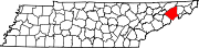 | |
| Towns | ||
| CDP | ||
| Unincorporated communities | ||
| Footnotes | ‡This populated place also has portions in an adjacent county or counties | |
| ||
| International | |
|---|---|
| National | |
| Geographic | |