
Halls, Tennessee
Halls, Tennessee | ||
|---|---|---|
FIPS code 47-31820[4] | | |
| GNIS feature ID | 1286606[2] | |
| Website | www | |
Halls is a town in
The town was founded in 1882 as a railroad station stop. It is named after Hansford R. Hall, one of the founders. Among the early business ventures were sawmills and cotton gins, founded in the 1880s to process local lumber and cotton.
History
The town was not established until 1882, when the Newport News & Mississippi Valley Railroad (later the Illinois Central Railroad) set up a railroad stop on land in northern Lauderdale County. By 1899, the town had its own bank, and the following year the Cumberland Telephone and Telegraph Company had set up a line connecting it to the county seat, Ripley.[5]
The village was originally named Hall's Station in honor of Hansford R. Hall, one of the founders. Other founders were J. S. Stephens and S. A. Jordan, early businessmen of Lauderdale County.
E. Stanfield, general merchant, was first to set up a business at Hall's Station in 1882. Other early businesses included Young & Sawyer, a steam-powered cotton gin; D. P. Shoffner, steam sawmill and wagon material; J. H. Farmer, saw-, grist- and planing-mill and cotton gin. As of 1887 there were about 400 people in the community.[6]
In August 1942, the U.S. Army Air Forces constructed Dyersburg Army Air Field on the north side of town. This was a major B-17 and B-24 base during World War 2. It closed in 1946 and was eventually converted to a municipal airport.[7]
On January 17, 1999 a tornado struck Halls damaging a restaurant and The Halls First United Methodist Church. The church has since been rebuilt in another location. [8]
Geography
Halls is located at 35°52′32″N 89°23′46″W / 35.87556°N 89.39611°W.[9]
According to the United States Census Bureau, the town has a total area of 3.7 square miles (9.6 km2), of which 3.7 square miles (9.6 km2) is land and 0.27% is water.
Halls is situated on the southeastern edge of the New Madrid Seismic Zone, an area with a high earthquake risk.
Demographics
| Census | Pop. | Note | %± |
|---|---|---|---|
| 1890 | 441 | — | |
| 1900 | 395 | −10.4% | |
| 1910 | 882 | 123.3% | |
| 1920 | 1,400 | 58.7% | |
| 1930 | 1,474 | 5.3% | |
| 1940 | 1,511 | 2.5% | |
| 1950 | 1,808 | 19.7% | |
| 1960 | 1,890 | 4.5% | |
| 1970 | 2,323 | 22.9% | |
| 1980 | 2,444 | 5.2% | |
| 1990 | 2,431 | −0.5% | |
| 2000 | 2,311 | −4.9% | |
| 2010 | 2,255 | −2.4% | |
| 2020 | 2,091 | −7.3% | |
| Sources:[10][11][3] | |||
2020 census
| Race | Num. | Perc. |
|---|---|---|
White (non-Hispanic)
|
1,319 | 63.08% |
Black or African American (non-Hispanic)
|
557 | 26.64% |
Native American
|
10 | 0.48% |
Asian
|
3 | 0.14% |
Other/Mixed
|
136 | 6.5% |
Latino
|
66 | 3.16% |
As of the 2020 United States census, there were 2,091 people, 887 households, and 557 families residing in the town.
2000 census
As of the
There were 946 households, out of which 29.7% had children under the age of 18 living with them, 45.3% were married couples living together, 17.7% had a female householder with no husband present, and 32.1% were non-families. 30.0% of all households were made up of individuals, and 15.9% had someone living alone who was 65 years of age or older. The average household size was 2.44 and the average family size was 3.03.
In the town, the population was spread out, with 26.7% under the age of 18, 7.7% from 18 to 24, 26.8% from 25 to 44, 22.3% from 45 to 64, and 16.4% who were 65 years of age or older. The median age was 37 years. For every 100 females, there were 87.1 males. For every 100 females age 18 and over, there were 81.8 males.
The median income for a household in the town was $24,142, and the median income for a family was $29,063. Males had a median income of $26,528 versus $19,300 for females. The
Transportation
Arnold Field, a former WW2 B-24 base, is the city's airport. It contains a single 4,700 foot concrete runway.
The town of Halls is served by the Fulton Division of the Canadian National Railroad.
Veterans' Museum
The Veterans' Museum, on the grounds of the former
References
- ^ "ArcGIS REST Services Directory". United States Census Bureau. Retrieved October 15, 2022.
- ^ a b U.S. Geological Survey Geographic Names Information System: Halls, Tennessee
- ^ a b "Census Population API". United States Census Bureau. Retrieved October 15, 2022.
- ^ a b "U.S. Census website". United States Census Bureau. Retrieved January 31, 2008.
- ^ Rust, Randal. "Lauderdale County". Tennessee Encyclopedia. Retrieved December 20, 2023.
- ^ Lauderdale County History, Goodspeed Publishing Co., 1887. Retrieved from Tennessee GenWeb website, April 10, 2011.
- ^ Fulbright, Jim. The Aviation History of Tennessee. Bicentennial Production of the Tennessee Department of Transportation, Aeronautics Division. p. 80.
- ^ [1], Retrieved from Lauderdale County website, September 19, 2019.
- ^ "Halls". Geographic Names Information System. United States Geological Survey, United States Department of the Interior. Retrieved May 3, 2009.
- ^ "Census of Population and Housing: Decennial Censuses". United States Census Bureau. Retrieved March 4, 2012.
- ^ "Incorporated Places and Minor Civil Divisions Datasets: Subcounty Resident Population Estimates: April 1, 2010 to July 1, 2012". Population Estimates. U.S. Census Bureau. Archived from the original on June 11, 2013. Retrieved December 11, 2013.
- ^ "Explore Census Data". data.census.gov. Retrieved December 8, 2021.
External links
Municipalities and communities of Lauderdale County, Tennessee, United States | ||
|---|---|---|
| City | 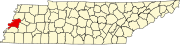 | |
| Towns | ||
| Unincorporated communities | ||
| ||