
Hamilton County, Kansas
Hamilton County | |
|---|---|
UTC−6 (MDT) | |
| Congressional district | 1st |
| Website | County Info |
Hamilton County is a
History
For many
In 1854, the Kansas Territory was organized, then in 1861 Kansas became the 34th U.S. state.
In 1873, Hamilton County was established, and named for Alexander Hamilton.
In the 1930s, the prosperity of the area was severely affected by its location within the Dust Bowl. This catastrophe intensified the economic impact of the Great Depression in the region.
Geography
According to the
Major highways
 U.S. Highway 50
- U.S. Highway 400
 K-27
K-27
Adjacent counties
- Greeley County (north)
- Wichita County (northeast/Central Time border)
- Kearny County (east/Central Time border)
- Stanton County (south/Central Time border)
- Prowers County, Colorado (west)
Demographics

| Census | Pop. | Note | %± |
|---|---|---|---|
| 1880 | 168 | — | |
| 1890 | 2,027 | 1,106.5% | |
| 1900 | 1,426 | −29.6% | |
| 1910 | 3,360 | 135.6% | |
| 1920 | 2,586 | −23.0% | |
| 1930 | 3,328 | 28.7% | |
| 1940 | 2,645 | −20.5% | |
| 1950 | 3,696 | 39.7% | |
| 1960 | 3,144 | −14.9% | |
| 1970 | 2,747 | −12.6% | |
| 1980 | 2,514 | −8.5% | |
| 1990 | 2,388 | −5.0% | |
| 2000 | 2,670 | 11.8% | |
| 2010 | 2,690 | 0.7% | |
| 2020 | 2,518 | −6.4% | |
| 2023 (est.) | 2,437 | [5] | −3.2% |
| U.S. Decennial Census[6] 1790-1960[7] 1900-1990[8] 1990-2000[9] 2010-2020[1] | |||
As of the
of any race were 20.60% of the population.There were 1,054 households, out of which 33.90% had children under the age of 18 living with them, 56.90% were married couples living together, 7.60% had a female householder with no husband present, and 32.10% were non-families. 29.40% of all households were made up of individuals, and 15.80% had someone living alone who was 65 years of age or older. The average household size was 2.49 and the average family size was 3.09.
In the county, the population was spread out, with 28.40% under the age of 18, 7.20% from 18 to 24, 25.30% from 25 to 44, 20.90% from 45 to 64, and 18.40% who were 65 years of age or older. The median age was 38 years. For every 100 females there were 97.60 males. For every 100 females age 18 and over, there were 92.60 males.
The
Government
Hamilton County is often carried by Republican Candidates. The last time a Democratic candidate has carried Hamilton County was in 1976 by
Presidential elections
| Year | Republican | Democratic | Third party | |||
|---|---|---|---|---|---|---|
| No. | % | No. | % | No. | % | |
| 2020 | 698 | 81.26% | 141 | 16.41% | 20 | 2.33% |
| 2016 | 705 | 80.48% | 121 | 13.81% | 50 | 5.71% |
| 2012 | 693 | 79.02% | 163 | 18.59% | 21 | 2.39% |
| 2008 | 844 | 77.01% | 233 | 21.26% | 19 | 1.73% |
| 2004 | 888 | 78.58% | 229 | 20.27% | 13 | 1.15% |
| 2000 | 901 | 75.59% | 264 | 22.15% | 27 | 2.27% |
| 1996 | 811 | 64.93% | 342 | 27.38% | 96 | 7.69% |
| 1992 | 716 | 51.96% | 386 | 28.01% | 276 | 20.03% |
| 1988 | 801 | 60.00% | 517 | 38.73% | 17 | 1.27% |
| 1984 | 1,037 | 70.64% | 408 | 27.79% | 23 | 1.57% |
| 1980 | 889 | 64.65% | 402 | 29.24% | 84 | 6.11% |
| 1976 | 560 | 41.70% | 746 | 55.55% | 37 | 2.76% |
| 1972 | 941 | 67.26% | 394 | 28.16% | 64 | 4.57% |
| 1968 | 751 | 56.25% | 410 | 30.71% | 174 | 13.03% |
| 1964 | 685 | 48.21% | 726 | 51.09% | 10 | 0.70% |
| 1960 | 885 | 59.76% | 591 | 39.91% | 5 | 0.34% |
| 1956 | 865 | 60.66% | 552 | 38.71% | 9 | 0.63% |
| 1952 | 1,209 | 72.70% | 437 | 26.28% | 17 | 1.02% |
| 1948 | 749 | 50.64% | 722 | 48.82% | 8 | 0.54% |
| 1944 | 795 | 62.35% | 471 | 36.94% | 9 | 0.71% |
| 1940 | 798 | 57.95% | 569 | 41.32% | 10 | 0.73% |
| 1936 | 720 | 44.55% | 885 | 54.76% | 11 | 0.68% |
| 1932 | 651 | 36.68% | 1,021 | 57.52% | 103 | 5.80% |
| 1928 | 839 | 68.43% | 363 | 29.61% | 24 | 1.96% |
| 1924 | 610 | 52.27% | 307 | 26.31% | 250 | 21.42% |
| 1920 | 591 | 57.66% | 371 | 36.20% | 63 | 6.15% |
| 1916 | 511 | 44.05% | 522 | 45.00% | 127 | 10.95% |
| 1912 | 134 | 21.30% | 263 | 41.81% | 232 | 36.88% |
| 1908 | 415 | 57.32% | 275 | 37.98% | 34 | 4.70% |
| 1904 | 215 | 58.58% | 126 | 34.33% | 26 | 7.08% |
| 1900 | 182 | 46.31% | 194 | 49.36% | 17 | 4.33% |
| 1896 | 185 | 45.57% | 216 | 53.20% | 5 | 1.23% |
| 1892 | 252 | 56.25% | 0 | 0.00% | 196 | 43.75% |
| 1888 | 480 | 59.11% | 295 | 36.33% | 37 | 4.56% |
Laws
Although the
Education
Unified school districts
Communities

List of townships / incorporated cities / unincorporated communities / extinct former communities within Hamilton County.[13]
Cities
Unincorporated community
Townships
.svg)
Hamilton County is divided into eight townships. None of the cities within the county are considered governmentally independent, and all figures for the townships include those of the cities. In the following table, the population center is the largest city (or cities) included in that township's population total, if it is of a significant size.
| Township | FIPS |
Population center |
Population | Population density /km2 (/sq mi) |
Land area km2 (sq mi) |
Water area km2 (sq mi) |
Water % | Geographic coordinates |
|---|---|---|---|---|---|---|---|---|
| Bear Creek | 04850 | 69 | 0 (0) | 452 (174) | 1 (0) | 0.19% | 37°49′19″N 101°56′36″W / 37.82194°N 101.94333°W | |
| Coolidge | 15425 | 128 | 0 (1) | 297 (115) | 1 (0) | 0.37% | 38°2′22″N 101°59′41″W / 38.03944°N 101.99472°W | |
| Kendall | 36425 | 101 | 0 (1) | 234 (90) | 0 (0) | 0% | 37°59′41″N 101°35′3″W / 37.99472°N 101.58417°W | |
| Lamont | 38275 | 89 | 0 (1) | 426 (164) | 0 (0) | 0.02% | 37°48′9″N 101°38′41″W / 37.80250°N 101.64472°W | |
| Liberty | 40075 | 38 | 0 (0) | 257 (99) | 0 (0) | 0.03% | 38°7′29″N 101°44′4″W / 38.12472°N 101.73444°W | |
| Medway | 45650 | 53 | 0 (0) | 279 (108) | 1 (0) | 0.28% | 38°4′51″N 101°51′13″W / 38.08083°N 101.85361°W | |
| Richland | 59325 | 27 | 0 (0) | 426 (164) | 0 (0) | 0% | 38°13′21″N 101°46′17″W / 38.22250°N 101.77139°W | |
| Syracuse | 69875 | 2,165 | 10 (27) | 210 (81) | 0 (0) | 0.01% | 37°59′10″N 101°45′5″W / 37.98611°N 101.75139°W | |
| Sources: "Census 2000 U.S. Gazetteer Files". U.S. Census Bureau, Geography Division. Archived from the original on August 2, 2002. | ||||||||
Gallery
-
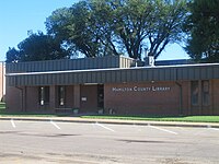 Hamilton CountyPublic Library in Syracuse
 -
 Christ's New Covenant Church and Syracuse Christian Academy in Syracuse


See also
- Community information for Kansas
- Kansas locations by per capita income
- List of counties in Kansas
- List of townships in Kansas
- List of cities in Kansas
- List of unincorporated communities in Kansas
- List of ghost towns in Kansas
References
- ^ a b c "QuickFacts; Hamilton County, Kansas; Population, Census, 2020 & 2010". United States Census Bureau. Archived from the original on August 17, 2021. Retrieved August 16, 2021.
- ^ "Find a County". National Association of Counties. Retrieved June 7, 2011.
- ^ Blackmar, Frank Wilson (1912). Kansas: A Cyclopedia of State History, Embracing Events, Institutions, Industries, Counties, Cities, Towns, Prominent Persons, Etc. Standard Publishing Company. pp. 803.
- ^ "US Gazetteer files: 2010, 2000, and 1990". United States Census Bureau. February 12, 2011. Retrieved April 23, 2011.
- ^ "Annual Estimates of the Resident Population for Counties: April 1, 2020 to July 1, 2023". United States Census Bureau. Retrieved April 3, 2024.
- ^ "U.S. Decennial Census". United States Census Bureau. Retrieved July 26, 2014.
- ^ "Historical Census Browser". University of Virginia Library. Retrieved July 26, 2014.
- ^ "Population of Counties by Decennial Census: 1900 to 1990". United States Census Bureau. Retrieved July 26, 2014.
- ^ "Census 2000 PHC-T-4. Ranking Tables for Counties: 1990 and 2000" (PDF). United States Census Bureau. Archived (PDF) from the original on March 27, 2010. Retrieved July 26, 2014.
- ^ "U.S. Census website". United States Census Bureau. Retrieved January 31, 2008.
- ^ "Dave Leip's Atlas of U.S. Presidential Elections".
- ^ "Map of Wet and Dry Counties". Alcoholic Beverage Control, Kansas Department of Revenue. November 2004. Archived from the original on October 8, 2007. Retrieved January 21, 2007.
- ^ a b "General Highway Map of Hamilton County, Kansas" (PDF). Kansas Department of Transportation (KDOT). January 2011. Archived (PDF) from the original on February 8, 2023.
Further reading
External links
- County
- Maps
- Hamilton County Maps: Current, Historic, KDOT
- Kansas Highway Maps: Current, Historic, KDOT
- Kansas Railroad Maps: Current, 1996, 1915, KDOT and Kansas Historical Society
Places adjacent to Hamilton County, Kansas | |
|---|---|
Municipalities and communities of Hamilton County, Kansas, United States | ||
|---|---|---|
| Cities | 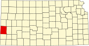 | |
| Unincorporated communities | ||
| Townships | ||
| ||
| International | |
|---|---|
| National | |