
Hammersmith Broadway
 | |
 | |
| Location | Hammersmith, London, England |
|---|---|
| Opening date | 1994 |
| No. of stores and services | 47 |
| Public transit access | |
| Website | hammersmithbroadway |
Hammersmith Broadway is a major transport node and
History
The shopping centre opened in 1994, on the site of many now-demolished buildings, including The Clarendon Hotel (a music venue) and Palmers Department Store.[1] The complex was designed by EPR Architects.
Tenants
Current tenants include
Transport
The complex includes a large, modern bus station, spread across two levels. The upper bus station is located directly above the shopping centre, whereas the lower bus station is located at ground level adjacent to the centre.
It is also served by two London Underground stations named Hammersmith: The District and Piccadilly lines station is located directly below the shopping centre, with entrances at either end of the centre, while the Circle and Hammersmith & City lines station is located a short distance north of the centre at Beadon Road.
Gallery
-
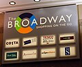 Shops advertised on the main entrance to Hammersmith Broadway
 -
 Statue in entrance to Hammersmith Broadway
 -
 Entrance to Hammersmith Broadway


References
- ^ "Background info". The Fulham and Hammersmith Historical Society. Retrieved 23 June 2019.
- ^ "SHOP LISTINGS". Hammersmith Broadway. Retrieved 2 April 2023.
- ^ "FOOD & DRINK". Hammersmith Broadway. Retrieved 2 April 2023.