
History of Banbury


Banbury is a circa 1,500-year-old
General history
Origin of the toponym
The
The derivation of the name of the
Roman and Anglo-Saxon history

Banbury stands at the junction of two ancient roads: Salt Way (used as a bridle path to the west and south of the town), its primary use being the local transportation of salt ; and Banbury Lane, which began near Northampton and is closely followed by the modern road. It continued through what is now Banbury High Street and onwards to the Fosse Way at Stow-on-the-Wold. The earliest settlement at Banbury was in the British Iron Age. The remains of a settlement with circular buildings dating back to 200 BC were found in 2002 during excavations for the foundations of a building in Hennef Way. The site contained around 150 pieces of pottery and stone.
Later there was a Roman villa at nearby Wykham Park.[4][6]
The area was settled by the
The Saxons built Banbury on the west bank of the River Cherwell. On the opposite bank they built Grimsbury, which was part of Northamptonshire but was incorporated into Banbury in 1889.[7] Neithrop was one of the oldest areas in Banbury, having first been recorded as a hamlet in the 13th century. It was formally incorporated into the borough of Banbury in 1889.[8]
Middle ages
Banbury's medieval prosperity was based on wool.
The manors of
The
Banbury Castle was built in 1135 by Alexander, Bishop of Lincoln, and survived into the English Civil War, when it was destroyed.
Medieval Banbury was badly hit by the Black Death of 1348–49 as it probably killed half the population of the town, but it quickly grew and had a population of about 1,600 for the next 300 years.[11]
For centuries, trade in wool, ale, cakes and cheese created wealth for the town. Wool was first referred to in 1268, and cheese was manufactured from the 15th to the 18th centuries. By the late 14th century
In 1247 the hundred of Banbury was valued at £5 (100 shillings) a year and in 1441
The Bishop of Lincoln's extensive Banbury estate, excepting Neithrop and Calthorpe, was sold to the Duke of Somerset in 1547, but by 1550 he granted it, excepting Hardwick to John Dudley, Earl of Warwick, then to the Duke of Northumberland shortly afterwards, who in turn granted it to the Crown in 1551 in exchange for other lands.[12]
Long before enclosure, the tenants of Neithrop had become freeholders, as recorded in the land deeds of 1583 to 1608 and 1614, with the permission of both Sir Anthony Cope and his son Sir William Cope.[13]
In about 1629 Sir William Cope, 2nd Baronet.[10] sold a large area of land at Drayton to William Fiennes, 1st Viscount Saye and Sele of Broughton Castle.[10] By 1790 this property belonged to Francis North, 1st Earl of Guilford of Wroxton Abbey.[10] In 1935 and 1942 the Norths then sold their lands at Drayton to Trinity College, Oxford.[10]
English Civil War

Banbury was partially destroyed by a fire in 1628. It played an important part in the
The Civil War helped develop Banbury's industry.
The Civil War and the short two sieges noticeably damaged town's prosperity. Two members of the Vivers family and two fellow Banburians petitioned Parliament for an official redress compensation in 1646 and 1647. They claimed the principal looter was a captain in the King's garrison at Banbury Castle. Another self-proclaimed sufferer was the mercer Edward Russell, who after nearly being executed for trying to suborn the Royalist officers to turn Parliamentarian was jailed for three months in 1644. He also claimed his shop and house were looted and destroyed by the castle's Royalist garrison[13] The garrison was soon defeated and the castle partly demolished using gunpowder. The Parliamentarian forces appeared to have also used the River Cherwell for access to Banbury at one point and briefly set up camp in the location of the present day Canalside trading estate, next to the public gallows.[16] In 1649 dissaffected soldiers of the New Model Army mutinied. Being a mutiny and in Banbury, it became known as the Banbury mutiny. The mutineers did not achieve all of their aims and some of the leaders were executed on 17 May 1649.
1660–1834


Villagers farmed the parish on a two-field
The opening of the Oxford Canal from Hawkesbury Junction to Banbury on 30 March 1778 gave the town a cheap and reliable supply of Warwickshire coal.[21] In 1787 the Oxford Canal was extended southwards,[22] finally opening to Oxford on 1 January 1790.[23] The canal's main boat yard was the original outlay of today's Tooley's Boatyard.[24]
Before the arrival of the Oxford Canal in 1779, the Canalside area was undeveloped, low-lying
The Cobb family may have obtained The hundred of Banbury when they bought the land site of Banbury castle in 1792[9] and in 1853 Edward Cobb was lord of the hundreds of Banbury and Bloxham.[9]
The council objected to the planting of trees in Horse Fair Road, and in 1826 John Walford was then accused of injuring trees planted by the town's commissioners which he considered, like the trees they were planting, to be a waste of money. The commissioners were heckled as a rioting mob destroyed all the trees and fences.[25]
In the nineteenth century John Golby Rusher was a successful publisher based in Banbury, particularly known for his books of nursery rhymes which were distributed nationally.[26][27][28][29] His father William Rusher was a bookseller and stationer and his uncle Philip Rusher, the manager of the town's Old Bank, had promoted Rusher's Patent Types, a redesign of the alphabet to save money in printing.[30][31]
1835–1912


The Banbury
In 1836 by the town council took over the running of Banbury and the right to erect gas-works was relinquished in 1833 to the Banbury Gas Light and Coke Company.[25]
In 1838, the Catholic St John the Evangelist Church was built in Banbury. In 1839, the presbytery and chancel was added to it. They were designed by Augustus Pugin. In 1847, the Sisters of Saint Paul of Chartres were invited to create a community in Banbury, St John's Priory. They later moved to St Paul's Convent in Selly Park.[33]
One of the first acts of the town's newly appointed
Living conditions had improved greatly in Victorian times with the removal of several poorly built cottages that were deemed to be only 'hovels' and a reduction in childhood ill health in the early 19th century. Many cottages in the district of 'Waterloo', which apparently lay just east of Banbury Bridge to the north of the road, had been transformed after the early 19th century so that by 1841 'Waterloo' was considered one of the better off parts of Grimsbury. Banbury was booming, and Grimsbury's principal expansion occurred between 1852 and 1881, when some 500 houses were built, around Middleton Road, Causeway, Merton Street, Duke Street, and North Street.[34]
In 1889, the hamlets of Grimsbury and Nethercote, Banbury became part of Banbury, before this time they were considered to be part of Warkworth in Northamptonshire, although they were both part of the Banbury (UK Parliament constituency) since 1832.[35]
Banbury's Freehold Land Societies came into existence in the 1840s as part of a new pro-Democracy political movement inspired, organised by Liberal Radicals to effect Parliamentary Reform. Liberalised Banbury's offshoot was a settlement in New Grimsbury. The hamlet was originally called Freetown in the 1840s. Early in 1851 an audience of 300 attended a rally led by James Taylor of Birmingham lecture in Banbury on Freehold Land Societies. Mr Taylor was a disciple of the Unitarian minister George Dawson, and thus became a vigorous crusader for the working-classes.[13]
The first two railways to reach Banbury opened in 1850. Firstly the
Upper and Lower Cherwell Streets and Windsor Street had also been built before 1851 as the town first began to grow. Neithrop expanded further between 1850 and 1881, with new housing providing for the Municipal Borough of Banbury's planned slum clearance from 'Waterloo' in Grimsbury and to deal with the then growing population and for the expanding population.[34] This was followed by the building between Windsor Street and Broad Street so that by 1881 there were some 350 then modern houses in the whole area.[34] The street known as Back Lane began converted into Castle Street West, as Castle Street East was created as part of a slum clearance from central Banbury in 1852.[34]
A
In the early 1870s the east side of Regents Place was developed by a William Wilkins between 1852 and 1871.
A large demonstration occurred in Banbury in July 1875 against the Vaccination Act of 1874. The demonstration was held to celebrate the release from Northampton Gaol of a man who had been imprisoned for 14 days after refusing to allow his child to be vaccinated. Musical bands and crowds met him at Banbury railway station, and he was presented with a purse of gold.[36]
Duke Street, was located at the edge of Wilkins' (now demolished) brick pit, was developed around 1870. South of the Causeway, the newly designated Merton Street was developed by various speculators between the years of 1873 and 1882. It is worth noting the cramped development of the housing on the Causeway and Merton Street (known locally as the 'Railway Terraces') that built by the Great Western Railway, for the company's workers to use on payment of a rent to the GWR. This can be compared with the then contemporary, but more generous, development of the freehold land estate with its forward looking 'build-to-own' policy and public ethos. Development of site in the area continued into the twentieth century, Avenue Road constructed in 1911 being a case in point. Allotments began to encroached on the mostly closed clay pit by 1923.[13]
Banbury town council also built the houses in King's Road and on the Easington estate at that time. More houses were built for the working population at the south end of Britannia Road and the area to the east between 1881 and 1930, and also in both Old Grimsbury Road and Gibbs Road in Grimsbury, and more up-market houses were built in both the Marlborough Road area and in Bath Road, Kings Road, Park Road, and Queen Street in Neithrop.
In 1891 the local medical officer for Banbury found that 62 cottages were dangerously filthy, 63 had defective drains, and 21 no water supply.[25] By 1900, Banbury had a population of 12,968.[25][34]
The land that was Peoples' Park had been enclosed in Hanoverian times and was set up as a private park in 1890 and opened in 1910, along with the adjacent bowling green.
The mostly late 19th-century suburb of Grimsbury witnessed rapid growth between 1881 and 1901.[25]
1913–1946
In 1911 many people were living in houses unfit for human habitation. The Municipal Borough of Banbury set up a housing committee which some houses were built in Kings Road. The Banbury Co-operative Society completed 12 houses in 1913 in Hightown Road.[25]
People's park was opened in 1919 [38][39]
The 1919 Housing Act was followed by the building of the Easington housing estate of 361 council houses in what was one of the first slum clearance schemes in the country. By 1930 the town's medical officer reported 131 houses still unfit for habitation. So in 1933 Banbury council opened the Ruscote housing estate of 160 houses. The heavily increased population between 1931 and 1949 was accommodated by the expansion of the town in three main areas, in each of which houses were built both by the town corporation and by private housing companies. Between the Oxford and Bloxham roads about 500 houses were built before 1939 to form the bulk of the suburb of Easington, and in the area of the older village and suburb of Neithrop some 500 houses were built before 1939 both around the earlier houses and further west in new streets on either side of the Warwick Road, a development which was extended to the south-west after 1945.[25]
Broughton Road and the West Bar area were mostly built in 1922, with a few building like the Gothic Villa dating from 1871 and the neighbouring West Bar Surgery GP's practice dating from the early 1960s.[37] A total of 770 council houses were built between 1919 and 1940, and another 2,545 (including Withycombe Drive in 1947) during the period from 1945 to 1967 as the population began to grow significantly. The housing developments were mainly in the western parts of the town between the Warwick and Broughton roads, with others being built on the site of the former brickworks in Grimsbury.[25] About 300 more houses were built after 1945. To the north of Grimsbury Square is the 1945–55 area of 'New Grimsbury' and south of it is the 1901 and earlier old town of 'Old Grimsbury'.[25]
National Filling Factory, Banbury was built in World War I[40] Production of filled shells began in April 1916 and ended in 1924.[40] At height of the war gave employment to 933 men and 548 women, by 1919 they were down to 100 men and 72 women.[40] It was closed in 1927.[40]
A then confidential memorandum was sent to Horace Lester on 18 May 1917, by Captain Snowball with idea that the factory could be used for another manufacturing purpose after the war,[40] like the motor depot at Slough Trading Estate had been listed for.[41][42][43][44]
It was dismantlement years leading up to the Second World War and become a Home Guard ranting zone. Some Luftwaffe bombs dropped behind the Bowling Green in the 1940s since they feared it had been reactivated .[40]
Part of it was cut through by the M40 and some is now the site close to the M40 and exit 11 (Banbury) that has been identified by developer Barwood as an appropriate location for the erection of industrial/distribution buildings.[40]
There was a smaller satellite depot on the Middleton Road, Grimsbury, in Banbury during 1919 and it was reactivated in World War II.[45] 20 World War II anti-tank phosphorus grenades and a small number of World War I phosphorus grenades were dug up by developers and defused by the army in 2012.[45]
| Location of World War II air-raid | Date | Type of air-aid | Deaths | Damage | Sources |
|---|---|---|---|---|---|
| The canal lock now at the back of the Castle Quay Shopping Centre | September 1940 | 2 bombs | The lock keeper | Minor | [46] |
| A store hut containing barrels of oil, the gas works and goods yard railway sidings, workers' mess hall and main down line, 30 feet from the signal box. |
3 October 1940 | 6 bombs | 6 railway staff | 2 of the 3 gas holders and part of the gas works ’ purification plant were destroyed, causing £20,000 worth of damage. The resulting fire burned fiercely for about 2 hours. The oil hut also caught fire, a goods yard siding was destroyed, 1 of the tracks on the down line was cut for 8 hours and the mess hall was destroyed. |
[46] |
| An empty field near the sight of a former WW1 shell filling station, behind the Bowling Green Inn, Overthorpe Rd | "later on in 1940" | 5 bombs | 0 | Minor | [46] |
| The houses on West Street and some old cottages on the corner of Bath Rd. | "Towards the end of the war" | Strafing with a machine gun | 0 | Minor | [46] |
The Northern Aluminium Company, later the Aluminium Company of Canada (ALCAN) sheet rolling factory That had been was built to the north of Banbury in 1931 expanded again in the mid 30s to meet increased demand from the aircraft industry. (it employed 4,000 people at its war time peak, many of them women.) 60% of its war time metal came from Banbury, working in conjunction with an aluminium recycling plant near Adderbury which processed metal from crashed English and German air planes.
1947–1970


The town saw rapid expansion during the 1930s and 1940s as housing was built for newcomers from nearby towns and the emerging London overspill, and another 2,545 (including Withycombe Drive in 1947) during the period from 1945 to 1967 as the population began to grow significantly. The housing developments were mainly in the western parts of the town between the Warwick and Broughton roads, with others being built on the site of the former brickworks in Grimbury.[25] A later expansion between the 1950s and 1970s would reach Hardwick, Ruscote, Easington, Bretch Hill and Poets' Corner, due to influxes from the London overspill and from the West Midlands.[13]
In 1961 a total of 6,504 households were built, mostly in the style of those around Neithrop's Admiral Holland pub. 231 other, older buildings in the town centre still had no indoor toilets, 1,325 had no fixed baths, 1,643 had no hot water taps, and 98 had no cold water tap.[25]
The land south of the Foscote Private Hospital in
The Woodgreen swimming pool was opened on 23 May 1939 and renovated in the late 1970s. It was closed in the early 2000s, heavily renovated in 2009 and reopened in 2010. The much frequented outdoor pool is closed from September to March due to the bad seasonal weather.[47]
The Ruscote estate, which now has a notable South Asian community, was expanded in the 1950s because of the growth of the town due to the London overspill and further grew in the mid-1960s.
After 1970
Banbury's growth accelerated after the 1970s with the completion of the
families have moved in since. It was expanded further in the mid-1980s. The main shopping facility is the now partly closed Hardwick arcade. Trinity Close was mostly built between 1973 and 1975, while both New Grimsbury and Bretch Hill continued to grow in the 1980s according to the O.S. street maps of those times.Trinity Close and Powys Grove they were originally created as separate entities between the late 1960s and early 1980s as the 1973, 1977 and 1983 Ordnance Survey maps help to illustrate. It may be noted that Bretch Hill Road may have remained a long
Banbury used to have Western Europe's largest
The town was renovated in 1981 and partly pedestrianized in 1991.
Recent crime and anti-social behaviour
There was a 200 strong riot in the Market Place in 1988, which was quickly brought under control by the police.[49]
There have been some concerns over
17 August 2011 saw only minor scuffles in Banbury as the national riots passed Banbury by.[51]
Local redevelopment plans

Woodgreen's 45-year-old[52][53] youth club was closed in April, 2010, demolished during July 2010,[52][53] and its replacement is due to open in early 2011. The redevelopment plan was valued at £3 million.[52][53]
There was a plan in the late 2000s to expand the Bretch Hill estate westwards into local farmland,[54][55][56] but this has now been suspended due to the credit crunch and local hostility to the plan, including the southern expansion towards Bodicote.[54][55][56][57][58]
The
Over the past few years there have been plans to build a new estate on the undeveloped
The former Penryth Road/Appleby Close play-park 52°03′58″N 1°22′00″W / 52.066235°N 1.366614°W(approx.) was closed and the facilities (a roundabout, bench, bicycle rack and spring rider) were removed in the 1990s due to vandalism. The area may now be redeveloped as a car park.
Industry and commerce
Before 1639

The
The fore-runners of Butchers Row were probably long standing butchers' stalls which were known to be in situ by 1438.[13]
1639–1870
In 1639, the woollen cloth draper Robert Vivers, who was also lessee of the prebendal estate, owned the Banbury Mill. In 1648 he sold it to Londoners Edward Darnelly, who was apothecary and his friend, the bowyer Thomas Brightwell, and in 1671 Mr Darnelly leased the mill windmill in Easington, for £44 a year to Samuel Bradford, the owner of Moor Mill in Oxford. Banbury's first major printer was John Cheney. He started out in 1765 as the innkeeper of the 'Unicorn' inn by next year he started selling paper as a side-line he had is known to have set up as a jobbing-printer by 1767.[13] A boat-building yard was opened in 1790 on the canal at the end of Factory Street and boats were built there until the canal ceased to be used for commercial transport. In the 18th century New Bank (and later called the Gillett Bank)[13] had also been Richard Tawney, who was the owner of a major brewery at Oxford. The coming of the railway enhanced Banbury's position as a market town, local economic epicentre and regional centre. This was the main factor behind the expansion of the New Bank under Joseph Ashby Gillett and his successors.[34] The Cobbs' factory for "weaving, webbing, and horsecloths" was founded around 1700 and continued in production until 1870. In the early 19th century the most successful brewery in Banbury was the one owned by Thomas Hunt's, opened in Bridge Street just before 1847. A blacking factory was also opened by 1832 and it had five employees in 1851, but closed around 1872.[13] The Italianate Elms House on Oxford Road, is a substantial villa built in 1863 for Jonathan Gillet, one of the senior partners of Gillet's Bank, is now the offices of the Primary Care Trust, which lies within the grounds of the Horton Hospital site.[37]
The Canalside area began to develop became a centre of Banbury's agricultural, transport, and electrical engineering industry at about the same time as the arrival of the railways in 1850.[16] By the year 1861 the Britannia Works agricultural machinery plant had become by far the largest single enterprise, employing 380 men and boys, and the Vulcan Foundry industrial railway and steam engine works employed between 40 and 50 people. Until the mid-19th century Banbury's trade and industry were based mostly on the products of agriculture and stock raising, with a modest volume of weaving, milling, baking, brewing and boat building.[13]
The agricultural implements and milling equipment works at the
At the
- A Charles Lampitt horse-seed-driller,
- Britannia Works agricultural machinery,
- An anti-attrition threshing machine,
- Various pharmaceutical preparations,
- A public demonstration of the action of phosphate of lime and magnesia on the soil,
- Inflated saddles,
- Plushes,
- Various mohair, hemp and sackcloth, blacking, mangles with mahogany tables and
- A lady's ornate walnut work-table.[13]
The coming of the local railways made possible the expansion of the approximately 200-year-old agricultural implement manufacturing business in Banbury. The Britannia Works company's site was set up by Sir Bernard Samuelson from the earlier foundry established by James Gardner. Sir Samuelson had obtained a licence to make McCormick reapers by 1851, and by 1859 the firm was producing numerous agricultural machines, including turnip cutters, a patent digging and forking machine, a patent reaping machine, and lawn mowers. The firm also built the now demolished railway viaduct at Hook Norton. By 1881 the production of the company's produce was carried out at two separate works in south-east Banbury, which were linked by a tramway with a depot beside the railway, south of the Great Western Railway's station. Britannia Works was one of the town's major employers until the 1920s.[13]
1869–1964


.png)


In 1870 Mr. T. R. Cobb sold his web-girth making mill to a company that later became the Banbury Tweed Co. Grain, brewing, wool and cloth were the centuries-old trade of Banbury, but the Banbury Tweed Co. factory finally closed its factory in 1932, bringing an end to an era.
The economic decline from the 1870s until the 1920s slowed down the rate of urban expansion as the various
Duke Street, was located at the western edge of Wilkins' (now demolished) brick pit, was developed around 1870.[13] There was a substantial 'brick, tile and drain works' with a short tramway in it to the east of Grimsbury in the versinaty of Howard Street according to the 1882, 1883 1900, 1910, 1922 1923 and 1947 Ordnance Survey maps. It had closed by 1923[13] and the last workshops had shut in 1955. It was mostly built on by 1965 according to the 1955 and 1965 O.S. maps.
In 1917 the Oxfordshire Ironstone Railway opened between an iron ore quarry north of Wroxton and a junction on the GWR just north of Banbury.[61] It was heavily used during the Second World War but closed in 1967.[61] Heavy clay and Ironstone deposits surround Banbury.[62]
The growth of Banbury's population had nearly stopped by the 1920s, and people left the town as its market and its economic importance in the district declined: it is recorded that only 9,700 animals were sold there in the whole of 1924, compared with 6,300 at the town's
In the late 1920s the economy of Banbury was revolutionised by the arrival of new industries and in particular by the relocation of the out of town livestock market to Grimsbury it used to be held in Neithrop and/or Bridge Street, Banbury. The new site selected due to its proximity to the railway station.[13]
The Northern Aluminium Co. Ltd. or Alcan Industries Ltd. pig and rolled aluminium factory was opened in 1931 on land acquired in 1929 on the east of the Southam road, in the then hamlet of Hardwick. The various Alcan facilities on the 53-acre (21 ha) site closed between 2006 and 2007.[13] The factory was demolished between 2008 and 2009. The laboratory was also closed in 2004 and demolished in 2009.[63][64]
The Northern Aluminium Company (ALCAN) sheet rolling factory That had been was built to the north of Banbury in 1931 expanded again in the mid 30s to meet increased demand from the aircraft industry. (it employed 4,000 people at its war time peak, many of them women.) 60% of its war time metal came from Banbury, working in conjunction with an aluminium recycling plant near Adderbury which processed metal from crashed English and German air planes.
After the
After 1964
Another major employer is
In the central area were built many large shops, a bus station, and a large car park north of Castle Street. In 1969 proposals for the redevelopment of the central area were in hand, leading to the creation of the Castle Quay shopping centre in 1977 and the nearby multi-story car park in 1972. The 1977 plans to build another
The former
Banbury has several shops in suburban local centres and in the town centre. There is a market held on Thursdays and Saturdays in the market place, as well as a farmers' market on the first Friday of every month.[65]
A shopping centre,
There are many local convenience shops scattered about the town in places like the Ruscote Arcade, Hardwick Arcade and Bradley Arcade.
Kraft Foods, Banbury

Kraft Foods in the Ruscote ward of Banbury operate a large food and coffee producing factory in the north of the town.[67] It was built in 1964, partly due to the London overspill. The factory is still sometimes known as General Foods after the American company which originally owned the building before it was taken over by Kraft. In October 2006 a building at Kraft Foods that was being prepared for demolition caught fire.[citation needed] There was also a small fire at the coffee plant on 7 December 2010.[68][69]
Industrial estates
The Tramway and Canalside industrial estates


The Tramway industrial estate and Canalside estate are mostly built on land once owned by the Britannia Works. The Tramway industrial estate is named after the industrial tramway that ran between factories on Windsor Street, Upper Windsor Street, Canal Street, Tramway Street and the plant next to Banbury station and the station's corporate freight siding between around 1881[citation needed] and 1935. The estate is now a home to many businesses like the Stagecoach bus depot, a Wacky Wardrobe fancy-dress shop, Magnet Kitchens' show, Teamtalk clothing limited room and a small local oil tanker depot by the station.
The other industrial estates
The mid-1950s saw the council established the Southam Road Industrial Estate. The estate was successful in bringing a wide range of industrial to the town. The most important newcomer at the time was General Foods Ltd, formerly Alfred Bird & Sons, and now Kraft Foods,[67] which produced convenience' foods, like custard and instant coffee. The company moved to Banbury from Birmingham in 1965 and received active political and fiscal co-operation from the council. A new factory with a floor space 80,000 square feet (7,400 m2) was being constructed in 1969 for Encase Ltd[citation needed] and a factory was being built for Demag Hoists and Cranes Ltd., a subsidiary of Demag Zug, one of the world's largest manufacturers of lifting equipment.[citation needed] The industrial estate had become one of the 'economic epicentres' of the Banbury region by the early 1970s.[citation needed]
The Overthorpe industrial estate[70] was built in the 1960s and 1970s and the Wildmear industrial estate was created in the late 1970s and early 1980s, over the former farm house, small late Victorian local swimming pool and pond as the 1973 and 1983 Ordnance Survey maps show. The Thorpe Way industrial estate, which is next to the long established spittle fields sewerage works, started up in the 1950s and grew further towards the Overthorpe industrial estate (which is named after the nearby village of Overthorpe, Northamptonshire) in the 1960s.
Farming
Banbury once had Western Europe's largest cattle market, on Merton Street in Grimsbury. The market was a key feature of Victorian life in both the town and countryside. In the late 1920s, the economy of Banbury was revolutionised by the arrival of new industries, in particular by the relocation of the out of town livestock market to Grimsbury It used to be held in Neithrop and/or Bridge Street, but moved to a part of Gimsbury next to Banbury station. The new site selected due to its proximity to the railway station.[citation needed] It was formally closed in June 1998, after being abandoned several years earlier and was replaced with a new housing development and Dashwood Primary School.[4]
The Barber family were local landlords, who let out their Easington estate's lands, examples being Little Wood close was leased to a local man in 1690, the adjacent lands in Berrymoor to another in 1692. The Barber family's property in Easington was thus farmed as a whole by successive tenants until late Victorian times.[citation needed]
The land south of the Foscote Private Hospital in Calthorpe, Oxfordshire and Easington farm were mostly open farmland until the early 1960s as shown by the Ordnance Survey maps of 1964, 1955 and 1947. It had only a few farmsteads, the odd house, an allotment field (which briefly became a rugby ground and is now under the Sainsbury's store), and the Municipal Borough of Banbury council's small reservoir just south Easington farm and a water spring lay to the south of it.
Berrymoor farm was finally demolished in circa 2004 after many years of dereliction had made it unsafe to use and became today's St. Mary's View. Much of the farm land was used to build a children's day-care, an industrial storage facility, a small electrical substation, and a branch of
Bretch Farm, near Claypits close, opened in about 1900, was expanded slightly in 1910, lost a large part of its land to the Bretch hill development (the
2008–2010 credit crunch


.png)
The
Bagel bite closed at 12 Market Place, BANBURY, OX16 5LG in 2009 after 3 years and returned in 2012 as Begle Dites at 12 Market Place, BANBURY, OX16 5LG.[72]
The Old Flyer closed in 2009 but reopened as the Old Auctioneer in 2011. The Yates night club closed in 2007, but had reopened as of 2010[update] as the Also Known AS Nightclub. The local branch of The Officers Club had moved to a smaller store, but had also weathered the economic storm until 2012. The local branch of Woolworths is now a branch of H&M Clothing. The Littern Tree Pub closed in 2005 to be replaced by the J D Wetherspoons Fleur De Lis in 2008. Chalky's, a local music retailer formerly based on the High Street, had moved into Castle Quay shopping centre to accommodate a larger floor space; the recession had caused the store to cease operations and was closed only after a few months having been situated within Castle Quay in the Spring of 2009.
The Polish delicatessens – Grosik, the various new shops in the Hanwell Fields Housing Estate and a recruitment drive by Prodrive have reduced the unemployment levels over the latter part of 2010 as the local economy began to improve.
Mixed fortunes 2012–2015
Arthur Whitcher Menswear, which was founded in 1955, closed in 2015,[74][75][76] as did Thee Olde Sweet Shoppe earlier and Jessica's Sweet Shop in 2014.
A site close to the M40 and exit 11 (Banbury) was identified by developer Barwood as an appropriate location for the erection of several industrial/distribution buildings in 2012 and work began in 2014.[40][77] British Airways, Fast Server and Prodrive have already bought some tenancies.[78][79][80][81][82][83][84][85]
Local government
In January 1554 Banbury was granted royal charter that established legally the town as a borough to be thus governed by the aldermen of the town.[citation needed]
Until the year 1889 the Town Council's activities were limited to the administration of local justice, the town's '
The town's supply of gas, electricity and water was in the hands of private companies until 1947, when the town council purchased the water company.[25] In 1967, the water company's former undertakings and assets that had passed to the Municipal Borough of Banbury (the then town council) were absorbed into the Oxford and District Water Board. The council also lost control to the county councils of the police in 1925 and elementary education in 1944, and the local fire brigade in 1947. The hospitals were nationalized by Clement Attlee's Labour government in 1946.[25]
Banbury was one of the boroughs reformed by the
Notable mayors
Banbury has had several notable mayors over the years since the post was created in 1607.[86][87]
- Thomas Webb was the first Mayor of Banbury town and held office in 1607, 1619, 1629 and 1638.
- George Mieholl was mayor in 1608.
- Local business man, and Parliamentarian sympathiser, Richard Vivers held it twice in 1621 and 1633.
- Thomas Whatley was mayor in 1623
- Mathew Whately was mayor in 1636.
- Organ Nicholls held it in 1641 and Aholiah West held the position from 1644 to 1645. They have the most unusual given/1st names to date.
- Lyne Spurrell was the first female mayor in 1838.
- Richard Goffe also has the longest run at five years, but not consecutively, in 1845, 1849, 1853, 1854, 1855.
- William Edmunds was mayor from 1887 to 1889 and oversaw the major expanding of the town council's borders and powers.
- William James Harding held the post from 1914 to 1918 (5 years), making his tenure the longest consecutive run so far.
- Surinder Dhesi was the town's first Asian mayor in 2004 and 2005.
- The Wheatly, Cheney (Cheyne in earlier years) and 'Edmunds families have produce more of Banbury's mayors than any others over the years with-
- Nathaniel Wheatly (1643 and 1688), William Wheatly (1667) and Richard Wheatly (1671, 1683, 1742).
- Richard Edmunds (1858, 1863 and 1864), William Edmunds (1887 to 1889) and Percy Spencer Edmudns (1895)
- Robert Cheyne (1746), John Cheney (1936) and Mary Cheney (1949).
- A housing estate was named after Thomas Tims (?) (1840).
- Roads are named after Sarah Beatrice Gillett(?) (1926), William George Mascord (1929), Fred Mold (1930) and Arthur Fairfax (1897 and 1905).
- Angela Billingham was mayor in 1976.
- Gordon Ross was mayor in 2016
Major schools
Banbury School
Former Cherwell British (Infants) School, and the old Dashwood school in Britannia Road was closed in the mid-2000s, with the new Dashwood school opening nearby.[37]
Wykham Park Academy, previously Banbury School, is a mixed, multi-heritage,[
Blessed George Napier Roman Catholic School
Drayton School
Drayton School was a comprehensive school with 650 students. It was on Stratford Road in Banbury. Its buildings are now used by the new North Oxfordshire Academy which succeeded it.
The school was opened in 1973 to relieve pupil demand for the over-subscribed Banbury School and was then exceed[clarification needed] in two more stages. In its first year it was called Drayton Hall as it was affiliated to Banbury School. In 1974 it became independent and was renamed Drayton School. The school made local headlines in 1982 when pupils staged a rooftop protest in response to a teachers' strike.
Drayton school was known for its sports facilities, in particular the
In December 1997
In September 1999 Graham Robb was appointed head teacher, with a mission to remove Drayton from special measures and for the school to pass a successful Ofsted inspection. By 2001, weaknesses in the curriculum and in teaching and learning had been addressed and the
April 2003 was a critical time for Drayton as
However, in the face of enormous opposition, due to the improved local reputation of the school, the County Council abandoned this proposal at an executive meeting in October 2003.[89]
Examination results also improved during this period. The results of the SAT tests the students take at age 14 improved dramatically in 2003.
In July 2004, Graham Robb left Drayton School having achieved his two objectives. After the refurbishment he piloted, Drayton was one of the few schools in Oxfordshire to have achieved a "Healthy Oxfordshire Schools" award set by Oxfordshire County School.[clarification needed]
In Summer 2006 Drayton achieved another all-time GCSEs record since it opened. It was then replaced by North Oxfordshire Academy in 2007.
North Oxfordshire Academy
North Oxfordshire Academy is a
At the end of the Summer Term 2007, two of the school's four main blocks, A Block and C block, were cleared and sealed off ready for refurbishment work that took place from September 2007 to the middle of 2009.
North Oxfordshire Academy is run by the
In a recent Ofsted/HMI report the officials advised that the academy had innovative strategies was continuing to move in a positive direction.[93]
The Warriner School
The Warriner School is a secondary school which opened in 1971 and is on Bloxham Road in Bloxham. It has 1,114 pupils in the 11–16 age range. It has Technology College status and serves the villages in the northern half of the Cherwell District. The school has a catering service and canteen, although school farm produce is not used for student consumption.
The school premises include a 120 acres (49 ha) farm and fully
The Warriner Farm is used for pupil education, as Rural Studies lessons can be held on the farm, enabling teachers to demonstrate with live animals.
Water treatment and sanitation
Apart from assuming the functions of the Paving Commissioners, the
Banbury has had three sewage works since the mid-19th century. They were planned out[
The public's opposition to a rate increase prevented the Local Board of Health from purchasing the water company in 1863. By 1870 the
In 1888 the local
By 1900 the Banbury Water Co. was supplying nearly the whole town with water and by 1914 a service reservoir with a capacity of 250,000 gallons had been constructed on the west side of the Oxford Road. It was then slightly enlarged after the Second World War.[25]
The local council, the Municipal Borough of Banbury had taken most local waterworks over by the 1880s, along with a small reservoir near Easington farm, and the
A water tower was built in Neithrop circa 1964.
Hospitals
The Horton General Hospital[96] and Foscote Private Hospital are in the ward. The hospital has 236 beds and was founded in 1872 by Mary-Ann Horton. It was briefly threatened with closure in 2009, but this threat has now receded due to local pressure. It was modernised steadily from the 1960s onwards.
Transport


Waterways
The Oxford Canal is a popular place for pleasure trips and tourist activity. The canal's main boat yard is now the listed site Tooley's Boatyard.
Railways
The main station, now called simply Banbury after Merton Street closed in the 1960s, is now served by trains running between Bournemouth and Birmingham via Reading, Oxford and Leamington Spa, and from London Marylebone via High Wycombe and Bicester, the fastest non-stop train taking 68 minutes to London Marylebone (and 62 minutes for the return journey).[citation needed]
Banbury has
Buses
Midland Red was a former bus company that operated in the Midlands, and also into Oxfordshire. The first garage opened in the town during 1919, with an initial allocation of three buses that had increased to five vehicles by 1922.[97][98] Some of the larger bus companies were nationalised in 1947, by the Attlee government; but BMMO, as part of the British Electric Traction group, was not nationalised until 1967.
Banbury's division was, later to join several other towns under the title of Midland Red South when Midland Red was split up on 6 September 1981.[97] Midland Red South Limited was bought out by Stagecoach in late 1993. It traded as Stagecoach Midland Red. It became part of Stagecoach in Oxfordshire and was corporately merged with Thames Transit's country wide depot services in 2002.[97][98]
Banbury has an intra-urban bus service provided by
The Banburyshire Community Transport Association Ltd charity provides special transport services for disabled in and around the town of Banbury.[99]
Public roads
The M40 motorway now runs close to the west of the village of Aynho with the nearest access at junction 10, with the A43 trunk road about 3.5 miles (5.6 km) south.
By the turn of the 1980s, plans had been unveiled to extend the motorway from Oxford to Birmingham through
There was a particularly nasty crash just north of Banbury in the winter of 1997, in which 1 person died and 9 were injured, due to a lorry hitting black ice and skidding into an oncoming tanker truck. Several cars were also later involved in the incident.
The Hennef Way bypass in central Banbury
A bypass was planned for the mid-1980s as both the 1983 and 1985 O.S. maps and a planning application of that time map show. The route would have been roughly from outside Drayton School, past Trinity Close and then through the still inbuilt part of Bretch Hill and Appleby close, past Dover Avenue, then beyond the water tower and communications mast (both made circa 1964), and into Easington via land just south of
In 2005 Oxfordshire County Council proposed building a ring road around Banbury, connecting the M40 to the Oxford Road at Bodicote, to ease town centre traffic. However, this is not expected to be built until 2016 at the earliest.[101]
Banbury United F.C.
Banbury United F.C. was first formed as Spencer Villa in 1931 and their home matches played at Middleton Road. At this time it was essentially a works club. In 1934, they changed their name to Banbury Spencer and moved to the Spencer Stadium. They had a lot of early success, winning most of the leagues which they played in.
Banburyshire

Banburyshire is an informal area (52°4′N 1°20′W / 52.067°N 1.333°W) of England comprising the region within approximately 20 miles of the market town of Banbury. The county of Oxfordshire has two main commercial centres, the city of Oxford itself, which serves most of the south of the county, and Banbury, which serves the north (such as Adderbury, Deddington, Wroxton, Great Bourton and Bloxham), plus parts of the neighbouring counties of Northamptonshire and Warwickshire.[102][103][104][105][106][107][108] Hook Norton brewery, on the outskirts of Banburyshire, is one of Britain's last working tower breweries (by April 2006) and supplies several Banbury and Oxfordshire pubs with beer.
From the former, the villages of King's Sutton and Middleton Cheney, and possibly also Aynho, Fenny Compton, Charlton and Croughton could be considered part of Banburyshire, and from the latter Upper and Lower Brailes also fall within Banbury's sphere of influence. Both the settlements of Bicester, Hinton-in-the-Hedges, Chipping Norton and Hook Norton are also on the border of Banburyshire's area.[103]
It is effectively encompassed by the former Banbury Rural District, Woodstock Rural District, Municipal Borough of Banbury, Southam Rural District, Brackley Rural District, Middleton Cheney Rural District and the north west of Ploughley Rural District (the part that was not in either Bicester Rural District or Headington Rural District before 1931) local government areas, which were abolished between 1935 and 1974.
Roman and Anglo-Saxon events
During excavations for the construction of an office building in Hennef Way in 2002, the remains of a British Iron Age settlement with circular buildings dating back to 200 BC were found. The site contained around 150 pieces of pottery and stone. Later there was a Roman villa at nearby Wykham Park.[4][6] Remains of a substantial Roman villa were found just west of the B4100 main road, near Hanwell, Oxfordshire.[15][109] A Roman town once stood at Blacklands, 0.5 miles (800 m) north of the village of King's Sutton[110][111] and coins from the 4th century AD have been alo been found there.[112]
The
Cherwell Edge
Cherwell Edge in
See also
- Alcan
- Banbury Guardian
- Banbury Merton Street railway station
- Banbury railway station
- Banbury Rural District
- Banbury Sound 107.6FM
- Banbury (UK Parliament constituency)
- Banburyshire
- Bodicote
- Drayton, Cherwell
- Benjamin Green
- Four Shires Magazine
- Horton General Hospital
- Kraft Foods Banbury
- Midland Red buses
- Middleton Cheney Rural District
- Municipal Borough of Banbury
- Norbar Torque
- November 2010 European Windstorms
- Oxfordshire Ironstone Railway
- Prodrive
- Westminster Group
- Westminster group plc
- National Filling Factory, Banbury
Gallery
-
 A former work shed in Banbury's Tramway Estate, opposite Morrison's supermarket in 2011. It is now used by Lazercraft, Wacky Wardrobe and Swan Foundry. It was built in about 1880 and was part of the former Britannia Works complex.
 -
 The 2006 'fine lady' and 1859Banbury Cross.
 -
 The building on extreme left foreground (the one where the sign is cut off to read " 'hop".) apparently has, on its Market Place-facing side, musket ball holes which date from the English Civil War. It was built in 1570. The muskets were fired from the castle, which stood on the other side of the Market Place, roughly where that row of buildings in the background stands.
 -
 Grimsbury in 1999 (right) and 2000 (left) prior to its redevelopment from 2004 to 2008. Thegarage became a Londisshop.
 -
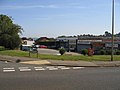
 The "Shires" crossroads in 1999 to the left, prior to redevelopment in 2003, and the same place in 2009 to the right.
 -
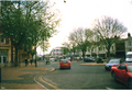 Bridge Street in 2001.
 -
 Neithrop Library.
 -
 Banbury Market
 -
 The station car park. The Whiz Kids' Nursery and activity centre is in the background.
 -
 Banbury station. An EWS freight rain and a Wrexham, Marylebone train are here too.
 -
 Banbury station. A Chiltern Railways Train arrives at Banbury railway station.
 -
 Banbury station. A former Wrexham & Shropshire locomotive stabled at Banbury station.
 -
 The 60-year-old oil terminal next to Banbury station. (It was upgraded circa 1980).
 -
 Browning park in Easington estate in 2001.
 -
 Part of the Neithrop estate, built in the 1920s or 1930s.
 -
 Local Shops. The small 1960s shopping precinct at the junction of Mewburn Road and the Queensway, Banbury.
 -
 Banbury Station View SE, towards Oxford and London. This is the main (General) station, on the former GWR Paddington to Birmingham line, so decrepit and a bottleneck it was rebuilt very soon after Nationalisation. Date 24 March 1961(1961-03-24).
 -
Banbury Market.
-
 Castle Quay's 1969 car park. The one from 1978 is not shown.
 -
 The booking hall and main entrance Banbury railway station, managed by Chiltern Railways.
 -
 St Mary's Church, Banbury. It was built in the 1790s to replace the Medieval one damaged during the English Civil War.
 -
 Banbury's former Crest Hotels building has been derelict for a long time.
 -
 Banbury war memorial in People's park on 29 November 2010.


.png)
.png)

.png)
.png)
.png)
.png)


.png)


.png)


References
- ^ Lest We Forget - WW2 - Middleton Cheney Village Website. Middletoncheney.org. Retrieved on 2010-11-11.
- ^ Lambert, Tim (14 March 2021). "A History of Banbury". localhistories.org.
- ^ "Oxford - Places - Banbury". BBC. 22 April 2008. Retrieved 19 July 2011.
- ^ a b c d e f g "The history of Banbury, Oxfordshire". Information-britain.co.uk. Retrieved 19 July 2011.
- ^ a b "About Banbury". The Rotary Club of Banbury. Archived from the original on 23 October 2008.
- ^ a b c "A history of Banbury and the Banbury Cross explained". Banbury-cross.co.uk. Retrieved 19 July 2011.
- ^ Crossley et al. 1972, pp. 5–18.
- ^ "Oxfordshire Parish Package Neithrop" (PDF). Retrieved 19 July 2011.
- ^ a b c d e Crossley et al. 1972, pp. 1–4.
- ^ a b c d e f g Lobel & Crossley 1969, pp. 103–112.
- ^ "A History of Banbury". localhistories.org. 14 March 2021.
- ^ Crossley et al. 1972, pp. 42–49.
- ^ a b c d e f g h i j k l m n o p q r s t u v w x y "Banbury: Economic history". british-history.ac.uk.
- ^ "Reindeer Inn". Hooky-pubs. Hook Norton Brewery. Archived from the original on 4 February 2012. Retrieved 19 July 2011.
- ^ a b c d Lobel & Crossley 1969, pp. 112–123.
- ^ a b c "Banbury Canalside Vision" (PDF). Civic Voice.
- ^ a b "History of the Horton General Hospital - Oxford University Hospitals". www.ouh.nhs.uk.
- ^ "Official review tells Hunt to knock back hospital downgrade".
- ^ a b Beeson 1989, p. 16.
- ^ Sherwood & Pevsner 1974, p. 437.
- ^ Compton 1976, p. 25.
- ^ Compton 1976, p. 37.
- ^ Compton 1976, p. 39.
- ^ a b "Tooley's Boatyard". Tooley's Boatyard. Archived from the original on 29 November 2011. Retrieved 19 July 2011.
- ^ a b c d e f g h i j k l m n o p q r s t u v w x Crossley et al. 1972, pp. 71–89.
- ^ Pearson, Edwin (1890). Banbury Chap Books and Nursery Toy Book Literature. A. Reader. pp. 23–27.
- ^ Rusher's Reading Made Most Easy. 1837.
- ^ Johnston, Cynthia. "J. H. Spencer's Chapbook Collection". Blackburn Museum and Art Gallery. Retrieved 25 August 2021.
- ^ John Cheney and His Descendants: Printers in Banbury Since 1767. Banbury. 1936. pp. 26–31.
{{cite book}}: CS1 maint: location missing publisher (link) - ISBN 978-0-7509-8496-6.
- ^ The Victoria History of the County of Oxford, Volume 10. 1972. p. 66.
- ^ "The Workhouse". workhouses.org.uk.
- ^ Historic England, Banbury - St John the Evangelist, Taking Stock, retrieved 9 June 2022
- ^ a b c d e f g h i j Crossley et al. 1972, pp. 18–28.
- ^ "Nethercote: History | British History Online". www.british-history.ac.uk. Retrieved 20 November 2021.
- ^ The Sanitary Record. 1875. p. 6.
- ^ a b c d e "Microsoft Word - 1 Front Cover.doc" (PDF). Cherwell District Council. Archived from the original (PDF) on 22 July 2011. Retrieved 19 July 2011.
- ^ The peoples Part II municipaldreams.worrdpress.com 9 July 2019 [dead link]
- ^ Municipal Dreams [dead link]
- ^ a b c d e f g h "Banbury shell filling factory played vital role during First World War". Banbury Guardian. 23 April 2012. Retrieved 13 July 2015.
- ^ "Slough Trading Estate". Everything2.com. Retrieved 13 July 2015.
- ^ p 109, The History of Slough, Maxwell Fraser, Slough Corporation, 1973
- ^ "Foreign News: Wal's Work". TIME.com. 20 February 1939. Archived from the original on 14 December 2008.
- ISBN 9781870092029.
- ^ a b "World War II grenades uncovered at Banbury building site". BBC News. 20 April 2012.
- ^ a b c d Bradley, Sam. "Banbury War Memorial - WWII Banbury". sjbradley.com.
- ^ "Pool is back by popular demand - Community". Banbury Guardian. Johnston Press. 26 May 2011. Retrieved 19 July 2011.
- ^ "Blood". Strum.co.uk. Retrieved 19 July 2011.
- ^ Marsh, Dr Peter; Fox, Kate (1992). "Drinking and Public Disorder". Social Issues Research Centre.
- ^ "Thames Valley Police – Ruscote / Hardwick / Neithrop". Thames Valley Police. Archived from the original on 1 February 2016. Retrieved 19 July 2011.
- ^ "Copycat riot fizzles out as police arrive (From Banbury Cake)". Banburycake.co.uk. 17 August 2011. Retrieved 13 July 2015.
- ^ a b c "Banbury Young Peoples Centre". Spired.com. Archived from the original on 24 November 2007. Retrieved 11 November 2010.
- ^ a b c "Banbury Young Peoples Centre". Spired.com. Archived from the original on 23 May 2010. Retrieved 11 November 2010.
- ^ a b c "Cherwell District Council - Interactive Local Plan". Cherwell District Council. Archived from the original on 13 August 2011. Retrieved 19 July 2011.
- ^ a b c "Waterways World: Latest". www.waterwaysworld.com. 7 November 2007. Retrieved 19 July 2011.
- ^ a b c "Our brands". www.countrywide.co.uk. Archived from the original on 27 January 2011.
- ^ a b c "DeHavilland". DeHavilland. 6 October 2010. Retrieved 19 July 2011.
- ^ a b "Cherwell District Council - Site Allocations Development Plan Documents (DPD) - Banbury and North Cherwell Site Allocations Development Plan Document". Cherwell District Council. 31 March 2004. Archived from the original on 13 August 2011. Retrieved 28 May 2011.
- ^ "College Fields planning application". Cherwell District Council. Archived from the original on 5 February 2008.
- ^ "GE B Exhibition Boards" (PDF). Cherwell District Council. Archived from the original (PDF) on 22 July 2011.
- ^ a b "Oxfordshire Ironstone Quarries Headquarters site:: OS grid SP4042 :: Geograph Britain and Ireland - photograph every grid square!". Geograph.org.uk. Retrieved 19 July 2011.
- ^ "Powered by Google Docs". Retrieved 19 July 2011.
- ^ "Former Alcan site sold - News". Banbury Guardian. Johnston Press. 8 July 2010. Retrieved 19 July 2011.
- ^ "End of the line for Banbury's Alcan factory". Oxford Mail. Newsquest. 6 August 2009. Retrieved 19 July 2011.
- ^ "Banbury Cross Website: General Information About Banbury". Banbury-cross.co.uk. Retrieved 19 July 2011.
- ^ "Home Page". Castle Quay Shopping Centre. 14 July 2011. Retrieved 19 July 2011.
- ^ a b "Kraft Foods Europe Home". Kraftfoods.co.uk. Retrieved 19 July 2011.
- ^ "Kraft: coffee production 'relatively unaffected' by Banbury factory fire". Foodmanufacture.co.uk. 9 December 2010. Retrieved 19 July 2011.
- ^ "Fire at Kraft factory". Oxford Mail. Newsquest. 7 December 2010. Retrieved 19 July 2011.
- ^ "Overthorpe Industrial Estate jobs – Find Overthorpe Industrial Estate jobs on". Goyocal.com. Archived from the original on 11 July 2011. Retrieved 19 July 2011.
- ^ http://www.ft.com/cms/s/0/77c7853e-376b-11e0-b91a-00144feabdc0.html?ftcamp=rss FT.com / Middle East / Politics & Society - Egyptian military dissolves parliament
- ^ "Bagel Bite in BANBURY - Sandwich And Snack Delivery Services - The Independent". independent.co.uk.
- ^ "Bagel Bite, Sandwich And Snack Delivery Services in BANBURY". scoot.co.uk.
- ^ "Whitcher Menswear 61 Parsons Street, Banbury, Oxfordshire, OX16 5NB - Banbury Guardian". Banburyguardian.co.uk. Retrieved 13 July 2015.
- ^ "Arthur Whitcher". LocalStore.co.uk. Retrieved 13 July 2015.
- ^ "Iconic store to close after 60 years of loyal service". Banburyguardian.co.uk. Retrieved 13 July 2015.
- ^ "Central M40 development approved". Banburyguardian.co.uk. Retrieved 13 July 2015.
- ^ "High profile industrial and distribution space in Banbury". Centralm40.co.uk. Retrieved 13 July 2015.
- ^ "The Cherwell-M40 Investment Partnership - Prodrive race to new headquarters at central M40 Banbury". Cherwell-m40.co.uk. Archived from the original on 13 July 2015. Retrieved 13 July 2015.
- ^ "Industrial Development to rent". Rightmove.co.uk. Retrieved 13 July 2015.
- ^ "The Cherwell-M40 Investment Partnership - Central M40 Site - Banbury". Cherwell-m40.co.uk. Retrieved 13 July 2015.
- ^ "Prodrive rally into Central M40 Banbury » Barwood". Barwood.co.uk. Archived from the original on 13 July 2015. Retrieved 13 July 2015.
- ^ "M40 - Central - ITV News". ITV News.
- ^ Ruddock, Kim. "Central M40". Corstorphine-wright.com. Retrieved 13 July 2015.
- ^ "Banbury shell filling factory played vital role during First World War". Banburyguardian.co.uk. Retrieved 13 July 2015.
- ^ "BanburyTown Council". Banbury.gov.uk. Archived from the original on 14 July 2011. Retrieved 19 July 2011.
- ^ "BanburyTown Council". Banbury.gov.uk. 1 April 2000. Archived from the original on 14 July 2011. Retrieved 19 July 2011.
- ^ "School website". Blessedgeorgenapier.co.uk. Retrieved 19 July 2011.
- ^ "EX141003". Oxfordshire County Council. Retrieved 19 July 2011.[permanent dead link]
- ^ "North Oxfordshire Academy". North Oxfordshire Academy. 13 May 2011. Retrieved 19 July 2011.
- ^ "United Learning Trust's website for the proposal of North Oxfordshire Academy". United Learning Trust. Archived from the original on 10 August 2011. Retrieved 19 July 2011.
- ^ "United Learning Trust Official Website". United Learning Trust. Retrieved 19 July 2011.
- ^ "March 2009 Ofsted/HMI Report" (PDF). Archived from the original (PDF) on 29 May 2009. Retrieved 19 July 2011.
- ^ "New webpage under construction". warrinerschoolfarm.org.uk. Archived from the original on 16 September 2017. Retrieved 14 January 2020.
- ^ "Poo power cuts Thames electricity bill by £15m - News releases". Thames Water. 7 December 2009. Retrieved 19 July 2011.
- ^ "Horton General Hospital". Oxfordradcliffe.nhs.uk. Retrieved 19 July 2011.
- ^ a b c "Depots - Banbury depot". MidlandRed.net. Archived from the original on 21 August 2011. Retrieved 19 July 2011.
- ^ "Banburyshire C.T.A. Ltd". Banburyshire-cta.co.uk. Archived from the original on 22 July 2011. Retrieved 19 July 2011.
- ^ "Hennef Way bridge in Banbury:: OS grid SP4641 :: Geograph Britain and Ireland - photograph every grid square!". Geograph.org.uk. Retrieved 19 July 2011.
- ^ "Archive news from the thisisoxfordshire". www.thisisoxfordshire.co.uk. Archived from the original on 31 August 2009.
- ^ McCarthy, David. "Community & news website for Banbury & Banburyshire". Banburyshireinfo.co.uk. Retrieved 19 July 2011.
- ^ a b "Banburyshire.com".
- ^ "Banburyshire". Mispedia.org. Archived from the original on 26 July 2011. Retrieved 19 July 2011.
- ^ "Banburyshire - Photos and All Basic Informations". Networkbase.info. Archived from the original on 21 July 2011. Retrieved 19 July 2011.
- ^ WEB-right, David McCarthy -. "About Banbury North Oxfordshire, historic home of Banbury Cross". Banburyshireinfo.co.uk. Archived from the original on 13 February 2011. Retrieved 19 July 2011.
- ^ "Banburyshire". Banter.cv31.co.uk. Archived from the original on 12 August 2011. Retrieved 19 July 2011.
- ^ "Planning a trip to Banburyshire, Banbury, County of Oxfordshire, United Kingdom". TripSage. 14 May 2009. Archived from the original on 17 July 2011. Retrieved 19 July 2011.
- ^ Sherwood & Pevsner 1974, p. 632.
- ^ Deegan & Foard, 2008, pages 118-119[clarification needed]
- ^ "homepage". Council for British Archaeology: South Midlands Region: Bedfordshire, Buckinghamshire, Northamptonshire & Oxfordshire. Archived from the original on 11 September 2011. Retrieved 19 July 2011.
- ^ Pevsner & Cherry 1973, p. 279.
- ^ a b "Anglo-Saxons.net". Anglo-Saxons.net. Retrieved 19 July 2011.
- ^ "St Peter's Parish Church history". Stpeters-hooknorton.org.uk. Archived from the original on 24 July 2011. Retrieved 19 July 2011.
- ^ "Cherwell Edge Golf Club in Oxfordshire". UK Golf Guide. 18 May 2011. Retrieved 19 July 2011.
- ^ "Welcome To Cherwell Edge Golf Club". Cherwelledgegolfclub.co.uk. Retrieved 19 July 2011.
Sources
- Beeson, C. F. C. (1989) [1962]. Simcock, A. V. (ed.). Clockmaking in Oxfordshire 1400–1850 (3rd ed.). Oxford: ISBN 0-903364-06-9.
- Compton, Hugh J. (1976). The Oxford Canal. Newton Abbot: ISBN 0-7153-7238-6.
- Crossley, Alan (ed.); Colvin, Christina; Cooper, Janet; Cooper, N. H.; Harvey, P. D. A.; Hollings, Marjory; Hook, Judith; Jessup, Mary; )
- ISBN 978-0-19722-726-8.
- ISBN 0-14-071022-1.
- Sherwood, Jennifer; ISBN 0-14-071045-0.
External links
- . Encyclopædia Britannica. Vol. 13 (11th ed.). 1911.
- North Oxfordshire Academy
- The Former Drayton School
- United Learning Trust's website for the proposal of North Oxfordshire Academy
- Maps that show the proximity of Banbury to the other counties mentioned
- A Banburyshire genealogical resource
- Banburyshire Community Transport Association
- A 1930s OS map
- Historical maps of Banbury and Banburyshire from 1833
