
Horsh Beirut
| Horsh Beirut | |
|---|---|
 | |
 | |
| Location | Beirut |
| Coordinates | 33°52′16″N 35°30′36″E / 33.87111°N 35.51000°E |

Horsh Beirut (
History

In the 13th century,
The park, Horsh, has suffered throughout history from frequent abuse of its timber especially by the armies of the
Horsh was bombed to burn by Israeli jet fighters during the
Today, Horsh Beirut is a 0.3-square-kilometre (0.12 sq mi)[6] triangular park at the southern border of the city limited by Omar Beyhum Street, 22 November Avenue, Abdelnasser Avenue and National Museum of Beirut (Musée national de Beyrouth).
It lies along the axis of the old airport road amidst areas of Mazraa, Tarik el-Jdideh, Qasqas, Sabra, Ghobeyri, Shiyah, Furn el-Shebak, and Badaro while it is separated from Ras el-Nabaa by the Beirut Hippodrome.
The park, or Horsh Beirut, has been reconstructed after the end of the Lebanese Civil War and it has been closed for the general public for about 25 years.[7] Lebanese citizens had to apply for a permission and only have chances to get one if they are older than 35 years.[7] At the same time there have been reports of Western foreigners getting permission while applications by Lebanese were rejected.[7][8] Beirut residents have repeatedly protested against the denial of access to the park including the unequal access policies for Western and non-Western park visitors.[7][9] However, it ended up being reopened to the public by the governor of Beirut, Ziad Chebib, on September 3, 2015, in what was considered a victory for civil society after constantly demanding its reopening to all Lebanese citizens.
Image gallery
-
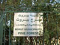 Information sign at the park gate from Badaro area
 -
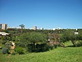
 Center of the park
 -
 Center of the park
 -
 Center of the park
 -
 Center of the park
 -
 Center of the park
 -
 New sorting bin in the center of the park


References
- ^ Doyle, Paul. Lebanon, Bradt Travel Guides, 2012, page 153.
- ISBN 9789027971586– via Google Books.
- ^ Al-Wali, T. (1993). Beirut fi'Tarikh wal'Hadara wal'Omran (Beirut: History, Culture, and Urbanism). Beirut: Dar al-Elem lil'Malayeen. pp. 106-107.
- ^ "Public spaces in the Middle East". The Economist. 11 June 2016. Retrieved 11 June 2016.
- ^ Al-Wali, T. (1993). Beirut fi'Tarikh wal'Hadara wal'Omran (Beirut: History, Culture, and Urbanism). Beirut: Dar al-Elem lil'Malayeen.
- ^ "Beirut Municipality Sells Beirut's Collective Memory and the Last of its Green Spaces | al Akhbar English". Archived from the original on 2017-09-19. Retrieved 2015-07-14.
- ^ a b c d "Closed to the Public for Decades, Beirut's Only Park May Re-Open This Year". nextcity.org.
- ^ Archived at Ghostarchive and the Wayback Machine: Horsh Beirut the forbidden green. YouTube.
- ^ "تظاهرة لفتح حرش بيروت / Demonstration to open Horsh Beirut". www.facebook.com.
- Al-Wali, T. (1993). Beirut fi'Tarikh wal'Hadara wal'Omran (Beirut: History, Culture, and Urbanism). Beirut: Dar al-Elem lil'Malayeen.