Ibstone
| Ibstone | |
|---|---|
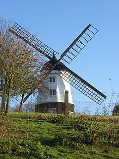
 Cobstone Windmill, Ibstone | |
Location within Buckinghamshire | |
| Population | 242 (2011 Census)[1] |
| OS grid reference | SU755935 |
| Civil parish |
|
| Unitary authority | |
| Ceremonial county | |
| Region | |
| Country | England |
| Sovereign state | United Kingdom |
| Post town | HIGH WYCOMBE |
| Postcode district | HP14 |
| Dialling code | 01491 |
| Police | Thames Valley |
| Fire | Buckinghamshire |
| Ambulance | South Central |
| UK Parliament | |
| Website | Ibstone Parish Council |
Ibstone (previously Ipstone) is a village and civil parish in Buckinghamshire, England. The village is in the Chiltern Hills on the border with Oxfordshire, about 2 miles (3.2 km) south of Stokenchurch. The population of the parish at the 2011 Census was 242,[1] an increase from 237 at the 2001 Census.[2]
The village name is Anglo-Saxon in origin and means 'Hibba's boundary stone', referring to the boundary with Oxfordshire. At the time of King Edward the Confessor the village was in the possession of Tovi, thane of the king, and was called Hibestanes.

The
The village includes
The politician Barbara Castle also lived in the village.
The common is an area of open access land and the standing stone (OS GR SU7507 9371) was erected for the Millennium -year 2000.
See also
References
- ^ a b "Civil Parish population 2011". Neighbourhood Statistics. Office for National Statistics. Retrieved 23 November 2016.
- ^ "Civil Parish population 2001". Neighbourhood Statistics. Office for National Statistics. Archived from the original on 23 November 2016. Retrieved 19 July 2008.
- ^ "Maria Tiddeman 1837–1915". Hymntime. Retrieved 7 October 2012.


