Illinois Technology and Research Corridor

The Illinois Technology and Research Corridor is a region of commerce and industry located along
Interstate 88 in the Chicago metropolitan area, primarily in Cook, DuPage, Kane, and DeKalb Counties. The corridor is home to the headquarters or regional centers for many Fortune 1000 companies (including many specializing in research, development, logistics, and technology), several office and industrial parks, colleges and universities, research and scientific institutions, medical centers, government centers, and abundant shopping, dining, lodging, and entertainment amenities. In addition to the I-90 Golden Corridor, the I-94 Lakeshore Corridor
, and the I-55 Industrial Corridor, the Illinois Technology and Research Corridor is one of the principal economic centers in suburban Chicago.
History
The first companies that formed the Illinois Technology and Research Corridor began locating in
Nicor) moved its research and administrative facilities to Naperville in 1962, followed by Bell Laboratories (1964), and the Amoco Research Center (now BP) in 1969.[1]
In Batavia, Fermilab was established as the National Accelerator Laboratory in 1967, with its particle accelerator becoming operational in 1972.[2]
The Corridor Group was formed in 1982, with representation by over 80 high technology companies, national labs, associated industries, and colleges and universities.[3]
Cities and villages
Cities and villages located partially or wholly within the scope of the Illinois Technology and Research Corridor include:
|
Companies

Major companies with a strong presence in the Illinois Technology and Research Corridor include:
- Ace Hardware, a hardware store chain headquartered in Oak Brook
- Acxiom,[4] in Downers Grove, is a customer and data information management company
- Aldi, a grocery store chain with US headquarters in Batavia
- APL Logistics, a freight transportation company with offices in Oak Brook
- Blistex, Incorporated, a personal care products company headquartered in Oak Brook
- BP, an international energy company with its North American chemicals headquarters and research facilities in Naperville
- Calamos, an asset management firm headquartered in Naperville
- Caterpillar, a construction equipment manufacturer with a plant in Montgomery
- ConAgra Foods, a packaged foods company with offices in Naperville
- Coskata, Inc., an energy research company headquartered in Warrenville
- Oakbrook Terrace
- Dover Corporation, a manufacturer of specialized industrial products and equipment headquartered in Downers Grove
- Eby-Brown, a wholesale distributor headquartered in Naperville
- Exelon, a Fortune 100 energy company, has its Exelon Nuclear headquarters in Warrenville and offices for ComEd in Oakbrook Terrace[5]
- Farm Progress, an agricultural publication publisher headquartered in St. Charles
- FGI Universal LLC, the largest frozen produce importer in the USA in Naperville
- First Alert, a safety products company headquartered in Aurora
- Follett Corporation, Bookseller, E-Commerce and software company in Westchester
- Hyundai, a motor vehicle company with regional offices in Aurora
- Joint Commission, health institution or program accreditation agency headquartered in Oakbrook Terrace
- MetLife, an insurance company with offices in Aurora
- Microsoft a computer technology company with offices in Downers Grove
- Mitutoyo, a company specializing in measuring instruments and metrological technology with U.S. headquarters in Aurora
- Molex, an electronic components manufacturer headquartered in Lisle
- Nalco, a water treatment and chemical company headquartered in Naperville
- Navistar, an automotive manufacturer headquartered in Lisle
- Nicor, a gas utility company headquartered in Naperville
- Nissan Motors, an automotive manufacturer with offices in Aurora and Naperville
- Nokia, an international telecommunications company, with offices in Naperville and Lisle.
- Oberweis Dairy, a dairy products company headquartered in North Aurora
- Portillo's Restaurants, a restaurant chain headquartered in Oakbrook Terrace
- Redbox, a media rental company headquartered in Oakbrook Terrace
- Sanford L.P., a writing products manufacturer headquartered in Oak Brook
- Downers Grove.
- Sara Lee, a food company headquartered in Downers Grove
- Smithfield Foods, a meat products manufacturer with subsidiary Armour-Eckrich Meats headquartered in Lisle and a processing facility in St. Charles
- Sunshine Biscuits, a cracker, cookie, and cereal manufacturer headquartered in Elmhurst
- Tellabs, a telecommunications company headquartered in Naperville
- Toyota Motor Sales, U.S.A., Inc., an automobile manufacturer with regional offices in Aurora and Naperville
- VVF, a personal care products manufacturer with a plant in Montgomery
- Westell, a modems manufacturer headquartered in Aurora
Higher education institutions

- Aurora University is a private liberal arts college located in Aurora
- Benedictine University a private university located in Lisle
- The College of DuPage is a community college that primarily serves DuPage County, located in Glen Ellyn
- DeVry University, headquartered in Oakbrook Terrace, offers numerous technical degrees at its eight Chicago area campuses.
- Elmhurst College is a private liberal arts college in Elmhurst
- Information Technologyand Management.
- Kishwaukee College is a community college that primarily serves DeKalb County, in Malta
- Midwestern University, a private graduate and professional school of health sciences in Downers Grove
- North Central College is a private liberal arts college located in Naperville
- Northern Illinois University, is a public university and research institution located in DeKalb. It is the second largest institution of higher education in the state of Illinois in terms of enrollment. A satellite campus is located in Naperville.
- Waubonsee Community College is a community college that primarily serves central & southern Kane County and northern Kendall County, in Sugar Grove
- Wheaton College is a private liberal arts college in Wheaton
Research institutions

- Argonne National Laboratory, on 1,700 acres (7 km2) in Lemont, is the oldest national research institution in the United States, chartered in 1946. The only multipurpose national laboratory in the Midwest, Argonne manages and operates a range of scientific user facilities, including the Advanced Photon Source, the Center for Nanoscale Materials and the Argonne Leadership Computing Facility. Argonne's annual budget is $650 million and employs 3,500 people. It is owned by the Department of Energy and operated by UChicago Argonne LLC.
- U.S. Atomic Energy Commission. It is home to the world's former highest energy particle accelerator, Tevatron. The accelerator was built in 1983 at a cost of $120 million, and was upgraded in 1994 at a cost of $290 million. It employs 2,100 people.
Medical centers

- Adventist GlenOaks Hospital, in Glendale Heights
- Adventist Hinsdale Hospital, in Hinsdale
- Advocate Good Samaritan Hospital, in Downers Grove
- Central DuPage Hospital, in Winfield
- Delnor Community Hospital, in Geneva
- Edward Hospital, in Naperville
- Elmhurst Memorial Hospital, in Elmhurst
- Kishwaukee Community Hospital, in DeKalb
- Provena Mercy Medical Center, in Aurora
- Rush-Copley Medical Center, in Aurora

Government centers
- DeKalb County Government Center and Courthouse, located in Sycamore
- DuPage County Government Center, Judicial Center, and Fairgrounds, located in Wheaton
- Kane County Government Center and Courthouse, located in Geneva
- Kane County Judicial Center and Fairgrounds, located in St. Charles
Shopping centers

- Cantera, an open-air shopping, dining, and entertainment complex located in Warrenville
- Chicago Premium Outlets, an outlet mall located in Aurora
- Geneva Commons, an upscale, open-air lifestyle center located in Geneva
- Oakbrook Center, a regional upscale, open-air shopping mall located in Oak Brook. It is the largest open-air shopping center in the contiguous United States.
- Town Square Wheaton, an upscale open-air shopping center located in Wheaton
- Westfield Fox Valley, a regional enclosed shopping mall located in Aurora
- Yorktown Center, a regional enclosed shopping mall located in Lombard
Points of interest


- The Air Classics Museum, an aviation museum at Aurora Municipal Airport in Sugar Grove
- The Arcada Theater, a historic theater in downtown St. Charles
- Blackberry Farm, a historical farmstead in Aurora
- Cantigny, a large park with historical museums and gardens, in Wheaton
- The Convocation Center, a 10,000-seat arena on the campus of Northern Illinois University in DeKalb
- Drury Lane Theatre, a theater and dining center in Oakbrook Terrace
- The DuPage Children's Museum, a museum and interactive learning center in downtown Naperville
- The Egyptian Theatre, a historic theater in downtown DeKalb
- Elfstrom Stadium, a minor league ballpark, home to the Kane County Cougars, located in Geneva
- The Ellwood House, a historical museum in DeKalb
- The Glidden House, a historical museum in DeKalb
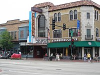
- The Grand Theatre, a historical theater in downtown Wheaton
- The Gurler House, a historical museum in DeKalb
- Hollywood Casino, a casino in downtown Aurora
- Huskie Stadium, a 30,000-seat football stadium located on the campus of Northern Illinois University in DeKalb
- Morton Arboretum, a botanical garden located in Lisle
- The Naperville Riverwalk, a riverwalk and park located in downtown Naperville along the DuPage River. The area is also home to the Centennial Beach recreational area and the iconic Moser Tower
- Oakbrook Terrace Tower, a 31-story office building located in Oakbrook Terrace. It is the tallest building in suburban Chicago.
- The Paramount Theatre, a historic theater located in downtown Aurora
- Pheasant Run and the Q Center, convention centers located in St. Charles
- Phillips Park Zoo, a zoological park featuring native species located in Aurora
- The Tivoli Theatre, a historic theater in downtown Downers Grove
- Two Brothers Roundhouse, a historic roundhouse, museum, and dining center located in downtown Aurora
See also
References
- ^ "Collection124ResearchAndDevelopmentCorridor". www.napersettlement.org. Retrieved 2019-12-28.
- ^ "Fermilab". www.encyclopedia.chicagohistory.org. Retrieved 2019-12-29.
- ^ "Collection124ResearchAndDevelopmentCorridor". www.napersettlement.org. Retrieved 2019-12-28.
- ^ "Our Agencies | IPG". IPG. Interpublic Group. Retrieved 8 December 2018.[permanent dead link]
- ^ "Exelon Nuclear extends lease for HQ at Cantera". Crain's Chicago Business. Retrieved 2018-04-14.


