
Intertidal zone
This article needs additional citations for verification. (May 2023) |
| Marine habitats |
|---|
 |
| Coastal habitats |
| Ocean surface |
|
| Open ocean |
| Sea floor |
The intertidal zone or foreshore is the area above
The well-known area also includes steep rocky
Water is available regularly with the tides that can vary from
A typical
.Zonation


Depending on the substratum and topography of the shore, additional features may be noticed. On rocky shores, tide pools form in depressions that fill with water as the tide rises. Under certain conditions, such as those at Morecambe Bay, quicksand may form.[3]
Low tide zone (lower littoral)
This subregion is mostly submerged – it is only exposed at the point of low tide and for a longer period of time during extremely low tides. This area is teeming with life;
Ecology

The intertidal region is an important model system for the study of ecology, especially on wave-swept rocky shores. The region contains a high diversity of species, and the zonation created by the tides causes species ranges to be compressed into very narrow bands. This makes it relatively simple to study species across their entire cross-shore range, something that can be extremely difficult in, for instance, terrestrial habitats that can stretch thousands of kilometres. Communities on wave-swept shores also have high turnover due to disturbance, so it is possible to watch Ecological succession over years rather than decades.
The burrowing invertebrates that make up large portions of sandy beach ecosystems are known to travel relatively great distances in cross-shore directions as beaches change on the order of days, semilunar cycles, seasons, or years. The distribution of some species has been found to correlate strongly with geomorphic datums such as the high tide strand and the water table outcrop.
Since the foreshore is alternately covered by the sea and exposed to the air, organisms living in this environment must be adapted to both wet and dry conditions. Intertidal zone biomass reduces the risk of shoreline
Humans have historically used intertidal zones as foraged food sources during low tide . Migratory birds also rely on intertidal species for feeding areas because of low water habitats consisting of an abundance of mollusks and other marine species.[4]
Legal issues
As with the dry sand part of a beach, legal and political disputes can arise over the ownership and use of the foreshore. One recent example is the New Zealand foreshore and seabed controversy. In legal discussions, the foreshore is often referred to as the wet-sand area.
For privately owned beaches in the United States, some states such as Massachusetts use the low-water mark as the dividing line between the property of the State and that of the beach owner; however the public still has fishing, fowling, and navigation rights to the zone between low and high water. Other states such as California use the high-water mark.
In the
.In Greece, according to the L. 2971/01, the foreshore zone is defined as the area of the coast that might be reached by the maximum climbing of the waves on the coast (maximum wave run-up on the coast) in their maximum capacity (maximum referring to the "usually maximum winter waves" and of course not to exceptional cases, such as tsunamis). The foreshore zone, a part of the exceptions of the law, is public, and permanent constructions are not allowed on it.
In the East African and West Indian Ocean, intertidal zone management is often neglected of being a priority due to there being no intent for collective economic productivity.[6] According to workshops performing questionaries, it is stated that eighty-six percent of respondents believe mismanagement of mangrove and coastal ecosystems are due to lack of knowledge to steward the ecosystems, yet forty-four percent of respondents state that there is a fair amount of knowledge used in those regions for fisheries.[citation needed]
Threats
.jpg)
Intertidal zones are sensitive habitats with an abundance of marine species, that can experience ecological hazards associated with tourism and human-induced environmental impacts. A variety of other threats that have been summarized by scientists include nutritional pollution, over harvesting, habitat destruction, and climate change.[7] Habitat destruction is advanced through activities including harvesting fisheries with drag nets and neglect of the sensitivity of them.[8]
Gallery
-
 Mussels in the intertidal zone in Cornwall, England
 -
 limpetsin the intertidal zone near Newquay, Cornwall, England.
 -
 Atidal poolin the intertidal zone during low tide, Sunrise-on-Sea, South Africa
 -
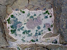
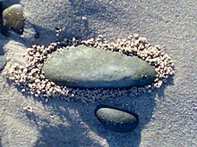 Unexplained crumbs of sand that appear to have been deposited around stone by escaping air
 -
 Rocks in intertidal zone completely covered by mussels, at Bangchuidao Scenic Area,Liaoning Province, China


See also
- Ballantine Scale
- Ecological forecasting
- Littoral series
- NaGISA
- Shorezone
- Tidelands
References
- ^ US Department of Commerce, National Oceanic and Atmospheric Administration. "What is the intertidal zone?". oceanservice.noaa.gov. Retrieved 2022-11-29.
- ^ a b "What is the Intertidal Zone?". WorldAtlas. 10 January 2018. Retrieved 2019-09-17.
- ^ "Why is Morecambe Bay so dangerous?". The Guardian. 2004-02-12.
- ^ a b "Intertidal Zone". National Geographic Society. 2019-10-10. Retrieved 2022-04-06.
- ^ "Intertidal Ecology" (PDF). USF College of Marine Science. 2002. Retrieved 31 May 2023.
- PMID 24375399.
- ^ "Climate Change Impacts on Intertidal Zone Populations". NCCOS Coastal Science Website. Retrieved 2022-04-03.
- PMID 24375399.

