Jabal al-Druze
This article includes a list of general references, but it lacks sufficient corresponding inline citations. (May 2016) |

| Part of a series on
Druze |
|---|
 |
Jabal al-Druze (
Geology

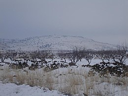
The Jabal al-Druze volcanic field, the southernmost in Syria, lies in the Haurun-Druze Plateau in SW Syria near the border with Jordan. The most prominent feature of this volcanic field is 1800m-high Jabal al-Druze (also known variously as Jabal ad Duruz, Djebel Al-Arab, Jabal Druze, Djebel ed Drouz). The alkaline volcanic field consists of a group of 118 basaltic volcanoes active from the lower-Pleistocene to the Holocene (2.6 million years ago to present). The large SW Plateau depression is filled by basaltic lava flows from volcanoes aligned in a NW-SE direction. This volcanic field lies within the northern part of the massive alkaline Harrat al-Sham (also known as Harrat al-Shaam) volcanic field that extends from southern Syria to Saudi Arabia.
Peaks
- Tell Qeni (1,803 m)
- Tell Joualine (1,732 m)
- Tell Sleiman (1,703 m)
- Tell Qleib (1,698 m)
- Tell Abou-Hamra (1,482 m)
- Tell El-Ahmar (1,452 m)
- Tell Abed-Mar (1,436 m)
- Tell Khodr-Imtan (1,341 m)
- Tell Azran (1,220 m)
- Tell Shihan (1,138 m)
In
See also
References
- ^ The Druze and Assad: Strategic Bedfellows
- ^ "Christians in Syria's Suwayda discuss history, coexistence with Druze majority". North Press. 18 September 2020.
