
Jacksonville, Alabama
Jacksonville | ||
|---|---|---|
FIPS code 01-38272 | | |
| GNIS feature ID | 0159857 | |
| Website | www | |
Jacksonville is a city in
History
Jacksonville was founded in 1833 on land purchased from
An EF3 tornado hit Jacksonville on
Geography
Nestled in the foothills of the Appalachians, Jacksonville is located at 33°48'56.758" North, 85°45'37.681" West (33.815766, -85.760467).[7]
According to the
Climate
| Climate data for Jacksonville, Alabama (2004-2022 Precipitation only) | |||||||||||||
|---|---|---|---|---|---|---|---|---|---|---|---|---|---|
| Month | Jan | Feb | Mar | Apr | May | Jun | Jul | Aug | Sep | Oct | Nov | Dec | Year |
| Average precipitation inches (mm) | 4.69 (119) |
5.33 (135) |
5.61 (142) |
4.77 (121) |
4.54 (115) |
4.63 (118) |
4.36 (111) |
4.12 (105) |
3.00 (76) |
3.07 (78) |
3.85 (98) |
5.35 (136) |
53.32 (1,354) |
| Source: NOAA(National Weather Service)[8] | |||||||||||||
Demographics
| Census | Pop. | Note | %± |
|---|---|---|---|
| 1850 | 716 | — | |
| 1860 | 703 | −1.8% | |
| 1870 | 958 | 36.3% | |
| 1880 | 882 | −7.9% | |
| 1890 | 1,237 | 40.2% | |
| 1900 | 1,176 | −4.9% | |
| 1910 | 2,231 | 89.7% | |
| 1920 | 2,395 | 7.4% | |
| 1930 | 2,840 | 18.6% | |
| 1940 | 2,995 | 5.5% | |
| 1950 | 4,751 | 58.6% | |
| 1960 | 5,678 | 19.5% | |
| 1970 | 7,715 | 35.9% | |
| 1980 | 9,735 | 26.2% | |
| 1990 | 10,283 | 5.6% | |
| 2000 | 8,404 | −18.3% | |
| 2010 | 12,548 | 49.3% | |
| 2020 | 14,385 | 14.6% | |
| U.S. Decennial Census[9] | |||
2020 census
| Race | Num. | Perc. |
|---|---|---|
White (non-Hispanic)
|
7,826 | 54.4% |
Black or African American (non-Hispanic)
|
5,085 | 35.35% |
Native American
|
24 | 0.17% |
Asian
|
334 | 2.32% |
Pacific Islander
|
17 | 0.12% |
Other/Mixed
|
646 | 4.49% |
Latino
|
453 | 3.15% |
As of the 2020 United States census, there were 14,385 people, 4,518 households, and 2,472 families residing in the city.
2010 census
As of the census
There were 4,917 households, out of which 22.1% had children under the age of 18 living with them, 33.5% were married couples living together, marriage 13.0% had a female householder with no husband present, and 49.8% were non-families. 33.2% of all households were made up of individuals, and 8.7% had someone living alone who was 65 years of age or older. The average household size was 2.24 and the average family size was 2.91.
In the city, the age distribution of the population shows 17.2% under the age of 18, 32.6% from 18 to 24, 20.3% from 25 to 44, 18.4% from 45 to 64, and 11.5% who were 65 years of age or older. The median age was 25.1 years. For every 100 females, there were 87.6 males. For every 100 females age 18 and over, there were 89.6 males.
The median income for a household in the city was $33,987, and the median income for a family was $50,863. Males had a median income of $35,615 versus $26,975 for females. The
Transportation
Two Alabama state routes pass through Jacksonville:
- State Route 21 (Pelham Road)
- State Route 204 (Nisbet Street)
Education
Jacksonville is the home of Jacksonville State University, a public, coeducational university with an enrollment of almost 10,000. It offers degrees in business, communication, education, family sciences, liberal arts and sciences, nursing and technology in addition to continuing education programs. The university's campus is located a few blocks north of the square.
Jacksonville is home to two public schools run by Jacksonville City Schools:
- Jacksonville High School (Grades 7-12).
- Kitty Stone Elementary School (Grades K-6).
There are also two public schools located northwest of the city proper that serve the unincorporated communities of Pleasant Valley and Williams and are run by Calhoun County Schools:
- Pleasant Valley High School
- Pleasant Valley Elementary School
There is also a Christian school called Jacksonville Christian Academy (JCA) located within the city.
The Calhoun County Center for the Arts offers classes through the Community Center.[11]
Media
Newspaper
- The Jacksonville News - Weekly, locally owned newspaper
- The Chanticleer - Student-run newspaper of Jacksonville State University
Magazine
- House to House Heart to Heart - Bi-monthly Christian magazine distributed through Churches of Christ; circulation over 2.5 million each issue
Television
- WJXS TV 24 - Local news, sports and programming
AM Radio
- WCHA Alabama 810 - Local news, sports and Classic Country music
FM Radio
Notable people
- Rick Bragg, Alabama writer who won the Pulitzer Prize for Feature Writing in 1996 while working for The New York Times
- Glen Browder, U.S. Representative from 1989 to 1997 and professor of political science at Jacksonville State University.
- John Henry Caldwell, U.S. Representative from 1873 to 1877.
- William Crutchfield, U.S. Representative from 1873 to 1875. Lived in Jacksonville from 1844 to 1850.
- Todd Cunningham, Major League Baseball center fielder
- Sallie Curb Arnold, artist featured in the Smithsonian American Art Museum.[13]
- major general in the Confederate States Army during the American Civil War
- William H. Forney, U.S. Representative from 1875 to 1893
- Riley Green, country music singer
- James A. Haley, U.S. Representative representing Florida from 1953 to 1977.
- Harvey Jackson III, notable Alabama historian
- Lilly Ledbetter, women's equality activist and plaintiff in the American employment discrimination case Ledbetter v. Goodyear Tire & Rubber Co.
- Shed Long, professional baseball player
- Darrell Malone, former National Football League cornerback
- Herman Clarence Nixon, political scientist, historian, and member of the Nashville-based Southern Agrarians
- John Pelham, celebrated Confederate officer
- Neel Reid, prominent early-twentieth century architect
References
- ^ "2020 U.S. Gazetteer Files". United States Census Bureau. Retrieved October 29, 2021.
- ^ a b "Explore Census Data". data.census.gov. Retrieved December 11, 2021.
- ^ a b Huddleston, John. "Jacksonville State holds first graduation following tornado". WTVM. Retrieved July 19, 2018.
- ^ Fritz, Angela. "Watch the horrible EF-3 tornado tear up Jacksonville State University in security cam video". The Washington Post. Retrieved July 19, 2018.
- ^ a b Porter, Joel. "Classes resume at Jacksonville State University after tornado". WHNT. Retrieved July 19, 2018.
- ^ McCreless, Patrick. "More than 1,000 volunteers pour into Jacksonville for tornado relief work (updated with video)". The Anniston Star. Retrieved July 19, 2018.
- ^ "US Gazetteer files: 2010, 2000, and 1990". United States Census Bureau. February 12, 2011. Retrieved April 23, 2011.
- ^ "Climate". weather.gov. National Oceanic and Atmosoheric Administration. Retrieved September 18, 2023.
- ^ "U.S. Decennial Census". Census.gov. Retrieved June 6, 2013.
- ^ "U.S. Census website". United States Census Bureau. Retrieved July 9, 2015.
- ^ Calhoun County Center for the Arts Archived May 26, 2013, at the Wayback Machine
- ^ "WLJS 91.9 Live Stream has moved - The Friendliest Campus in the South". www.jsu.edu. Retrieved May 9, 2023.
- ^ "Sallie Curb Arnold". Smithsonian American Art Museum.
- ^ "Hindman, Thomas Carmichael - Biographical Information". Biographical Directory of the United States Congress. Retrieved May 31, 2007.
External links
33°48′57″N 85°45′38″W / 33.815766°N 85.760467°W
Municipalities and communities of Calhoun County, Alabama, United States | ||
|---|---|---|
| Cities | 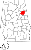 | |
| Towns | ||
| CDPs | ||
| Unincorporated communities | ||
| Ghost town | ||
| Footnotes | ‡This populated place also has portions in an adjacent county or counties | |
| ||
| International | |
|---|---|
| National | |
| Geographic | |
| Other | |