
Jakar
Jakar
Chakkar Byakar | ||
|---|---|---|
Dzongkhag Bumthang | | |
| Gewog | Chhoekhor | |
| Settled | ca. 1549 | |
| Elevation | 2,587 m (8,488 ft) | |
| Population (2017) | ||
| • Total | 6,243 | |
| Time zone | UTC+06:00 (BTT) | |
| Climate | Cwb | |
Jakar (
History
The town is the site of Chakhar Lhakhang, a small and unassuming temple which marks the site of the "Iron Palace" of Sindhu Raja, the Indian monarch who is believed to have first invited
According to the Jakar foundation myth, a roosting white bird signaled the proper and auspicious location to found a monastery around 1549. The settlement thus earned the moniker Jakar, meaning "white bird."[3]: 168
There are many significant Buddhist sacred sites nearby the town, such as Kurjey Lhakhang, which holds a body print of Guru Rinpoche; Jambey Lhakhang, one of the 108 monasteries that in mythology were miraculously constructed by King Songten Gampo in one night; and Tamsshing Lhakhag established by Tertön Padma Lingpa (1450–1521).[7] In addition, one of the country's largest monastic colleges, Lhodrak Kharchhu Monastery, overlooks Jakar.
Geography
Location
Jakar is located in
Climate
Jakar has a subtropical highland climate (Köppen: Cwb).
| Climate data for Bumthang (1996−2018) | |||||||||||||
|---|---|---|---|---|---|---|---|---|---|---|---|---|---|
| Month | Jan | Feb | Mar | Apr | May | Jun | Jul | Aug | Sep | Oct | Nov | Dec | Year |
| Mean daily maximum °C (°F) | 11.4 (52.5) |
13.0 (55.4) |
15.4 (59.7) |
17.5 (63.5) |
19.7 (67.5) |
22.0 (71.6) |
22.7 (72.9) |
22.7 (72.9) |
21.6 (70.9) |
18.8 (65.8) |
15.6 (60.1) |
12.9 (55.2) |
17.8 (64.0) |
| Mean daily minimum °C (°F) | −3.9 (25.0) |
−1.0 (30.2) |
2.2 (36.0) |
6.2 (43.2) |
9.5 (49.1) |
13.0 (55.4) |
14.4 (57.9) |
14.2 (57.6) |
12.5 (54.5) |
7.0 (44.6) |
1.2 (34.2) |
−2.9 (26.8) |
6.0 (42.9) |
| Average precipitation mm (inches) | 5.7 (0.22) |
10.2 (0.40) |
34.8 (1.37) |
64.9 (2.56) |
94.0 (3.70) |
95.9 (3.78) |
152.6 (6.01) |
138.3 (5.44) |
87.0 (3.43) |
55.2 (2.17) |
6.7 (0.26) |
2.9 (0.11) |
748.2 (29.45) |
| Average precipitation days | 0.8 | 2.2 | 6.5 | 12.3 | 15.7 | 16.2 | 21.7 | 19.6 | 14.5 | 6.6 | 0.9 | 0.4 | 117.4 |
| Source: World Meteorological Organization[10] | |||||||||||||
Transport
Jakar is accessed via a north-south road that connects to the Lateral Road, the main highway of Bhutan.[8]
Jakar is also the site of
Main sights
Jakar Dzong
Constructed in 1667,
Tourism
Being located in the spacious and tree covered Bumthang (Choekhor) Valley, the area is also a popular tourist destination, and consequently the town is served by several good quality hotels and craft shops, along with several guest houses.
The bazaar is located on a street of single story buildings in an area of the town called Chamkhar. A new bazaar consisting of three story traditional buildings in the Dekiling area was planned to be completed in 2010.
Culture
Jakar, like the rest of Bumthang District and its neighbors, is culturally part of eastern Bhutan. While Dzongkha is the national language of administration and instruction, local languages include Bumthang and Brokkat. Jakar is famous throughout Bhutan for its distinctive and brightly colored woven wool items called yethra.
Schools
There are 19 schools in the dzongkhag. There are two higher secondary schools, three middle secondary schools and two lower secondary schools and the rest are community schools.
Gallery

-
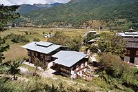 Houses near Jakar
 -
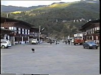 Jakar street


See also
References
- ^ Approved Thromdes & Boundaries in 2 July 2010, Approved Class B Thromdes, Bumthang Thromde; Thromde List part 2 http://www.mowhs.gov.bt/publications/approved-thromde-and-boundaries/ Archived 28 December 2017 at the Wayback Machine
- ^ a b Pelden, Sonam (7 May 2010). "Cabinet Approves Thromdes". Bhutan Observer online. Archived from the original on 20 January 2011. Retrieved 30 July 2011.
- ^ ISBN 978-1740595292. Retrieved 9 August 2011.
- ISBN 0878083618. Retrieved 20 August 2011.
- ^
 This article incorporates text from this source, which is in the public domain. Worden, Robert L. (September 1991). Savada, Andrea Matles (ed.). Bhutan: A Country Study. Federal Research Division. Arrival of Buddhism.
- ISBN 8186239014. Retrieved 12 August 2011.
- ISBN 0802715443. Retrieved 21 August 2011.
- ^ Government of Bhutan. 2011. Archived from the original(PDF) on 2 October 2011. Retrieved 28 July 2011.
- ^ "Parks of Bhutan". Bhutan Trust Fund for Environmental Conservation online. Bhutan Trust Fund. Archived from the original on 2 July 2011. Retrieved 26 March 2011.
- ^ "World Weather Information Service – Bumthang". World Meteorological Organization. Retrieved 24 August 2023.
- ^ Wangchuk, Samten (1 June 2010). "Who'll Take Wing". Kuensel online. Archived from the original on 12 May 2013. Retrieved 8 September 2011.
- ^ "Bathpalathang Airport Will not Complete on Time". Bhutan Broadcasting Service. 14 August 2010. Archived from the original on 18 May 2013. Retrieved 8 September 2011.
- ^ Yeshi, Samten (18 August 2010). "Quality Outweighs Deadline". Kuensel online. Archived from the original on 12 May 2013. Retrieved 8 September 2011.
- ^ Saraswati (10 December 2010). "Despite River Training Works, Bathpalathang Airport Will Finish on Time". Business Bhutan online. Retrieved 8 September 2011.
- ^ Yeshi, Samten (2 June 2010). "River Diversion Work Begins". Kuensel online. Archived from the original on 13 May 2013. Retrieved 8 September 2011.
- ^ Dema, Kesang (21 September 2010). "Penalty Paid ... From One Pocket to Another". Kuensel online. Archived from the original on 13 May 2013. Retrieved 8 September 2011.
- ^ a b Yeshi, Samten (20 May 2011). "Second Deadline Likely to be Missed". Kuensel online. Archived from the original on 13 May 2013. Retrieved 8 September 2011.
- ^ Dorji, Gyalsten K (26 November 2009). "2 Domestic Airports by 2010". Kuensel online. Archived from the original on 5 March 2012. Retrieved 25 July 2011.
- ^ Pelden, Sonam (8 January 2010). "Groundwork Begins for Taking to the Air". Kuensel online. Archived from the original on 5 March 2012. Retrieved 25 July 2011.
- ^ Dorji, Gyaltsen K (9 February 2011). "An April Beginning?". Kuensel online. Archived from the original on 12 May 2013. Retrieved 9 August 2011.
- ^ Tenzin, Tashi (8 September 2011). "Picture Story – So Close Yet So Far". Kuensel online. Archived from the original on 12 May 2013. Retrieved 8 September 2011.
- ^ Yeshi, Samten (1 February 2011). "Unresolved Land Issues in Bumthang". Kuensel online. Archived from the original on 13 May 2013. Retrieved 8 September 2011.
- ^ Dorji, Gyalsten K (19 December 2011). "On Drukair's Historic Flight". Kuensel online. Archived from the original on 11 February 2012. Retrieved 16 January 2012.
- ^ "Aerial photo". 29 December 2011. Archived from the original on 23 January 2013. Retrieved 23 February 2012.
- ^ Dorji, Gyalsten K (23 December 2011). "Drukair's Maiden Flight Fails to Break Even". Kuensel online. Archived from the original on 6 September 2012. Retrieved 16 January 2012.
External links
 Jakar travel guide from Wikivoyage