
Jefferson County, Mississippi
Jefferson County | |
|---|---|
UTC−5 (CDT) | |
| Congressional district | 2nd |
| Website | www |
Jefferson County is a
One of the first of two counties organized in the
Geography
According to the
Major highways
- U.S. Highway 61
 Mississippi Highway 28
 Mississippi Highway 33
Adjacent counties
- Claiborne County (north)
- Copiah County (northeast)
- Lincoln County (southeast)
- Franklin County (south)
- Adams County (southwest)
- Tensas Parish, Louisiana (west)
National protected areas
- Homochitto National Forest (part)
- Natchez Trace Parkway (part)
Demographics
| Census | Pop. | Note | %± |
|---|---|---|---|
| 1800 | 2,940 | — | |
| 1810 | 4,001 | 36.1% | |
| 1820 | 6,822 | 70.5% | |
| 1830 | 9,755 | 43.0% | |
| 1840 | 11,650 | 19.4% | |
| 1850 | 13,193 | 13.2% | |
| 1860 | 15,349 | 16.3% | |
| 1870 | 13,848 | −9.8% | |
| 1880 | 17,314 | 25.0% | |
| 1890 | 18,947 | 9.4% | |
| 1900 | 21,292 | 12.4% | |
| 1910 | 18,221 | −14.4% | |
| 1920 | 15,946 | −12.5% | |
| 1930 | 14,291 | −10.4% | |
| 1940 | 13,969 | −2.3% | |
| 1950 | 11,306 | −19.1% | |
| 1960 | 10,142 | −10.3% | |
| 1970 | 9,295 | −8.4% | |
| 1980 | 9,181 | −1.2% | |
| 1990 | 8,653 | −5.8% | |
| 2000 | 9,740 | 12.6% | |
| 2010 | 7,726 | −20.7% | |
| 2020 | 7,260 | −6.0% | |
| 2023 (est.) | 6,941 | [8] | −4.4% |
| U.S. Decennial Census[9] 1790-1960[10] 1900-1990[11] 1990-2000[12] 2010-2013[13] | |||
| Race | Num. | Perc. |
|---|---|---|
White
|
891 | 12.27% |
Black or African American
|
6,138 | 84.55% |
Native American
|
10 | 0.14% |
Asian
|
14 | 0.19% |
Pacific Islander
|
5 | 0.07% |
Other/Mixed
|
128 | 1.76% |
Latino
|
74 | 1.02% |
As of the
Education
Jefferson County School District operates public schools in all of the county.[15]
Communities
City
- Fayette (county seat)
Unincorporated communities
Ghost towns or defunct
Politics
Jefferson County is overwhelmingly Democratic, and has supported Democratic candidates in presidential elections with at least 80% of the vote since Bill Clinton in 1992, who won 79%. Republicans have not garnered even 25% of the vote in presidential elections since 1972 (when Jefferson was one of only three counties in Mississippi to vote for George McGovern).
The last Republican to win the county was Barry Goldwater. Although Goldwater lost nationally in a landslide, he carried the state of Mississippi (and also Jefferson County) in a landslide, winning over 87% of the vote and carrying every county. Jefferson County supported him with 95% of the vote. Goldwater's lopsided victory was the result of Mississippi's decades-long suppression of the voting rights of African Americans, which only began to be reversed with the passage of the Voting Rights Act of 1965.[citation needed]
| Year | Republican | Democratic | Third party | |||
|---|---|---|---|---|---|---|
| No. | % | No. | % | No. | % | |
| 2020 | 531 | 13.59% | 3,327 | 85.13% | 50 | 1.28% |
| 2016 | 490 | 12.69% | 3,337 | 86.45% | 33 | 0.85% |
| 2012 | 468 | 10.56% | 3,951 | 89.13% | 14 | 0.32% |
| 2008 | 551 | 12.30% | 3,883 | 86.71% | 44 | 0.98% |
| 2004 | 630 | 18.16% | 2,821 | 81.32% | 18 | 0.52% |
| 2000 | 600 | 17.61% | 2,786 | 81.75% | 22 | 0.65% |
| 1996 | 489 | 15.68% | 2,531 | 81.15% | 99 | 3.17% |
| 1992 | 562 | 15.96% | 2,796 | 79.39% | 164 | 4.66% |
| 1988 | 702 | 20.64% | 2,693 | 79.18% | 6 | 0.18% |
| 1984 | 856 | 21.88% | 3,049 | 77.94% | 7 | 0.18% |
| 1980 | 751 | 20.17% | 2,871 | 77.09% | 102 | 2.74% |
| 1976 | 782 | 22.83% | 2,562 | 74.78% | 82 | 2.39% |
| 1972 | 1,131 | 43.37% | 1,457 | 55.87% | 20 | 0.77% |
| 1968 | 147 | 4.35% | 2,121 | 62.75% | 1,112 | 32.90% |
| 1964 | 1,258 | 94.80% | 69 | 5.20% | 0 | 0.00% |
| 1960 | 137 | 12.52% | 229 | 20.93% | 728 | 66.54% |
| 1956 | 189 | 19.65% | 440 | 45.74% | 333 | 34.62% |
| 1952 | 610 | 53.09% | 539 | 46.91% | 0 | 0.00% |
| 1948 | 14 | 1.41% | 15 | 1.51% | 967 | 97.09% |
| 1944 | 25 | 3.16% | 766 | 96.84% | 0 | 0.00% |
| 1940 | 7 | 0.87% | 801 | 99.13% | 0 | 0.00% |
| 1936 | 9 | 1.01% | 884 | 98.88% | 1 | 0.11% |
| 1932 | 24 | 3.07% | 753 | 96.29% | 5 | 0.64% |
| 1928 | 63 | 7.05% | 830 | 92.95% | 0 | 0.00% |
| 1924 | 50 | 9.14% | 497 | 90.86% | 0 | 0.00% |
| 1920 | 14 | 3.15% | 430 | 96.63% | 1 | 0.22% |
| 1916 | 3 | 0.65% | 456 | 99.13% | 1 | 0.22% |
| 1912 | 2 | 0.46% | 408 | 94.66% | 21 | 4.87% |
Notable people
- Abijah Hunt, merchant who lived in Old Greenville during the Territorial Period, and owned a chain of stores and public cotton gins along the Natchez Trace[17]
- David Hunt, Antebellum planter who lived on Woodlawn Plantation in Jefferson County, and became one of 12 planter millionaires in the Natchez District before the American Civil War.
- Zachary Taylor, U.S. president, planter, and soldier who often stayed on his plantation, Cypress Grove in Jefferson County, between 1840 and 1848.
See also
- Cypress Grove Plantation
- National Register of Historic Places listings in Jefferson County, Mississippi
- Prospect Hill Plantation
- Springfield Plantation (Fayette, Mississippi)
- Woodland Plantation (Church Hill, Mississippi)
- Wyolah Plantation
References
- ^ "Census - Geography Profile: Jefferson County, Mississippi". United States Census Bureau. Retrieved January 9, 2023.
- ^ https://msgw.org/jefferson/
- ^ "Find a County". National Association of Counties. Archived from the original on May 31, 2011. Retrieved June 7, 2011.
- ^ Gannett, Henry (1905). The Origin of Certain Place Names in the United States. Govt. Print. Off. p. 168.
- ^ https://msgw.org/jefferson/
- ^ "King: They'll take small victories in struggling Mississippi county." CNN. 25 September 2009, Retrieved September 26, 2009.
- ^ "2010 Census Gazetteer Files". United States Census Bureau. August 22, 2012. Archived from the original on September 28, 2013. Retrieved November 4, 2014.
- ^ "Annual Estimates of the Resident Population for Counties: April 1, 2020 to July 1, 2023". United States Census Bureau. Retrieved April 5, 2024.
- ^ "U.S. Decennial Census". United States Census Bureau. Retrieved November 4, 2014.
- ^ "Historical Census Browser". University of Virginia Library. Retrieved November 4, 2014.
- ^ "Population of Counties by Decennial Census: 1900 to 1990". United States Census Bureau. Retrieved November 4, 2014.
- ^ "Census 2000 PHC-T-4. Ranking Tables for Counties: 1990 and 2000" (PDF). United States Census Bureau. Archived (PDF) from the original on March 27, 2010. Retrieved November 4, 2014.
- ^ "State & County QuickFacts". United States Census Bureau. Archived from the original on June 7, 2011. Retrieved September 3, 2013.
- ^ "Explore Census Data". data.census.gov. Retrieved December 9, 2021.
- ^ Leip, David. "Dave Leip's Atlas of U.S. Presidential Elections". uselectionatlas.org. Retrieved March 4, 2018.
- Briscoe Center for American History
External links
 Media related to Jefferson County, Mississippi at Wikimedia Commons
Places adjacent to Jefferson County, Mississippi | ||||||||||||||||
|---|---|---|---|---|---|---|---|---|---|---|---|---|---|---|---|---|
| ||||||||||||||||
Municipalities and communities of Jefferson County, Mississippi, United States | ||
|---|---|---|
| City | 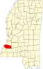 | |
| Unincorporated communities | ||
| Ghost towns | ||
| ||
31°44′N 91°02′W / 31.73°N 91.03°W
| International | |
|---|---|
| National | |
| Other | |