
Kadrina
You can help expand this article with text translated from the corresponding article in Estonian. (August 2023) Click [show] for important translation instructions.
|
Kadrina | |
|---|---|
2011 Census[1] ) | |
| • Total | 2,269 |
Kadrina is a
(12 km southwest).As of the 2011 census, the settlement's population was 2,269.[1]
The name of Kadrina is derived from the St. Catherine's church and parish which establishment dates back to 1231. Earlier name of the settlement was Tõrvestevere (German: Tristfer).[2]
The development from a village to larger settlement began after the Tallinn–Saint Petersburg railway was built and Kadrina railway station was established in 1870. A school was opened in 1902.
Gallery
-
 Kadrina railway station
 -
 Kadrina church
 -
 Memorial of War of Independence at Kadrina cemetery
 -
 New Generation Mini Cup
 -
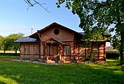
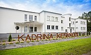 School


References
- ^ a b "Population by place of residence (settlement), sex and age". Statistics Estonia. 31 December 2011. Retrieved 31 May 2013.
- ^ "Kadrina kirik" (in Estonian). Kadrina vald. Retrieved 5 August 2011.
External links
Wikimedia Commons has media related to Kadrina.
- Kadrina Parish (in Estonian)
| Preceding station | Elron | Following station | ||
|---|---|---|---|---|
| Tapa towards Tallinn
|
Tallinn–Narva
|
Rakvere towards Narva
| ||

| International | |
|---|---|
| National | |
| Geographic | |
This Lääne-Viru County location article is a stub. You can help Wikipedia by expanding it. |