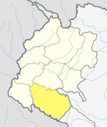
Kailali District
This article has multiple issues. Please help improve it or discuss these issues on the talk page. (Learn how and when to remove these template messages)
|
Kailali District | |
|---|---|
NPT) | |
| Postal Codes | 10900 |
| Area code | 91 |
| Main Language(s) | Tharu, Nepali language, Doteli |
| Website | ddckailali |
Kailali District (
Before the reunification of Nepal by Gorkha King
Geography and climate
| Climate zone[1] | Elevation range | % of area |
|---|---|---|
| Lower Tropical | below 300 meters (1,000 ft) | 59.3% |
| Upper Tropical | 300 to 1,000 meters 1,000 to 3,300 ft. |
25.9% |
| Subtropical | 1,000 to 2,000 meters 3,300 to 6,600 ft. |
13.8% |
Demographics
| Census year | Pop. | ±% p.a. | ||
|---|---|---|---|---|
| 1981 | 257,905 | — | ||
| 1991 | 417,891 | +4.94% | ||
| 2001 | 616,697 | +3.97% | ||
| 2011 | 775,709 | +2.32% | ||
| 2021 | 911,155 | +1.62% | ||
| ||||
| Source: Citypopulation[2] | ||||
At the time of the 2011 Nepal census, Kailali District had a population of 775,709.
As their first language, 41.5% spoke
Ethnicity/caste: 41.9% were Tharu, 20.8% Chhetri, 12.4% Hill Brahmin, 8.4% Kami, 3.9% Thakuri, 3.8% Magar, 2.2% Damai/Dholi, 1.1% other Dalit, 0.9% Sarki, 0.6% Musalman, 0.5% Lohar, 0.5% Sanyasi/Dasnami, 0.4% Badi, 0.4% Newar, 0.3% Raji, 0.3% Tamang, 0.2% Gurung, 0.2% other Terai, 0.1% Terai Brahmin, 0.1% Halwai, 0.1% Kathabaniyan, 0.1% Rai, 0.1% Yadav and 0.1% others.[5]
Religion: 94.9% were Hindu, 2.0% Buddhist, 1.9% Christian, 0.6% Muslim, 0.2% Prakriti and 0.3% others.[6]
Literacy: 65.9% could read and write, 2.7% could only read and 31.4% could neither read nor write.[7]
Administration
The district consists of 13 Local Levels, of which one is a sub-metropolitan city, six are urban municipalities and six are
- Dhangadhi Sub-Metropolitan City
- Lamki Chuha Municipality
- Tikapur Municipality
- Ghodaghodi Municipality
- Bhajani Municipality
- Godawari Municipality
- Gauriganga Municipality
- Janaki Rural Municipality
- Bardagoriya Rural Municipality
- Mohanyal Rural Municipality
- Kailari Rural Municipality
- Joshipur Rural Municipality
- Chure Rural Municipality
See also
References
- ^
The Map of Potential Vegetation of Nepal - a forestry/agroecological/biodiversity classification system (PDF), . Forest & Landscape Development and Environment Series 2-2005 and CFC-TIS Document Series No.110., 2005, ISBN 87-7903-210-9, retrieved Nov 22, 2013
- ^ "NEPAL: Administrative Division". www.citypopulation.de.
- ^ NepalMap Language
- ^ 2011 Nepal Census, Social Characteristics Tables
- ^ NepalMap Caste
- ^ NepalMap Religion
- ^ NepalMap Literacy
- ^ "स्थानिय तह" (in Nepali). Ministry of Federal Affairs and General Administration. Archived from the original on 31 August 2018. Retrieved 1 September 2018.
External links
- "Districts of Nepal". Statoids.

