
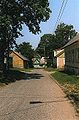
Kallaste
Kallaste | |
|---|---|
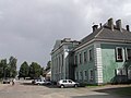
 Main street of Kallaste | |
 Kallaste Location in Estonia | |
| Coordinates: 58°39′55″N 27°9′44″E / 58.66528°N 27.16222°E | |
| Country | |
| County | |
| Municipality | |
| Area | |
| • Total | 1.9 km2 (0.7 sq mi) |
| Population (2020) | |
| • Total | 714 |
| • Rank | 47th |
| • Density | 380/km2 (970/sq mi) |
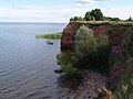
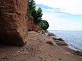
Kallaste is a town in Peipsiääre Parish, Tartu County, Estonia.[1] It is located on the western shore of Lake Peipus. Most of the population are Russians, 15% being Estonians.
History
Kallaste was founded in the 18th century as a village of Russian Old Believers. It became a small borough (alevik) in 1921 and a town 1 May 1938.
Demographics
| Ethnicity | 1922[2] | 1934[3] | 1941[4] | 1959[5]
|
1970[6]
|
1979[7]
|
1989[7]
|
2000[8]
|
2011[9]
|
2021[10] | ||||||||||
|---|---|---|---|---|---|---|---|---|---|---|---|---|---|---|---|---|---|---|---|---|
| amount | % | amount | % | amount | % | amount | % | amount | % | amount | % | amount | % | amount | % | amount | % | amount | % | |
| Estonians | 201 | 12.4 | 189 | 11.8 | 163 | 15.0 | 359 | 21.5 | 405 | 25.2 | 343 | 24.0 | 268 | 19.7 | 256 | 21.1 | 132 | 15.5 | 135 | 19.9 |
| Russians | 1424 | 87.5 | 1412 | 88.0 | 923 | 84.7 | - | - | 1140 | 71.1 | 1013 | 70.8 | 1005 | 73.8 | 883 | 72.9 | - | - | 496 | 72.9 |
| Ukrainians | - | - | 0 | 0.00 | - | - | - | - | 7 | 0.44 | 19 | 1.33 | 23 | 1.69 | - | - | - | - | 17 | 2.50 |
| Belarusians | - | - | - | - | - | - | - | - | 7 | 0.44 | 12 | 0.84 | 13 | 0.96 | - | - | - | - | 6 | 0.88 |
| Finns | - | - | 0 | 0.00 | 0 | 0.00 | - | - | 9 | 0.56 | 6 | 0.42 | 8 | 0.59 | - | - | - | - | 4 | 0.59 |
| Jews | 0 | 0.00 | 0 | 0.00 | 0 | 0.00 | - | - | 0 | 0.00 | 1 | 0.07 | 1 | 0.07 | - | - | - | - | 3 | 0.44 |
| Latvians | - | - | 0 | 0.00 | 0 | 0.00 | - | - | 1 | 0.06 | 1 | 0.07 | 2 | 0.15 | - | - | - | - | 0 | 0.00 |
| Germans | 1 | 0.06 | 4 | 0.25 | - | - | - | - | - | - | 6 | 0.42 | 3 | 0.22 | - | - | - | - | 3 | 0.44 |
| Tatars | - | - | 0 | 0.00 | - | - | - | - | - | - | 2 | 0.14 | 6 | 0.44 | - | - | - | - | 0 | 0.00 |
| Poles | - | - | 0 | 0.00 | 0 | 0.00 | - | - | - | - | 0 | 0.00 | 0 | 0.00 | - | - | - | - | 0 | 0.00 |
| Lithuanians | - | - | 0 | 0.00 | 0 | 0.00 | - | - | 1 | 0.06 | 1 | 0.07 | 1 | 0.07 | - | - | - | - | 6 | 0.88 |
| unknown | 0 | 0.00 | 0 | 0.00 | 2 | 0.18 | 0 | 0.00 | 0 | 0.00 | 0 | 0.00 | 0 | 0.00 | 0 | 0.00 | - | - | 3 | 0.44 |
| other | 1 | 0.06 | 0 | 0.00 | 2 | 0.18 | 1309 | 78.5 | 34 | 2.12 | 27 | 1.89 | 31 | 2.28 | 72 | 5.95 | 720 | 84.5 | 18 | 2.65 |
| Total | 1627 | 100 | 1605 | 100 | 1090 | 100 | 1668 | 100 | 1604 | 100 | 1431 | 100 | 1361 | 100 | 1211 | 100 | 852 | 100 | 680 | 101.6 |
Gallery
-
-
-
 Bank in Kallaste
 -
-
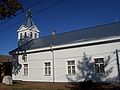 Orthodox church in Kallaste
 -
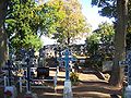 Orthodox graveyard
 -
 Kallaste Bus station
 -
 Soviet World War II memorial


References
- ^ "X-GIS(3) Portal". xgis.maaamet.ee. Retrieved 31 January 2022.
- hdl:10062/4445.
- hdl:10062/4439.
- ^ Eesti Statistika : kuukiri 1942-03/04 (in German and Estonian). Tallinn: Riigi Statistika Keskbüroo. 1942. pp. 66–67.
- ISBN 9985-820-72-X.
- ^ Население районов, городов и поселков городского типа Эстонской ССР : по данным Всесоюзной переписи населения на 15 января 1970 года (in Russian). Tallinn: Eesti NSV Statistika Keskvalitsus. 1972. p. 79.
- ^ ISBN 978-9949-7193-2-7– via Digar.
- ISBN 9985-74-167-6.
- ^ "RL004: EESTLASTE ARV JA OSATÄHTSUS ELUKOHA (ASULA) JÄRGI, 31. DETSEMBER 2011". Estonian Statistical Database. Retrieved 7 May 2023.
- ^ "RL21429: Rahvastik Rahvuse, Soo, Vanuserühma Ja ELukoha (Haldusüksus) Järgi, 31. DETSEMBER 2021". Estonian Statistical Database (in Estonian).
External links
 Media related to Kallaste at Wikimedia Commons
| ||
Jaanilinn (Ivangorod) and Petseri (Pechory) were annexed by the Soviet Union in 1945 and are currently part of Russia. | ||

This Estonia location article is a stub. You can help Wikipedia by expanding it. |