
Kelleys Island State Park
| Kelleys Island State Park | |
|---|---|
Ohio state park | |
| Website | Kelleys Island State Park |
Kelleys Island State Park is a public recreation area occupying one-quarter of
embayment usually separated from the lake by a sand bar.[5]
Gallery
-
 The famousglacial groovesof Kelleys Island.
 -
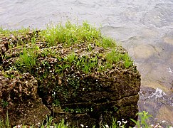 A close up of alvar in the state park.
 -
 Lakeside daises in the state park.
 -
 The park's public beach.
 -
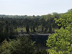 Former quarries cause dramatic cliffs like these.


References
- ^ a b "Kelleys Island State Park". Geographic Names Information System. United States Geological Survey, United States Department of the Interior.
- ^ "Kelleys Island State Park". Ohio Department of Natural Resources. Retrieved November 5, 2020.
- ^ "Glacial Grooves State Memorial". National Natural Landmarks. National Park Service. Retrieved November 5, 2020.
...very large limestone glacial grooves that measure several feet in depth.
- ^ "North Shore Alvar State Nature Preserve". Ohio Department of Natural Resources. Retrieved November 5, 2020.
- ^ "North Pond State Nature Preserve". Ohio Department of Natural Resources. Retrieved November 5, 2020.
External links
Wikimedia Commons has media related to Kelleys Island State Park.
Wikivoyage has a travel guide for Ohio State
Parks that includes
Kelleys Island State Park.
Parks that includes
Kelleys Island State Park.
- Kelleys Island State Park Ohio Department of Natural Resources
- Kelleys Island State Park Map Ohio Department of Natural Resources