
Kincardineshire
Kincardineshire
A' Mhaoirne | |
|---|---|
 | |
| Country | Scotland |
| County town | Stonehaven |
| Area | |
| • Total | 380 sq mi (984 km2) |
| Ranked 22nd of 34 | |
| Chapman code | KCD |
| Website | https://www.kincardineshirelieutenancy.co.uk/ |
Kincardineshire or the County of Kincardine, also known as the Mearns (from the Scottish Gaelic A' Mhaoirne meaning "the Stewartry"), is a historic county, registration county and lieutenancy area on the coast of northeast Scotland. It is bounded by Aberdeenshire on the north and west, and by Angus on the south.
The name "Kincardine" is also used in
History
.PNG)
Anciently, the area was the Province of Mearns, bordered on the north by Marr, and on the west by Angus. The name of the province simply refers to its status; the more important provinces were governed by a great steward (Mormaer), while the less important ones were governed by a mere steward (Maer).
It included the
The introduction of sheriffs in the 11th century created a parallel authority over the area, based at the town of
In 1296, King John Balliol wrote a letter of surrender from the castle to Edward I of England after a short war that marked the beginning of the Wars of Scottish Independence. In 1600, the Estates of Parliament ordered the shrieval governance of Kincardineshire to be conducted at the Stonehaven Tolbooth.
In the mid-19th century, local government reforms replaced the ancient provinces by
The county lost its administrative status in 1975. The area of
Geography


Roughly triangular in shape, Kincardineshire consists of the largely flat
Rivers
Among the rivers are Cowie Water, Carron Water, Luther Water, Burn of Muchalls, Burn of Pheppie, Burn of Elsick, Burn of Monboys, Bervie Water and the lower reaches of the River Dee.
Structures and sites
- Allardice Castle
- Cowie Castle (ruins)
- Catterline
- Dunnottar Castle
- Fetteresso Castle
- Fowlsheugh Nature Reserve
- Lewis Grassic Gibbon Centre, Arbuthnott[5]
- Muchalls Castle
- Portlethen Moss
- Stonehaven Tolbooth
- Ury House
Coat of arms
The county's coat of arms displayed and reflected the history of the Honours of Scotland, which were kept at Dunnottar Castle and later at Kinneff, both within the historical boundaries of the county, during the Wars of the Three Kingdoms. It was: Gules, the Sceptre and Sword of Scotland crosswise in saltire, with the Crown of Scotland in chief and a ruined castle on a mound in base, all or. The motto was LAUS DEO, Latin for "Praise God". It was originally the motto of the Viscounts of Arbuthnott, whose seat is in the county, and the 14th Viscount was Lord Lieutenant of Kincardine at the time of the arms' matriculation by the Lord Lyon in 1927.[6]
Constituency
There was a
In 1918 the Kincardineshire constituency was merged with part of the
In 1950 Kincardine and Western Aberdeenshire was divided between the West Aberdeenshire constituency and the North Angus and Mearns constituency. North Angus and Mearns then covered the whole of the county of Kincardineshire, including the former parliamentary burgh of Inverbervie, and part of the county of Angus, the latter being previously within the Forfarshire constituency.
In 1983, eight years after the abolition of the local government county of Kincardineshire, North Angus and Mearns was replaced by new constituencies.
The county currently makes up part of the West Aberdeenshire and Kincardine constituency of the House of Commons.
Transport
Rail

The
Historic transport routes
The ancient
Settlements
- Altens
- Arbuthnott
- Auchenblae
- Balnagask
- Banchory
- Bridge of Muchalls
- Cammachmore
- Catterline
- Chapelton of Elsick
- Cookney
- Cove Bay
- Crawton
- Downies
- Drumlithie
- Edzell Woods
- Fettercairn
- Findon
- Fordoun
- Glenbervie
- Gourdon
- Inverbervie
- Johnshaven
- Kincorth
- Kinneff
- Kirkton of Durris
- Laurencekirk
- Luthermuir
- Maryculter
- Marykirk
- Muchalls
- Netherley
- Newtonhill
- Nigg
- Old Portlethen
- Portlethen
- St Cyrus
- Stonehaven
- Tewel
- Torry
- Tullos
-
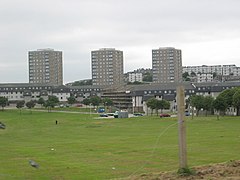 Balnagask
 -
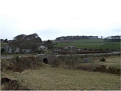 Bridge of Muchalls
 -
 Catterline
 -
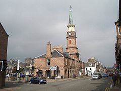 Stonehaven


Notable people
The author Lewis Grassic Gibbon, born James Leslie Mitchell, was a Scottish writer. His Sunset Song is one of the best-known Scottish novels of the 20th century. It was voted Scotland's favourite book in a poll announced at the 2005 Edinburgh International Book Festival.[9] Set in a fictional village in the Mearns, the book draws heavily from Mitchell's upbringing in Arbuthnott. One of the key features of the book, and some of his other writing, is the balanced and immersive use of the local Doric Scots dialect mixed with standard English, in a manner easily and enjoyably accessible to someone unfamiliar with the North East of Scotland.
Notable residents
- Richard Henry Brunton, born in Kincardine
- Cosmo Innes born in Durris Castle
- Hercules Linton (1837–1900), born in Inverbervie, designer of the Cutty Sark
- James Murdoch, born in Stonehaven
- James Taylor (tea planter) born on the Monboddo estate, Laurencekirk[10]
- Robert William Thomson born in Stonehaven
See also
References
- ^ "Fettercairn, Scotland". Archived from the original on 1 January 2013. Retrieved 8 October 2008.
- ^ Historic Environment Scotland. "Stonehaven Sheriff Court House and Police Station, including boundary walls, Dunnottar Avenue, Bogwell Lane, Stonehaven (LB41617)". Retrieved 26 December 2022.
- ^ "No. 18384". The Edinburgh Gazette. 10 June 1948. p. 609.
- ^ Historic Environment Scotland. "33 Evan Street, Kinnear House, And 1 Robert Street Including Boundary Walls, Gatepiers And Railings (LB41622)". Retrieved 18 July 2021.
- ^ "Lewis Grassic Gibbon Centre". Retrieved 29 April 2007.
- ^ Urquhart, R.M. Scottish Burgh and County Heraldry (1973 ed.). Heraldry Today. p. 99. consulted 20 December 2013.
- ^ Archibald Watt, Highways and Byways around Kincardineshire, Stonehaven Heritage Society (1985)
- ^ C. Michael Hogan, Elsick Mounth, Megalithic Portal, A. Burnham ed. (2005)[1]
- ^ Canongate Books (29 August 2005). "Sunset Song – Scotland's Best Read". Archived from the original on 24 April 2007. Retrieved 29 April 2007.
- ^ "Ceylon Tea Museum". www.ceylonteamuseum.com. Retrieved 19 March 2019.
External links
- . Encyclopædia Britannica. Vol. 15 (11th ed.). 1911.
- Historic map showing the Mearns by H. Moll (d. 1732)
- Interactive map of modern Kincardineshire
| International | |
|---|---|
| National | |