
Kohler, Wisconsin
Kohler, Wisconsin | ||
|---|---|---|
FIPS code 55-40275[5] | | |
| GNIS feature ID | 1567601[2] | |
| Website | www | |
Kohler is a village in
History
Originally called Riverside within the rural
In 1900,
In 1931 the
In 1934, 1954–1965, 1983, and 2015, the United Auto Workers and other unions have gone on strike against the Kohler Company, causing limited to major disruptions to village operations.
Geography
Kohler is located at 43°44′18″N 87°46′52″W / 43.73833°N 87.78111°W (43.738244, -87.781109).[10]
According to the United States Census Bureau, the village has a total area of 5.63 square miles (14.58 km2), of which, 5.41 square miles (14.01 km2) of it is land and 0.22 square miles (0.57 km2) is water.[11]
Demographics
| Census | Pop. | Note | %± |
|---|---|---|---|
| 1920 | 403 | — | |
| 1930 | 1,748 | 333.7% | |
| 1940 | 1,789 | 2.3% | |
| 1950 | 1,716 | −4.1% | |
| 1960 | 1,524 | −11.2% | |
| 1970 | 1,738 | 14.0% | |
| 1980 | 1,651 | −5.0% | |
| 1990 | 1,817 | 10.1% | |
| 2000 | 1,926 | 6.0% | |
| 2010 | 2,120 | 10.1% | |
| 2019 (est.) | 2,059 | [4] | −2.9% |
| U.S. Decennial Census[12] | |||
2010 census

As of the
There were 784 households, of which 38.6% had children under the age of 18 living with them, 68.9% were married couples living together, 6.6% had a female householder with no husband present, 2.0% had a male householder with no wife present, and 22.4% were non-families. 19.0% of all households were made up of individuals, and 9.8% had someone living alone who was 65 years of age or older. The average household size was 2.70 and the average family size was 3.12.
The median age in the village was 42 years. 30.5% of residents were under the age of 18; 3.2% were between the ages of 18 and 24; 22% were from 25 to 44; 29.4% were from 45 to 64; and 15% were 65 years of age or older. The gender makeup of the village was 47.2% male and 52.8% female.
2000 census
| Population | 1926 | 100.00% |
| • White |
1872 | 97.20% |
| • Asian |
37 | 1.92% |
| • Latino |
16 | 0.83% |
| • Two or more races | 10 | 0.52% |
| • African American |
1 | 0.05% |
| • Pacific Islander |
1 | 0.05% |
| • Other races |
5 | 0.26% |
The population density was 354.0 people per square mile (136.7/km2). There were 792 housing units at an average density of 145.6 per square mile (56.2/km2).
There were 568 families and 737 households, out of which 38.7% had children under the age of 18 living with them, 71.4% were married couples living together, 3.9% had a female householder with no husband present, and 22.9% were non-families. 21.0% of all households were made up of individuals, and 10.3% had someone living alone who was 65 years of age or older. The average household size was 2.61 and the average family size was 3.06.
In the village, the population was spread out, with 28.8% under the age of 18, 3.3% from 18 to 24, 27.5% from 25 to 44, 27.9% from 45 to 64, and 12.5% who were 65 years of age or older. The median age was 40 years. For every 100 females, there were 92.2 males. For every 100 females age 18 and over, there were 93.0 males.
The median income for a household in the village was $75,000, and the median income for a family was $86,123. Males had a median income of $53,839 versus $32,188 for females. The
Businesses
As a company town, the

Kohler has two major shopping areas: the Shops at Woodlake Kohler just north of the village's downtown, and Deertrace on the extreme southeast side of the village at the intersection of WI 28 and Washington Avenue.
In July 2022,
Gallery
-
 Kohler Company Main Office
 -
 The American Club
 -
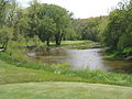 Blackwolf Run
 -
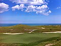 Whistling Straits


Notable people
- Jake Dickert, football coach
- Walter Ireland, member of Wisconsin State Assembly and businessman
- Kohler Company
- Herbert Kohler, Jr., industrialist
- John Michael Kohler, founder of Kohler Company, industrialist, philanthropist
- Walter J. Kohler, Sr., politician and industrialist, 26th Governor of Wisconsin
- Walter J. Kohler, Jr., politician and industrialist, 33rd Governor of Wisconsin
- David Leitch, Hollywood stuntman and film director
- NBAplayer
See also
References
- ^ "2019 U.S. Gazetteer Files". United States Census Bureau. Retrieved August 7, 2020.
- ^ a b "US Board on Geographic Names". United States Geological Survey. October 25, 2007. Retrieved January 31, 2008.
- ^ a b "U.S. Census website". United States Census Bureau. Retrieved November 18, 2012.
- ^ a b "Population and Housing Unit Estimates". United States Census Bureau. May 24, 2020. Retrieved May 27, 2020.
- ^ a b "U.S. Census website". United States Census Bureau. Retrieved January 31, 2008.
- ^ "Kohler Village, * Garden At The Factory Gate,' Ages Gracefully". The Sheboygan Press. June 1, 1976. p. 9.
- ^ “Village of Kohler Predates Today’s New Town Developments.” Sheboygan (WI) Press, 21 May 1973, 38.
- ^ “Village of Kohler Predates Today’s New Town Developments.” Sheboygan (WI) Press, 21 May 1973, 38.
- ^ Young, James C. “A Model Town That Grew on a Prairie.” New York Times, 11 October 1931, SM6.
- ^ "US Gazetteer files: 2010, 2000, and 1990". United States Census Bureau. February 12, 2011. Retrieved April 23, 2011.
- ^ "US Gazetteer files 2010". United States Census Bureau. Archived from the original on July 2, 2012. Retrieved November 18, 2012.
- ^ "Census of Population and Housing". Census.gov. Retrieved June 4, 2015.
- ^ "Aurora Begins Process to Build Replacement Hospital, Outpatient Surgery Center and Medical Office Building in Eastern Sheboygan County" (Press release). Aurora Health Care. April 11, 2017. Retrieved December 20, 2017.
External links
 | ||||
Villages | ||||
Towns | ||||
| CDPs | ||||
| Other communities |
| |||
| Former communities |
| |||
| Footnotes | ‡This populated place also has portions in an adjacent county or counties | |||
| ||||