
Kurnell, New South Wales
| Kurnell Federal division(s) | Cook | ||||||||||||||
|---|---|---|---|---|---|---|---|---|---|---|---|---|---|---|---|
| |||||||||||||||
Kurnell is a
History
Kurnell is the place where
Captain

Cook's landing place is located on the north-eastern part of the national park, just near
The first land grant of 700 acres (283.3 ha) was made in 1815, to Captain James Birnie, who established Alpha Farm. 'Alpha' is the first letter in the Greek alphabet and the name was thought appropriate for the first farm in the area. In 1821 John Connell Junior was also granted land here and used it for timber getting. His father purchased Alpha Farm from Birnie and by 1842 the Connell family's estate was over one thousand acres (4 km2) in size. In 1860, Alpha Farm was sold to Thomas Holt (1811–88), who owned most of the land that stretched from Sutherland to Cronulla. The area was known as Birniemere for a time and Holtmere was once a locality.

Before the 1920s, Kurnell was used by fishermen as schools of several varieties of fish inhabited the Botany Bay foreshore and the open sea. Fishermen built numerous huts and shacks which sheltered them for the weekend fishing. During the Great Depression, from the late 1920s, many severely affected low-income families took up residence there, in a shantytown.[3]
2015 storm
On 16 December 2015 a
Name
It is possibly a corruption of a Dharug term "cunthal", "kundle" or "koondool", perhaps meaning "place of or where the wild carrot grows".[8] Alternatively it is an Aboriginal corruption of the surname of John Connell, who was granted land in the area in 1821.[9]
Heritage listings
Kurnell has a number of heritage-listed sites, including:
- Cape Solander Drive: Kamay Botany Bay National Park[10]
Population
In the 2016 Census, there were 2,267 people in Kurnell. 83.1% of people were born in Australia and 90.6% of people only spoke English at home. The most common responses for religion were No Religion 27.5%, Anglican 27.3% and Catholic 26.9%.[1]
Places of interest

The northern part of the peninsula is a historic site known as Captain Cooks Landing Place with a number of memorials located here:
- Captain Cook Memorial Obelisk
- Kamay Botany Bay Discovery Centre
- Sir Joseph Banks Memorial
- Solander Monument
- Sutherland Monument
- Marton Park (Home of the mighty Kurnell Stingrays) on Game Day
The Discovery Centre provides information and displays relics from the early days in Kurnell's history. Endeavour Heights is a recreation area in the Botany Bay National Park. The Kurnell Lookout provides brilliant views of Botany Bay and the northern headland of Botany Bay at La Perouse. Cape Solander is popular amongst whale watchers during the migration season.
Commercial areas

The small residential area with a population of 2,260 is located to the north with a small group of shops in the village of Kurnell.
Kurnell is dominated by an industrial area, which once included the
Transport
Sport and recreation
Kurnell is home to the Stingrays JRLFC, one of the Shire's rugby league clubs. Green hills Skatepark is located in Kurnell on Captain Cook Drive. It consists of a small and large bowl and street sections. Triathlons are held in Kurnell annually. There are running tracks through Botany Bay National Park, as well as running along the beach and swimming in the netted area of

Gallery
-
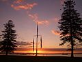 Kurnell flag masts at sunset
 -
 Sutherland's monument
 -
 Kurnell sandstone cliffs, view towards Pacific Ocean
 -
 Sir Joseph Banks Memorial
 -
 Cliff andPacific oceanview


References
- ^ a b Australian Bureau of Statistics (27 June 2017). "Kurnell (State Suburb)". 2016 Census QuickStats. Retrieved 1 January 2017.
- ^ KURNELL, kurnell.com About AUSTRALIA. "AUSTRALIA – KURNELL, Birthplace of the Modern Australian Nation, Captain's Cook's Landing Place .au". www.kurnell.com. Retrieved 13 January 2018.
- ^ a b "Kurnell – A Pictorial History". www.ssec.org.au. Archived from the original on 22 May 2009. Retrieved 13 January 2018.
- ^ "Severe Storms Archive". www.bom.gov.au. Retrieved 4 May 2019.
- ^ a b "Sydney residents in shock after tornado". SBS News. Special Broadcasting Service. 16 December 2015. Retrieved 16 December 2015.
- ^ "Catastrophic summer events cost insurers more than $550m". ABC News. Australian Broadcasting Corporation. 25 March 2016. Retrieved 16 February 2017.
- ^ "Sydney tornado: Clean-up underway in Kurnell after 'unprecedented' storm delivers 213 km/h winds". ABC News. Australian Broadcasting Corporation. 16 December 2015. Retrieved 16 December 2015.
- ^ "THE NAME OF KURNELL". The Sydney Morning Herald. No. 23, 371. New South Wales, Australia. 6 December 1912. p. 7. Retrieved 15 November 2019 – via National Library of Australia.
- ^ "Kurnell". Geographical Names Register (GNR) of NSW. Geographical Names Board of New South Wales. Retrieved 15 November 2019.
- .
- ^ "The Kurnell Peninsula – Sand Dunes". www.ssec.org.au. Retrieved 13 January 2018.
- ^ "Sydney desalination plant opens". The Sydney Morning Herald. 28 January 2010. Retrieved 13 January 2018.
- ^ Water storage and supply reports – Sydney Catchment Authority
- ^ 8 March 2012 Water storage and supply reports – Sydney Catchment Authority
- ^ "Transdev NSW route 987". Transport for NSW.
34°00′42″S 151°12′25″E / 34.01159°S 151.20686°E
| International | |
|---|---|
| National | |