
Kyle, South Dakota
Kyle
Pejuta ȟaka ( FIPS code | 46-34460[4] | |
|---|---|---|
| GNIS feature ID | 2393072[2] | |
Kyle (
The community was named for James H. Kyle, a Senator from South Dakota.[7]
Geography
According to the United States Census Bureau, the CDP has a total area of 2.0 square miles (5.2 km2), all land.
In North America, the continental pole of inaccessibility is between Kyle and Allen, located 1,650 km (1,030 mi) from the nearest coastline at 43°22′N 101°58′W / 43.36°N 101.97°W.[8]
Demographics
| Census | Pop. | Note | %± |
|---|---|---|---|
| 1990 | 914 | — | |
| 2000 | 970 | 6.1% | |
| 2010 | 846 | −12.8% | |
| 2020 | 943 | 11.5% | |
| U.S. Decennial Census[3] | |||
As of the census[4] of 2000, there were 970 people, 205 households, and 168 families residing in the CDP. The population density was 481.3 inhabitants per square mile (185.8/km2). There were 219 housing units at an average density of 108.7 per square mile (42.0/km2). The racial makeup of the CDP was 94.43%
There were 205 households, out of which 53.7% had children under the age of 18 living with them, 36.6% were married couples living together, 34.1% had a female householder with no husband present, and 17.6% were non-families. 13.7% of all households were made up of individuals, and 1.0% had someone living alone who was 65 years of age or older. The average household size was 4.46 and the average family size was 4.88.
In the CDP, the population was spread out, with 45.4% under the age of 18, 9.9% from 18 to 24, 29.4% from 25 to 44, 11.5% from 45 to 64, and 3.8% who were 65 years of age or older. The median age was 21 years. For every 100 females, there were 97.2 males. For every 100 females age 18 and over, there were 105.4 males.
The median income for a household in the CDP was $26,750, and the median income for a family was $27,000. Males had a median income of $21,953 versus $13,710 for females. The
Education
The Little Wound School is administered by the tribe in association with the Bureau of Indian Education (BIE). It has elementary, middle, and high school grades, with a total of more than 900 students, who are primarily Oglala Lakota in ethnicity.
References
- ^ "ArcGIS REST Services Directory". United States Census Bureau. Retrieved October 15, 2022.
- ^ a b U.S. Geological Survey Geographic Names Information System: Kyle, South Dakota
- ^ a b "Census Population API". United States Census Bureau. Retrieved October 15, 2022.
- ^ a b "U.S. Census website". United States Census Bureau. Retrieved January 31, 2008.
- ISBN 978-0-9761082-9-0. Archived from the originalon October 18, 2016. Retrieved February 12, 2014.
- ^ "U.S. Census Bureau: Kyle CDP, South Dakota". www.census.gov. United States Census Bureau. Retrieved May 28, 2022.
- ^ Federal Writers' Project (1940). South Dakota place-names, v.1-3. University of South Dakota. p. 45.
- doi:10.1080/14702540801897809. Archived from the original(PDF) on June 29, 2014. Retrieved June 3, 2011.
External links
Municipalities and communities of Oglala Lakota County, South Dakota, United States | ||
|---|---|---|
| Town | 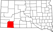 | |
| CDPs | ||
| Unincorporated communities | ||
| Indian reservation | ||
| Footnotes | ‡This populated place also has portions in an adjacent county or counties | |
| ||
| International | |
|---|---|
| National | |
| Other | |