L'Haÿ-les-Roses
L'Haÿ-les-Roses | |
|---|---|
Roseraie du Val-de-Marne | |
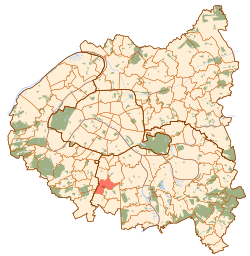
 Paris and inner ring departments | |
| Coordinates: 48°46′48″N 2°20′15″E / 48.779995°N 2.337393°E | |
| Country | France |
| Region | Île-de-France |
| Department | Val-de-Marne |
| Arrondissement | L'Haÿ-les-Roses |
| Canton | L'Haÿ-les-Roses |
| Intercommunality | Grand Paris |
| Government | |
| • Mayor (2020–2026) | Vincent Jeanbrun[1][2] |
| Area 1 | 3.8 km2 (1.5 sq mi) |
| Population (2021)[3] | 31,392 |
| • Density | 8,300/km2 (21,000/sq mi) |
| Time zone | UTC+01:00 (CET) |
| • Summer (DST) | UTC+02:00 (CEST) |
| INSEE/Postal code | 94038 /94240 |
| Elevation | 45–110 m (148–361 ft) |
| 1 French Land Register data, which excludes lakes, ponds, glaciers > 1 km2 (0.386 sq mi or 247 acres) and river estuaries. | |
L'Haÿ-les-Roses (French:
L'Haÿ-les-Roses owes the second part of its name to the Roseraie du Val-de-Marne rose garden located there.
Name
The commune of L'Haÿ-les-Roses was originally called simply L'Haÿ. The name was recorded for the first time in a
In May 1914 the name of the commune became officially L'Haÿ-les-Roses (meaning "L'Haÿ the roses") in honour of the
It is one of the very few French communes with a "ÿ" in its name. A full list of French toponyms containing "ÿ" can be found here.
Demographics
|
| ||||||||||||||||||||||||||||||||||||||||||||||||||||||||||||||||||||||||||||||||||||||||||||||||||||||||||||||||||
| |||||||||||||||||||||||||||||||||||||||||||||||||||||||||||||||||||||||||||||||||||||||||||||||||||||||||||||||||||
| Source: EHESS[4] and INSEE (1968–2017)[5] | |||||||||||||||||||||||||||||||||||||||||||||||||||||||||||||||||||||||||||||||||||||||||||||||||||||||||||||||||||
Education
Primary schools in the commune:[6]
- Seven preschools: Blondeaux, La Roseraie, Garennes, Jardin Parisien, Lallier I, Lallier II, Vallée-aux-Renards
- Seven elementary schools: Blondeaux, Centre, Jardin Parisien A, Jardin Parisien B, Lallier A, Lallier B, Vallée-aux-Renards
Junior high schools: Collège Pierre de Ronsard and Collège Chevreul.[7]
Senior high schools/sixth-form colleges are in surrounding municipalities:[7]
- Lycée Frédéric Mistral - Fresnes
- Lycée d’enseignement général et technologique Gustave Eiffel - Cachan
- Lycée polyvalent Maximilien Sorre - Cachan
- Lycée polyvalent Pauline Roland Chevilly-Larue - Chevilly-Larue
Notable people
- Arthur Bernède (1871–1937), playwright and novelist
- Michel Eugène Chevreul (1786–1889), chemist
- Marcelle Géniat (1881–1959), actress
- Pierre Gandon (1889–1990), illustrator and engraver of postage stamps.
- Jean-Marc Rouvière (1958), essayist
- Franck Lagorce (1968), automobile race driver
- Cécile Cinélu (1970), athlete
- Clémence Poésy (1982), actress
- Alaixys Romao (1984), footballer
International relations
L'Haÿ-les-Roses is
See also
References
- ^ a b "Attempted murder investigation opened after ramming attack on French mayor's house". France 24. 2 July 2023. Retrieved 2 July 2023.
- ^ "Répertoire national des élus: les maires" (in French). data.gouv.fr, Plateforme ouverte des données publiques françaises. 30 November 2023.
- ^ "Populations légales 2021". The National Institute of Statistics and Economic Studies. 28 December 2023.
- ^ Des villages de Cassini aux communes d'aujourd'hui: Commune data sheet L'Haÿ-les-Roses, EHESS (in French).
- ^ Population en historique depuis 1968, INSEE
- ^ "Liste des établissements scolaires de la ville." L'Haÿ-les-Roses. Retrieved on September 7, 2016.
- ^ a b "Liste des collèges et lycées de la commune." L'Haÿ-les-Roses. Retrieved on September 7, 2016.
External links
- town council website (in French)
- Roseraie du Val-de-Marne Archived 2013-11-05 at the Wayback Machine


