
Lüneburg Heath
This article needs additional citations for verification. (April 2017) |
| Classification | Luneburg Heath |
|---|---|
| State(s) | Lower Saxony |
| Country | Germany |


Lüneburg Heath (
Lüneburg Heath has extensive areas, and the most yellow of
Geography
Location


From a geographical point of view, Lüneburg Heath is a specific
Lüneburg Heath covers an area which includes the districts (
Lüneburg Heath lies between the rivers Elbe to the north, the Drawehn to the east, the Aller to the south and southwest, the middle course of the Wümme to the west and the Harburg Hills (Harburger Berge) to the northwest.
On the northwestern edge of Lüneburg Heath are the Harburg Hills and south of
Hills and elevations

The highest elevation on Lüneburg Heath is the
Several of these hills - the Wilseder Berg, the Falkenberg, the Haußelberg and the Breithorn - were used by the mathematician, Carl Friedrich Gauss, as triangulation stations in his topographical surveys of the Kingdom of Hanover from 1821 to 1825.[1]
Rivers and streams
Rivers in the area, beside the numerous small heathland streams, include the
.Geology
The immediate subsurface layers on Lüneburg Heath are almost exclusively made up of deposits from the
During the Saalian Stage (230,000–130,000 years ago) the area of the present-day Lüneburg Heath was covered three times by a continental ice sheet. In the last glacial period (110,000–10,000 years ago) the ice sheet no longer covered the Lüneburg Heath area; it reached only as far as the
The region is mostly covered by a
Natural divisions
Lüneburg Heath is divided into the following natural sub-divisions:
- Hohe Heide
- The Hohe Heide ("High Heath") consists of a series of Saalian glaciation (230,000–130,000 years ago) with the Wilseder Berg at its heart. Unlike the other natural divisions of Lüneburg Heath, the terrain is quite rugged. Characteristic of the area are dry hilltops, periglacial dry valleys and hollows like the Totengrund. Heathland dominates the landscape. They are part of the Lüneburg Heath Nature Parkand of great importance for tourism. In addition there are also extensive pine forests.
- The South Heath (Südheide) is dominated by expanses of gently undulating, hilly end moraines from earlier ice ages. There are still large areas of heath on the military training areas near Bad Fallingbostel and Munster (Örtze); these are out-of-bounds to visitors however. The Osterheide near Schneverdingen also belongs to this natural subdivision. It is part of the Lüneburg Heath Nature Reserve. Near Schneverdingen and south of Soltauthere are several bogs. A large area of the Südheide is covered by pine forests.
- Numerous end moraines run through the Ostheide ("East Heath") which stretches on the eastern edge of Lüneburg Heath from Lüneburg to north of Wolfsburg. In parts of this region the land is intensively cultivated. The northern area, the so-called Göhrde and the Drawehn, are by contrast mostly wooded like the southern ridge of end moraine.
- Uelzen Basin and Ilmenau depression
- The Uelzen districtor the Klein Bünstorfer Heide ("Klein Bünstorf Heath").
- Luheheide
- The ridges of end moraine on the Luheheide have clearly defined slopes that fall away sharply to the Elbe Valley. The heath is deeply incised by all the rivers that drain northwards to the Elbe; rivers such as the Seeve, Aue, Luhe (Ilmenau). The ridges between them are wooded and sparsely populated. Settlements are crowded together in the valleys. There is hardly any heathland left in this area, it has been largely reforested by pines.[2][3]

Climate
Lüneburg Heath lies in a temperate maritime climatic region moderated by the Atlantic, with mild winters, cool summers and precipitation all-year round. The Hohe Heide, however, has a "low mountain climate" with lower temperatures and higher precipitation than in the surrounding area.
Nature

Nature parks and nature reserves

In the northwestern part of Lüneburg Heath is the
Formation of the heath landscape


After the end of the
The heath and its surrounding area belong to those regions of the


Not until after 1000 AD does the
By cutting the turf the regenerative capacity of the soils was exhausted. The regular removal of the top layer of soil contributed to the spreading of heathland. As heather decomposes, the
The oft-expressed view in the literature that the heath arose in the
The heath is not therefore a
Plant population/Phytocenosis
In the 20th century, numerous conservation measures were implemented on Lüneburg Heath; as a result, it is one of the best researched regions of central Europe.
Heathland
Sand heaths form about 20% of the Lüneburg Heath Nature Reserve and may be broken down into further sub-divisions, the most important being:

- Ordinary sand heath (Typische Sandheide, Genisto-Callunetum)
- In addition to the common juniper(Juniperus communis). Ordinary sand heath is the most widespread of the heathland types. Its proportion has increased in recent decades at the expense of other heath habitats. This reduction in the variety of heathland types may be due to increasing nitrogen levels from the air, the increase in plant litter (Rohhumusauflagen) and the natural ageing of the heathland.
- Lichen-rich sand heath (Flechtenreiche Sandheide, Genisto-Callunetum cladonietosum)
- The lichen-rich sand heaths can be told apart from the other types of heathland by the presence of various cup lichens (Cladonia), ciliated fringewort (Ptilidium ciliare) and juniper haircap (Polytrichum juniperinum). They occur frequently on dry, south-facing slopes. This type of heath is found west of Niederhaverbeck and near Sundermühlen.
- Clay heath (Lehmheide, Genisto-callunetum danthonietusum)
- This can be identified by the presence of field wood-rush (Luzula campestris). Clay heaths have become very rare within the Lüneburg Heath. They are found on the Wilseder Bergand south of Niederhaverbeck.
- Blueberry sand heath (Heidelbeer-Sandheide, Genisto-Callunetum, Vaccinium myrtillus Rasse)
- Blueberries (Vaccinium myrtillus) are the signature species of this type of heath and, more rarely, cranberries (Vaccinium vitis-idaea). Blueberry heath is the second most common type of vegetation on the heathlands and occurs especially on northern slopes, the edges of woods and thick juniper hedges. This type of heath is particularly characteristic of the northern slopes of the Wilseder Berg, as well as the Steingrund and Totengrund. In those places, cranberries have even ousted the common heather (Calluna vulgaris) in places.
- Wet sand heath (Feuchte Sandheide, Genisto-Callunetum, Molinia-Variante)
- Wet sand heath is the ideal habitat for
-
 Lichen-rich sand heath north of Niederhaverbeck
 -
 Clay heath south of Niederhaverbeck
 -
 Blueberry sand heath on the northern slope of the Wilseder Berg
 -
 Wet sand heath near the Pietzmoor


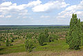
Woods


The greater part (about 58%) of the Lüneburg Heath Nature Reserve consists of woods, primarily
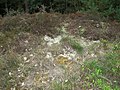
Bogs
The largest bog on Lüneburg Heath is the Pietzmoor, which lies east of Schneverdingen. It was drained however and peat was cut there until the 1960s. The Nature Park Association carried out work in the 1980s to try to turn it back to its natural waterlogged state. For example, some of the drainage ditches were filled which led to a considerable rise in the water levels of the former peat cuts. However typical bog vegetation has not yet re-established itself.[8]
Animals
Many species of animal live on Lüneburg Heath, particularly birds that are at home in the wide, open landscape, some of which are seriously threatened by the intensive-farming techniques in other areas. These include the: black grouse (Tetrao tetrix), the nightjar (Caprimulgus europaeus), the woodlark (Lullula arborea), the great grey shrike (Lanius excubitor), the red-backed shrike (Lanius collurio), the northern wheatear (Oenanthe oenanthe), the wryneck (Jynx torquilla), the European green woodpecker (Picus viridis), the stonechat (Saxicola torquata), the Eurasian curlew (Numenius arquata), the common quail (Coturnix coturnix) and the black stork (Ciconia nigra).[9] In the Lüneburg Heath, the population of the very rare black grouse is rising continually. In 2007, 78 were counted, 13 more than in the previous year. Since 2003, the number of grouse has doubled.
Wolves, although once extinct in the area, have returned to the Lüneburg Heath.[10][11]
Numerous species including European bison, moose and brown bear which once inhabited the region may be seen in the Lüneburg Heath Wildlife Park alongside more exotic animals like snow leopards and Arctic wolves.
Culture and history


Early history
Transition to settlement culture
After the withdrawal of the
Settlements
Lüneburg Heath was always relatively sparsely populated due to the poor soils in the area. The region was dominated by heath farming which was a less intensive form of land usage necessary for its large areas of barren terrain and heathland. An important economic sideline of past centuries was heathland
Heath convents
In the Lüneburg Heath region, six
The end of heathland farming in the 19th century


From 1831 feudalism was abolished in the Kingdom of Hanover and those heathland areas that were common land for the villages were divided amongst the individual farmers. Heathland farming died out at the end of the 19th century. Many farmers sold their land to the Prussian treasury or the Hanover monastic chamber, who afforested the land with pines. As a result, the area of heath was drastically reduced. In the late 19th century a number of farmers from the area were encouraged by British authorities to settle in the Philippi area of Cape Town, South Africa due to their knowledge of farming in barren sandy soils.[17]
In 1800, large parts of Northwest Germany had been covered with heaths and bog. Today, by contrast the only large, continuous areas of heath remaining are in the Lüneburg Heath Nature Reserve and on a few military training areas.
The changing perception of the heath

painting by Erwin Vollmer, 1942
As late as the turn of the 18th to the 19th century, the barren and almost treeless heathlands were still perceived as hostile and threatening environments, as evinced by two travel logs of journeys between 1799 and 1804:
As I had traversed the Hanoverian dominions in so many directions, I did not expect to find nature clothed in charms, or a high degree of population, fertility, and cultivation. Next to Lauenburg, I think it is the worst tract of an equal extent that I ever met with. The soil is one vast sandy desert, which is either naturally bare, or covered with patches of heath or grass.
- — Charles Gottlob Küttner: Travels through Denmark, Sweden, Austria and part of Italy, in 1798 & 1799. London 1805.[18]
On leaving Zell we passed through a dark wood, of at least two leagues in extent; and from that city to Harburgh, in a line of nearly twenty German miles, we travelled over sandy plains and extensive heaths. At a great distance, geese, ducks and sheep of a very poor appearance, never failed to indicate the vicinity of some wretched hamlet. What habitations! Whole families, of the most wretched appearance, and covered with tattered garments, associate together, eat and sleep with their cattle. Near these real catacombs we observed growing a few stalks of rye and barley, and here and there a few tufu of buck-wheat. The straw is short and stunted, and the ears of a diminutive size. Population and agriculture must ever be dependant on each other.
- — Michel Ange Mangourit: Travels in Hanover, during the years 1803 and 1804. London 1806.[19]
The poem Der Heideknabe ("The Heath Lad") from the year 1844 by
:(...) Out, out of the town! And there it stretches,
- The heath, misty, ghostly,
- The wind swishing over it,
- Oh, every step here is like a thousand others!
- And all so still, and all so quiet,
- You look around for signs of life,
- Only hungry birds dart by
- Out of the clouds, to spear worms (...).
Towards the middle of the 19th century the first positive descriptions of the heath emerged, initially inspired by the romantic movement. With the Industrial Revolution in Germany, unspoilt nature became more important for people, providing a welcome contrast with the rapidly burgeoning cities. Because the heathlands of North Germany were being increasingly decimated by cultivation and reforestation, they now appeared to be worth protecting. Numerous writers and painters portrayed the beauty of the heath, particularly when it was in bloom in August and September. One important heathland artist was Eugen Bracht. The most famous heath poet was the local writer Hermann Löns (1866–1914), who spent some time living in a hunting lodge near Westenholz. He worked the heath countryside into his books and promoted the foundation of the first German nature reserve on Lüneburg Heath. His purported remains were buried in a juniper copse at Tietlingen near Walsrode in 1935. His works were a source for Heimatfilme that were shot on Lüneburg Heath, such as Grün ist die Heide ("The Heath Is Green") from 1932 and remade in 1951 and 1972, as well as Rot ist die Liebe ("Red is Love") from 1956.
History of conservation on Lüneburg Heath
Around 1900, there were growing demands to save the heathland and bogs of northwest Germany, which were threatened by reforestation and drainage. On Lüneburg Heath, Wilhelm Bode, then the

In the same year, an appeal by Curt Floerike appeared in Kosmos magazine, citing the establishment of
The area of Lüneburg Heath near Wilsede was selected as the location for the north German national park. Using the VNP's funds, more than 30 km2 of heathland were purchased or rented by 1913. In 1921, a police ordinance placed more than 200 km2 of Lüneburg Heath under protection, the first time this had been achieved in Germany. One problem that arose as early as the 1920s was the steadily increasing number of visitors. In 1924, in order to keep visitors away from sensitive areas of heathland, a volunteer Heath Guard (Heidewacht) was founded.
The Reich conservation law was passed in 1933 and Lüneburg Heath was designated as an official nature reserve. Although plans to build a motorway through the park and for the heath to be used as a

Between 1891 and the
A large area of the nature park belonging to the society near
Forest fire
In August 1975, fire broke out on the Südheide which turned out to be the biggest forest fire in West Germany to that date. Serious forest fires broke out in the southern part of the area near Stüde, Neudorf-Platendorf, Meinersen and then by Eschede near Celle, with devastating effects and fatalities.
German surrender at the end of the Second World War
On 4 May 1945, the heath was the scene of the
Transport
Road
Three motorways (Autobahnen) run across Lüneburg Heath, the A 7, A 27 and A 250, as well as various federal roads, the B 3, B 71, B 440 and others.
Railways
Lüneburg Heath is served by the following railway lines:
- The Hanover–Hamburg railway: Hamburg–Lüneburg–Uelzen–Celle–Hanover
- The Rotenburg (Wümme)–Bremen
- The Heath Railway (Heidebahn): (Hamburg)–Buchholz in der Nordheide–Soltau–Bad Fallingbostel–Walsrode–Bennemühlen–Hanover
- The Munster–Uelzen
- The Brunswick–Uelzen railway: Uelzen–Wieren–Wittingen–Gifhorn–Braunschweig
- The Heath Express(Heide-Express).
Important towns
- Amelinghausen
- Bad Fallingbostel
- Bispingen
- Buchholz in der Nordheide
- Celle
- Gifhorn
- Hermannsburg
- Lüneburg
- Munster
- Schneverdingen
- Soltau
- Uelzen
- Walsrode
Tourism
Today the area is a popular tourist destination. Contributing to this are the theme park,
Kunststätte Bossard in the Nordheide near Jesteburg is an expressionist Gesamtkunstwerk open to the public.
The memorial/exhibition at the former Bergen-Belsen concentration camp near the town of Bergen is also located in the Lüneburg Heath.
See also
- Lüneburg Heath Nature Park
- Lüneburg Heath Nature Reserve
- Ahlden House
- Auf der Lüneburger Heide (song)
- Terminal moraine
- List of glacial moraines
References
- ^ gwdg.de – Overview of surveyed triangulation systems
- ^ cf. BFN Lower Saxony Landscape Profile Archived 2009-04-14 at the Wayback Machine
- ^ Phenologcal Natural Region Map
- ^ nlwkn.niedersachsen.de – Nature reserves in Lower Saxony
- ^ Heinz Ellenberg: Vegetation Mitteleuropas mit den Alpen in ökologischer, dynamischer und historischer Sicht, Stuttgart 1996, p. 721
- ^ cf. Herrmann Cordes u.a.: Naturschutzgebiet Lüneburger Heide. Bremen 1997, S. 163ff
- ^ cf. Herrmann Cordes u.a.: Naturschutzgebiet Lüneburger Heide. Bremen 1997, p. 113ff
- ^ VNP–Schriften 1: 14 Jahre Naturschutzgroßprojekt Lüneburger Heide. Niederhaverbeck 2007, S. 92ff
- ^ Tobias Kleinburg, Johannes Prüter: Naturschutzgebiet Lüneburger Heide. Schneverdingen 2006, p. 22ff und Herrmann Cordes u.a.: Naturschutzgebiet Lüneburger Heide. Bremen 1997, p. 209ff
- ^ "Chronologie: Wölfe in Niedersachsen (Ab 2015)".
- ^ "Wildtiermanagement Niedersachsen - Wolf - Wolfsnachweise in Niedersachsen". Archived from the original on 2017-06-27. Retrieved 2018-12-12.
- ^ cf. Hansjörg Küster: Geschichte der Landschaft in Mitteleuropa. p. 101ff.
- ^ cf. Herrmann Cordes u.a. (Hrsg.): Naturschutzgebiet Lüneburger Heide, p. 49ff.
- ^ cf. Hansjörg Küster: Geschichte der Landschaft in Mitteleuropa. S. 163ff.
- Heath beekeeping in Südheide Nature Park
- ^ cf. Herrmann Cordes u. a. (Hrsg.): Naturschutzgebiet Lüneburger Heide S. 73ff.
- ^ Battersby-Lennard, Jane; Haysom, Gareth (April 2012). "Philippi Horticultural Area: A City asset or potential development node?" (PDF). Retrieved 2022-01-10.
- ^ Translated from the German. p. 199 books.google. German original: "Da ich die Hannöverschen Lande in so vielen Richtungen durchwandert habe, so war ich gewiß nicht vorbereitet, eine schöne Natur, Fruchtbarkeit, starke Bevölkerung und hohen Anbau zu erwarten; aber ich dachte nicht, daß es so gar elend wäre. Mich dünkt, es ist, nebst dem Lauenburgischen, der schlechteste Strich von einem solchen Umfange, der mir je vorgekommen ist. Der Boden dieses ganzen Landes ist eine ungeheure Sandwüste, die von Natur entweder ganz nackt ist, oder Heidekraut, oder dünn verstreute , stechende Grashalmen hervorbringt." Karl Gottlob Küttner: Reise durch Deutschland, Dänemark, Schweden, Norwegen und einen Theil von Italien in den Jahren 1797, 1798, 1799. Vierter Theil. Zweyte verbesserte Ausgabe. Leipzig 1804. Hamburg, den 29sten August 1799. p. 414 books.google
- ^ p. 22 books.google. French original: "En quittant Zell, on traverse un bois noir pendant au moins deux lieues; et de cette ville à Haarbourg (dans une longueur d'environ vingt milles d'Allemagne), on ne passeras toujours sur des chaussées de sable, mais dans des landes à perte de vue. On y peut prendre hauteur comme en mer, pour savoir où l'on est. De loin en loin, des oies, des canards, des moutons d'une espèce misérable, indiquent la vicinité d'un hameau chétif ou d'une habitation. Quels repaires! Des familles au teint hâve, aux vêtemens déchirés, devisent, dînent et dorment dans l'étable de leurs bestiaux. Auprès de ces véritables catacombes, s'élèvent de minces tuyaux de seigle et d'orge, et ça et là des touffes de sarrasin. Les pailles, en sont courtes et les épis grêles. Sans population; point d'engrais; sans engrais, point d'agriculture." Michel Ange Bernard Mangourit: Voyage en Hanovre, fait dans les années 1803 et 1804; Contenant la description de ce pays sous ses rapports politique, religieux, agricole, commercial, minéraligique, etc. DENTU, Paris 1805 , p. 55 books.google
External links
 Lüneburg Heath travel guide from Wikivoyage
- Lüneburg Heath images (in English and German)
53°10′07″N 9°56′23″E / 53.16861°N 9.93972°E
| International | |
|---|---|
| National | |