
Laborec
| Laborec | |
|---|---|
 Laborec at Strážske | |
| Location | |
| Country | Ukraine, Slovakia |
| Physical characteristics | |
| Source | |
| • location | Laborec Highlands |
| Mouth | |
• location | Latorica |
• coordinates | 48°30′14″N 21°54′04″E / 48.504°N 21.901°E |
| Length | 126 km (78 mi) |
| Basin size | 4,523 km2 (1,746 sq mi) |
| Basin features | |
| Progression | Latorica→ Bodrog→ Tisza→ Danube→ Black Sea |
| Tributaries | |
| • left | Uzh, Cirocha |
The Laborec (Rusyn: Лаборець; Hungarian: Laborc) is a river in eastern Slovakia that flows through the districts of Medzilaborce, Humenné, and Michalovce in the Košice Region, and the Prešov Region. The river drains the Laborec Highlands. It is 126 km (78 mi) long and its basin size is 4,523 km2 (1,746 sq mi).[1]
Tributaries
Tributaries of the Laborec river include the Uzh which joins the Laborec near the city of Drahňov in Michalovce District, and the Cirocha river. The Laborec itself is a tributary, flowing into the Latorica river.
Gallery
-
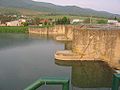 Bridge over the Laborec at Strážske
 -

-
 The river near Michalovce, where the legendary Prince Laborec is said to have died.


References
External links
Wikimedia Commons has media related to Laborec.
| Authority control databases: National |
|---|