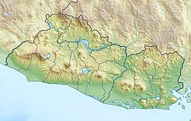
Coatepeque Caldera
(Redirected from
Lake Coatepeque
)| Coatepeque Caldera | |
|---|---|
Pipil) | |
| English translation | "at the snake hill" |
| Geography | |
| Country | Coatepeque, Santa Ana |
| Coordinates | 13°51′53″N 89°32′48″W / 13.864702°N 89.546800°W |
| Type | Caldera lake |
| Basin countries | El Salvador |
| Max. length | 7 km (4.3 mi)[2] |
| Max. width | 10 km (6.2 mi)[2] |
| Surface area | 10 sq mi (26 km2) |
| Average depth | 115 ft (35 m) |
| Max. depth | 115 m (377 ft) |
| Surface elevation | 745 m (2,444 ft) |
| Islands | Isla Teopán |
| References | [2] |
Coatepeque Caldera (
lava flows formed near the west edge of the caldera, and six rhyodacitic lava domes
have formed. The youngest dome, Cerro Pacho, formed after 8000 BC.
Lake Coatepeque
Lake Coatepeque (Lago de Coatepeque) is a large
Teopan, which was a Mayan
site of some importance.
See also
References
- ^ "Global Volcanism Program | Coatepeque Caldera". Smithsonian Institution | Global Volcanism Program. Retrieved 13 April 2023.
- ^ a b c "Coatepeque Caldera - Location/Geological Setting". www.geo.mtu.edu. Retrieved 13 April 2023.
External links
Wikimedia Commons has media related to Coatepeque Caldera.


