
Lake County, Minnesota
Lake County | |
|---|---|
UTC−5 (CDT) | |
| Congressional district | 8th |
| Website | www |
Lake County is a county in the U.S. state of Minnesota. As of the 2020 census, the population was 10,905.[2] Its county seat is Two Harbors.[3]
History
Prior to the arrival of Europeans, the area had long been inhabited by Native American groups. At the time of European contact, the principal Native American groups in the region were the
The Wisconsin Territory was established by the Federal Government effective July 3, 1836, and existed until its eastern portion was granted statehood (as Wisconsin) in 1848. Therefore, the Federal Government set up the Minnesota Territory effective March 3, 1849. The newly organized territorial legislature created nine counties across the territory in October of that year. One of those original counties, Itasca, had its eastern section partitioned off on February 20, 1855, into two new counties: the western part was designated Newton and the eastern part was named Superior County. The territorial legislature returned to the matter on March 3, changing Superior County to Saint Louis County. Then on March 1, 1856, the county name was again changed, to Lake County, and the "Saint Louis County" name was given to the previous Newton County. With the new name came the designation of county seat at Beaver Bay, which had first been platted in 1856. The county's boundaries were altered in 1874, when its eastern part was partitioned off to create Cook County.
In 1868, iron ore was discovered on the Vermilion Range by George Stuntz. A spur of the Duluth and Iron Range Railroad was extended to the Lake Superior shore, and a settlement quickly sprang up at the terminus. This settlement was incorporated as a village (Two Harbors) on March 9, 1888, and that same year a vote was taken to transfer the county seat from Beaver Bay to Two Harbors (1888).[5]
In 1906, the
In 2021, the Greenwood Fire burned over 10,500 acres of the county southwest of Isabella, beginning near Greenwood Lake.[6][7]
Geography
Lake County lies on the north side of Minnesota. Its north border abuts the south border of the province of
Lake County is located in the Arrowhead Region of Northeastern Minnesota.
Major highways
 Minnesota State Highway 1
 Minnesota State Highway 61
 Minnesota State Highway 169
- List of county roads
Adjacent counties
- Rainy River District, Ontario- north
- Cook County - east
- Ashland County, Wisconsin - southeast (across Lake Superior)
- Bayfield County, Wisconsin - south (across Lake Superior)
- Douglas County, Wisconsin - south (across Lake Superior)
- Saint Louis County - west
Protected areas
- Finland State Forest
- George H. Crosby Manitou State Park
- Gooseberry Falls State Park
- Sand Lake Peatland Scientific and Natural Area[8]
- Split Rock Lighthouse State Park
- Superior National Forest (part)
- Tettegouche State Park
Demographics
| Census | Pop. | Note | %± |
|---|---|---|---|
| 1860 | 248 | — | |
| 1870 | 135 | −45.6% | |
| 1880 | 106 | −21.5% | |
| 1890 | 1,299 | 1,125.5% | |
| 1900 | 4,654 | 258.3% | |
| 1910 | 8,011 | 72.1% | |
| 1920 | 8,251 | 3.0% | |
| 1930 | 7,068 | −14.3% | |
| 1940 | 6,956 | −1.6% | |
| 1950 | 7,781 | 11.9% | |
| 1960 | 13,702 | 76.1% | |
| 1970 | 13,351 | −2.6% | |
| 1980 | 13,043 | −2.3% | |
| 1990 | 10,415 | −20.1% | |
| 2000 | 11,058 | 6.2% | |
| 2010 | 10,866 | −1.7% | |
| 2020 | 10,905 | 0.4% | |
| 2023 (est.) | 10,855 | [11] | −0.5% |
| U.S. Decennial Census[12] 1790-1960[13] 1900-1990[14] 1990-2000[15] 2010-2020[2] | |||
2020 Census
| Race | Num. | Perc. |
|---|---|---|
White (NH)
|
10,281 | 94.3% |
Black or African American (NH)
|
11 | 0.1% |
Native American (NH)
|
50 | 0.5% |
Asian (NH)
|
55 | 0.5% |
Pacific Islander (NH)
|
0 | 0% |
Other/Mixed (NH)
|
395 | 3.62% |
Latino
|
113 | 1.03% |
2000 census

As of the
ancestry.There were 4,646 households, out of which 27.10% had children under the age of 18 living with them, 57.80% were married couples living together, 6.60% had a female householder with no husband present, and 32.40% were non-families. 28.00% of all households were made up of individuals, and 12.70% had someone living alone who was 65 years of age or older. The average household size was 2.32 and the average family size was 2.83.
The county population contained 22.30% under the age of 18, 6.60% from 18 to 24, 24.50% from 25 to 44, 26.70% from 45 to 64, and 20.00% who were 65 years of age or older. The median age was 43 years. For every 100 females there were 99.70 males. For every 100 females age 18 and over, there were 99.60 males.
The median income for a household in the county was $40,402, and the median income for a family was $46,980. Males had a median income of $39,719 versus $26,500 for females. The
Government and politics
Lake County has a historic Democratic/Labor lean. It was the top county for Socialist Party of America candidate Eugene V. Debs in 1908,[17] 1912,[18] and 1920.[19] The last Republican to carry the county was Herbert Hoover in his failed run for re-election in 1932 against Franklin D. Roosevelt,[20] although in the 1932 election Socialist Norman Thomas received 19.32% of the county's vote, one of the highest percentages in the country.[21] Ironically, Lake County was the only county in Minnesota to vote for Hoover in 1932, despite going on to give Roosevelt his largest percentage in the state in 1936 and continue to vote staunchly Democratic in every election since. In 2016, Lake County was the whitest county in the entire country to vote for Democrat Hillary Clinton over Republican Donald Trump,[22] though Clinton became the first and only Democrat since the streak began to fail to obtain a majority of the county’s vote. Furthermore, Trump got the highest percentage of the vote of any Republican since 1928, and went on to further increase his vote share in 2020.
| Year | Republican | Democratic | Third party | |||
|---|---|---|---|---|---|---|
| No. | % | No. | % | No. | % | |
| 2020 | 3,393 | 47.11% | 3,647 | 50.64% | 162 | 2.25% |
| 2016 | 2,932 | 44.96% | 3,077 | 47.19% | 512 | 7.85% |
| 2012 | 2,610 | 38.27% | 4,043 | 59.28% | 167 | 2.45% |
| 2008 | 2,636 | 37.82% | 4,174 | 59.89% | 159 | 2.28% |
| 2004 | 2,769 | 39.16% | 4,212 | 59.57% | 90 | 1.27% |
| 2000 | 2,465 | 37.56% | 3,579 | 54.53% | 519 | 7.91% |
| 1996 | 1,684 | 27.93% | 3,388 | 56.20% | 957 | 15.87% |
| 1992 | 1,465 | 23.05% | 3,415 | 53.72% | 1,477 | 23.23% |
| 1988 | 1,838 | 31.83% | 3,887 | 67.31% | 50 | 0.87% |
| 1984 | 2,003 | 30.68% | 4,468 | 68.43% | 58 | 0.89% |
| 1980 | 2,414 | 34.83% | 3,864 | 55.75% | 653 | 9.42% |
| 1976 | 2,313 | 35.05% | 3,973 | 60.21% | 313 | 4.74% |
| 1972 | 2,575 | 40.70% | 3,640 | 57.53% | 112 | 1.77% |
| 1968 | 1,351 | 22.93% | 4,266 | 72.42% | 274 | 4.65% |
| 1964 | 1,205 | 20.34% | 4,704 | 79.39% | 16 | 0.27% |
| 1960 | 2,276 | 36.83% | 3,888 | 62.91% | 16 | 0.26% |
| 1956 | 2,055 | 39.96% | 3,079 | 59.87% | 9 | 0.17% |
| 1952 | 1,451 | 33.83% | 2,814 | 65.61% | 24 | 0.56% |
| 1948 | 924 | 24.78% | 2,555 | 68.52% | 250 | 6.70% |
| 1944 | 792 | 24.45% | 2,401 | 74.13% | 46 | 1.42% |
| 1940 | 933 | 24.99% | 2,750 | 73.67% | 50 | 1.34% |
| 1936 | 617 | 18.20% | 2,717 | 80.15% | 56 | 1.65% |
| 1932 | 1,290 | 42.97% | 1,059 | 35.28% | 653 | 21.75% |
| 1928 | 2,014 | 72.84% | 618 | 22.35% | 133 | 4.81% |
| 1924 | 1,251 | 46.63% | 60 | 2.24% | 1,372 | 51.14% |
| 1920 | 990 | 40.93% | 594 | 24.56% | 835 | 34.52% |
| 1916 | 401 | 30.22% | 506 | 38.13% | 420 | 31.65% |
| 1912 | 182 | 14.38% | 195 | 15.40% | 889 | 70.22% |
| 1908 | 584 | 51.23% | 152 | 13.33% | 404 | 35.44% |
| 1904 | 603 | 67.45% | 77 | 8.61% | 214 | 23.94% |
| 1900 | 639 | 66.98% | 278 | 29.14% | 37 | 3.88% |
| 1896 | 595 | 64.05% | 320 | 34.45% | 14 | 1.51% |
| 1892 | 290 | 60.04% | 126 | 26.09% | 67 | 13.87% |
| Position | Name | District | Term Ending | |
|---|---|---|---|---|
| Commissioner | Pete Walsh | District 1 | 2026 | |
| Commissioner | Derrick (Rick) Goutermont | District 2 | 2024 | |
| Commissioner | Richard (Rick) Hogenson | District 3 | 2024 | |
| Commissioner and Vice Chair | Jeremy Hurd | District 4 | 2026 | |
| Commissioner and Chairperson | Rich Sve | District 5 | 2024 | |
| Position | Name | Affiliation | District | |
|---|---|---|---|---|
| Senate | Grant Hauschild[25] | Democrat | District 3 | |
| House of Representatives | Roger Skraba | Republican | District 3A | |
| House of Representatives | Natalie Zelezinkar | Republican | District 3B | |
| Position | Name | Affiliation | District | |
|---|---|---|---|---|
| House of Representatives | Pete Stauber[26] | Republican | 8th | |
| Senate | Amy Klobuchar[27] | Democrat | N/A | |
| Senate | Tina Smith[28] | Democrat | N/A | |
Communities
Cities
- Beaver Bay
- Silver Bay
- Two Harbors (county seat)
- Isabella
Census-designated place
Unincorporated communities
Ghost towns
- Avon
- Avoy
- Beaver
- Britton
- Buell
- Case
- Clark
- Crystal
- Darby Junction
- Drummond
- Eclfo
- Emetta
- Fernburg Tower
- Forest Center
- Freedom
- Green
- Greenwood Junction
- Howlett
- Jordan
- Kent
- London
- Malmota (Marmata)
- Maple
- Marble Lake
- Moose
- Morris
- Murfin
- Nigadoo
- Norshore Junction
- North Branch
- Riblet
- Scott Junction
- Silver
- Splitrock
- Stafford
- Summit
- Swift
- Thomas
- Wanless
- Westover
- Whyte
- Wolf
- York
Townships
Unorganized territories
See also
References
- ^ "Minnesota Place Names". Minnesota Historical Society. Archived from the original on June 20, 2012. Retrieved March 18, 2014.
- ^ a b "State & County QuickFacts". United States Census Bureau. Retrieved April 20, 2023.
- ^ "Find a County". National Association of Counties. Retrieved June 7, 2011.
- ^ "MNHS "Time Line"". Archived from the original on September 17, 2006. Retrieved August 11, 2009.
- ^ Upham, Warren. Minnesota Geographic Names (1920), pp. 293-96 (accessed April 23, 2019)
- ^ Hollingsworth, Jana (August 23, 2021). "Minnesota's largest wildfire likened to a 'freight train' as it grows, spurs more evacuations". Star Tribune. Retrieved August 24, 2021.
- ^ "Greenwood Fire expected to cross Highway 1; more evacuations begin". Duluth News Tribune. August 23, 2021. Retrieved August 24, 2021.
- ^ a b c Lake County MN Google Maps (accessed April 23, 2019)
- ^ PeakBagger.com "Lake County MN" (accessed April 23, 2019)
- ^ "2010 Census Gazetteer Files". United States Census Bureau. August 22, 2012. Archived from the original on September 21, 2013. Retrieved October 21, 2014.
- ^ "Annual Estimates of the Resident Population for Counties: April 1, 2020 to July 1, 2023". Retrieved March 18, 2024.
- ^ "U.S. Decennial Census". United States Census Bureau. Archived from the original on May 7, 2015. Retrieved October 21, 2014.
- ^ "Historical Census Browser". University of Virginia Library. Retrieved October 21, 2014.
- ^ "Population of Counties by Decennial Census: 1900 to 1990". United States Census Bureau. Retrieved October 21, 2014.
- ^ "Census 2000 PHC-T-4. Ranking Tables for Counties: 1990 and 2000" (PDF). United States Census Bureau. Archived (PDF) from the original on March 27, 2010. Retrieved October 21, 2014.
- ^ "P2 HISPANIC OR LATINO, AND NOT HISPANIC OR LATINO BY RACE – 2020: DEC Redistricting Data (PL 94-171) – Lake County, Minnesota".
- ^ "Dave Leip's Atlas of US Presidential Elections for 1908". Retrieved September 19, 2018.
- ^ "Dave Leip's Atlas of US Presidential Elections for 1912". Retrieved September 19, 2018.
- ^ "Dave Leip's Atlas of US Presidential Elections for 1920". Retrieved September 19, 2018.
- ^ "Presidential election of 1932 - Map by counties". geoelections.free.fr. Retrieved September 19, 2018.
- ^ "Dave Leip's Atlas of US Presidential Elections for 1932". Retrieved September 19, 2018.
- ^ "Election Day 2016 by the numbers - News, Sports, Jobs - Adirondack Daily Enterprise". www.adirondackdailyenterprise.com. Retrieved September 19, 2018.
- ^ Leip, David. "Atlas of US Presidential Elections". uselectionatlas.org. Retrieved September 19, 2018.
- ^ "Welcome To Lake County, MN". www.co.lake.mn.us. Retrieved April 25, 2023.
- ^ "MN State Senate". www.senate.mn. Retrieved March 23, 2023.
- ^ "Representative Pete Stauber". Representative Pete Stauber. Retrieved June 24, 2020.
- ^ "U.S. Senator Amy Klobuchar". www.klobuchar.senate.gov. Retrieved June 24, 2020.
- ^ "Home". Senator Tina Smith. Retrieved June 24, 2020.
External links
- County website
- Lake County Visitor Information Website
- Mn/DOT – maps of Lake County (Southern portion, Central portion, Northern portion)
Places adjacent to Lake County, Minnesota | ||||||||||||||||
|---|---|---|---|---|---|---|---|---|---|---|---|---|---|---|---|---|
| ||||||||||||||||
Municipalities and communities of Lake County, Minnesota, United States | ||
|---|---|---|
| Cities | 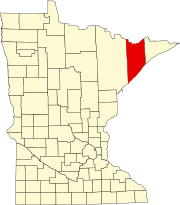 | |
| Townships | ||
| CDPs | ||
| Other communities | ||
| Unorganized territories | ||
| Ghost town | ||
| ||
47°32′N 91°23′W / 47.53°N 91.39°W
| International | |
|---|---|
| National | |
| Other | |