Lake George State Forest
| Lake George State Forest | |
|---|---|
 Welcome sign near the community of Volusia, Florida | |
| Location | Volusia County, Florida, United States |
| Nearest city | DeLand or Pierson (town) |
| Coordinates | 29°09′20″N 81°26′20″W / 29.15546°N 81.4389°W |
| Area | 21,176 acres (8,570 ha) |
| Governing body | Florida Department of Agriculture and Consumer Services, Florida Forest Service |
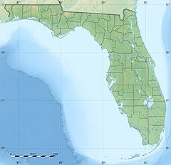
The Lake George State Forest is a designated protected area and state forest in the U.S. state of Florida. The 21,176-acre (8,570 ha) forest is located in northwestern Volusia County, Florida, near Lake George and the communities of Pierson, Barberville, and Volusia. It is overseen by the Florida Forest Service within the Florida Department of Agriculture and Consumer Services.[1]
Lake George State Forest is divided into three tracts of land. The northernmost Astor Tract stretches roughly from a point between Pierson and Lake George south to State Road 40 east of the Volusia settlement. South of SR 40 are the Mary Farms and Dexter Tracts, which encompasses land between the St. Johns River to the west, and Barberville, US 17, and De Leon Springs State Park to the east, and south to the banks of Lake Dexter, Spring Garden Creek, and the Lake Woodruff National Wildlife Refuge.[1]
Lake George State Forest should not be confused with the Lake George Forest, a separate 7,858-acre (3,180 ha) property to the immediate north which is jointly owned by Volusia County and the St. Johns River Water Management District (SJRWMD),[2] or the Lake George Conservation Area, a 11,973-acre (4,845 ha) site owned by the SJRWMD.[3]
History
Prior to European settlement, the area had for thousands of years been the home to Native American tribes like the extinct Timucua. They left behind a rich archaeological history in the form of large middens of freshwater shellfish, which they deposited along the banks of the St. Johns River and Lake George. The Bluffton Mound and Midden at the Bluffton Recreation Area in Lake George State Forest is one such example.[1]
Lake George State Forest is formed from lands previously resourced for timber, production of naval stores, cattle grazing, and hunting.
Dry conditions brought on by severe drought led to massive wildfires in 1998, which left close to half of the forest charred and damaged. After efforts to salvage the area's timber, restoration again involved planting of pine seedlings.[1]
Natural features

Lake George State Forest is named for Lake George, the largest lake in Florida after Lake Okeechobee, and the largest lake of the St. Johns River system. The river itself bounds a 3.5 miles (5.6 km) section of the forest, offering both a vibrant ecology and a wealth of recreation opportunities. The forest and associated wetlands are located within the Lake George watershed, and as such, serve as an important aquifer recharge area.[1]
The arboreal composition of the Lake George State Forest is primarily longleaf and slash pines, with bald cypress and other bottomland hardwood hammocks found in lowland deposits and along the floodplain.[1]
Lake George State Forest is part of two
Recreation
Numerous recreation opportunities are found at Lake George State Forest, including fishing (on the river, lake, and at Jenkins Pond), picnicking, and an interpretive nature trail three-quarter mile (1.21 km) in length. The fall and spring months bring great opportunities for migratory bird-watching, as the forest is part of the Great Florida Birding Trail.[4]
No boat ramps are available within the State Forest boundaries, but community boat ramps are found nearby. Small watercraft such as canoes can launch from the river bank.[1]
Visitors may access the forest during daylight hours. Roads, designated trails, and permanent fire lines are available for hiking, bicycling, and horseback riding. Primitive camping, hunting, and vehicle access is also possible by obtaining a permit from the State Forest Service.[1]
References
- ^ a b c d e f g h i j "Forest Management". Florida Forest Service. Retrieved March 27, 2010.
- ^ "Recreation Guide to District Lands: Lake George Forest". St. Johns River Water Management District Archived September 30, 2019, at the Wayback Machine. Retrieved March 27, 2010.
- ^ "Recreation Guide to District Lands: Lake George Conservation Area". St. Johns River Water Management District Archived September 30, 2019, at the Wayback Machine. Retrieved March 27, 2010.
- ^ a b "Lake George Dexter/Mary Farms Unit". Florida Fish and Wildlife Conservation Commission. Retrieved March 27, 2010.
- ^ "Lake George WMA". Florida Fish and Wildlife Conservation Commission. Retrieved March 27, 2010.

