
Larch Mountain (Multnomah County, Oregon)
| Larch Mountain | |
|---|---|
 Larch Mountain, as seen from Washougal, Washington. | |
| Highest point | |
| Elevation | 4,061 ft (1,238 m) NAVD 88[1] |
| Prominence | 975 ft (297 m)[2] |
| Coordinates | 45°31′57″N 122°5′17″W / 45.53250°N 122.08806°W[1] |
| Geography | |
| Location | Multnomah County, Oregon, U.S. |
| Topo map | USGS Multnomah Falls |
| Geology | |
| Age of rock | 1.8–1.4 Ma |
| Mountain type | Shield volcano[3] |
| Volcanic field | Boring Lava Field |
| Last eruption | 1.4 Ma |
| Climbing | |
| Easiest route | paved road (June–October) hiking trails (November–May) |

Larch Mountain is an
Geography
Larch Mountain is located in
History
In 1879, Amos James Moore was the first known person to advocate for the logging and settling of Larch Mountain. Attractive due to its proximity to Portland and the Columbia River, it contained what were considered some of the highest-quality cedar, hemlock, and fir trees in the United States. In 1886, the Bridal Veil Lumbering Company started logging and constructed a lumber mill, followed a year later by the Latourrel Falls Wagon Road and Lumber Company. The operation rapidly expanded with the construction of a wooden plank road extending from Larch Mountain to the railroad line near the river, allowing for the large-scale logging of the mountain. The Bridal Veil Lumbering company became known for the high quality of its timber.[10]
In 1902, a fire swept through one of the mills, completely destroying it as well as the town. Both were soon rebuilt in new locations. This event is often heralded as the start of the decline of the large-scale Victorian logging practices, which were replaced by more modern techniques. Only a few remnants of the former system exist today. Logging continued in the new forms on the mountain for several more decades. In 1928, the United States Forest Service began reforesting the slopes of Larch Mountain, so that more lumber could be produced. A fire in 1936 marked the end of the timber business on the mountain. Causing around $100,000 of damage, it severely damaged the lumber mill, which was not rebuilt due to the depletion of the timber supply on the mountain.[10]
Geology
Larch Mountain is the remnant of an ancient
Sherrard Point was exposed during the
Biology
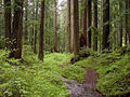
Larch Mountain contains some of the largest
Recreation
The Larch Mountain area contains multiple popular
A loop around Larch Mountain itself is formed by the Larch Mountain Trail, the Multnomah Creek Way Trail #444, and the Oneonta Trail #424.[15]
Gallery
-
 View from the summit with Mount Hood in the distance.
 -
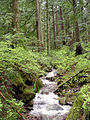 A creek in Larch Mountain forest.
 -
-
 Larch Mountain Trail plaque
 -
 View of Mt St Helens from the summit of Larch Mountain


See also
References
- ^ a b c "Larch Reset". NGS Data Sheet. National Geodetic Survey, National Oceanic and Atmospheric Administration, United States Department of Commerce. Retrieved 2008-11-18.
- ^ a b "Larch Mountain, Oregon". peakbagger.com. Archived from the original on 2006-11-08. Retrieved 2008-04-01.
- ^ "The Boring Volcanic Field – Hills of the Portland Basin". USGS Cascades Volcano Observatory. Archived from the original on 2015-12-22. Retrieved 2015-12-29.
- ^ Cascades Volcano Observatory (2014-06-11). "The Boring Volcanic Field — Hills of the Portland Basin". USGS. Archived from the original on 2015-02-21. Retrieved 2015-02-21.
All existing Boring Volcanic centers are extinct, but the Boring Volcanic Field presumably is not. Since activity started 2.6 million years ago, it is rare that 50,000 years passed without an eruption. The probability of an eruption in the Portland/Vancouver metro area however, is very low.
- ^ Reed, Ione (1971-12-25). "What, Indeed, Is in a Name?". Eugene Register-Guard. p. 8. Archived from the original on 2021-10-26. Retrieved 2015-04-30.
- ^ a b "Larch Mountain Picnic Area". United States Forest Service. Archived from the original on 2015-09-24. Retrieved 2015-08-11.
- ^ "Larch Mountain Trail (#441)". 2022-01-15. Archived from the original on 2022-01-15. Retrieved 2022-01-15.
- ^ House, Kelly (2015-11-20). "Upper Larch Mountain Road to close for winter next week". The Oregonian. Portland, Oregon. Archived from the original on 2015-11-25. Retrieved 2015-12-28.
- ^ "Larch Mountain Trailhead". United States Forest Service. Archived from the original on 2016-01-21. Retrieved 2015-12-28.
- ^ a b Prohaska, Sharr (1992). History of the Development of Bridal Veil, Oregon and the Bridal Veil Lumbering Company: Report for Multnomah County (PDF) (Report) (June ed.). Archived (PDF) from the original on 2015-12-23. Retrieved 2015-12-23.
- ISBN 9780898868470. Archivedfrom the original on 2023-04-01. Retrieved 2020-12-12.
- ^ Hart, Steve (2015-02-26). "Sherrard Point". OregonHikers.org. Archived from the original on 2015-08-23. Retrieved 2015-08-11.
- ^ ISBN 978-0-89997-468-2.
- ^ a b Hart, Steve (2010-02-18). "Larch Mountain Hike". OregonHikers.org. Archived from the original on 2015-12-22. Retrieved 2015-12-20.
- ^ "Multnomah Creek Way Trail #444". United States Forest Service. Archived from the original on 2015-12-22. Retrieved 2015-12-21.