
Lincang
Lincang
临沧市 | ||
|---|---|---|
Postal code 677XXX | ||
| Area code | 0883 | |
| ISO 3166 code | CN-YN-09 | |
| Licence plate prefixes | 云S | |
| Website | www | |
Lincang (simplified Chinese: 临沧; traditional Chinese: 臨滄; pinyin: Líncāng) is a prefecture-level city located in the southwest of Yunnan province, People's Republic of China.
History
Lincang was previously called Baihuai during the Shang dynasty.
On December 26, 2003, the state council approved the cancellation of Lincang District and set up prefecture-level Lincang city.
Geography and climate

Lincang covers latitude 23° 05′-25° 02′ N and longitude 98° 40′-100° 33′ E, thus straddling the
Burma's Shan State
. Elevations within the prefecture range from 450 to 3,504 metres (1,476 to 11,496 ft).
Located at an altitude of above 1,450 m (4,760 ft) and within 30
relative humidity
above 80% and there is a marked reduction in sunshine. With monthly percent possible sunshine ranging from 24% in July to 75% in January, the city receives 2,227 hours of bright sunshine annually.
| Climate data for Lincang (1991–2019 normals, extremes 1971–2010) | |||||||||||||
|---|---|---|---|---|---|---|---|---|---|---|---|---|---|
| Month | Jan | Feb | Mar | Apr | May | Jun | Jul | Aug | Sep | Oct | Nov | Dec | Year |
| Record high °C (°F) | 25.9 (78.6) |
28.6 (83.5) |
30.5 (86.9) |
32.4 (90.3) |
34.2 (93.6) |
34.4 (93.9) |
32.7 (90.9) |
31.7 (89.1) |
30.9 (87.6) |
29.6 (85.3) |
27.2 (81.0) |
25.8 (78.4) |
34.4 (93.9) |
| Mean daily maximum °C (°F) | 20.6 (69.1) |
22.6 (72.7) |
25.4 (77.7) |
27.2 (81.0) |
27.4 (81.3) |
27.0 (80.6) |
26.3 (79.3) |
26.9 (80.4) |
26.3 (79.3) |
24.7 (76.5) |
22.6 (72.7) |
20.4 (68.7) |
24.8 (76.6) |
| Daily mean °C (°F) | 11.8 (53.2) |
14.1 (57.4) |
17.2 (63.0) |
19.6 (67.3) |
21.2 (70.2) |
22.2 (72.0) |
21.9 (71.4) |
21.9 (71.4) |
21.0 (69.8) |
18.9 (66.0) |
15.1 (59.2) |
12.1 (53.8) |
18.1 (64.6) |
| Mean daily minimum °C (°F) | 5.5 (41.9) |
7.4 (45.3) |
10.6 (51.1) |
13.4 (56.1) |
16.5 (61.7) |
19.1 (66.4) |
19.4 (66.9) |
19.0 (66.2) |
17.9 (64.2) |
15.3 (59.5) |
10.3 (50.5) |
6.6 (43.9) |
13.4 (56.1) |
| Record low °C (°F) | −1.3 (29.7) |
1.5 (34.7) |
0.9 (33.6) |
6.9 (44.4) |
10.2 (50.4) |
13.4 (56.1) |
14.6 (58.3) |
13.7 (56.7) |
10.9 (51.6) |
6.7 (44.1) |
1.8 (35.2) |
−1.0 (30.2) |
−1.3 (29.7) |
| Average precipitation mm (inches) | 22.4 (0.88) |
14.3 (0.56) |
20.5 (0.81) |
42.6 (1.68) |
100.9 (3.97) |
155.7 (6.13) |
255.6 (10.06) |
215.1 (8.47) |
141.7 (5.58) |
108.2 (4.26) |
37.3 (1.47) |
11.4 (0.45) |
1,125.7 (44.32) |
| Average precipitation days (≥ 0.1 mm) | 3.4 | 3.7 | 5.3 | 9.5 | 15.9 | 21.7 | 25.9 | 23.2 | 19.2 | 15.0 | 6.0 | 3.6 | 152.4 |
| Average relative humidity (%)
|
63 | 56 | 52 | 57 | 67 | 78 | 82 | 81 | 79 | 78 | 73 | 70 | 70 |
| Mean monthly sunshine hours | 250.5 | 233.2 | 241.7 | 223.3 | 189.6 | 126.3 | 100.5 | 132.0 | 132.7 | 155.4 | 209.6 | 232.3 | 2,227.1 |
| Percent possible sunshine | 75 | 72 | 65 | 58 | 46 | 31 | 24 | 33 | 36 | 44 | 64 | 70 | 52 |
| Source 1: China Meteorological Administration[2][3][4] | |||||||||||||
| Source 2: Weather China[5] | |||||||||||||
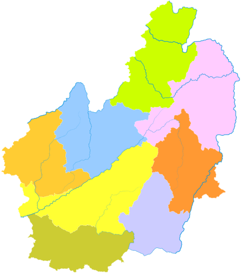
Subdivisions
| Map | |||||
|---|---|---|---|---|---|
| Name | Hanzi
|
Hanyu Pinyin
|
Population (2010) |
Area (km2) | Density (/km2) |
Linxiang District
|
临翔区 | Línxiáng Qū | 323,708 | 2,652 | 122 |
| Fengqing County | 凤庆县 | Fèngqìng Xiàn | 458,330 | 3,451 | 133 |
| Yun County | 云县 | Yún Xiàn | 449,460 | 3,760 | 120 |
| Yongde County | 永德县 | Yǒngdé Xiàn | 369,702 | 3,296 | 112 |
| Zhenkang County | 镇康县 | Zhènkāng Xiàn | 176,356 | 2,642 | 67 |
| Shuangjiang Lahu, Va, Blang and Dai Autonomous County | 双江拉祜族佤族布朗族傣族自治县 | Shuāngjiāng Lāhùzú Wǎzú Bùlǎngzú Dǎizú Zìzhìxiàn | 176,549 | 2,292 | 77 |
| Gengma Dai and Va Autonomous County | 耿马傣族佤族自治县 | Gěngmǎ Dǎizú Wǎzú Zìzhìxiàn | 296,302 | 3,837 | 77 |
| Cangyuan Va Autonomous County | 沧源佤族自治县 | Cāngyuán Wǎzú Zìzhìxiàn | 179,098 | 2,539 | 71 |
Demography
Among the resident population, the
ethnic minorities
population is 905,835, accounting for 37.28% of the total population.
| National name | Han |
Yi | Wa | Dai | Lahu | Bulang |
Bai | Hui |
Lisu | Miao | Others |
|---|---|---|---|---|---|---|---|---|---|---|---|
| Population | 1523662 | 355768 | 235165 | 114312 | 85818 | 40434 | 30904 | 10081 | 9237 | 8856 | 15260 |
| Proportion of total population (%) | 62.72 | 14.64 | 9.68 | 4.71 | 3.53 | 1.66 | 1.27 | 0.41 | 0.38 | 0.36 | 0.63 |
| Proportion of minority population (%) | --- | 39.28 | 25.96 | 12.62 | 9.47 | 4.46 | 3.41 | 1.11 | 1.02 | 0.98 | 1.68 |
Natural resources
coal ash), germanium and uranium.[7] Lincang is also home to the world's oldest cultivated tea tree, especially pu'er tea, some 3,200 years old, in the village of Jinxiu (锦绣), Xiaowan town, of Fengqing County.[8][9]
Transport
References
- ISBN 978-7-5037-9653-1.
- ^ 中国气象数据网 – WeatherBk Data (in Simplified Chinese). China Meteorological Administration. Retrieved 20 September 2023.
- ^ "Experience Template" 中国气象数据网 (in Simplified Chinese). China Meteorological Administration. Retrieved 20 September 2023.
- ^ 中国地面国际交换站气候标准值月值数据集(1971-2000年). China Meteorological Administration. Archived from the original on 2013-09-21. Retrieved 2010-05-25.
- ^ 临沧 - 气象数据 -中国天气网 (in Chinese). Weather China. Retrieved 26 November 2022.
- ISBN 978-7-5037-6548-3.
- ^ Sparton Resources Inc.
- ^ The Oldest Tea Tree on the Earth, (Kunming, 2006).
- ^ News article about oldest tea tree