.
Figure demonstrating the concept of topographic prominence: The prominence of a peak is the height of the peak's summit above the lowest contour line encircling it and no higher summit. For example, vertical arrows show the topographic prominence of three peaks on an island. A dotted horizontal line links each peak (except the highest) to its key col.
The dividing line between a mountain with multiple peaks and separate mountains is not always clear (see also Highest unclimbed mountain). A popular and intuitive way to distinguish mountains from subsidiary peaks is by their height above the highest saddle connecting it to a higher summit, a measure called topographic prominence or re-ascent (the higher summit is called the "parent peak"). A common definition of a mountain is a summit with 300 m (980 ft) prominence. Alternatively, a relative prominence (prominence/height) is used (usually 7–8%) to reflect that in higher mountain ranges everything is on a larger scale. The table below lists the highest 100 summits with at least 500 m (1,640 ft) prominence, approximating a 7% relative prominence. A drawback of a prominence-based list is that it may exclude well-known or spectacular mountains that are connected via a high ridge to a taller summit, such as Eiger, Nuptse or Annapurna IV. A few such peaks and mountains with nearly sufficient prominence are included in this list, and given a rank of "S".
It is very unlikely that all given heights are correct to the nearest metre; indeed, the sea level is often problematic to define when a mountain is remote from the sea. Different sources often differ by many metres, and the heights given below may well differ from those elsewhere in this encyclopedia. As an extreme example, Ulugh Muztagh on the north Tibetan Plateau is often listed as 7,723 m (25,338 ft) to 7,754 m (25,440 ft), but appears to be only 6,973 m (22,877 ft) to 6,987 m (22,923 ft). Some mountains differ by more than 100 m (330 ft) on different maps, while even very thorough current measurements of Mount Everest range from 8,840 m (29,003 ft) to 8,849 m (29,032 ft). These discrepancies serve to emphasize the uncertainties in the listed heights.
Though some parts of the world, especially the most mountainous parts, have never been thoroughly mapped, it is unlikely that any mountains this high have been overlooked, because
used to measure elevations of most otherwise inaccessible places. Still, heights or prominences may be revised, so that the order of the list may change and even new mountains could enter the list over time. To be safe, the list has been extended to include all 7,200 m (23,622 ft) peaks.
The highest mountains above sea level are generally not the highest above the surrounding terrain. There is no precise definition of surrounding base, but
Atacama Trench
, which is about 560 km (350 mi) away, although most of this rise is not part of the mountain.
The highest mountains are also not generally the most voluminous.
Hualalai and Mauna Kea, the volume can only be estimated based on surface area and height of the edifice. Mount Kilimanjaro is the largest non-shield volcano in terms of both base area (635 km2 or 245 sq mi) and volume (4,793 km3 or 1,150 cu mi). Mount Logan
is the largest non-volcanic mountain in base area (311 km2 or 120 sq mi).
The highest mountains above sea level are also not those with peaks farthest from the centre of the Earth, because the
Chimborazo, Ecuador's tallest mountain, is usually considered to be the farthest point from the Earth's centre, although the southern summit of Peru's tallest mountain, Huascarán, is another contender.[7]
Both have elevations above sea level more than 2 km (1.2 mi) less than that of Everest.
The following graph ranks the countries by number of mountain peaks over 7,200 metres (23,622 ft) above sea level. 38 peaks are on de facto borders and two (Jongsong Peak and Sia Kangri) are on tripoints.
Stem and leaf plot
The following is a
stem and leaf plot
of the above data. The two digits to the left of the line are the first two digits of the mountain's height (metres), and each digit to the right of the line represents the third digit of the mountain's height. Each number on the right is linked to the corresponding mountain's article. For example, the height of one of the mountains (namely Mount Everest) is 8,848 metres (29,029 ft). Also, it is apparent that there are four mountains above 8,500 metres (27,900 ft).
Olympus Mons, the tallest mountain on any planet in the Solar System
Rheasilvia crater's central peak, the tallest mountain in the Solar System
Notes
^Peaks which are considered sub-prominences are given a rank of "S".
^For Nepal, the heights indicated on the Nepal Topographic Maps are followed. For China and the Baltoro Karakoram, the heights are those of Mi Desheng's "The Maps of Snow Mountains in China". For the Hispar Karakoram the heights on a Russian 1:100,000 topo map.[9] seem to be more accurate than the customarily quoted heights probably based on US army maps from the 50s.[10] Elsewhere, unless otherwise indicated, heights are those in [11]
^Prominences over 1,500 m (4,900 ft) are from Peaklist.org,[12] the remainder from Jurgalski and de Ferrantin.[13]
^Coordinates were established by comparing topographical maps with satellite images and SRTM-derived terrain maps. The terrain maps and satellite images often do not match exactly. An asterisk (*) indicates that the map and image are shifted by more than 100 m (330 ft) and/or that the landscapes around the summit do not match.
^The first higher mountain beyond the key saddle with at least 500 m (1,600 ft) prominence itself.
^The number of ascents and failed attempts up to 2004 is extracted from Alpine Club Himalayan Index.[14] These are the number of expeditions (not individuals) that announced their ascent or attempt in a journal. They are probably quite accurate for the rarely climbed peaks (though omissions were noted), but greatly underestimate the number of ascending parties on the easier and/or more popular mountains, like most eight-thousanders. For instance, up to 2004 Mount Everest was scaled 2,251 times by individuals.[15]
^Given the large differences between multiple "definitive" measurements of Mount Everest, the height agreed by China and Nepal on 8 December 2020 8,848.86 m (29,031.7 ft) is used for the rounded values. For more information, see Mount Everest#Surveys.
^Cho Oyu's height is 8,188 m (26,864 ft) according to the Nepal Survey's 1996 topographical map,[17] which represents the best known measurement to date. Previous estimates have been 8,153 m (26,749 ft) and 8,201 m (26,906 ft).
^Wholly claimed by China as a part of its Tibet Autonomous Region; on the border with Bhutan according to Bhutan
^The lower West peak, 2.5 km (1.6 mi) away, was climbed in 1984 and twice since.
^ abcdefIn India's disputed Ladakh region, claimed by Pakistan
^
Xinjiang Uyghur Autonomous Region, claimed by India as a part of its Ladakh
union territory
^ abcdOn the border of the Siachen Glacier area, which is controlled by India, but is also claimed by Pakistan
^The height is unknown, but over 7,200 m (23,600 ft) on both Chinese and Russian maps of the area.
^In the Siachen Glacier region controlled by India, but claimed by Pakistan
^The 1998 1:50,000 National Geographic map of Mount Everest has a height of 7,583 m (24,879 ft) for "Bei Peak" and 7,066 m (23,182 ft) for Bei'ao (North Col), giving a 517 m (1,696 ft) prominence. Mi Desheng's 1997 1:100,000 map of the Everest region has a 7,543 m (24,747 ft) summit and a 7,042 m (23,104 ft) indication near the col, not quite corresponding to the lowest pass. His 1975 1:50,000 version (in Chinese only) has Changtse at 7,580 m (24,870 ft) and North Col at 7,028 m (23,058 ft). All maps agree that the eastern summit is the highest.
^Abbey, Major A. (1996). "Kabru - Mountain of the Gods". Himalayan Journal. 52: 29–36. In this report the northern and highest point of the massif is called Kabru III (first ascent May 1994) and the central, median height peak is called Kabru North. The latter may have been climbed as early as 1883.
^Hechtel, Richard (1965). "Talung Peak". AAJ. The Himalayan index has the 1964 expedition as an attempt, but Franz Lindner and Tenzing Nindra did claim the summit.
^The name and information about this summit was extracted from the May 2003 edition of Japanese Alpine News.


.jpg)


.jpg)


.jpg)


_(25571147500)_(3to4).jpg)


.JPG)

_(25871754125).jpg)


.jpg)


 1. The summit of Mount Everest, the highest point on Earth
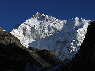 3.Himalaya
 4.Himalaya
 5.Himalaya
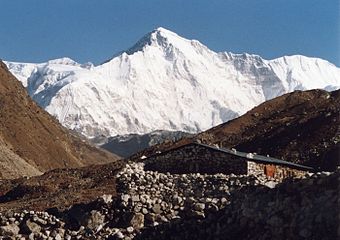 6.Himalaya
 7.Himalaya
 8.Himalaya
 9.Himalaya
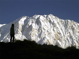 10.Himalaya
 11. Gasherbrum I, the second-highest mountain of the Karakoram
 12. Broad Peak, the third-highest mountain of the Karakoram
 13. Gasherbrum II in the Karakoram
 14.Himalaya


