
Louisiana Highway 15
This article needs additional citations for verification. (June 2016) |
| ||||
|---|---|---|---|---|
| ||||
| North end | US 167 in Lillie | |||
| Location | ||||
| Country | United States | |||
| State | Louisiana | |||
| Parishes | Pointe Coupee, West Feliciana, Concordia, Catahoula, Franklin, Richland, Ouachita, Union | |||
| Highway system | ||||
| ||||
| ||||
Louisiana Highway 15 (LA 15) is a
US 425
and is a major four-lane highway through the area.
Route description
LA 15 begins at a junction with
Beginning in Ferriday, LA 15 is co-signed with US 425 and becomes a major four-lane through route. The highway passes through the communities of Clayton, Sicily Island, Wisner, and Gilbert before entering the city of Winnsboro. Here, US 425 and LA 15 make connections with LA 4 and LA 17.[2][4]
Continuing northward, the highway travels through
US 165 Bus. into the downtown area. During this stretch, LA 15 has a diamond interchange with I-20 and passes the Monroe Civic Center.[2][4][5]
In Downtown Monroe, LA 15 turns west and runs concurrent with
US 80 across the Ouachita River and into the neighboring city of West Monroe. Just beyond the Lea Joyner Bridge, US 80 and LA 15 intersect LA 34 then zigzag through town, intersecting several major thoroughfares that provide access to the parallel I-20. West of the city limits, LA 15 turns off of US 80 and heads northwest to Farmerville, situated on Lake D'Arbonne.[2][5]
LA 15 overlaps both
History
Much of the present route of LA 15 originated as State Route 15 prior to the
Plaquemines Parish
that is called Highway 15.
Beginning at Farmersville, through Monroe, Rhymes Store, Alta, R.S. Baughton's Store, Mangham, Winnsboro, Sicily Island, Clayton, to a point on Route 3.
— 1921 Louisiana Legislative Route Description
Major intersections
| Parish | Location | mi[1] | km | Destinations | Notes | |||
|---|---|---|---|---|---|---|---|---|
LA 970 south | Southern terminus; southern end of LA 970 concurrency; location also known as Keller | |||||||
| | 2.653 | 4.270 | LA 970 north | Northern end of LA 970 concurrency; to Pointe Coupee Parish Port | ||||
LA 418 | To Pointe Coupee Parish Port | |||||||
| | 5.913– 6.081 | 9.516– 9.786 | Bridge over Old River Lock | |||||
| West Feliciana |
No major junctions | |||||||
| Concordia | | 14.232– 17.063 | 22.904– 27.460 | Three bridges over Old River Control Structure channels | ||||
LA 910 (Dora Knapp Road) | Eastern terminus of LA 910 | |||||||
LA 565 – Monterey | Southeastern terminus of LA 565 | |||||||
| St. Genevieve | 51.109 | 82.252 | Southern terminus of LA 131 | |||||
| | 57.962 | 93.281 | LA 3232 | Western terminus of LA 3232 | ||||
US 84 west (Louisiana Avenue) – Jonesville | Southern end of US 84 concurrency | |||||||
| 59.613 | 95.938 | LA 568 (Louisiana Avenue) | Northern end of US 84 concurrency; southern end of US 425 concurrency; southern terminus of LA 568 | |||||
| 59.946 | 96.474 | LA 903 (Kentucky Avenue) | Eastern terminus of LA 903 | |||||
| Clayton | 65.617– 65.752 | 105.600– 105.818 | Southern terminus of US 65 | |||||
| 66.229 | 106.585 | LA 566 (McAdams Road, River Drive) | ||||||
Catahoula parish line | 66.299– 66.437 | 106.698– 106.920 | Bridge over Tensas River | |||||
LA 567 | Eastern terminus of LA 567 | |||||||
LA 921 | ||||||||
| Sicily Island | 78.465 | 126.277 | Eastern terminus of LA 8 | |||||
LA 913 | Northern terminus of LA 913 | |||||||
| | 85.518 | 137.628 | LA 3148 (Norris Hill Road) | Western terminus of LA 3148 | ||||
LA 562 west (Oak Street) | Southern end of LA 562 concurrency | |||||||
| 88.140 | 141.848 | LA 562 east | Northern end of LA 562 concurrency | |||||
| | 89.113 | 143.413 | LA 875 | Northern terminus of LA 875 | ||||
LA 128 west (Gill Street) | Southern end of LA 128 concurrency | |||||||
| 92.626 | 149.067 | LA 572 | Western terminus of LA 572 | |||||
| 93.046 | 149.743 | LA 128 east (Lee Street) | Northern end of LA 128 concurrency | |||||
LA 3210 | Southern terminus of LA 3210 | |||||||
| 97.878 | 157.519 | LA 3210 | Northern terminus of LA 3210 | |||||
LA 3201 | Eastern terminus of LA 3201 | |||||||
| 100.787 | 162.201 | LA 864 (Loop Road) | Southern terminus of LA 864 | |||||
| 101.480 | 163.316 | LA 865 (West Street) | Northern terminus of LA 865 (southern segment) | |||||
| 102.009 | 164.168 | Southern end of LA 4 concurrency | ||||||
| 102.290– 102.333 | 164.620– 164.689 | Northern end of LA 4 concurrency; southern terminus of LA 17; eastern terminus of LA 130 | ||||||
| 104.913 | 168.841 | LA 868 | Southern terminus of LA 868 | |||||
| | 107.154 | 172.448 | LA 867 | Western terminus of LA 867 | ||||
LA 577 – Crowville | Western terminus of LA 577 | |||||||
| 108.786 | 175.074 | LA 857 | Southern terminus of LA 857 | |||||
LA 132 west (Main Street) | Southern end of LA 132 concurrency | |||||||
| 113.568 | 182.770 | LA 132 | Northern end of LA 132 concurrency | |||||
LA 856 | Western terminus of LA 856 | |||||||
| 115.888– 115.976 | 186.504– 186.645 | I-20 – Rayville | Northern end of US 425 concurrency; southern terminus of LA 137 | |||||
LA 135 south | Southern end of LA 135 concurrency | |||||||
| | 121.574 | 195.654 | LA 135 north – Rayville | Northern end of LA 135 concurrency | ||||
| | 122.860– 122.954 | 197.724– 197.875 | Bridge over Boeuf River | |||||
LA 841 (Prairie Road) | Northern terminus of LA 841 | |||||||
| 139.899 | 225.146 | LA 594 (Texas Avenue) | Southwestern terminus of LA 594 | |||||
| 140.062 | 225.408 | I-20 via South 3rd Street | Southern end of US 165 Bus. concurrency | |||||
| 140.332– 140.485 | 225.842– 226.089 | I-20 – Vicksburg, Shreveport | Exit 117C on I-20 (eastbound exit via 116B) | |||||
| 141.303 | 227.405 | US 165 Bus. north (Louisville Avenue) | Northern end of US 165 Bus. concurrency; southern end of US 80 concurrency | |||||
| Monroe–West Monroe line | 141.732– 141.959 | 228.096– 228.461 | Lea Joyner Bridge over Ouachita River | |||||
I-20 | Eastern terminus of LA 34 | |||||||
| 143.694– 143.701 | 231.253– 231.264 | LA 143 (North 7th Street) | ||||||
| 144.258 | 232.161 | I-20 | Southern end of LA 617 concurrency | |||||
| 144.519 | 232.581 | LA 617 north (Warren Drive) | Northern end of LA 617 concurrency | |||||
| 145.332 | 233.889 | I-20 via Downing Pines Road | ||||||
| | 146.390 | 235.592 | I-20 | Northern terminus of LA 3249 | ||||
I-20 – Eros | Northern end of US 80 concurrency; northern terminus of LA 546 | |||||||
LA 616 (Ole Highway 15) | Western terminus of LA 616 | |||||||
| Southern terminus of LA 552 | ||||||||
LA 145 south – Downsville, Choudrant | Northern terminus of LA 145 | |||||||
| 163.328 | 262.851 | Northern terminus of LA 552 | ||||||
| | 170.199– 170.227 | 273.909– 273.954 | Southern end of LA 33 concurrency | |||||
| Farmerville | 171.445– 171.631 | 275.914– 276.213 | James Peyton Smith Bridge over Lake D'Arbonne | |||||
| 172.762 | 278.033 | LA 3281 (Park Street) | Eastern terminus of LA 3281; to National Guard Armory | |||||
| 172.870 | 278.207 | Southern end of LA 2 concurrency | ||||||
| 173.341 | 278.965 | Northern end of LA 33 concurrency; to Farmerville Stadium | ||||||
| 173.421 | 279.094 | Northern end of LA 2 concurrency; to Lake D'Arbonne State Park | ||||||
| 176.130 | 283.454 | Southern terminus of LA 549 | ||||||
| | 184.875 | 297.527 | LA 550 | |||||
| Southern terminus of LA 558 | ||||||||
LA 3269 | Eastern terminus of LA 3269 | |||||||
| 190.847– 190.871 | 307.138– 307.177 | LA 3121 – Taylortown | Southern terminus of LA 3121 | |||||
| 190.896 | 307.217 | LA 3269 | Western terminus of LA 3269 | |||||
US 167 – Bernice, Junction City | Northern terminus | |||||||
1.000 mi = 1.609 km; 1.000 km = 0.621 mi
| ||||||||
Gallery
-
 Bridge over the Boeuf River on LA 15
 -
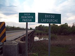 Ouachita/Richland Parish Line over Bayou Lafourche
 -
 Historical marker for General Claire Chennault in Gibson
 -
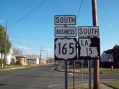 Signs along LA 15 in Monroe


References
- ^ a b Louisiana Department of Transportation and Development, Highway Inventory Unit (2016). "LRS Conversion Tool". Louisiana Department of Transportation and Development. Retrieved March 1, 2018.
- ^ a b c d e Google (March 1, 2018). "Overview Map of LA 15" (Map). Google Maps. Google. Retrieved March 1, 2018.
- ^ Louisiana Department of Transportation and Development, Office of Multimodal Planning (February 2012). District 61: Official Control Section Map, Construction and Maintenance (PDF) (Map). Scale not given. Baton Rouge: Louisiana Department of Transportation and Development. Retrieved March 1, 2018.
- ^ a b c Louisiana Department of Transportation and Development, Office of Multimodal Planning (February 2012). District 58: Official Control Section Map, Construction and Maintenance (PDF) (Map). Scale not given. Baton Rouge: Louisiana Department of Transportation and Development. Retrieved March 1, 2018.
- ^ a b c Louisiana Department of Transportation and Development, Office of Multimodal Planning (February 2012). District 05: Official Control Section Map, Construction and Maintenance (PDF) (Map). Scale not given. Baton Rouge: Louisiana Department of Transportation and Development. Retrieved March 1, 2018.
External links
KML is from Wikidata