
Lower Silesian Forest
| Lower Silesian Forest Polish: Bory Dolnośląskie | |
|---|---|
 Lower Silesian Forest is predominantly made of pine trees | |
| Map | |
 | |
| Geography | |
| Location | Lower Silesian Voivodeship, Lubusz Voivodeship, Poland |
| Coordinates | 51°22′14″N 15°07′13″E / 51.3705°N 15.1204°E |
Lower Silesian Forest (
The area of the Lower Silesian Forest is predominantly flat, with the biggest point, the hill called Dębniak measuring only 238 meters above sea level. The wilderness is subdivided into several smaller forests, and it is crossed by a number of rivers, including the Kwisa, the Bóbr, and the Szprotawa. Among most important urban centers in this region are Bolesławiec, Węgliniec, Żagań, Żary, Szprotawa, and Pieńsk.
The Lower Silesian Forest is very popular among hunters, as it is rich in such animals as deer, wild pigs, hares, foxes, and wolves.
Honey production is cultivated in the forest since the Middle Ages, and the Lower Silesian Forest Heather Honey (Miód wrzosowy z Borów Dolnośląskich) is designated a traditional food by the Ministry of Agriculture and Rural Development of Poland.[1]
Gallery
-
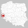 Location within Poland
 -
 Forest near Ruszów
 -
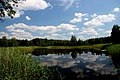 Pond in Żagań
 -
 German bunker from World War II near Szprotawa


See also
- Silesia Walls
References
- ^ "Miód wrzosowy z Borów Dolnośląskich". Ministerstwo Rolnictwa i Rozwoju Wsi - Portal Gov.pl (in Polish). Retrieved 10 November 2023.
This Poland location article is a stub. You can help Wikipedia by expanding it. |